
Last updated January 2024 | Words and photos by Vietnam Coracle | 32 comments

Tom Divers is the founder and creator of Vietnam Coracle. He’s lived, travelled and worked in Vietnam since 2005. Born in London, he travelled from an early age, visiting over 40 countries (he first visited Vietnam in 1999). Now, whenever he has the opportunity to make a trip, he rarely looks beyond Vietnam’s borders and his trusty motorbike, Stavros. Read more about Tom on the About Page, Vietnam Times and ASE Podcast.
Northern Vietnam represents some of the best motorbiking opportunities in Southeast Asia. In the north, the mountains are higher and the passes loftier than anywhere else in Vietnam. For many riders, northern Vietnam is the highlight of their road trip experience. The scenery is sublime, the roads are ambitious, and the history and culture are fascinating. I’ve brought together all of my northern motorbike guides to create a collection of 13 Northern Routes. Riders can choose to pursue each route separately or link the guides together and follow them across the northern region, thus creating a ‘Great North’ itinerary.


[Back Top]
MOTORBIKING NORTHERN VIETNAM
13 Motorbike Routes in the ‘Great North’
For each of the 13 northern motorbike routes on this page, I’ve included bullet-points for quick details, a brief overview, a direct link to the full guide, an embedded interactive map of the route, and a title image. I’ve listed the 13 northern routes geographically starting south of Hanoi and moving from west to east around the northern region. My colour-coded map features shaded areas indicating the regions covered by each of the 13 northern routes and direct links to the guides. Although these 13 northern routes cover thousands of kilometres, they represent just a fraction of the many great roads, tracks, and regions that northern Vietnam has to offer. The best time of year to ride in northern Vietnam is March-May and September-November. (In addition to the routes on this page, see Related Guides for more.)
CONTENTS:
[View Map]
- 1. Mường Lống Loop (north-central)
- 2. Limestone Loop (north-central)
- 3. Trans-Northern Belt Road (pan-northern)
- 4. Harvest Route (northwest)
- 5. Extreme Northwest Loop (northwest)
- 6. Sin Ho Loop (northwest)
- 7. Y Ty Loop (northwest)
- 8. Borders & Back-Roads Loop (northwest)
- 9. Tuyen Quang Magic ‘8’ Loop (central north)
- 10. Ha Giang Loop (extreme north)
- 11. The High-Roads Routes (northeast)
- 12. The Northeast Loops (northeast)
- 13. Binh Lieu Loop (northeast)
Support My Website
Please donate or become a patron if you enjoy my work. Vietnam Coracle is totally free & independent. I do not receive payment for anything I write.
Thank you, Tom
ROUTE MAP:
13 Northern Motorbike Routes
Muong Long Loop | Limestone Loop | Trans-Northern Belt Road | Harvest Route | Extreme Northwest Loop | Sin Ho Loop | Y Ty Loop | Borders & Back-Roads Loop | Tuyen Quang Magic 8 Loop | Extreme North Loop | High Roads Routes | Northeast Loops | Binh Lieu Loop
*Road Safety & Disclaimer: Riding a motorbike in Vietnam – or anywhere in the world – has its dangers. I would hope & expect anyone who chooses to pursue a self-drive road trip based on the information on this website does so with care, respect & due diligence. I encourage careful riding & adherence to road rules, but I am not responsible for the legality or manner in which you ride, nor any negative consequences which may result from your decision to ride a motorbike in Vietnam: you do so at your own risk. Read more >
1. Muong Long Loop:
- Route: Vinh→Kim Liên→Thanh Chương→Con Cuông→Mường Xén→Mường Lống→Qùy Châu→Qùy Hợp
- Distance & Duration: 630km; 4-7 days
- Provinces: Nghê An
- Scenery: verdant agricultural valleys, limestone karsts, brooding mountains, glistening rivers, rice fields, waterfalls, tea hills
- Road conditions: good paved roads, occasional rough patches, opportunities for detours
- Best Time of Year: April-July
- Full Guide: The Mường Lống Loop
Nghệ An, in north-central Vietnam, is the largest province in the nation and one of the least explored by travellers. Riders usually skip this province, but Nghệ An is one of the best riding regions in the nation and should be considered a major destination for road-trippers. The Mường Lống Loop is a motorbike route to rival any other in Vietnam for scenery and adventure. This route stretches from the coast in the east to the mountainous border with Laos in the west, culminating in a mini-loop near Mường Lống, a remote village in the far northwest of the province, which is, without a doubt, one of the best stretches of road and scenery anywhere in Vietnam……continue reading
ROUTE MAP: The Mường Lống Loop
COVER PHOTO: [Click image for full guide]


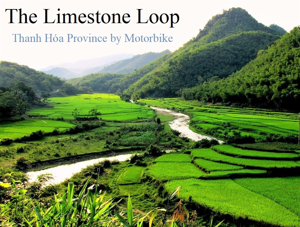
2. Limestone Loop:
- Route: Hanoi→Mai Châu→Pù Luông→Lao border
- Distance & Duration: 700-800km; 3-6 days
- Provinces: Thanh Hóa & Hòa Bình
- Scenery: limestone karsts, bamboo forests, villages, rice fields, homestays
- Road conditions: mostly good, paved roads & lanes, some rough sections, fairly light traffic
- Best time of year: March to October
- Full Guide: The Limestone Loop
Spreading southwest of Hanoi, the Limestone Loop is just a few hours’ ride from the capital, and yet it takes in some of the most picturesque scenery in the country. Much of this motorbike route travels through Thanh Hóa, a province punctuated by limestone pinnacles, rivers, and rice paddies. Quiet roads meander along steep valleys cloaked in bamboo forests, and mountain passes twist skyward towards isolated Lao border crossings. Thanh Hóa is overlooked by most travellers in favour of neighbouring Ninh Bình, which is now extremely touristy. Thanh Hóa, on the other hand, is only recently starting to attract attention, in particular the stunning setting of Pù Luông Nature Reserve……continue reading
ROUTE MAP: The Limestone Loop
COVER PHOTO: [Click image for full guide]
3. Trans-Northern Belt Road:
- Route: Hạ Long→Điên Biên via road QL279
- Distance & Duration: 937km; 3-6 days
- Provinces: Bắc Giang, Lạng Son, Bắc Kạn, Tuyên Quang, Hà Giang, Lào Cai, Lai Châu, Sơn La, Điện Biên
- Scenery: mountains, limestone karsts, jungles, rivers, valleys, villages, rice terraces, lakes, waterfalls
- Road conditions: good, paved surface, some narrow sections, some roadworks, light traffic
- Best time of year: March to October
- Full Guide: Trans-Northern Belt Road
Traversing the breadth of Vietnam from east to west at its widest and most mountainous point, QL279 is an historic route and the third longest road in the nation, measuring 937km. Sometimes referred to as Đường Vành Đai Phía Bắc (Trans-Northern Belt Road), QL279 passes through 10 northern provinces and some of the most spectacular landscapes and complex terrain in the country. The road forms an arc across the northern crest of Vietnam, echoing the national border with China. QL279 is named after the short but bloody Sino-Vietnamese border war in February, 1979. Hence, 2=February, 79=1979, QL=quốc lộ (national route)……continue reading
ROUTE MAP: The Trans-Northern Belt Road
COVER PHOTO: [Click image for full guide]

4. Harvest Route:
- Route: Mù Cang Chải→Tú Lệ
- Distance & Duration: 50km; 1 day
- Provinces: Yên Bái
- Scenery: rice terraces, lush valleys, rivers, mountains, villages, homestays
- Road conditions: good, paved main road & paved back-roads, usually light traffic
- Best time of year: May to October
- Full Guide: The Harvest Route
Every year, between September and October, the terraced rice fields of Mù Cang Chải, a rural district in Yên Bái Province, put on a show of picturesque harvest colours as hundreds of stepped rice paddies, carved into the contours of steep valleys, are illuminated by the autumn sun. The curving terraces, although man-made, appear to be in complete harmony with the landscape, creating a hypnotic patterning across the hills and valleys. I call this spectacle the ‘Theatre of Rice’ and the best way to see the ‘show’ is to ride the ‘Harvest Route’: a short and scenic section of Highway QL32 between the towns of Tú Lệ to Mù Cang Chải, via the lofty Khau Phạ Pass……continue reading
ROUTE MAP: The Harvest Route
COVER PHOTO: [Click image for full guide]

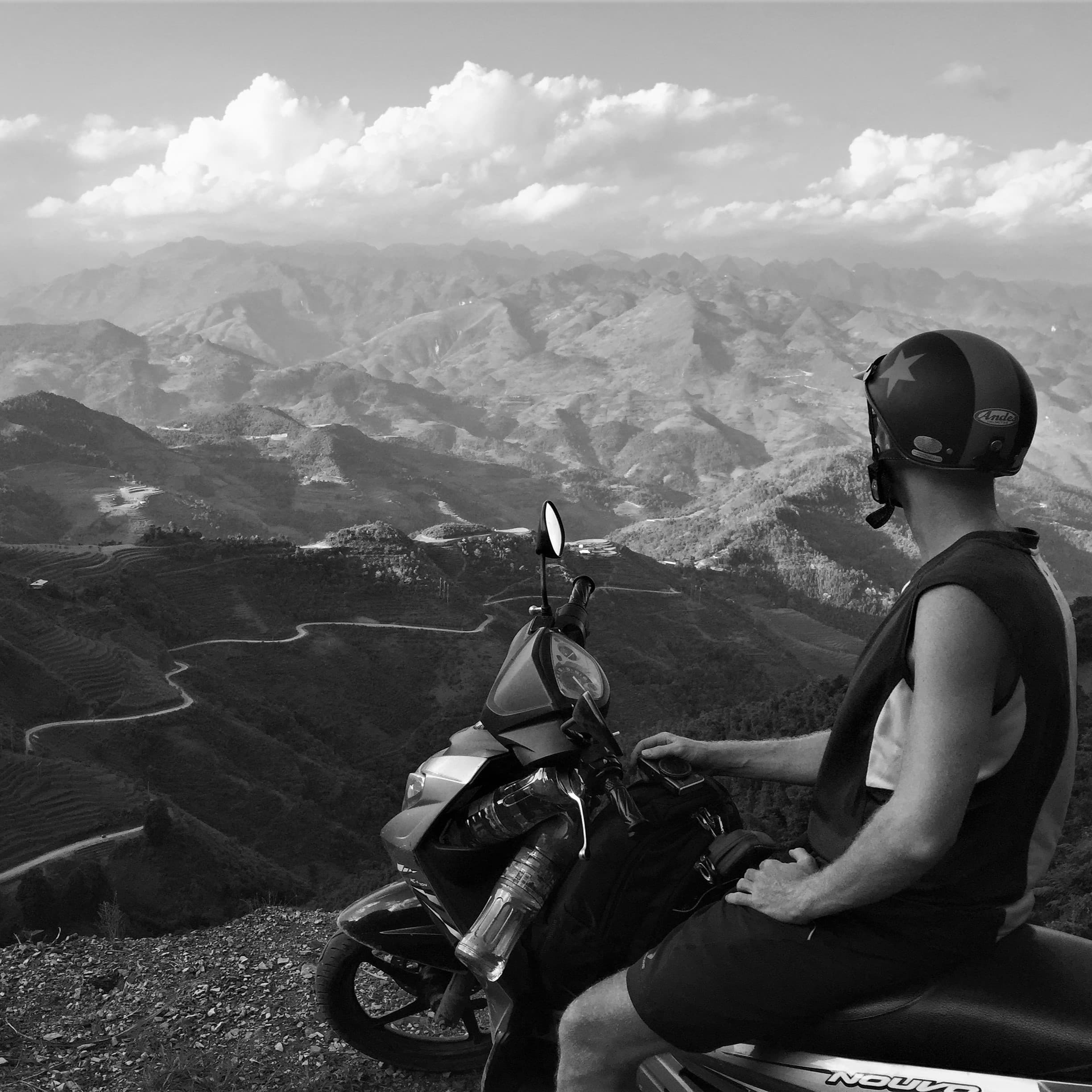
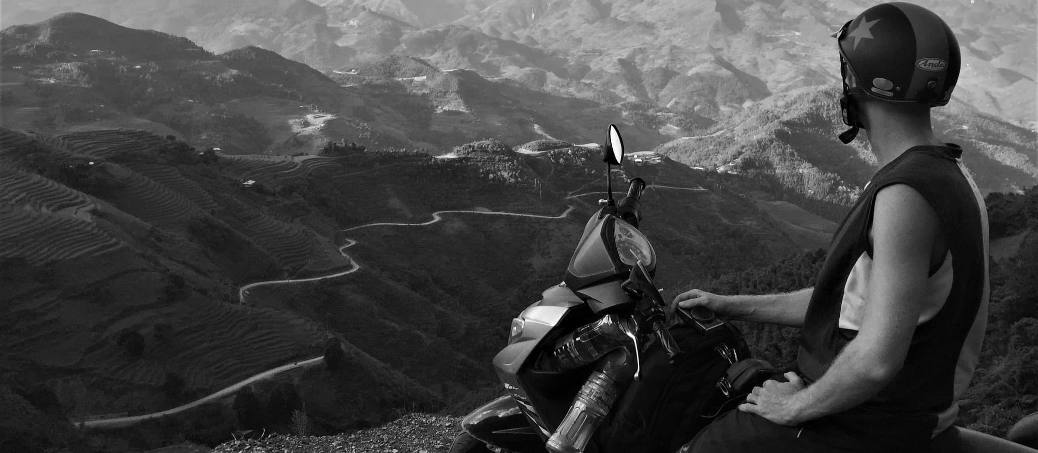
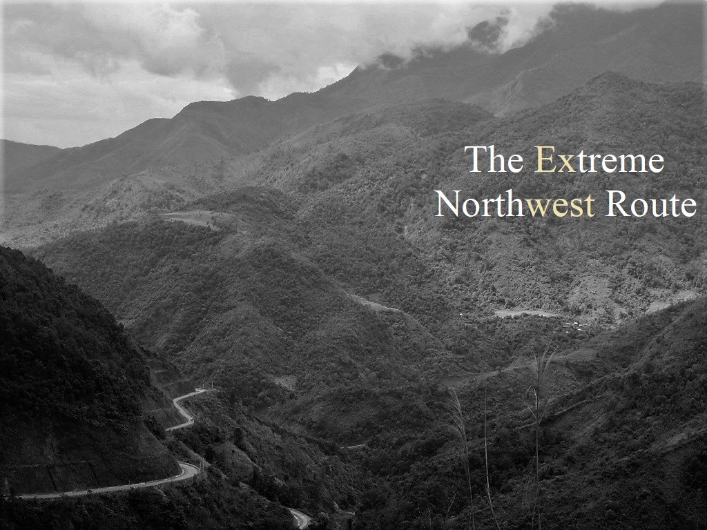
5. Extreme Northwest Loop:
- Route: Lào Cai→Lai Châu→Mường Lay→Mường Tè→Mường Nhé→Điện Biên Phủ
- Distance & Duration: 300-800km; 2-7 days
- Provinces: Lào Cai, Lai Châu & Điện Biên
- Scenery: remote borderlands, mountains, rivers, rice terraces, villages
- Road conditions: mostly paved, remote roads, high chance of landslides, very light traffic
- Best time of year: April to October
- Full Guide: Extreme Northwest Loop
A sprawling, mountainous bulge around the Black River basin, the extreme northwest of Vietnam is probably the most remote region of the entire country, and certainly one of the least-travelled. The extreme northwest abuts both China and Laos, thus this route travels through extensive borderlands, which are often very sensitive. Indeed, this region is perilously close to the infamous Golden Triangle. As such, local police, government officials, and travel restrictions will almost certainly hinder your progress. New roads through the mountains create an extremely mountainous, off-the-beaten-track, and circuitous route between Lào Cai and Điện Biên Phủ. The roads lead further, higher, and deeper into the northwest mountains than ever before, threading between peaks pushing 10,000ft, which are the southeastern-most extent of the same geological collision that formed the Himalayas…….continue reading
ROUTE MAP: The Extreme Northwest Loop
COVER PHOTO: [Click image for full guide]
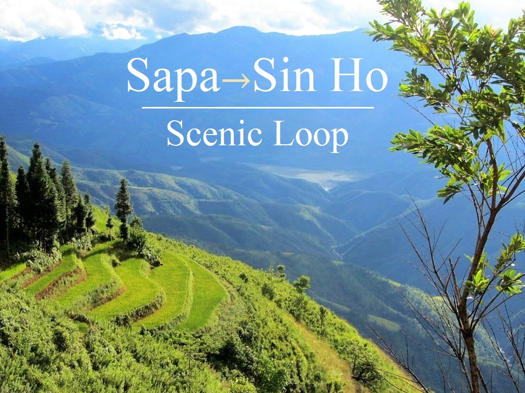
6. Sin Ho Loop:
- Route: Sapa→Lai Châu→Sìn Hồ→Phong Thổ
- Distance & Duration: 320km; 2-4 days
- Provinces: Lai Châu
- Scenery: big mountains, plunging valleys, rivers, rice terraces, light traffic
- Road conditions: good mountain highways, paved back-roads, some rough patches
- Best time of year: April to October
- Full Guide: Sin Ho Loop
High up on the slopes of the Hoàng Liên Sơn Mountain Range (known in French colonial times as the Tonkinese Alps), Sìn Hồ is a small market town reached via spectacular mountain roads. While Sapa, the famous mountain retreat, is now enormously popular with Vietnamese and foreign tourists, Sìn Hồ is rarely visited by travellers. These two highland towns are connected by lofty mountain passes, affording jaw-dropping views over a landscape on a scale not found anywhere else in Vietnam. Ride the Sin Ho Loop and you’ll be rewarded with some of the grandest alpine scenery in Southeast Asia……continue reading
ROUTE MAP: The Sin Ho Loop
COVER PHOTO: [Click image for full guide]
7. Y Ty Loop:
- Route: Sapa→Y Tý→Chinese border→Lào Cai
- Distance & Duration: 195km; 1-2 days
- Provinces: Lào Cai
- Scenery: rice terraces, remote borderlands, mountains, rivers, villages
- Road conditions: mostly paved back-roads, some bad sections, generally very light traffic
- Best time of year: April to October
- Full Guide: Y Ty Loop
North of Sapa, dramatic mountains continue all the way to the Chinese border. Several small roads penetrate deep into steep, terraced valleys and climb high above ferocious rivers, swollen with cold mountain water, to remote minority villages. Creating a scenic loop, starting and ending in Sapa via the hilltop hamlet of Y Tý, this relatively short but dramatic road trip is a great escape from the increasingly touristy mountain town of Sapa. Either bathed in a warm, sharp highland light shimmering over the ripe rice terraces like a halo, or covered in a cold, haunting, Dickensian fog so thick it induces feelings of claustrophobia, the Y Ty Loop is a rewarding (and occasionally challenging) way to spend a day or two in the saddle……continue reading
ROUTE MAP: Y Ty Loop
COVER PHOTO: [Click image for full guide]

8. Borders & Back-Roads Loop:
- Route: Sapa→Lào Cai→Mường Khương→Si Ma Cai→Bắc Hà→Xín Mần→Hoàng Su Phì→ Hà Giang
- Distance & Duration: 235-4805km; 2-5 days
- Provinces: Lào Cai, Hà Giang
- Scenery: mountains, gorges, borderlands, terraced rice fields, minority villages
- Road conditions: mostly decent paved back-roads, some rough sections, risk of landslides, light traffic
- Best time of year: April to October
- Full Guide: Borders & Back-Roads Loop
Connecting two of the most mountainous provinces in the country (Lào Cai and Hà Giang), this motorbike route straddles the Chinese border, carving a meandering course over mountain ranges and along river valleys. Linking the towns of Sapa and Hà Giang, this road trip is a slow crawl through some of the remotest parts of Vietnam, mostly on small roads blasted out of the mountainsides. Dramatic scenery, fascinating border towns, ethnic minority markets, and lush farmland abound. This is a route to be taken slowly – there’s hardly a kilometre without a hairpin bend – and with plenty of time to allow for unforeseen circumstances, such as bad weather and landslides, which regularly block the way……continue reading
ROUTE MAP: Borders & Back-Roads Loop
COVER PHOTO: [Click image for full guide]

9. Tuyen Quang Magic ‘8′ Loop:
- Route: Tuyên Quang→Vĩnh Lộc→Na Hang→Lâm Bình
- Distance & Duration: 260km; 2 days
- Provinces: Tuyên Quang
- Scenery: limestone karst mountains, rivers, lakes, rice fields, palm forests, fruit & vegetable farms
- Road conditions: decent paved provincial roads, few rough patches, opportunities for off-road detours
- Best time of year: April to October
- Full Guide: Tuyen Quang Magic ‘8’ Loop
Under 100km from Hanoi, the terrestrially craggy and ethnically diverse province of Tuyên Quang lays hidden in plain sight. Like most areas of northern Vietnam that few can pinpoint on a map, the roads, which hug rivers, circle limestone karsts, bisect pomelo farms and vault mountain passes, make for an intrepid, rewarding and yet peaceful motorbiking experience. Encircled by more familiar northern destinations, the Tuyên Quang Magic ‘8’ Loop can be enjoyed as a stand-alone road trip from Hanoi or as part of a longer ‘Great North’ motorbike adventure……continue reading
ROUTE MAP: Tuyen Quang Magic ‘8’ Loop
COVER PHOTO: [Click image for full guide]

10. Ha Giang Loop:
- Route: Hà Giang→Tam Sơn→Yên Minh→Du Gìa→Đồng Văn→Mèo Vạc→Bảo Lạc
- Distance & Duration: 385km; 3-7 days
- Provinces: Hà Giang
- Scenery: limestone karsts, deep gorges, remote borderlands, minority villages, rivers
- Road conditions: very mountainous paved roads, some rough sections, fairly light traffic
- Best time of year: April to October
- Full Guide: The Ha Giang Loop
Hà Giang is Vietnam’s northern-most province. The mysterious landscape along the Chinese border – a mythical combination of conical limestone peaks and deep, craterous valleys – is probably the most striking in the country. Once considered the last frontier for adventurous travel in Vietnam, Hà Giang gained an almost legendary status among independent travellers. In recent years, visitor numbers have surged and road conditions have improved, making access to this remote part of the country relatively easy. With mountain passes hanging onto cliff-faces high above roaring rivers, and back-roads threading through forests of limestone pinnacles, it’s ideal territory for a motorbike road trip……continue reading
ROUTE MAP: The Ha Giang Loop
COVER PHOTO: [Click image for full guide]

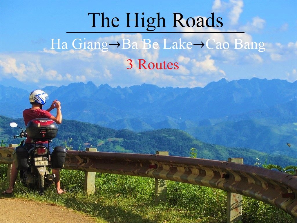
11. The High-Roads Routes:
- Route: Hà Giang→Ba Bể Lake→Cao Bằng
- Distance & Duration: 310-370km; 1-3 days
- Provinces: Hà Giang, Bắc Kạn, Cao Bằng
- Scenery: limestone karsts, mountains, deep valleys, jungle, terraced rice fields, remote borderlands, minority villages
- Road conditions: paved back-roads & mountain highways, optional off-road sections, risk of landslides, light traffic
- Best time of year: April to October
- Full Guide: The High-Roads Routes
The roads linking the three northern provinces of Hà Giang, Cao Bằng and Bắc Kạn travel through some of the most spectacular regions of Vietnam. The landscape around here is extraordinary: many travellers consider this their favourite corner of Southeast Asia. Connecting these three provinces, a handful of incredible mountain roads corkscrew their way through a complex terrain of steep valleys, limestone karsts, and raging rivers. There are several different route options for riding between Hà Giang, Ba Bể Lake (in Bắc Kạn Province), and Cao Bằng, all of which are stunning, but none of which are particularly straightforward, due to road conditions, mountainous topography, and the likelihood of landslides……continue reading
ROUTE MAP: The High-Roads Routes
COVER PHOTO: [Click image for full guide]
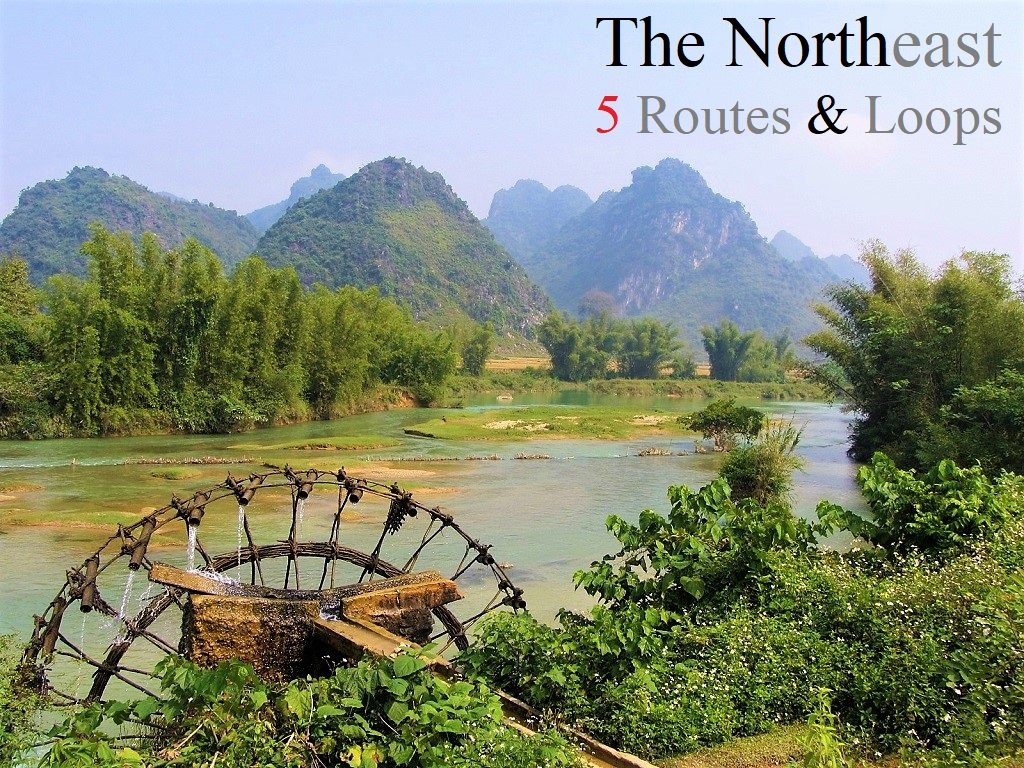
12. The Northeast Loops:
- Route: Cao Bằng→Pác Bó Cave→Bản Giốc Falls→Lạng Sơn→Mẫu Sơn Mountain→Bắc Sơn→Bắc Kạn→Ba Bể Lake
- Distance & Duration: 165-455km; 1-6 days
- Provinces: Cao Bằng, Bắc Kạn, Lạng Sơn
- Scenery: limestone karsts, villages, majestic waterfalls, caves, remote borders, mountains, lakes, rivers
- Road conditions: good, paved back-roads & highways, some rough sections, off-road options, generally light traffic
- Best time of year: April to October
- Full Guide: The Northeast Loops
In my opinion, the three northeastern provinces of Cao Bằng, Lạng Sơn and Bắc Kạn currently offer the best on-road motorbiking opportunities anywhere in Vietnam. Why? Because all three northeastern provinces are utterly beautiful – characterized by limestone karsts, unbroken forests, misty mountains, blue rivers, farms, and craft villages – and are crisscrossed by a growing network of increasingly good-quality paved back-roads and national highways; tourists are few, traffic is generally very light, people are friendly, food is rustic and hearty, opportunities for getting off the beaten path are many, and there’s a real sense of adventure……continue reading
ROUTE MAP: The Northeast Loops
COVER PHOTO: [Click image for full guide]
13. Binh Lieu Loop:
- Route: Bình Liêu→China Border Road→Dinosaur Spine→Hoành Mô Border Gate→Khe Vằn Waterfall→Cao Sơn
- Distance & Duration: 115km; 1-2 days
- Provinces: Quảng Ninh
- Scenery: extraordinary mountain views, deep valleys, forests, jungles, waterfalls, borderlands
- Road conditions: good paved roads & narrow back-roads, very light traffic
- Best time of year: March to October
- Full Guide: Binh Lieu Loop
A small, mountainous district in the far northeast of Vietnam, Bình Liêu is home to some extraordinary roads, highland scenery, waterfalls, hiking and homestays. Hemmed in to the north, east and west by the Chinese border, Bình Liêu is part of Quảng Ninh Province. Barren mountains rise above lush valleys, ambitious roads lead up steep slopes and along precipitous ridges to frontier border towns and hamlets inhabited by several ethnic minority groups, who make up 96% of the district’s population. The Bình Liêu Loop, and the district more broadly, has the potential to be a mini Hà Giang for motorbike road-trippers. However, foreigners currently aren’t allowed to overnight in Bình Liêu without first obtaining a permit, and some areas of the district are off-limits to foreign travellers altogether……continue reading
ROUTE MAP: The Binh Lieu Loop
COVER PHOTO: [Click image for full guide]

*Disclosure: I never receive payment for anything I write: my content is always free and independent. I’ve written this guide because I want to: I like these routes and I want my readers to know about them. For more details, see my Disclosure & Disclaimer statements and my About Page


Hi Tom,
Thank you for your page! It has been unbelievably helpful in planning my moped trip from HCMC to Hanoi. I have a quick question. In my planning, I have followed your Beach Bum route to Vinh, but now I would like to find the ideal route to go from Vinh to Hanoi, while also stopping at Hoa Lu along the way. Where should I start/look for in my planning for this part of the route?
Thank you for all your wonderful info!
Hi Ben,
Well, personally I would go due west of Vinh to link up with the Ho Chi Minh Road going north as far as Cuc Phuong National Park and then turn due east on QL12B to Hoa Lu. From there to Hanoi is a pretty grim ride whichever route you take, whether direct on QL1A (remember that motorbikes can’t use CT01) or trying to wriggle through the smaller roads. Again, personally I would head due west again to rejoin the Ho Chi Minh Road and take it into the capital. For that part of the Ho Chi Minh Road, see Section 8 of this guide.
Best,
Tom
Hey Tom,
I am planning to visit Vietnam in March and I’d like to do a 4+ day motorbike trip in the north, but I have no motorbike experience yet. Ha Giang and the Northwest have the best looking landscapes to me, but I’m not sure if it they would be very doable for someone with no experience (especially with the traffic on the Ha Giang loop). Would you recommend to try the Northeast instead, or perhaps somewhere else?
Hi Patrick,
Well, wherever you ride, you would need to be extremely careful of course, especially with no motorbike experience.
I think I would suggest riding the Limestone Loops instead. This is a highly scenic area with good roads and very light traffic, and two good accommodation hubs (Pu Luong and Mai Chau) at which to base yourself while riding the loops and from which to rent a bike for a few days.
Best,
Tom
Hi Tom,
Is there a route that you recommend going from the Limestone loops (Mai Chao) to the more northern routes? Perhaps to the Northeast and connecting to the Trans-Northern Belt Road?
Thanks,
Rakhal
Hi Rakhal,
From Mai Chau and the Limestone Loops region, there are many potential routes, but I’d recommend joining road 6 Cũ north of Mai Chau and then joining QL43 until you hit QL37 and then join QL32 up to Nghia Lo and then eventually hitting QL279 (the Trans-Northern Belt Road).
Best,
Tom
Hey Tom, I’m currently planning a Loop through Northern Vietnam (Hanoi to Ninh Binh, to Sapa, to Ha Giang, to Lang Son, to Ha Long Bay/Cat Ba and back to Hanoi to give you a rough idea of the route). I’ve got a month planned for this and the one thing that is currently on my mind is: Are there enough gas stations in the more rural parts of Northern Vietnam? I am a bit worried I will be running out of gas when there are a few days of riding off the beaten path. What are your experiences with this?
Thanks so much, your site has given me many many ideas and waypoints for my upcoming trip!
Hi David,
In general, gas stations appear at fairly regular intervals, even on most of these northern routes. If/when there are long stretches without gas stations, I will have mentioned it in the specific guides to each route, which are linked to on the page above.
However, you shouldn’t let you fuel gauge get too low before looking to fill up. Also, make a note of how far your bike goes on a full tank: most ordinary bikes in Vietnam will do anywhere between 100-250km on a tank.
If you really get stuck, chances are that some one nearby will be able to help you out – some some villages, for example, sell petrol in glass bottles.
Best,
Tom
Hi!
The rough road sections marked on the map at ba be lake isn’t too bad. Its a dirt road, but easy to drive. It could become muddy with heavy rain I think, but even so it’s only 20 meters until a paved road again.
Hi Bente,
Thanks for the update. I assume you’re referring to the Ba Be Lake route from the High Roads guide.
Best,
Tom
Hi Tom, i recently stumbled across your guides and i’ve been inspired since!
I was in Vietnam many times, but reading this, i see there is still more for me to explore. I’m planning another bike trip, but i’m not sure how to do it, since i’ve seen a lot already and none of the Loops that you suggest fits exactly what i want. Do you maybe have any recommendation on how i could combine your loops or create a new loop?
The things i want to see is:
-Area around Pu Luong
-heading north to see Ta Xua
-and then i found another spot that looks indrecidble, called Ta Chi Nhu
-more north to Mu Cang Chai
-Fansipan
and then basically back to Hanoi, since i’ve seen all of Ha Giang already.
Does that make any sense, can i combine some of your routes to fit in my destinations somehow? I really love your routes and all the recommendations you have along it, which makes it hard to just create a new loop, as i dont have any spots except the ones i listed. So i would rather take one, or multiple of your routes and fit my destinations in. I have 2 weeks in total, but wouldnt necessarily use all of that for the bike tour, if its possible in less time.
Any advice is highly appreciated!
Thank you.
Hi David,
If you want to do that then you could add your routes to the ones on this page as follows: The Limestone Loop (that covers Pu Luong), The Harvest Route (that covers Mu Cang Chai), the Sin Ho Loop (that covers the Fansipan & Sapa area). In between those loops, just add your other areas, such as Ta Xua and Ta Chi Nhu.
Best,
Tom
Thank you so much, i will be looking closer into these loops and will try to combine These 🙂
I’ve also read your weather Guide and it seems like you suggest the northwest is best in the spring. Fortunately i will be coming at the end of May to that Area. However, if i look online at climate diagrams, a lot of them show that during the end of May it will already start raining a lot. Do you think that could be a Problem in the northwest area? Not sure how accurate these weather diagrams are, since the north seems to have so different weather conditions even a few hundred km from another.
And thank you again!
Hi David,
May should be OK for the northwest. In general, because that region is so mountainous, the weather can be unpredictable and changeable. Windy.com is best for reliable forecasts: open it up, zoom in on the region, select the rain/thunder option from the right sidebar menu, and run the satellite for the next few days.
Best,
Tom
Hi Tom,
Thank you for your amazing guides and for sharing your knowledge.
I will be in Hanoi in April and want to do one of your routes, but I do not have a motorbike licence (yet) so will have to do it on a scooter. Can you recommend any routes which would be doable on a scooter?
Thanks in advance!
Harry
Hi Harry,
As long as the scooter is in good condition, you should be able to ride most routes, but not off road, of course.
Perhaps it’s a good idea to start with a short route, such as the Sin Ho Loop.
Best,
Tom
Thanks Tom. I will be using a 50cc – will this change anything?
As long as it’s in good condition, it should be ok, just very slow (and noisy) on the hills.
Tom
Hi Tom,
I second all the great comments about the knowledge sharing and helping travellers (especially bike drivers hehe). I hope you are getting the donations and economic support you defenitly deserve.
It’s our (my partner and I) first time in Vietnam and my intention is to grab a sense of the main areas of the country to hopefully comeback in the future and focus on the ones we liked the most or felt we needed more time. Our itinerary is to visit Hanoi and Halong, then we plan to spend 7/8 days in the North and after that 7/8 more days in central Vietnam (Hoi an, Hue and Phong Nha ke-Bang). My initial idea for the North was to go to Sepa and then travel east till Bao lac. May I ask you a few questions?
Do you think that’s a reasonable route for 7 days or we’ll be missing too many things?
I take we’ll need to rent the bike in Hanoi to make the route circular (also I’d like a bike for 2 people, cb500x or similar). Do you know if we can take a bus (+ 300/500cc bike) back from Bao lac or close by? Or we’ll need to drive back to Hanoi? How long do you think it will take?
And finally, my intention is to return the bike in hanoi, fly to danag and rent another one there. Would you recomend instead driving down from Hanoi? Keep in mind that unfortunatly we are limited in time…
Understanding the amount of time and energy you are putting into the page, I was wondering if adding a forum to the page will help you answering questions, etc since subscribers/riders could return back your help replying to others travellers. Just a suggestion (may be you have already discarted the idea for good reasons).
Thanks a lot!
Daniel
Hi Daniel,
You could ride from Sapa to Bao Lac in 7 days. But the more time you have, the better your road trip will be.
I don’t think you’d be able to take such a big bike on most buses in northern Vietnam, so you will probably need to ride back from Bao Lac to Hanoi. You could do that in one day if you start in the morning.
Because you have limited time, you should rent a bike in Danang, rather than riding from Hanoi to Danang.
I recommend some good rental companies on this page, some of which have offices in Hanoi, Ha Giang and Danang.
Instead of a forum, I have comment sections at the bottom of all my guides where people can write updates, suggestions and share their travel experiences.
Best,
Tom
Hi Tom,
Thank you for sharing your wealth of knowledge on Vietnam. Your blog is really the bible for anyone looking for a motorbike adventure in Vietnam!!
I will be arriving in Hanoi end of March and will have a total of 15 days. Hoping to spend ~12 days exploring the north (I’ve done south to North route in 2015!). Not yet set on a route, but think of doing Ha Giang loop, combined with the High Roads and North East loops? Or would you rather suggest the trans northern route instead and possible heading north west?
I was also wondering if you have any updated news on police checkpoints on the Ha Giang loop. From what I’ve been reading on Reddit and from info from the Styles Motorbikes rental company I contacted, it seems after a tourist death a year ago they’ve really intensified these checkpoints and you don’t get off as lightly with just a “coffee fine”. Fines seem to now be 1.5-2m dong. Have you heard anything recent on this?
Also would you suggest renting in Hanoi and taking the train to Lao Cai or less hassle to just rent in Ha Giang and take a sleeper bus?
Any input is much appreciated. Thanks again for all the info you put out there.
Hi Johnny,
For bike rental, it would be best to take the bus to Ha Giang and rent there. Ha Giang has lots of bike rental outlets now – see our full Ha Giang Loop guide for details. Also, there have been reports of difficulties over the last year or so with taking motorbikes on the Hanoi-Lao Cai train, however you can do it by bus instead.
We will be publishing a guide to taking the sleeper bus between Hanoi and Ha Giang pretty soon, so look out for that.
Yes, there are now quite regular police check-points on the Ha Giang Loop, and most foreign riders will be stopped and fined if there do not have a local license or valid international license. It’s best to ask your bike rental company for more advice about that.
As for the route, Ha Giang plus one of the High-Roads connections to the northeast is a good itinerary for 12 days riding in the north.
An alternative would be be the Trans-Northern Belt Road plus a northwest route, such as the Sin Ho Loop. This would be much less touristy than the Ha Giang Loop, but this is a decision that most riders with limited time have to make.
Best,
Tom
Hi Tom,
These guides are epic! I’m returning to Vietnam to complete my motorbike journey that was cut short due to covid from Jan -March of 2020, I got from Saigon to Hanoi before having to leave. Unfortunately, I have much less time for this trip so, my focus will be entirely on the north. Based on your description, Ha Giang, the High-Roads, and the North-East Loops are the way to go. I’ll have 2-2.5 weeks from mid-october this year.
I was planning to keep the route fairly loose and see how I go each day and stitch together the routes you have highlighted. I was just wondering if you have any general suggestions, or advice regarding this trip? And specifically, do you have a recommended route out of Hanoi (or is it better to find bus/train out of hanoi and begin in Ha Giang, or some variation)?
Very much appreciated!
– John
Hi John,
Yes, in general that sounds like a good idea and potential route.
I would certainly suggest taking the bus to your start point and picking up your bike there rather than riding out from Hanoi, especially considering that 2-2.5 weeks isn’t that much time to ride the roads you’re considering: better to spend all your time riding the mountains than riding through the traffic and highways of Hanoi.
That entire region is great for riding and scenery. Remember that road conditions change all the time and that if you’re going there between November-February temperatures can be surprisingly cold.
The more flexible you can be with your route and your time, the better.
Best,
Tom
Hi ,
just wanted to say I’m so happy I stumbled across your site.
I’m going to Hanoi in Feb 2023 and would like to know in your opinion what the best 3 day ride for mountain valleys and steeped rice padys is. Also if you know of a reputable motorcycle rental company in Hanoi.
Thanks
Dennis Snider
Hi Dennis,
For bike rental, please take a look at this page.
Bear in mind that February is still technically ‘winter’ in the northern provinces of Vietnam, so it’s quite likely that the terraced rice fields will be fallow. For more, take a look at my Weather Guide.
Mu Cang Chai and the Sin Ho Loop are both quite short and very pretty rides with lots of rice fields.
Best,
Tom
Tom, I just want to say this site is incredible. Its been the inspiration ALL YEAR for a motorbike trip to Vietnam and after holding out and hoping they’re would be longer visas issued, i’ve taken the 30days available and am now ready to tackle the North in September (1st-30th). Your site is a constant reference and in particular this guide.
Following on from ‘Ben K’s comment, my plan all along is to actually do a Big Northern Loop. Landing in Hanoi and going south and then clockwise/west it looks something like (major stops only) Hanoi-Ninh Binh-Mai Chau-Dien Bien Phu-Sapa- Ha Giang- Cao Bang-Bac Son- Ha Long Bay/Cat Ba. Im pretty set on each day’s riding having around 19-20 stops which allows a week or so (allowing for extra stops along the way) to unwind on the CoTo islands/Cat Ba/ Ha Long Bay.
My only empty route is from Bac Son to Haiphong. I know you’ve mentioned how uninspiring the road back to Hanoi from Haiphong is so i will probably get the train, but getting to Haiphong itself on two wheels i haven’t seen great deal covered. Is there a particular road you would rather choose or a favourite town that way to make a stop over at? Any feedback on the Loop in mind would be much appreciated.
Thanks
Hi Pat,
Thanks for your message.
From Bac Son to Hai Phong (Cat Ba Island) you can combine roads QL1B due south for a bit until it joins up with road QL279 all the way to Ha Long City, from where you can put your bike on an amazing public ferry directly across to Cat Ba Island (read about that here). This should be a good route.
However, I only get up to that particular region once a year at most, so I’m no authority.
Other than that, your route is ambitious but good. The more time you have, the better. After the first few days you’ll have a better idea of how things are going to go. The biggest mistake most people (including myself) make is trying to do too much in too short a time. You need to expect that not everything will go according to plan: sometimes things are out of your control, such as weather or road works.
I hope this helps,
Tom
Hey Tom, I’ve only just stumbled across your blog whilst trying to piece together the bare bones of a trip for next March, but it has been incredibly useful so far! All of these loops look amazing, and from what I can gather so much of what the country has to offer is in the North, though from what I can see there isn’t an “All in one” North Vietnam route. We have about 3 weeks, any suggestions?
Hi Ben,
It’s a difficult decision, but on balance with three weeks you’d have a great time stitching together the Ha Giang Loop and the Northeast Loops via the High-Roads between the two.
Please bear in mind that road conditions are in a constant state of flux in the northern mountains – check the comments section at the bottom of my guides for any recent reader updates and ask other travellers as you go.
I hope this helps,
Tom
Hi, this looks good. Do you have a GPX for this route?
Hi Paul,
There are 9 different routes on this page – if you click the link to each route, you will find a google map of that specific route. You can export each map and download the KML, then you should be able to open the map on your phone. However, it depends on your device, so you might need to google the method for your specific phone.
Best,
Tom