
First published October 2023 | Words and photos by Vietnam Coracle | 12 comments

Tom Divers is the founder and creator of Vietnam Coracle. He’s lived, travelled and worked in Vietnam since 2005. Born in London, he travelled from an early age, visiting over 40 countries (he first visited Vietnam in 1999). Now, whenever he has the opportunity to make a trip, he rarely looks beyond Vietnam’s borders and his trusty motorbike, Stavros. Read more about Tom on the About Page, Vietnam Times and ASE Podcast.
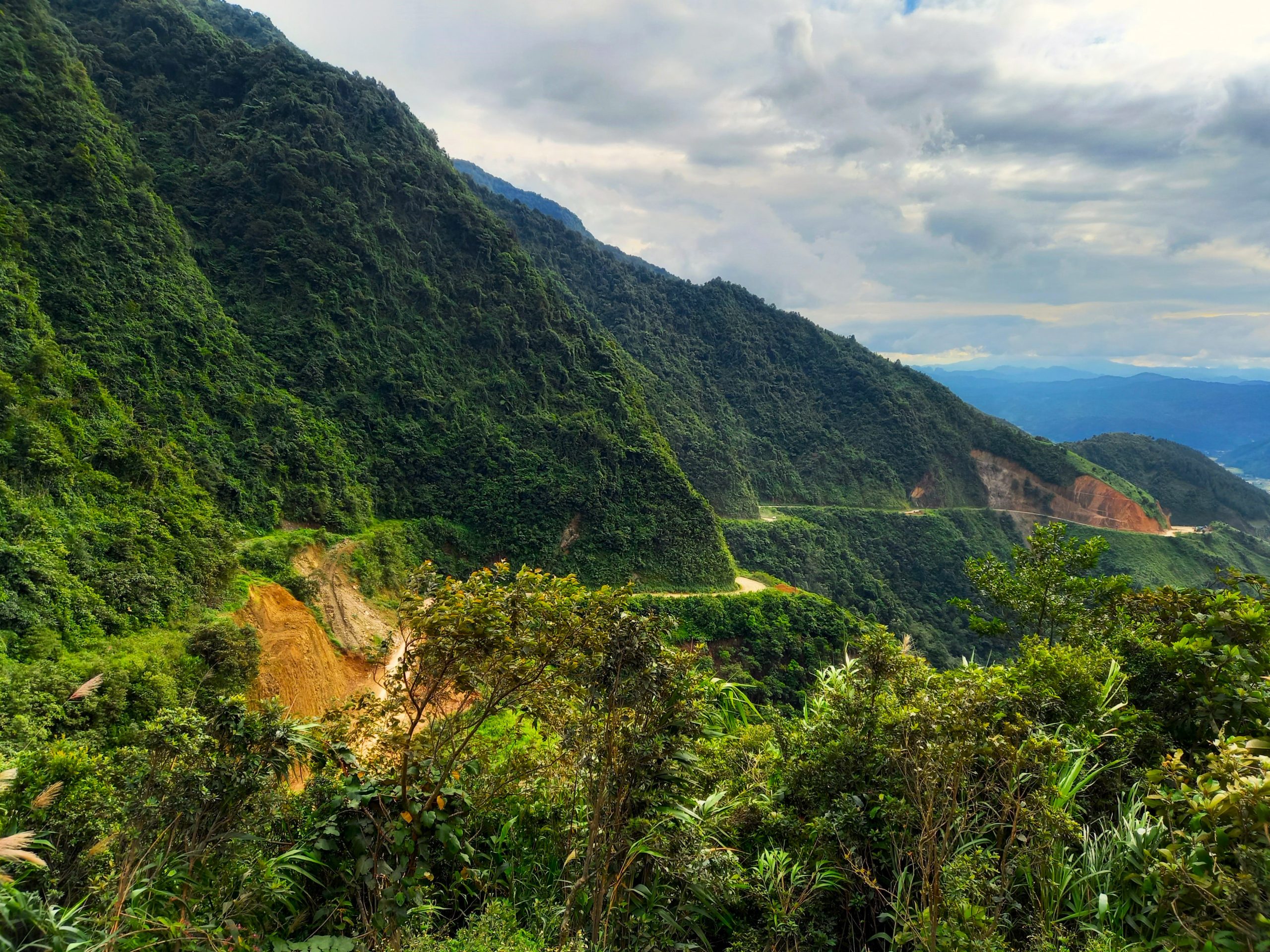
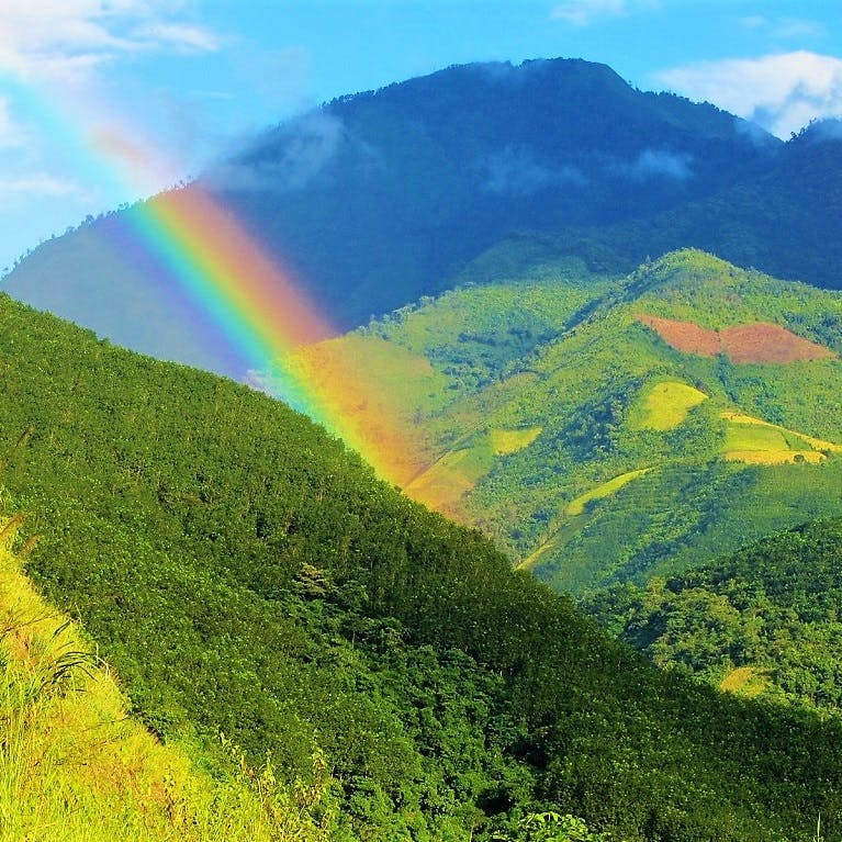
Traversing the breadth of Vietnam from east to west at its widest and most mountainous point, QL279 is an historic route and the third longest road in the nation, measuring 937km. Sometimes referred to as Đường Vành Đai Phía Bắc (Trans-Northern Belt Road), QL279 passes through 10 northern provinces and some of the most spectacular landscapes and complex terrain in the country. The road forms an arc across the northern crest of Vietnam, echoing the national border with China. QL279 is named after the short but bloody Sino-Vietnamese border war in February, 1979. Hence, 2=February, 79=1979, QL=quốc lộ (national route). China simultaneously attacked 6 northern border provinces and cut the roads, preventing the Vietnamese from supplying troops or aid to the region. A new road – effectively a new border – was constructed in order to defend the densely populated Red River valley and delta regions and the capital city, Hanoi. This road became QL279.
[Back Top]

TRANS-NORTHERN BELT ROAD: QL279
One Road Across the Northern Crest of Vietnam from East to West
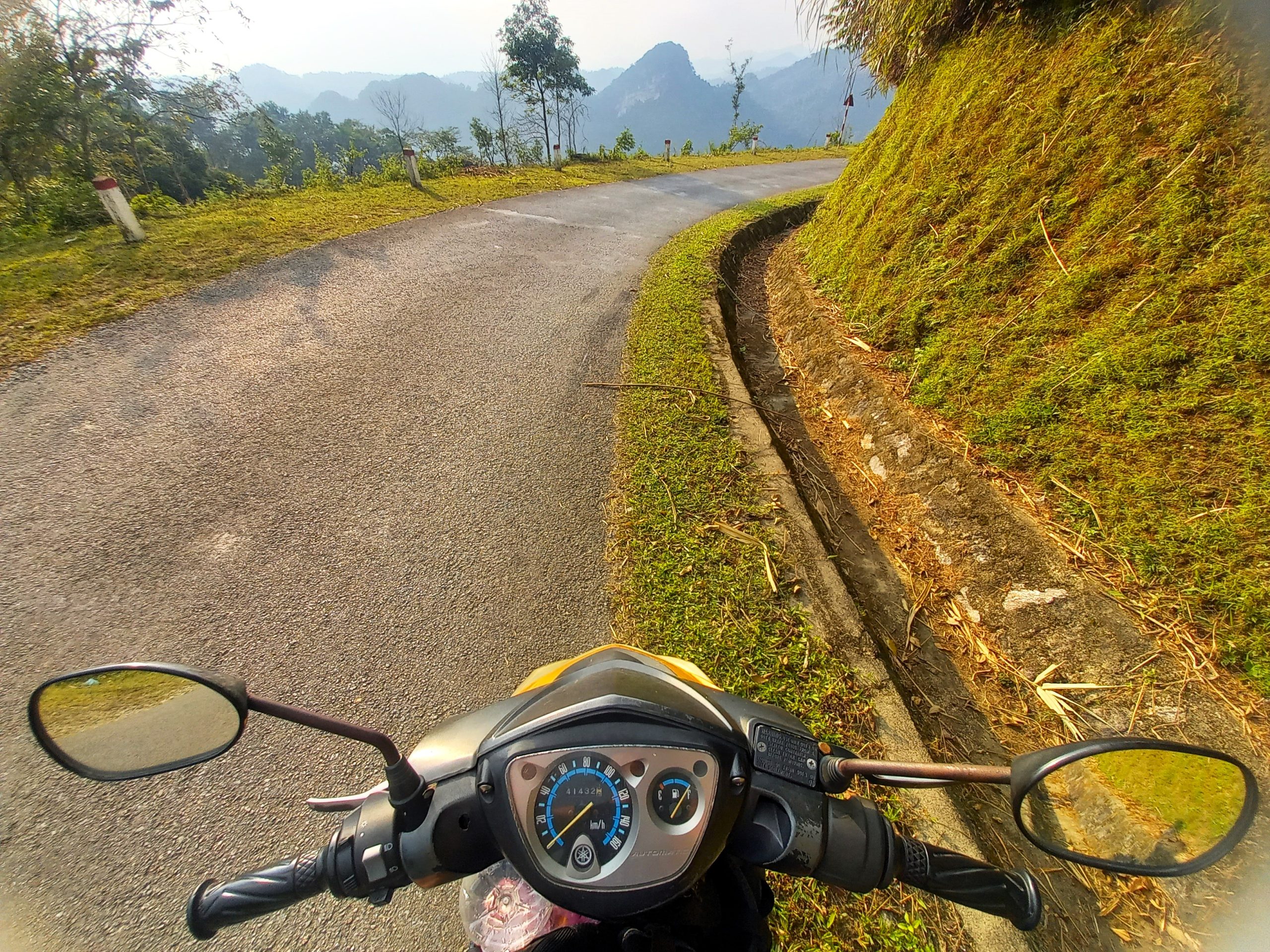
This is a guide to riding the entire length of Road QL279 from east to west across the breadth of the nation. Beginning near the coastal city of Hạ Long in Quảng Ninh Province on the Gulf of Tonkin, not far from the northeastern-most border crossing with China, QL279 travels west through the provinces of Bắc Giang, Lạng Son, Bắc Kạn, Tuyên Quang, Hà Giang, Lào Cai, Lai Châu, Sơn La and Điện Biên all the way to the Tây Trang border gate with Laos, deep in the northwestern mountains: a total distance of 937km. Originally constructed between 1979-1987, although the conflict for which the road was built is now decades past, this route is still considered a valuable military and strategic infrastructure, just as the Trường Sơn Đông Road and Hồ Chí Minh Road are.
CONTENTS:
Support My Website
Please donate or become a patron if you enjoy my work. Vietnam Coracle is totally free & independent. I do not receive payment for anything I write.
Thank you, Tom
ROUTE MAP:
Trans-Northern Belt Road: QL279
Hạ Long to Điện Biên Phủ: 937km
*Road Safety & Disclaimer: Riding a motorbike in Vietnam – or anywhere in the world – has its dangers. I would hope & expect anyone who chooses to pursue a self-drive road trip based on the information on this website does so with care, respect & due diligence. I encourage careful riding & adherence to road rules, but I am not responsible for the legality or manner in which you ride, nor any negative consequences which may result from your decision to ride a motorbike in Vietnam: you do so at your own risk. Read more >
Overview & Details:
Below is a brief overview of the QL279 route, followed by more specific details about important considerations, such as weather, accommodation, duration, food and drink, and connecting routes:
QUICK DETAILS:
- Route: east to west across the northern crest of Vietnam on one road from Hạ Long to Điện Biên Phủ
- Distance: 937km
- Duration: 3-6 days (one-way)
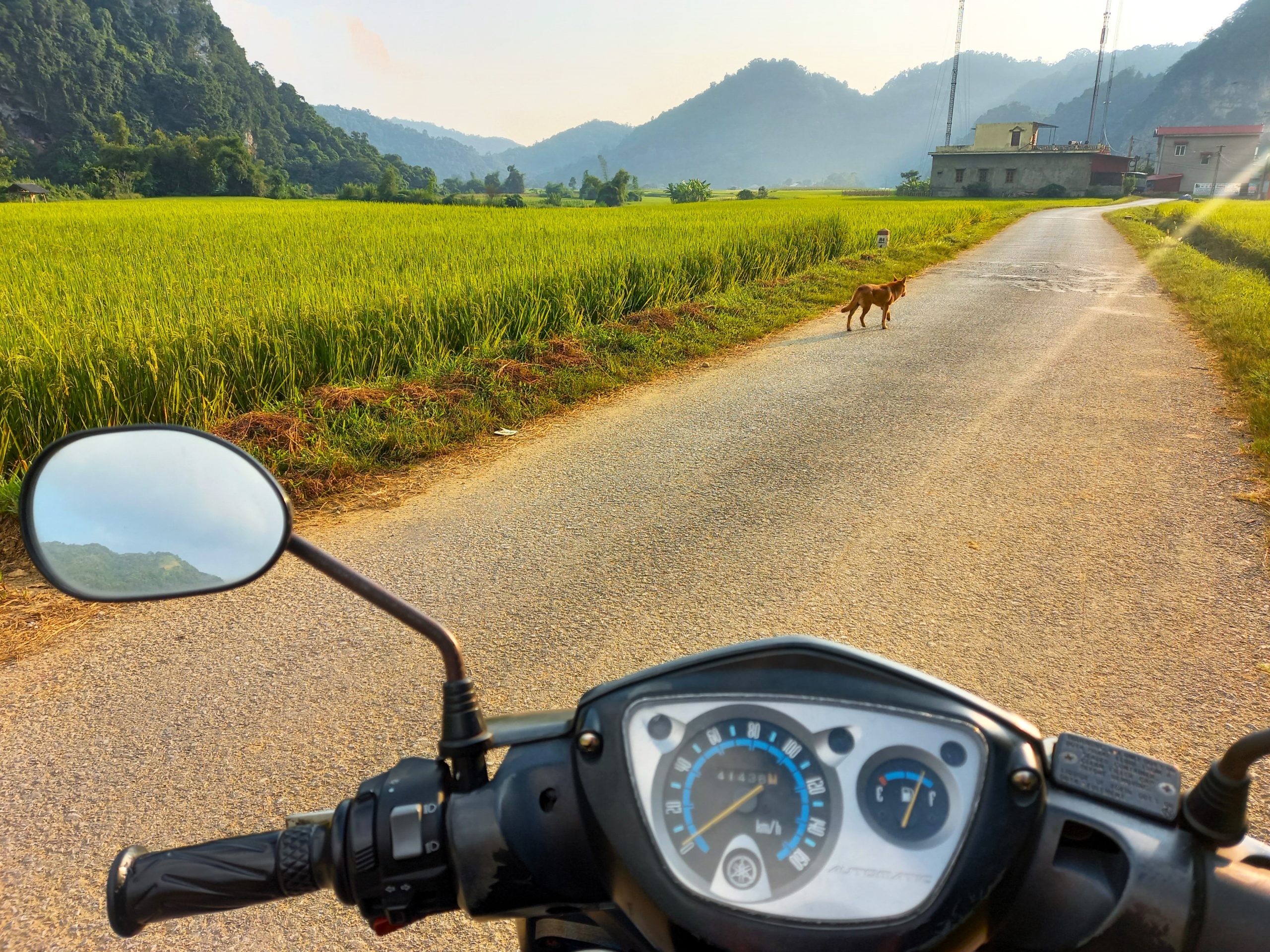
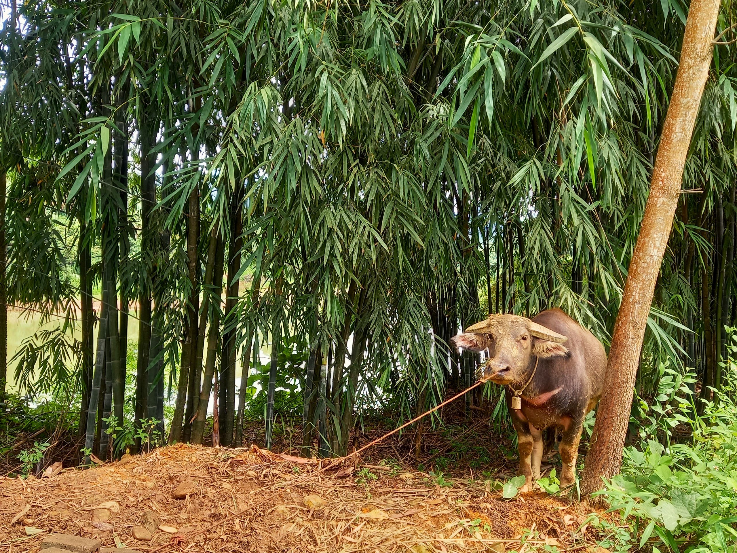
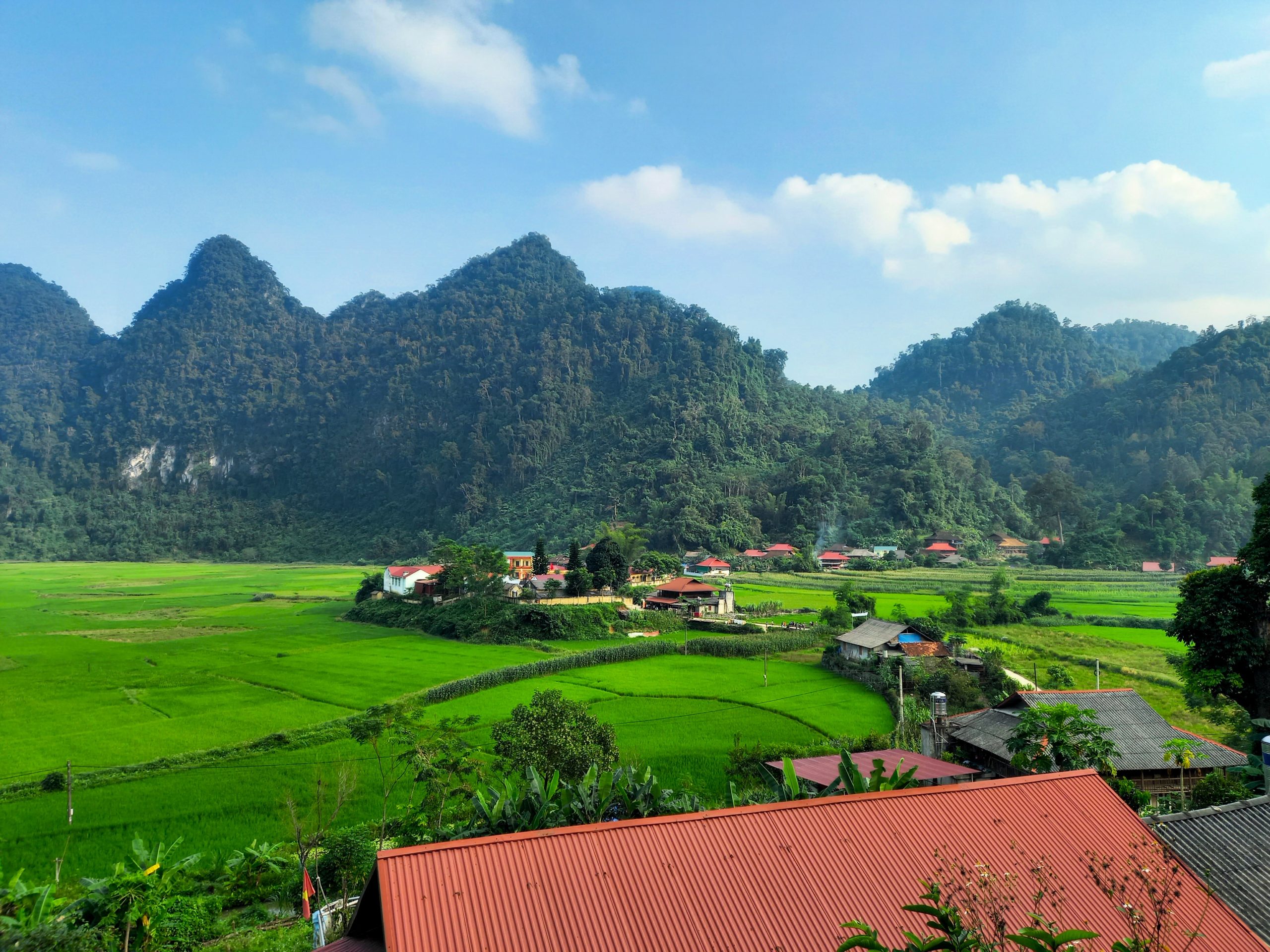
- Scenery: mountains, limestone karsts, jungle, rivers, valleys, villages, rice terraces, lakes, waterfalls
- Attractions: dramatic landscapes, mountain passes, good riding, war sites, homestays, waterfalls, caves
- Road Conditions: good, paved surface, some narrow sections, some roadworks, light traffic
- Best Time: March-October
ABOUT THE ROUTE:
Distance: The full distance of road QL279 from start to end is 937km. However, you can join QL279 at multiple points along its length.
Duration: Assuming you want to ride the entire length of QL279, most riders will need a minimum of 3 days: that would mean riding at least 300km each day, which is a lot on this mountainous road. It’s a much better idea to spend 4-6 days riding QL279, which gives you time to enjoy the ride and the scenery, make some stops at waterfalls and lakes, take some short detours, and stay at some of the lovely homestays along the way.
Start & End: The official start of QL279 is at an intersection near Cẩm Phả in Quảng Ninh Province, not far from Hạ Long City, reached via a fantastic coast road. Alternatively, you can connect to QL279 directly from Hạ Long City. The latter is just 2-3 hours by road from Hanoi, and nearby Hải Phòng and Vân Đồn both have airports. The official end of QL279 is at the Tây Trang border gate to Laos, which is 30km south of Điện Biên Phủ City. However, you can join QL279 at many different points along its course. Indeed, many of my other northern route guides incorporate sections of QL279.

Weather & Time of Year: Road QL279 can be ridden year-round, but the best period for weather is March-October. Temperatures can get very cold in the mountains between November-February, and regular rains fall between June-August.
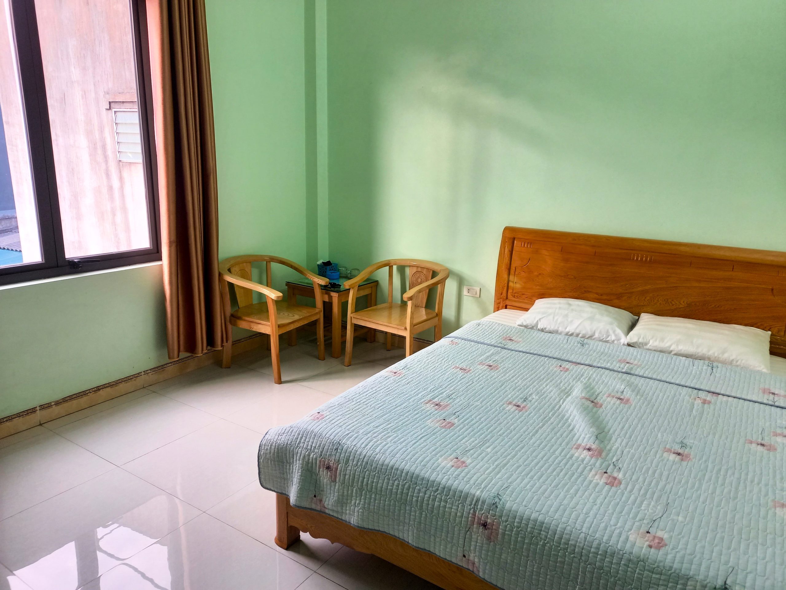
Accommodation: Although much of this route is relatively remote, there are a handful of towns with guesthouses and mini-hotels, and villages offering homestays. In particular, several homestay clusters, such as Bắc Sơn, Ba Bể and Lâm Bình make for very nice and atmospheric places to overnight. In addition, there are a couple of outstanding accommodations on the route, such as Cinnamon Eco Lodge. Alternatively, there are opportunities to make small detours to larger towns for a wider range of accommodation, such as Lạng Sơn. I have marked a dozen or so places to stay on my map as examples of what’s available.
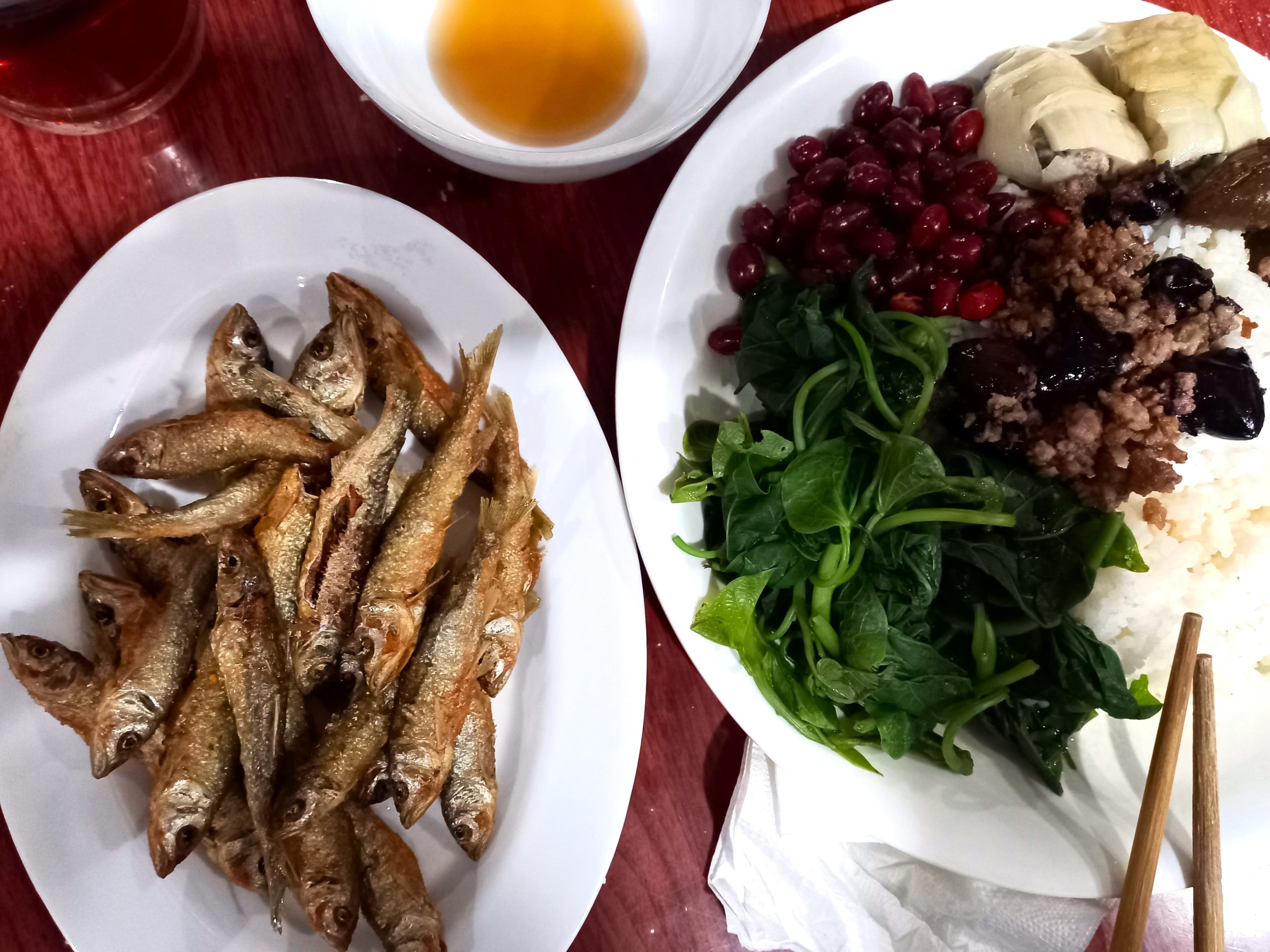
Food & Drink: All towns and villages along the route have plenty of quán cơm-phở (rice and noodle eateries). However, it’s worth noting that food is often only available at mealtimes: don’t expect to find breakfast after 9am or dinner after 8pm in the smaller settlements. Coffee is nowhere near as ubiquitous (or as good) in the northern highlands as it is in the Vietnamese lowlands, but rice and corn liquor (rượu gạo/ngô) are readily available.
Connecting Routes: QL279 connects to many other great routes in the northern mountains. The Hà Giang Loop, Cao Bằng Routes, Tuyên Quang Magic 8, Mù Cang Chải Harvest Route, Extreme Northwest Loop and many more all link up easily with QL279. (See Related Routes)

Section 1:
Hạ Long→Cẩm Phả→Chi Lăng→Bắc Sơn | 250km
[View Map]
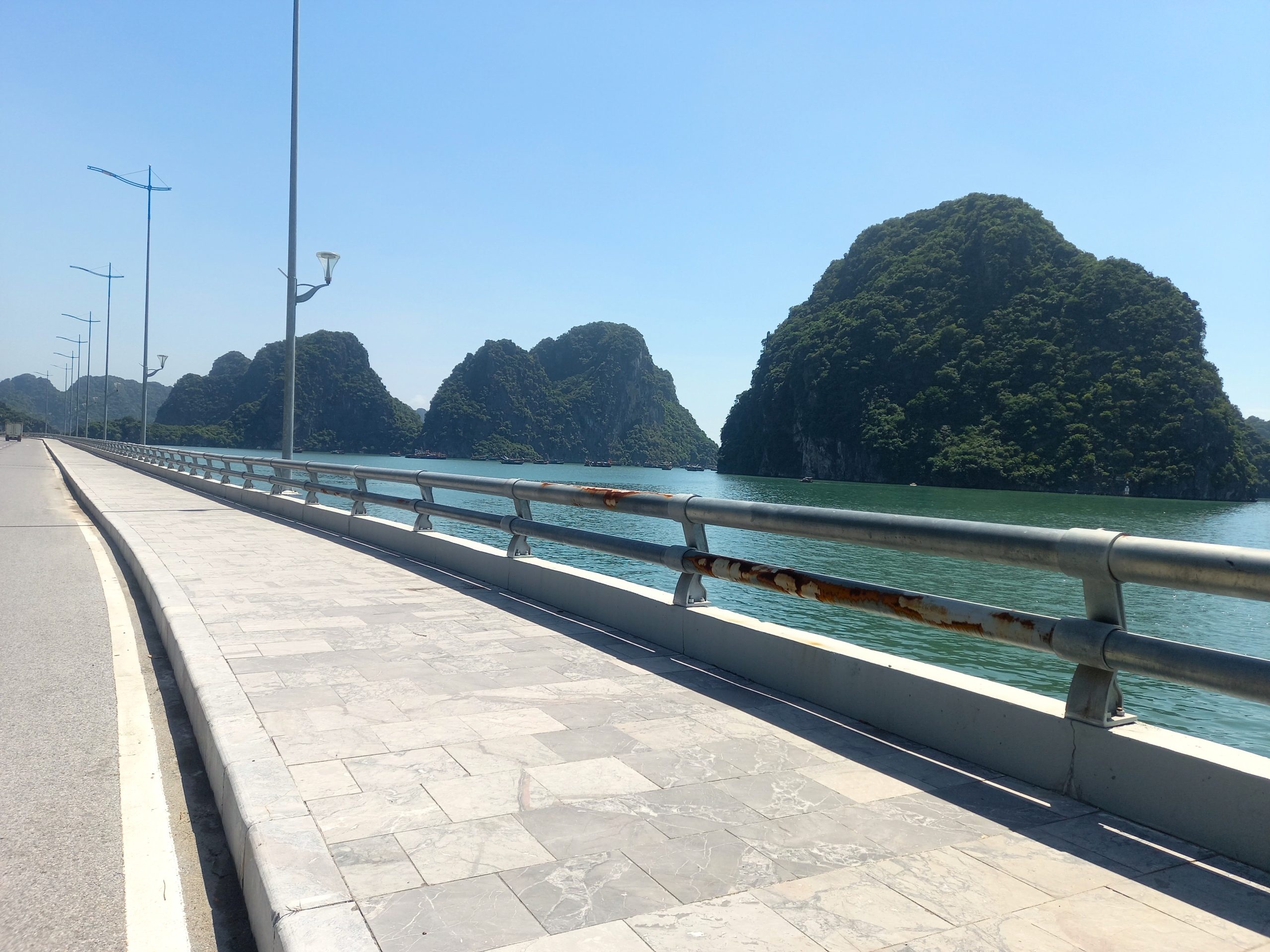
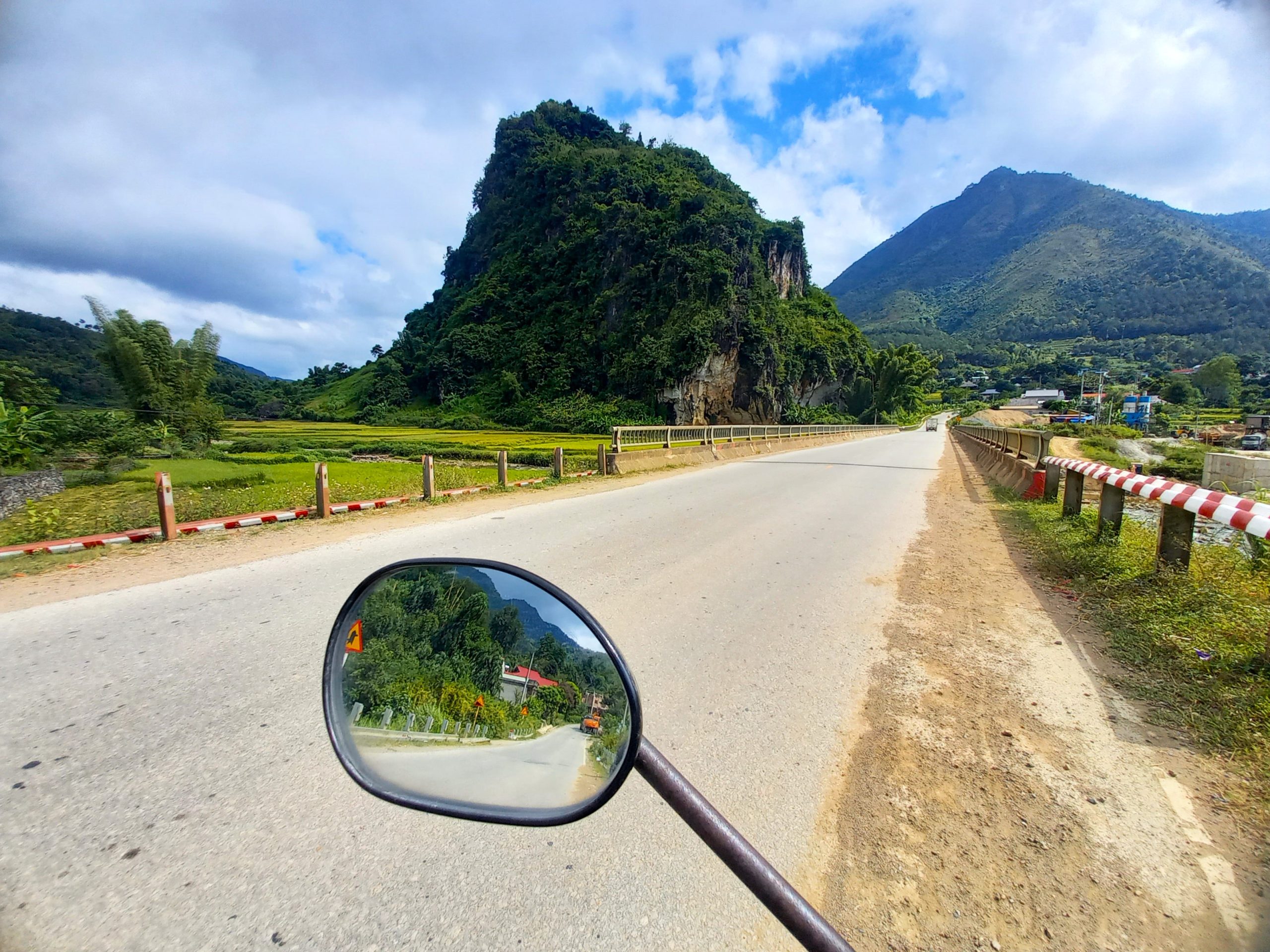
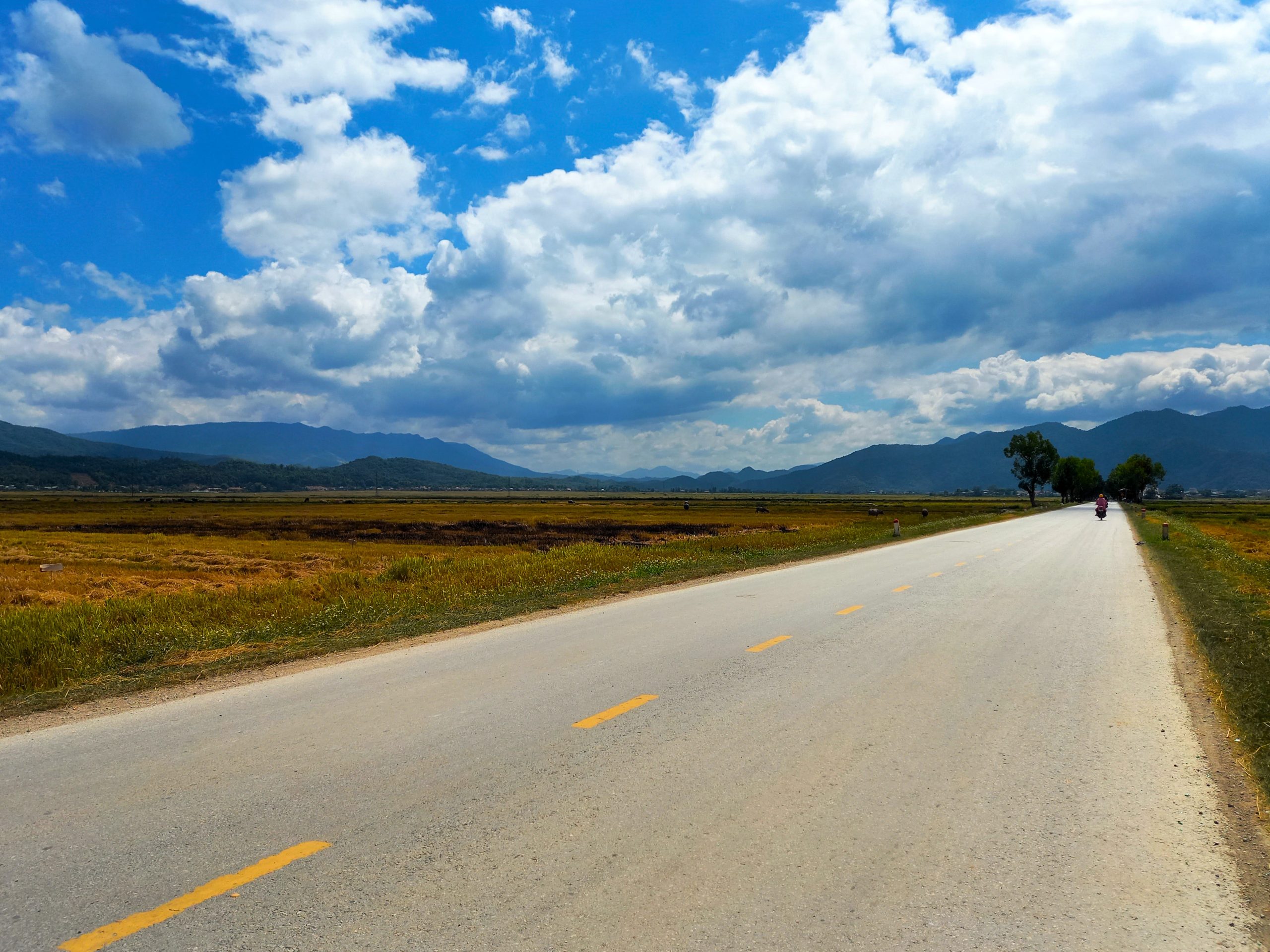
To begin Road QL279 at its most eastly point, start in Hạ Long City and take the fantastic coast road along a karst-studded shoreline towards the coal-mining town of Cẩm Phả. A few kilometres before reaching the latter, turn due north for km01 of the trans-northern belt road: QL279. Although the road immediately climbs into the hills, in truth it is not a glamourous beginning to the journey: passing through grim cement plants and industrial zones, the air filled with a fine dust and trucks littering the road as it leads back behind Hạ Long City Port. (You can easily avoid this by taking a more direct route from Hạ Long to join QL279 north of the city: see the red line on my map. But if you do, you will miss the coast road to Cẩm Phả.)
Once the road starts heading north into the mountains, the trucks dissipate and the landscape becomes greener and the air fresher. Several mountain passes meander deeper into the forested highlands of the northeast. At Chi Lăng, a town in a valley circled by limestone pillars, there’s a hotel if you need it, or you could branch east on Highway QL1A to Lạng Sơn for a greater variety of accommodation options. If not, head straight over the railway tracks and continue north up the extremely steep Bén Pass. The landscape opens up and the scenery gets better and better. Bình Gia is a crossroads where you can branch south to the incredibly pretty Bắc Sơn valley, where there are many homestays to stay the night.
Section 2:
Bắc Sơn→Ba Bể Lake→Na Hang Lake→Lâm Bình | 270km
[View Map]
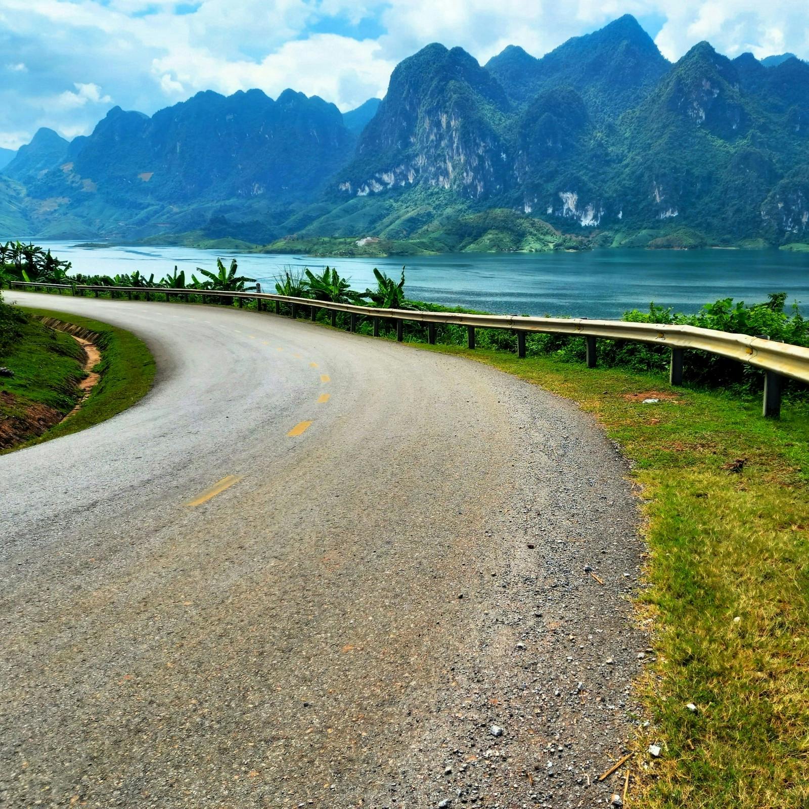
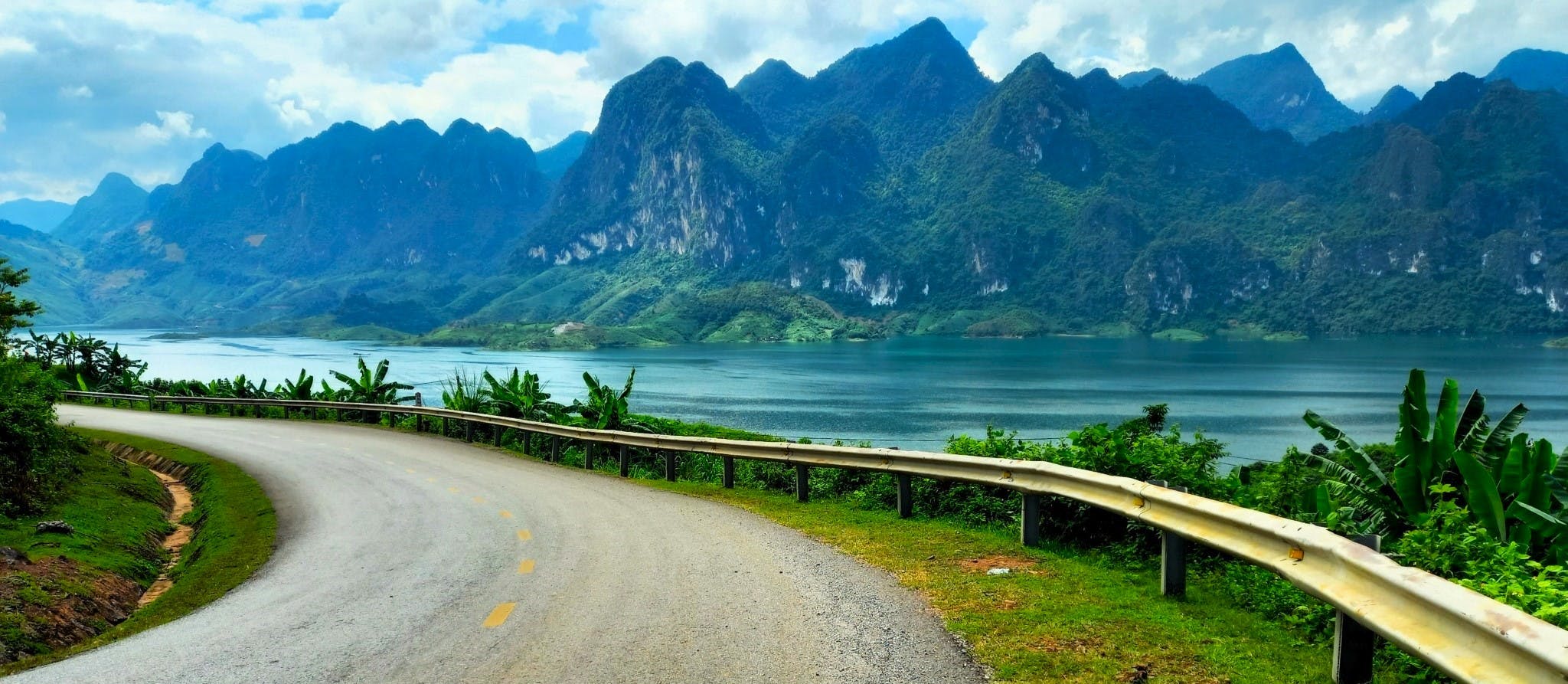
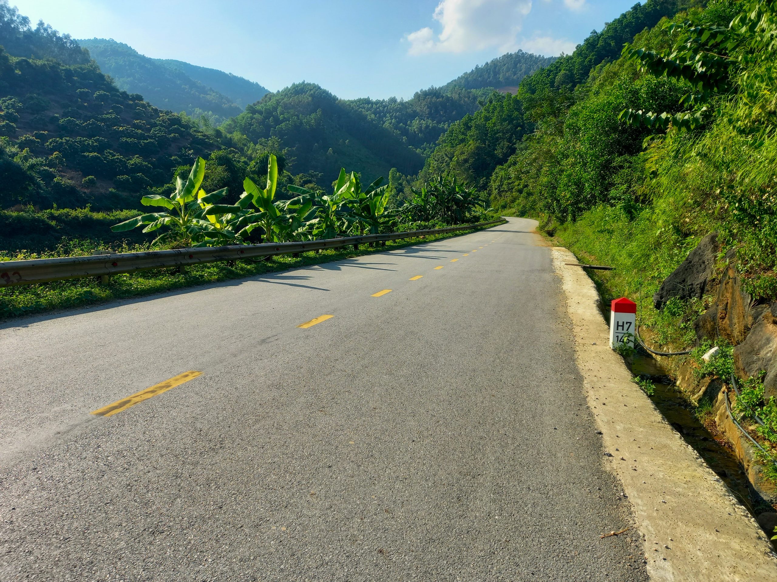
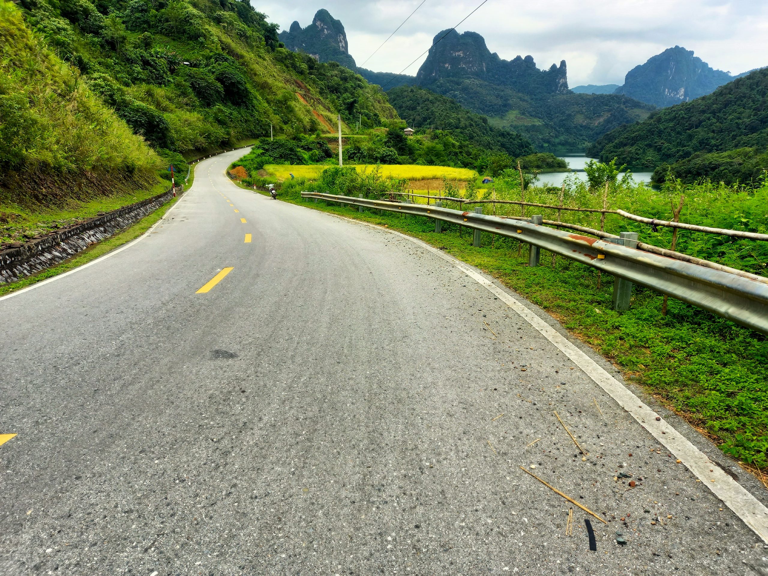
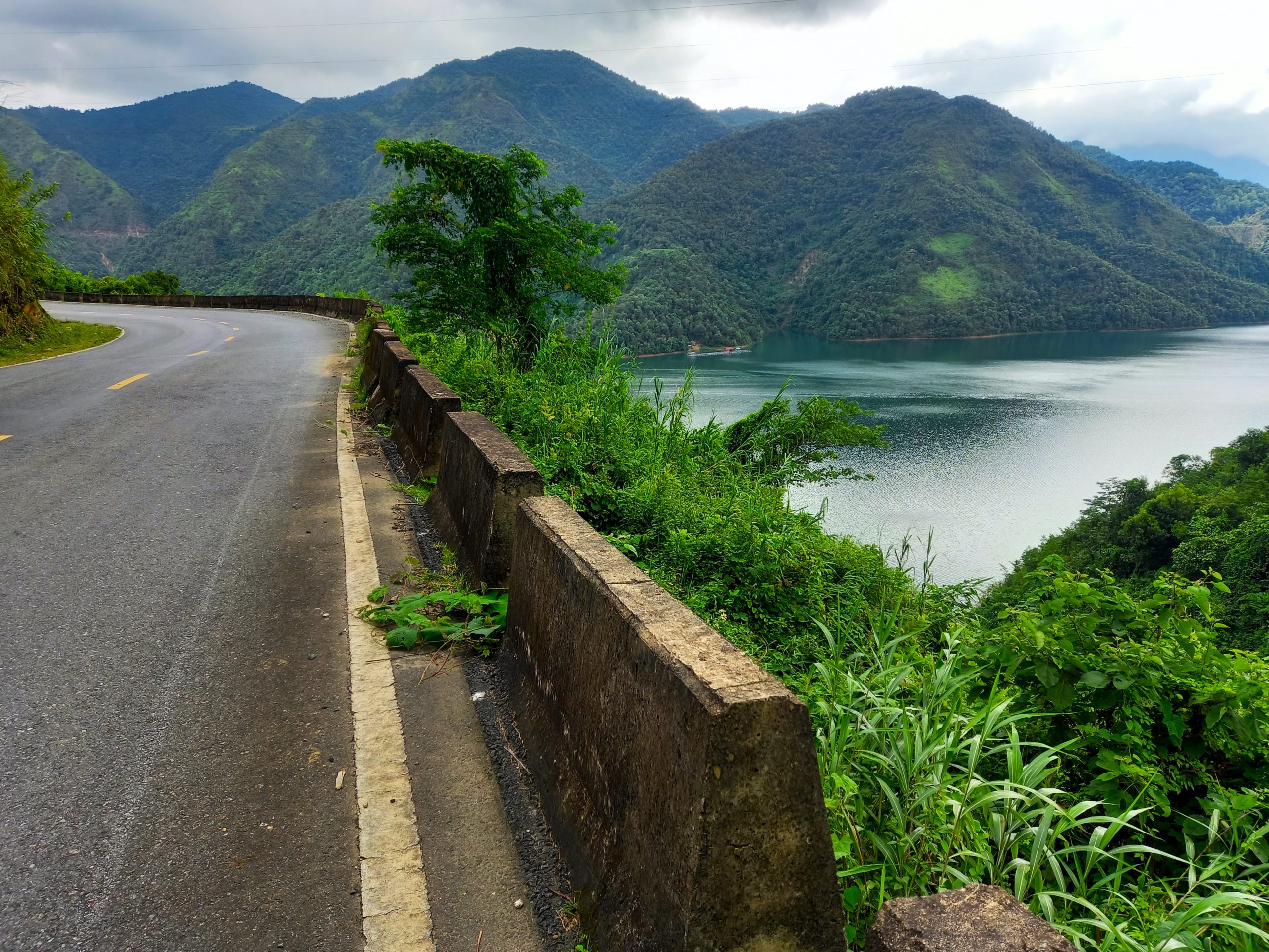
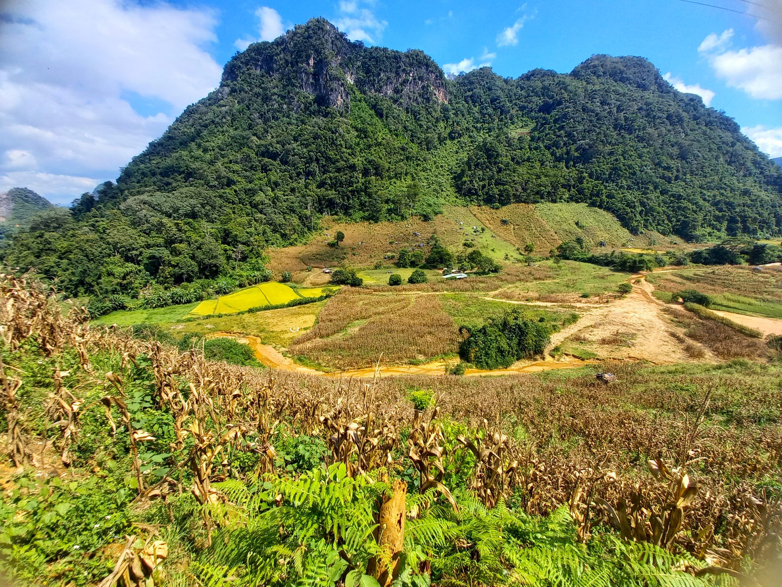
From Bình Gia, QL279 branches northwest into the sparsely populated, densely forested and rarely explored highlands of Bắc Kạn Province. This section of road stretches for over 250km across the crest of the trans-northern belt road. Passing rivers and waterfalls, through jungles and ethnic minority hamlets, the road weaves deeper and deeper into the empty mountains of a region known simply as the Việt Bắc: ‘North Vietnam’. There’s practically no traffic at all. And, with a couple of short exceptions, the road is in good condition, making riding a joy.
At the intersection with QL3, you can join the highway south to Bắc Kạn City where there are lots of accommodation options. Alternatively, continue north on QL279 towards Chợ Rã where there are guesthouses and a short detour to Ba Bể Lake, a beautiful body of serene water encircled by limestone mountains and dotted with excellent lakeside homestays.
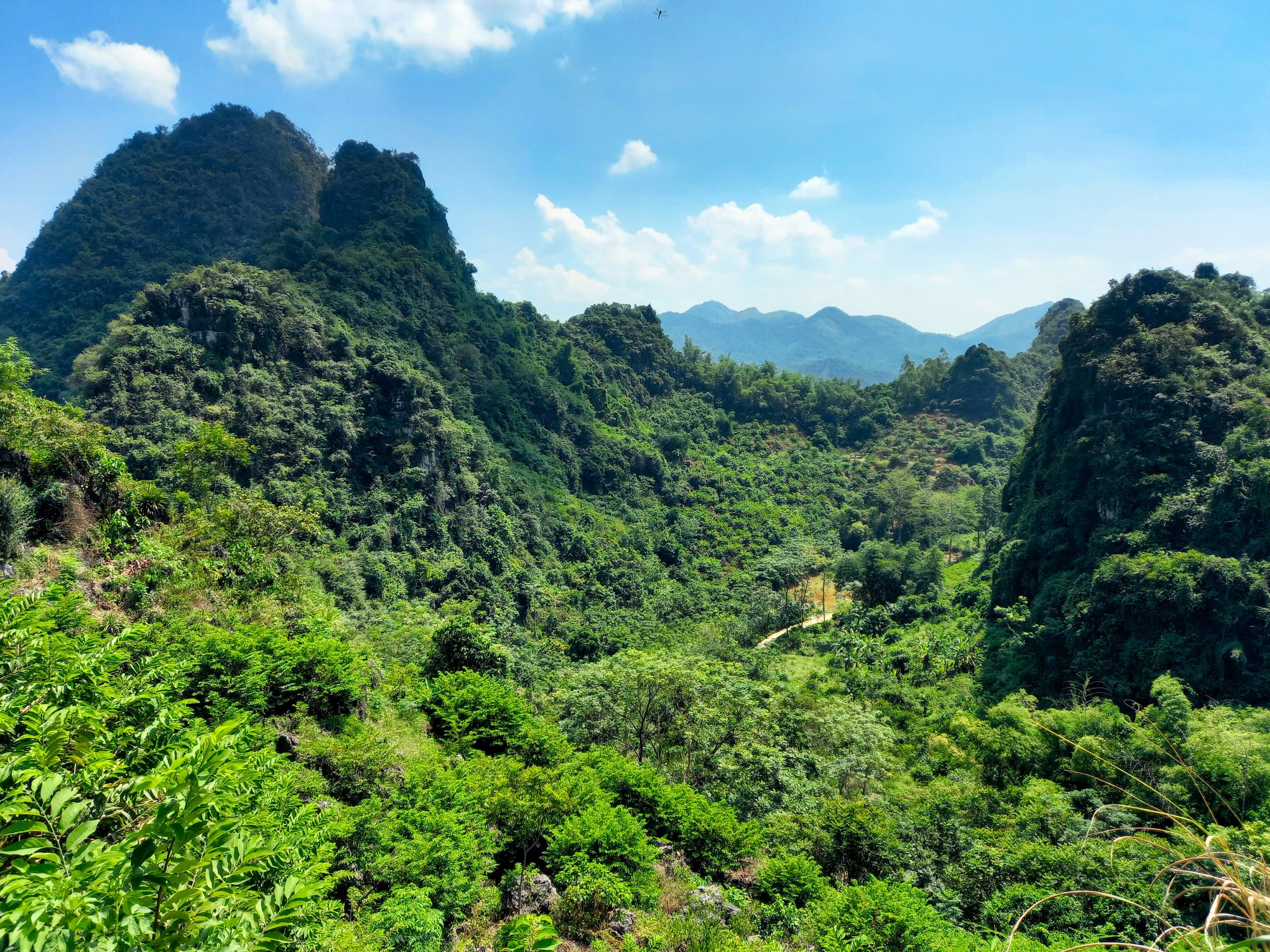
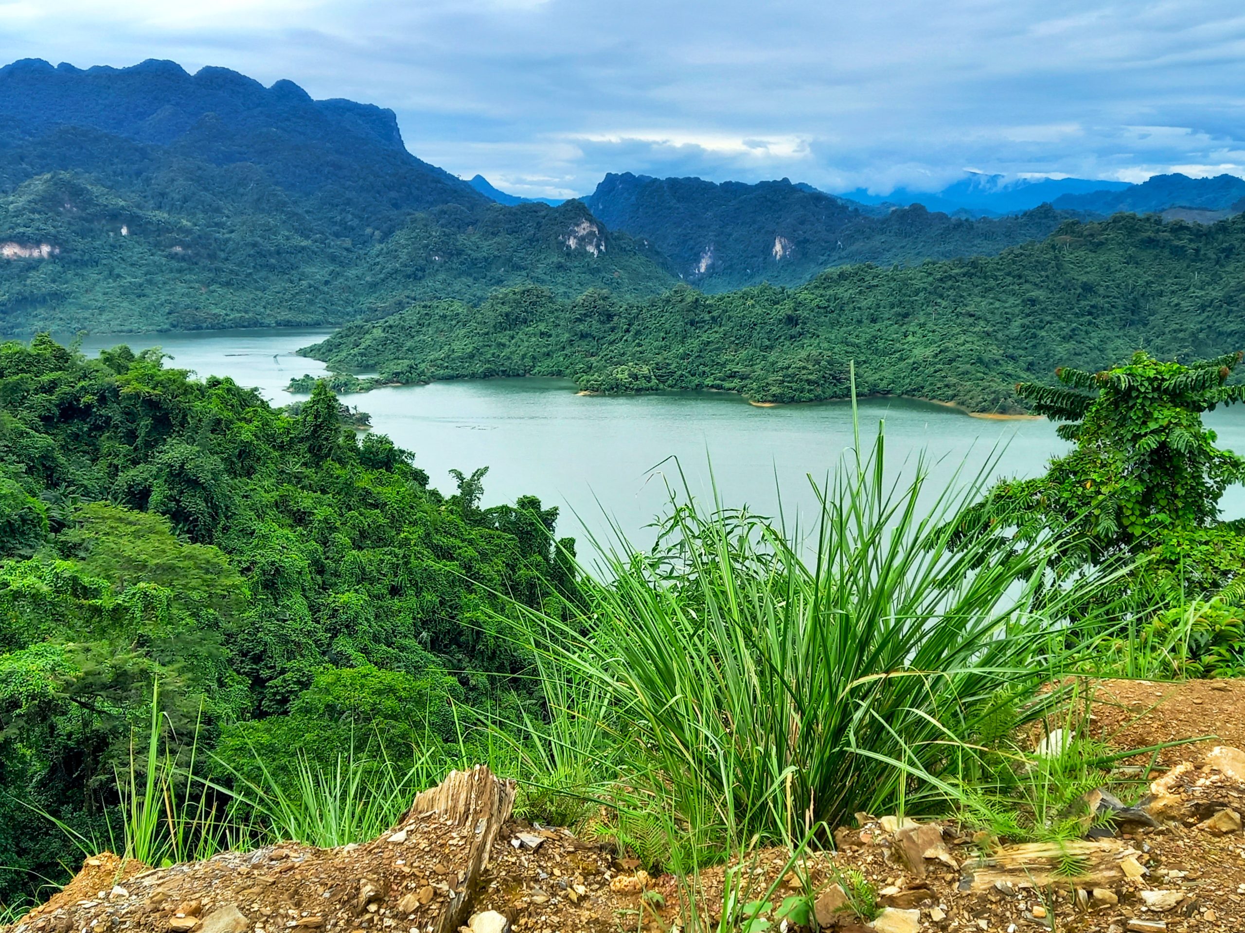
The ride from Chợ Rã west all the way to Na Hang and Lâm Bình is sublime. North of Ba Bể, the jungle appears to melt over the conical limestone peaks like wax down the side of a candle. The road, in excellent condition and totally empty, soars and swirls from peak to peak, valley to valley, lake to lake. It’s an immersive ride. Add a couple of waterfall stops and boat explorations of Na Hang Lake and a night in one of the many atmospheric homestays around Lâm Bình and you have a memorable day on the road. There are good mini-hotels in Na Hang town or take the scenic detour north on DT190/DT188 to Lâm Bình where many good homestays scattered around the pretty countryside.


Section 3:
Lâm Bình→Việt Quang→Phố Ràng→Than Uyên | 255km
[View Map]
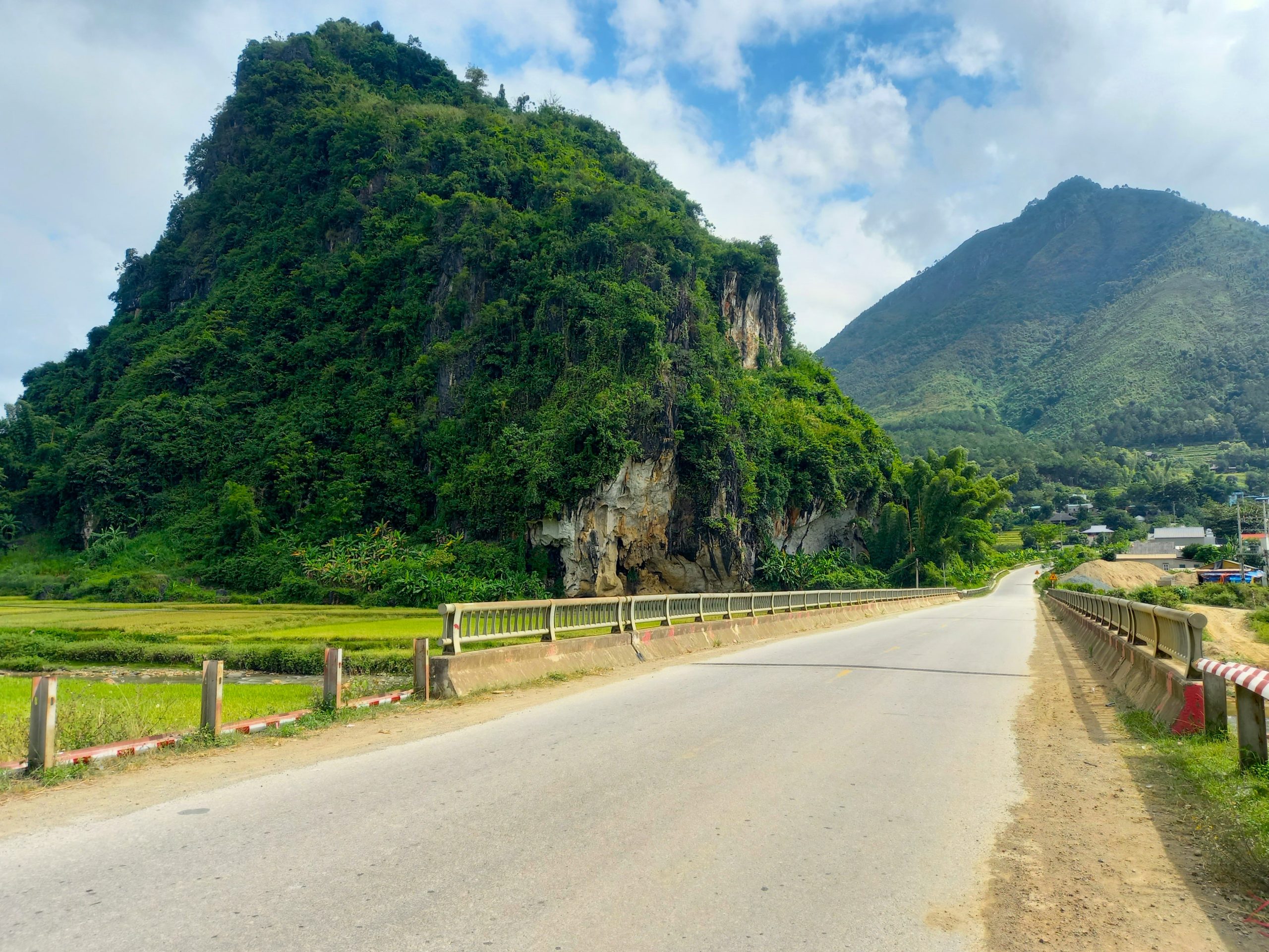
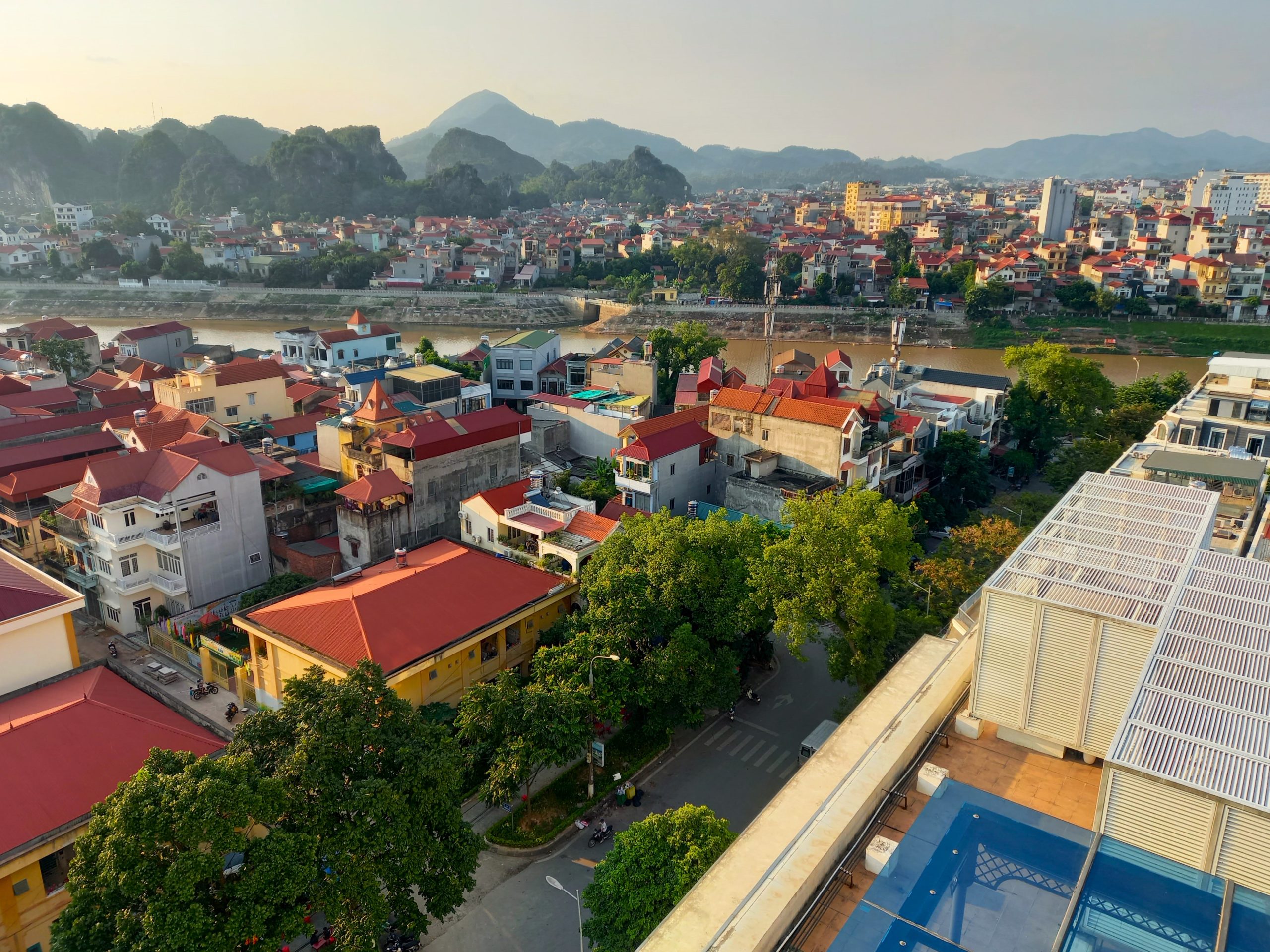
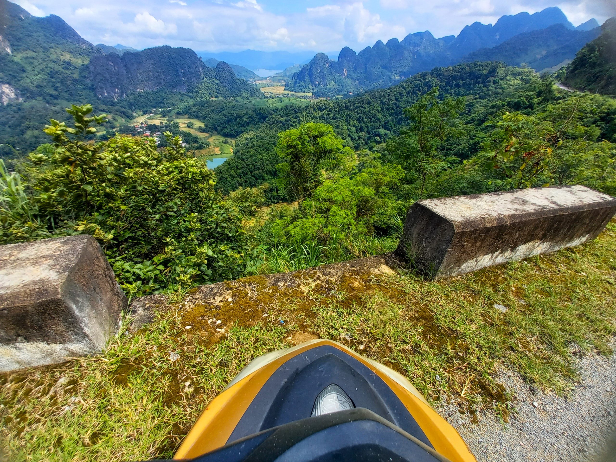
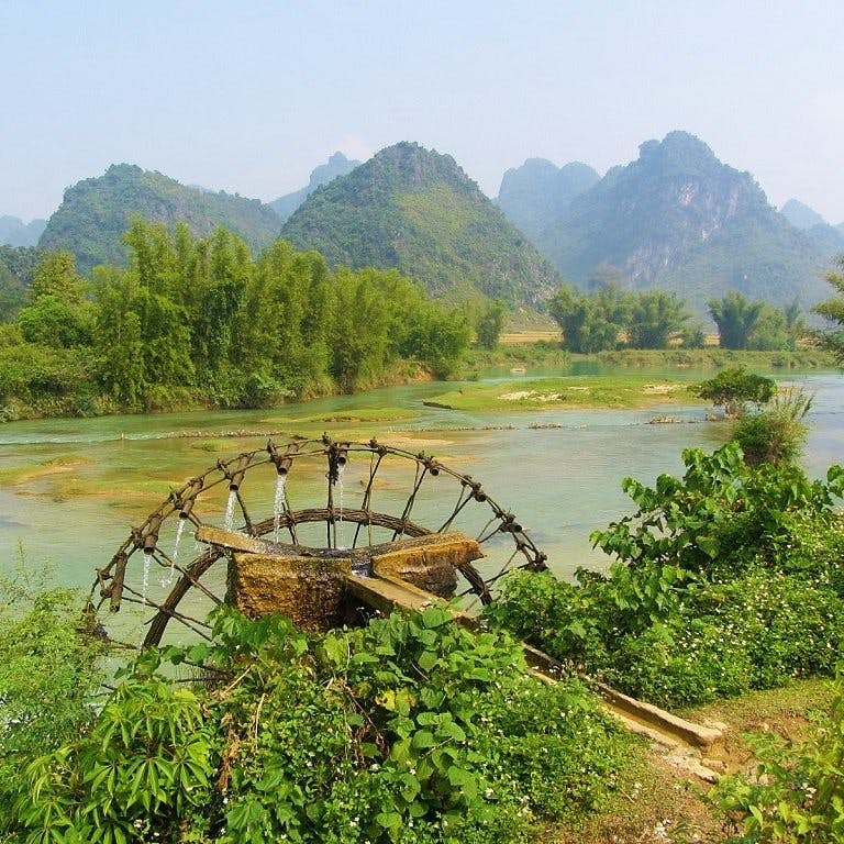
Continuing west from Na Hang, a section of lowland scenery along a river plain leads to the bustling little town of Việt Quang, which is the gateway to the famous landscapes of Hà Giang to the north. Việt Quang has a few decent mini-hotels if you need them and also an unexpected little bar serving excellent-value margaritas, made by a young local. Moving westward from Việt Quang, QL279 is now in perfect condition after many years of slow repairs. The hillsides are planted with cinnamon trees whose bark is laid on the roadside to dry, scenting the air and you ride past. There’s an excellent place to stay here: Cinnamon Eco Lodge.
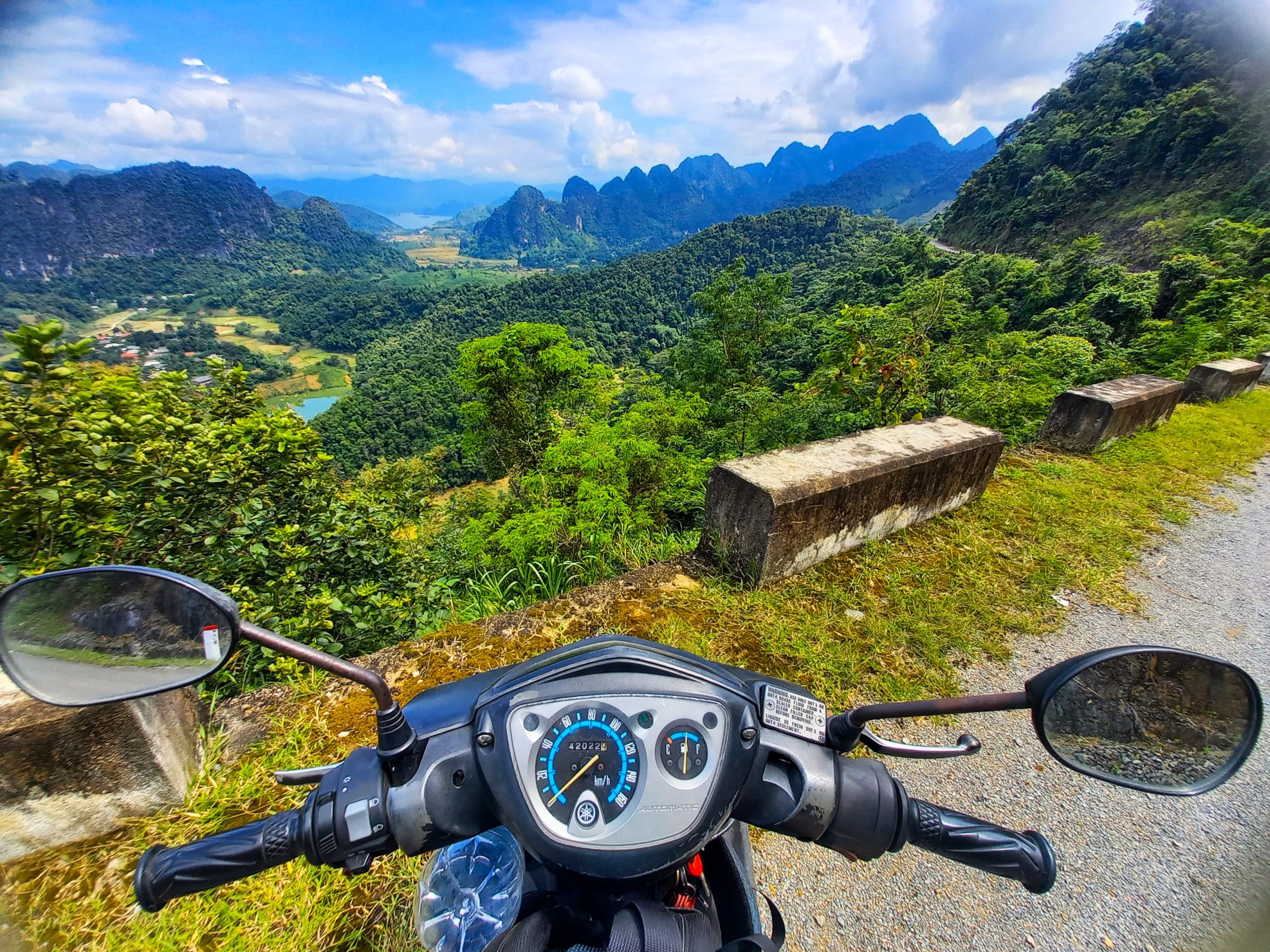
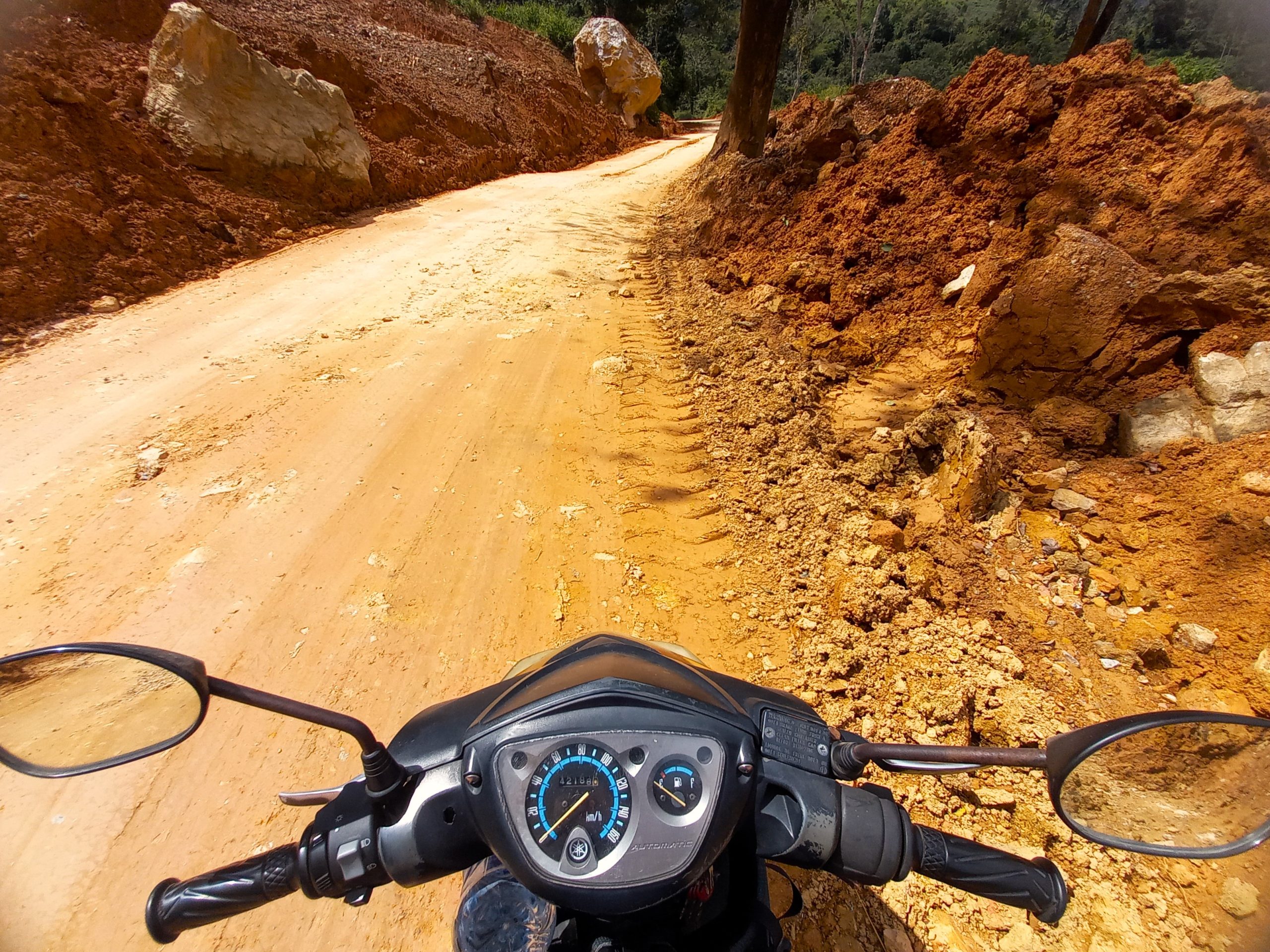
At Phố Ràng the road heads south across the wide waters of the Red River. Unfortunately, the next 70km from Bảo Hà to the Khau Cọ Pass is under repairs. Some sections are OK, but others are quite horrible with all the dust and trucks. In dry weather, it’s still fine to ride, just a bit unpleasant. This is a shame because the Khau Cọ Pass is spectacular: the gateway to the really high mountains of the Tây Bắc (northwest) and the Hoàng Liên Sơn Range. After the junction with QL32 ride a bit further south to the pleasant little town of Than Uyên. This is a good night stop with a couple of fine guesthouses, decent food – including fresh salmon (cá hồi) from local farms – cool mountain air and a little lake.
Section 4:
Than Uyên→Quỳnh Nhai→Tuần Gíao→Điện Biên Phủ | 235km
[View Map]
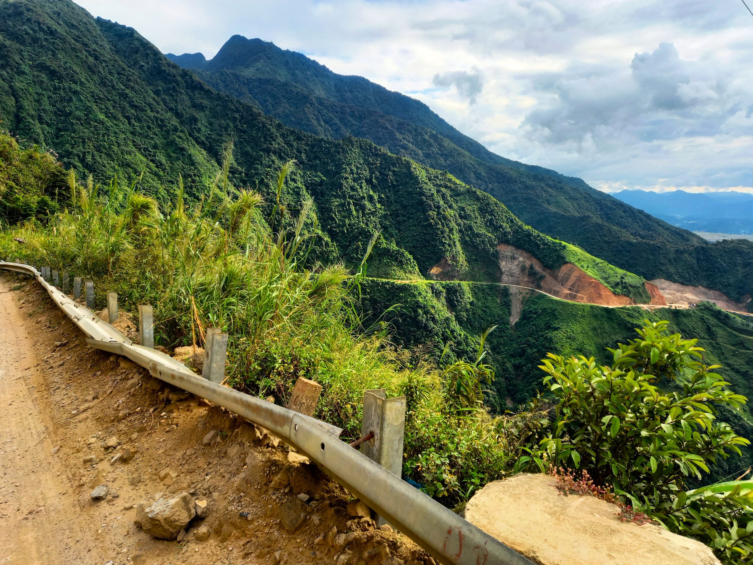
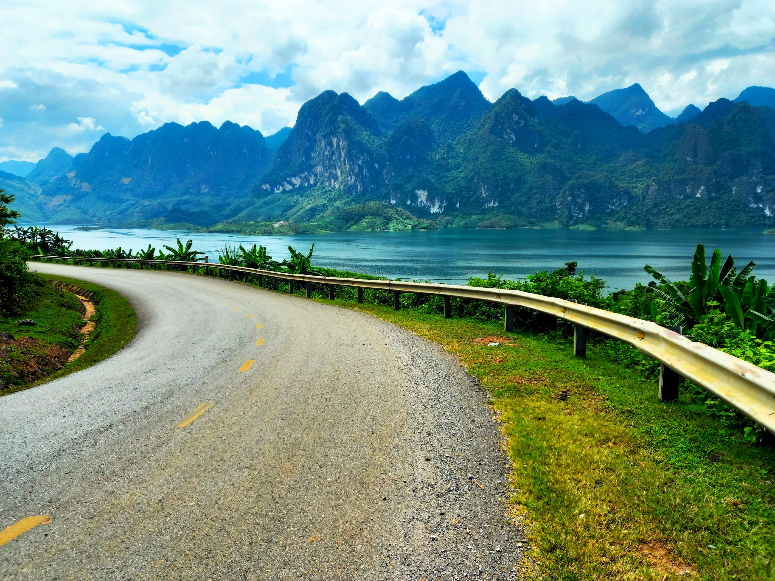
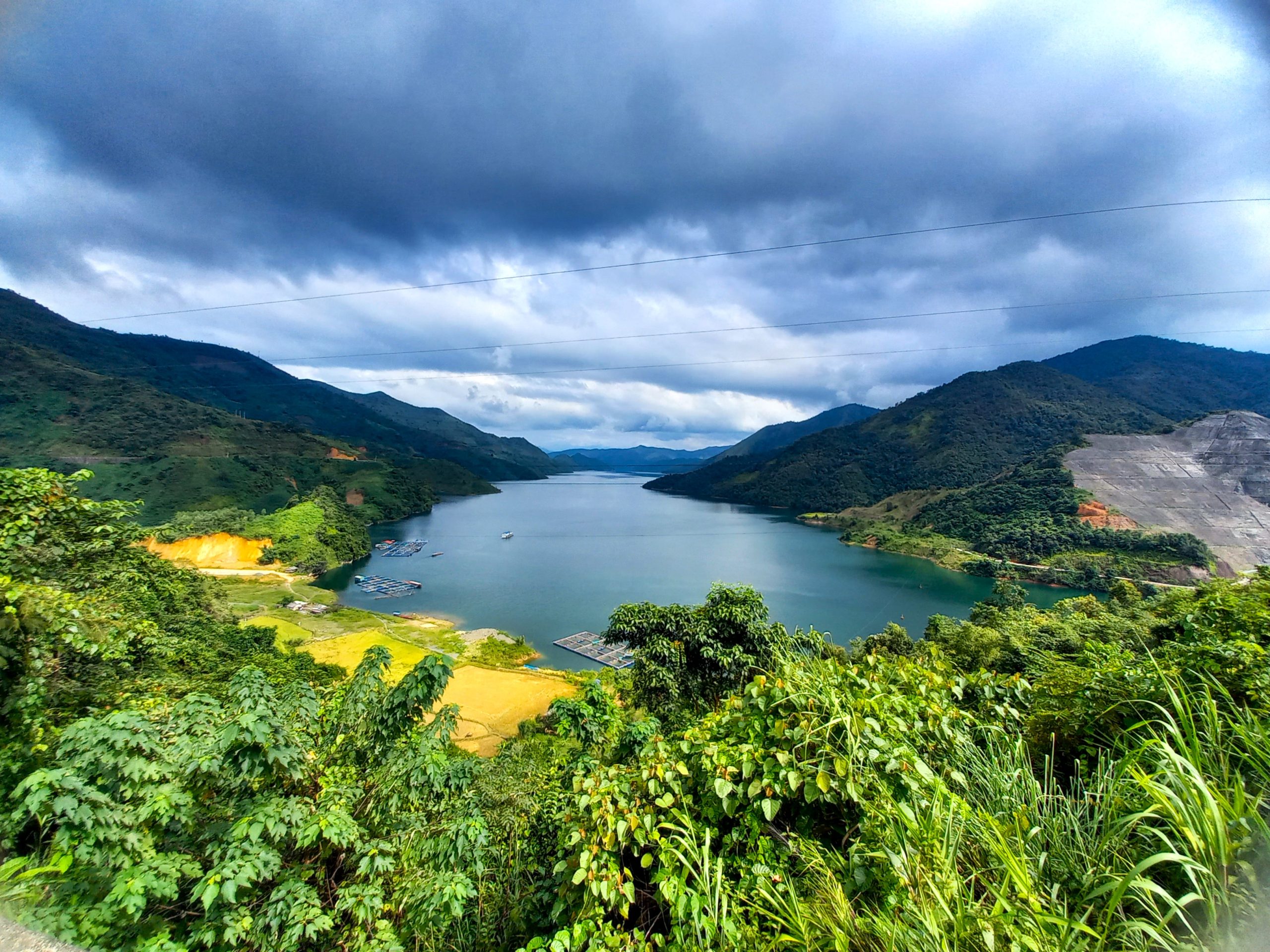
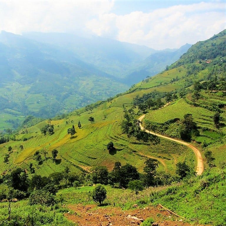
Heading south of Than Uyên, QL279 bears west at Mường Kim beginning a long, snaking path around the perimeter of Hồ Bản Chắt, an enormous reservoir filled with blue water and surrounded by green mountains and limestone overhangs. The road is in excellent condition and there’s no traffic at all. After the lake, a series of passes meander down to the Sông Đà (Black River) which, contrary to its name, is a delightful blue backed by limestone pinnacles forming a jagged crest. A long bridge crosses the broad waterway to Quỳnh Nhai where there are guesthouses. Then a fabulous pass leads up from Hủa Tát with stupendous views back over the Black River Valley and continuing through more limestone magic and jungles to Tuần Giáo.
Tuần Giáo, where there are some guesthouses, is the point at which QL279 joins the main artery to the remote outpost city of Điện Biên Phủ, site of the famous Vietnamese victory over the colonial French in 1954. The road is wide and winding, curling through valleys, over the Tằng Quái Pass and across rivers to the town itself, which lies in a clearing in the mountains. Dusty but pleasant, there are lots of hotels, food and drink options in Điện Biên Phủ, as well as war-related sites, such as A1 Hill and the museum.
The final leg of QL279 to the Tây Trang border with Laos crosses a wide open plain before spiraling up the mountains to the border gate, a scenic ride somewhat spoiled by a large cement plant. The border is remote with signs for freight carriage to Laos, Thailand, China and Myanmar written in all four languages. This is the end point of the trans-northern belt road: km937 of Vietnam’s third longest artery stretching across the breadth of the the nation at its widest and most mountainous point.
*Disclosure: I never receive payment for anything I write: my content is always free and independent. I’ve written this guide because I want to: I like this route and I want my readers to know about it. For more details, see my Disclosure & Disclaimer statements and my About Page


Dear Tom.
Thank you so much for describing the trip along QL 279.
I was able to follow it together with a friend and our great guide from Tigit in September last year. We rode each and every kilometer of QL 279 on 3 Honda Blades 110 to make it in true vietnamese style 🙂
It was an epic trip and a big adventure – especially as we travelled to Vietnam just a few days after typhoon Yagi hit the North last September. Luckily, we could ride everywhere where we planned, although we saw a lot of destruction. Especially at the beginning of the trip in Hai Phong and Ha Long (destruction by wind) and in Lao Cai Province (destruction by water).
We must have passed by thousands of landslides, the worst section being between Nghia Do and Pho Rang (the road actually being a muddy river).
A lot of road construction was still going on in the area you described (section between Bảo Hà & the Khau Cọ Pass).
Apart from that we really enjoyed the trip as it was a very authentic experience, mostly away from any tourist areas.
Ha Long was a ghost town when we’ve been there. I guess usually this is the only place along the road that would be very busy with all kind of tourists. In Mu Cang Chai we saw many vietnamese tourists at some of the rice-terrace-photo-spots (disguised in Hmong gear), in Bac Ha there have been some vietnamese tourists visiting the sunday market (but just a handful of western tourists).
Its true as you write – some of the most spectacular landscapes and complex terrain in the country along QL279. It has been my tenth visit to Vietnam (2nd for a scooter trip), so I have some comparison 🙂
Due to the limited speed with the smaller bikes one can still take in everything that’s happening left and right of the road (landscape and local life and farm animals crossing the road)
When looking at your written guide now, I remember that we must have stopped at the same or very similar places where you took your photos. We started early every day, didn’t need to rush when driving and had a lot of time to enjoy our lunches at local Pho restaurants and some Ca Phe Sua Da in the afternoon, talking with the locals – owners or other guests – our guide being the translator.
Also the conversations we had with him in this 15 days added to the experience and expansion of our knowledge of the vietnamese culture.
Most of the places along this route are off the beaten path from the point of view of a western tourist.
This made it very interesting and outstanding.
In total, we travelled 15 days: starting in Ha Noi -> Ha Long (1N) -> Dong Mo (1N) -> Bac Kan (1N) -> Na Hang (1N) -> Bac Ha (2N, to see the weekend market) -> Cinnamon Eco Lodge (1N – great recommendation from you) -> Than Uyen (1N) -> Dien Bien Phu (1N, end of QL279-part of the trip) -> Son La (1N) -> Mu Cang Chai (1N, perfect views of the rice terraces in September, and possible to drive up to the view points inside the terraces) -> Tram Tau (2N) -> Moc Chau (1N) -> Ha Noi.
Recommendations for accomodation are:
Palette Collect’s Boutique Hotel, Ha Long
Phương Nam Hotel, Bac Kan
Khách Sạn Thắng Sen, Na Hang
Hotel Samu, Bac Ha
Cinnamon Eco Lodge
Love Hill, Than Uyen
Khách Sạn Hoa Hồng, Sơn La
Mu Cang Chay Big View Homestay, Mu Cang Chay
Na Tham Eco Hill Homestay, Tram Tau
Skyline Farm & Homestay, Moc Chau
Your website was and is a great inspiration and source of information for all past and upcoming trips to Vietnam. Thank you.
Hi Martin,
Thank you for the trip report. I’m very happy to hear that you enjoyed this route. And I agree that it’s refreshing to be on a route that’s no often travelled by foreign riders. There’s some great accommodation and scenery along the way, and I imagine that the section under works will be completed soon enough.
I hope you return to Vietnam many more times for even more exploration.
Best,
Tom
The road construction between Việt Quang and Than Uyên is still in full force. 170km between the two areas, about 150km of that was full of trucks, dust and a lack of pavement. Be warned!
I think the drive would be awesome if it wasn’t full of construction like it is now.
Hi Jeff,
Thank you for this update. It is a shame that section is still undergoing construction. But, as you say, when it’s finished it will be a great stretch of road.
Thanks again.
Best,
Tom
Anyone has an alternate route to from Ha Giang to Son La? We will try our luck on the back roads starting with the 196A. The Cau Yen Ha bridge is temporarily closed according to Google map. Any info on that? Cheers!
Hi Felix,
If you don’t want to take QL279 across the Red River, then you can just ride up to Lao Cai and Sapa, then join QL32 south to rejoin QL279 and continue towards Son La.
Best,
Tom
Hi Tom,
Thanks for the suggestion! We are riding bicycles and came from the coast through Ha Giang so we decided to spare us the climbs around Sapa and tried our luck on the QL279. Excepted for the first pass leading to Khan Yen, it was actually not all that bad. Construction only lasted for about 80km. Less traffic and more of an adventure feeling on the road.
Hopes this helps someone else!
Hi Félix,
Thank you for the update and good luck with the rest of your ride!
Best,
Tom
Update June 2025
Rode the 65km on DL279 from Than Uyên to Lang Uech today. The first 25km is a total washout. Took 90 minutes. Mud, landslides, single track on cliff-face, streams instead of road. Hard to tell where the road ever was in some parts. Buses and coaches still trying to get through but were stopped at 2 landslides awaiting clearance. Bike still got through.
After the first 25km though, some stretches of brilliant new highway mixed with compressed road underlay etc. But all very manageable. Will be a beautiful ride when complete.
Hi Brad,
Thanks for the update on the road conditions on that section. I would imagine that the rains have made it worse than usual. At least it’s only a relatively short section that’s bad and it’s just a matter of time before it’s finished. I’m glad you enjoyed the rest of it.
Best,
Tom
17//11/2023: Inspired by the “Trans-Northern Belt Road: QL279” posting we left Hanoi to Son La (# 280 km), drove north to Trai Tho Hung Bac (Lai Châu) on the DT 106; nice quiet road and very beautiful landscape. We then joined the QL 279 to go East. Between the Ba Chat reservoir and the intersection with the CT05, there is #80 km of heavy road construction with tens of big trucks making the trip in this portion not so pleasant even if the weather was dry. I guess if raining some places may be challenging.
We continued on the East on QL279 to Ba Be Lake and then Bac Kan and drove South to Thai Nguyen and Hanoi.
Four days trip, # 900 km, welcoming people, fantastic landscapes and coffee shops now even in remote places. Thanks to VietnamCoracle 🙂 🙂
Hi Dom,
Thanks for your trip report. I’m glad you enjoyed the ride.
Yes, I mentioned the section under repairs in the guide and marked it on the map – it’s a pity because this is the only section of the entire road that’s not in good condition. However, I expect the roadworks will be finished by 2024.
Thanks, again.
Best,
Tom