
First published June 2021 | Words and photos by Vietnam Coracle | 4 comments
This post was last updated 4 years ago. Please check the comments section for possible updates, or read more on my Updates & Accuracy page.
INTRODUCTION | CONTENTS | MAP | IMAGES
One of most visually arresting regions in the nation, Ha Giang is Vietnam’s northern-most province, abutting China. Characterized by limestone pillars, plunging valleys and cascading rice terraces, before the Covid-19 pandemic hit Ha Giang was fast becoming the most talked about destination in Vietnam. This is significant because, even a decade ago, foreign travellers were a relatively rare sight on the winding mountain roads of Ha Giang Province. But, by 2019, anyone setting out to ride the legendary Ha Giang Extreme North Loop by motorbike could expect to pass at least a couple of hundred other two-wheeled travellers on the road each day in peak season. Now, however, after almost 18 months of the pandemic in Vietnam, Ha Giang is once again void of travellers; once again a remote frontier region where craterous valleys echo to the sound of roaring rivers and rice grows silently on the steep slopes. Once again the empty spiraling roads of Ha Giang Province beg for adventurous travellers to take to the saddle. Ha Giang is still here, still visually stunning, still waiting to be explored. This Ha Giang Picture Book is intended to remind travellers what awaits them once borders reopen and travel restrictions are lifted.
[Back Top]
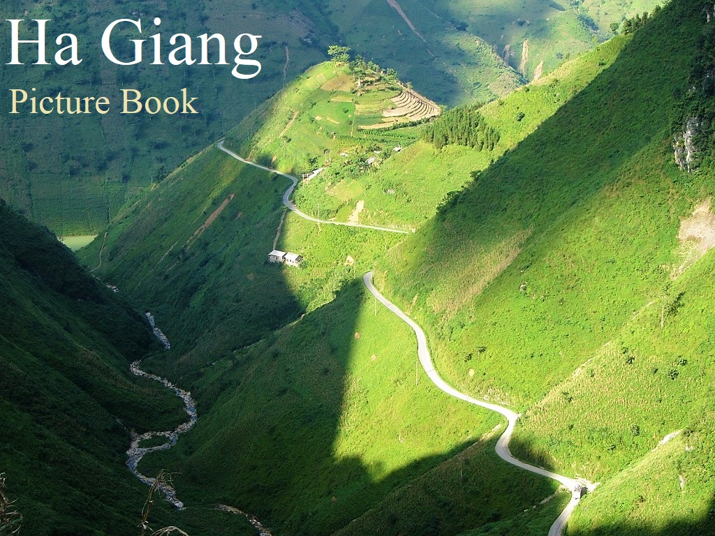
A PICTURE BOOK OF HA GIANG
Featuring 50 images, this picture book has one purpose: to showcase the beauty of Ha Giang in order to inspire travel here whenever that becomes possible again. For anyone who hasn’t visited Vietnam before, Ha Giang should be high on your list of priorities; and for those who’ve been to Ha Giang already, you’ll know that once isn’t enough. The images on this page are from all across Ha Giang Province, including landscapes and townscapes, people and places, architecture and accommodation. I’ve numbered and captioned each image, including links to any relevant guides. I’ve also plotted the location of every image on my map with a number corresponding to the images on this page. In addition, I’ve linked to all my Ha Giang guides in the Related Posts at the end of this gallery. (Please note that I can’t guarantee every location is totally accurate: I’ve done my best, but these photos were taken on multiple trips over many years.)

*Please Support Vietnam Coracle: I never receive payment for anything I write: all my content is free to read & independently financed. There’s no sponsored content whatsoever. If you like this picture book of Ha Giang, please consider supporting the work I do. See my Support Page for details. Thank you, Tom
MAP:
Locations of images in Ha Giang Province
View in a LARGER MAP
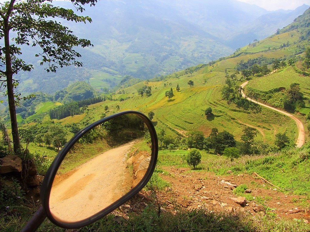
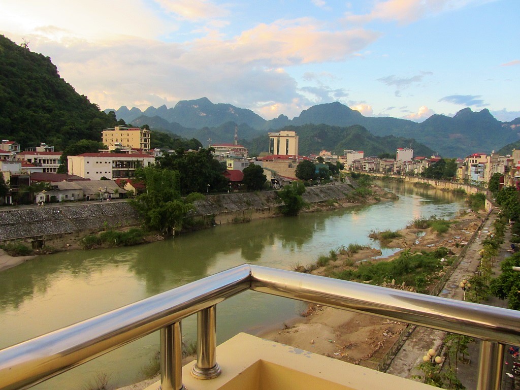
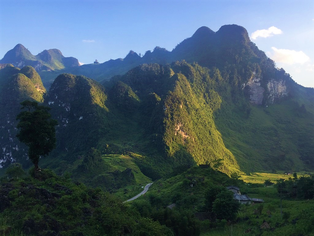
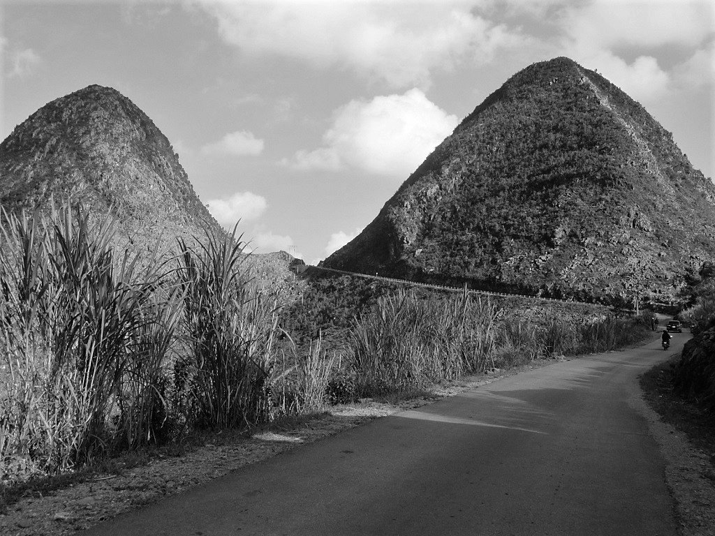
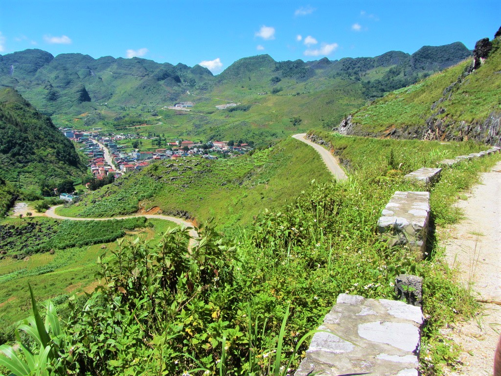
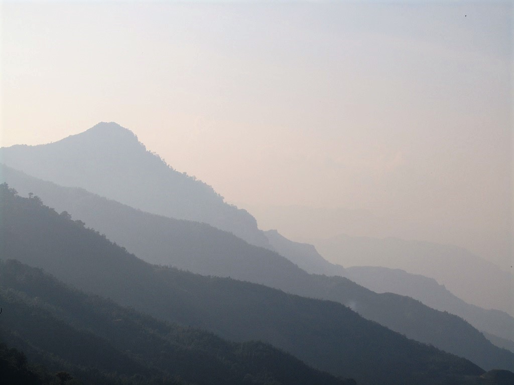
1. Limestone mountains on road DT176, Ha Giang Loop [MAP]
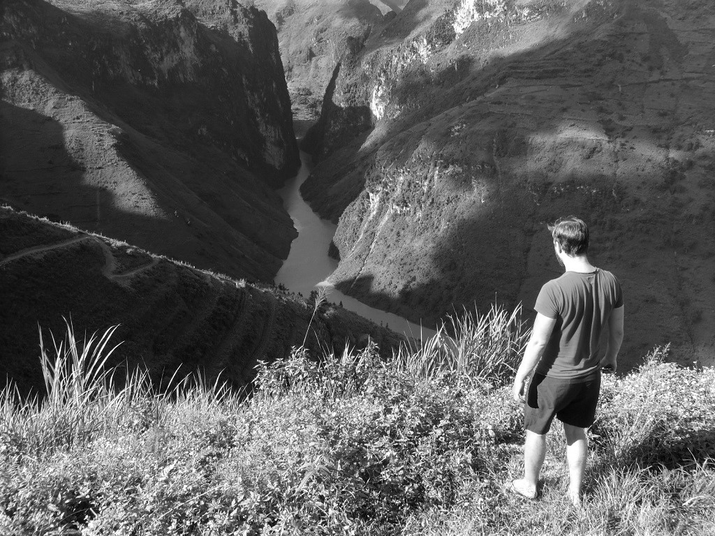
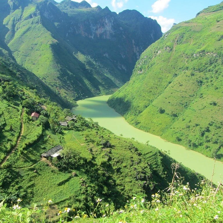
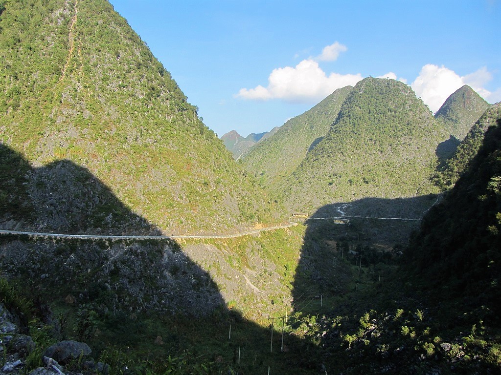
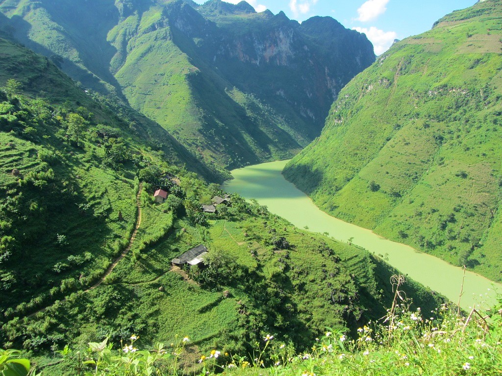
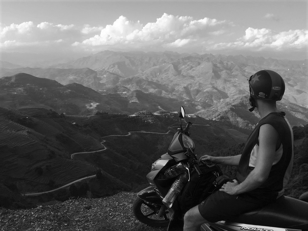
2. Gorge on the Nho Que River seen from the Ma Pi Leng Pass, Ha Giang Loop [MAP]
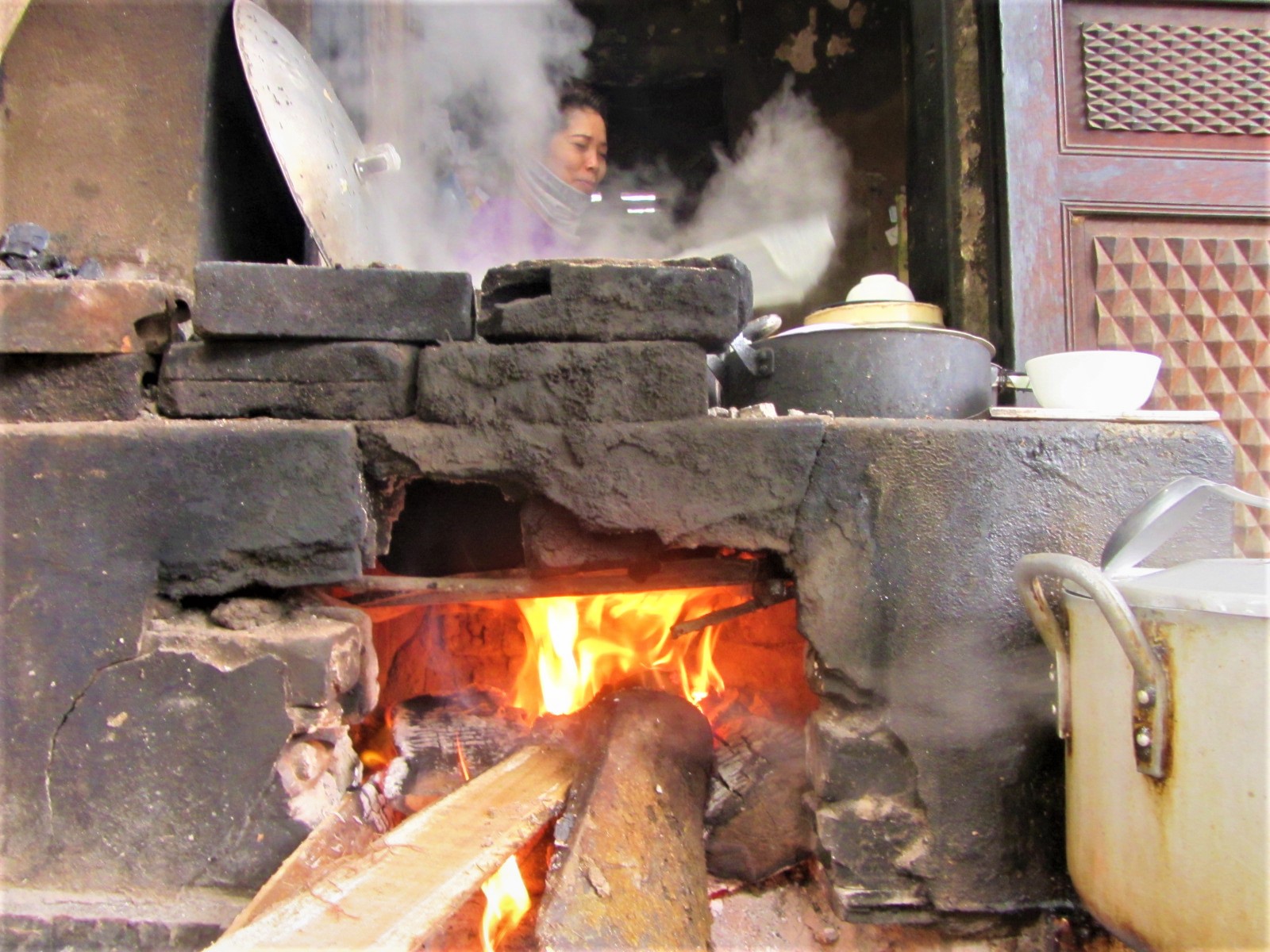
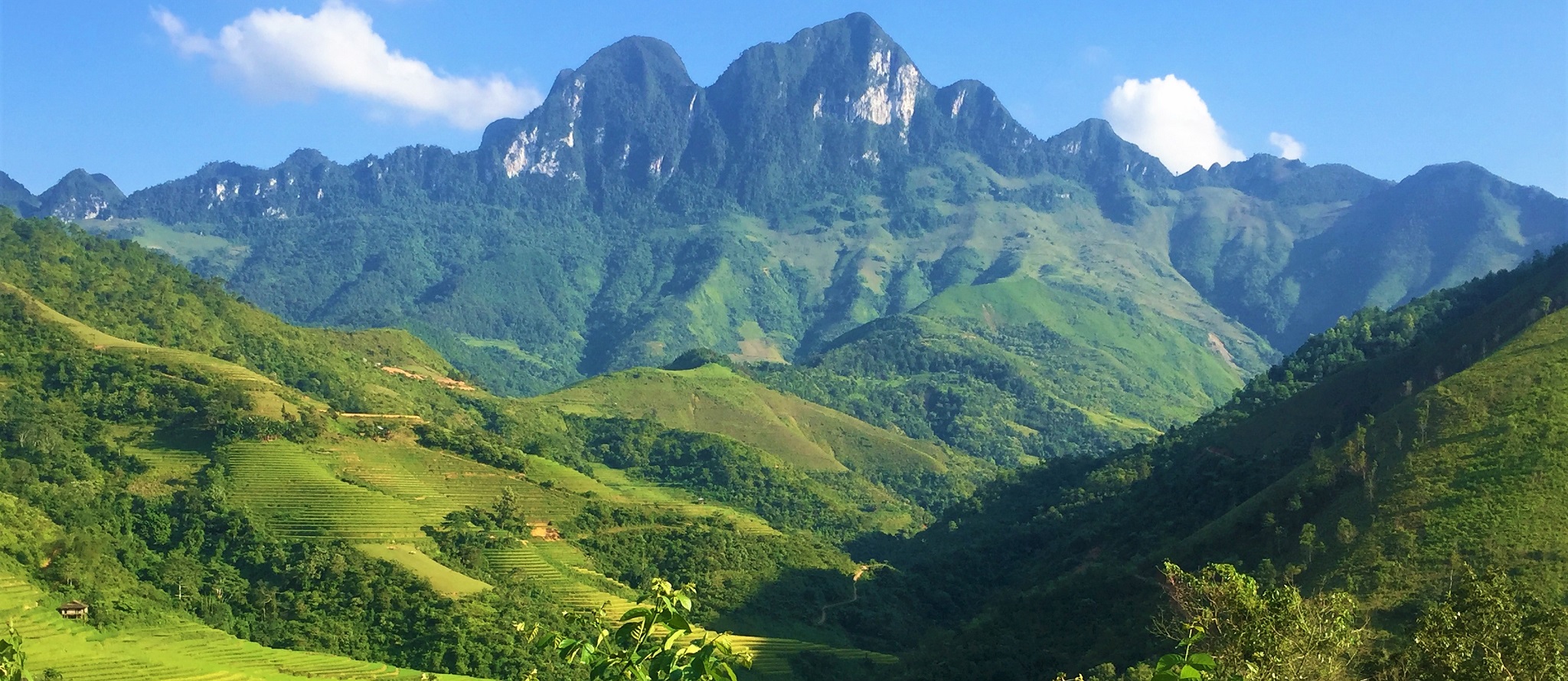
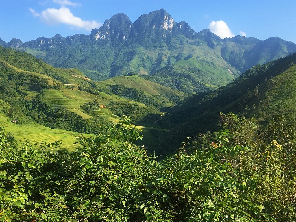
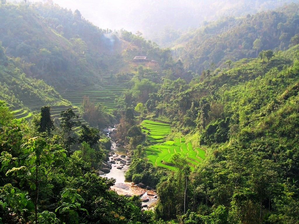
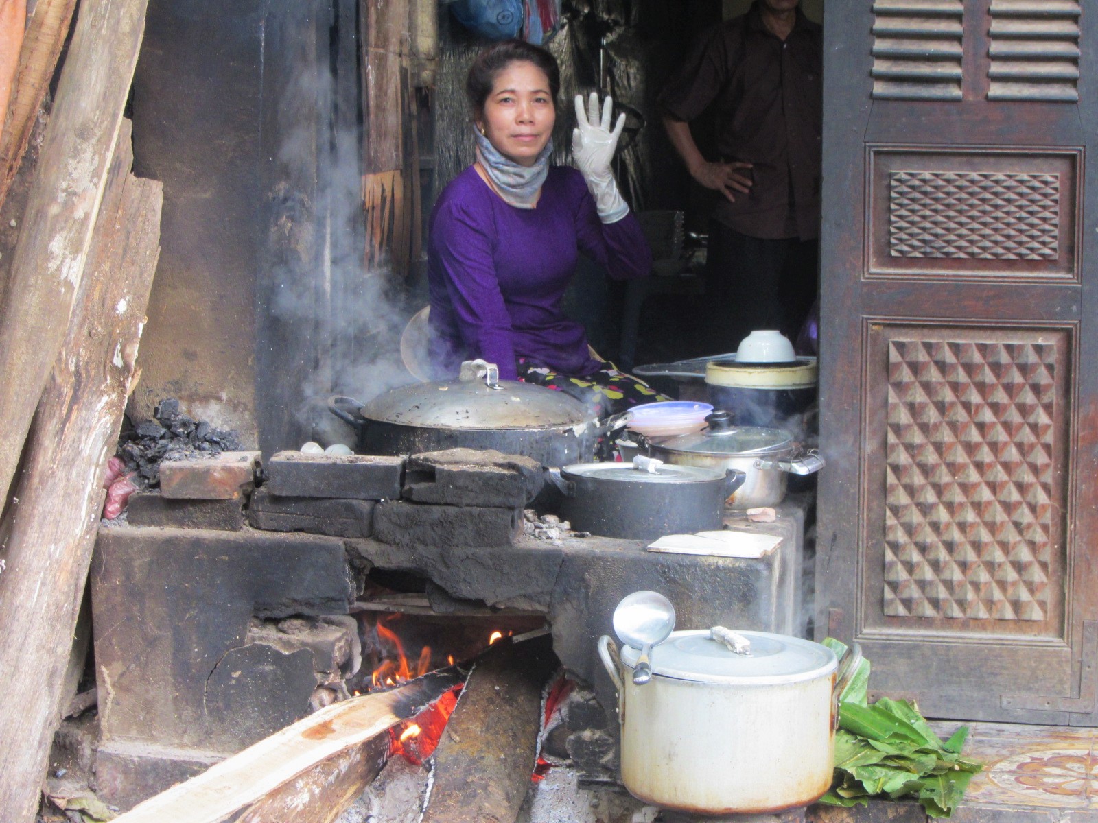
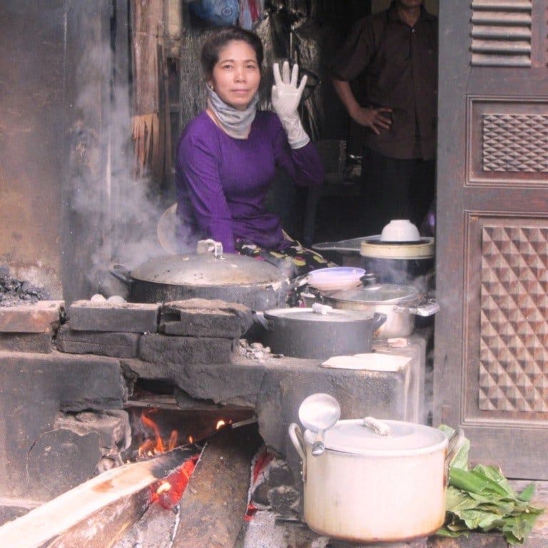
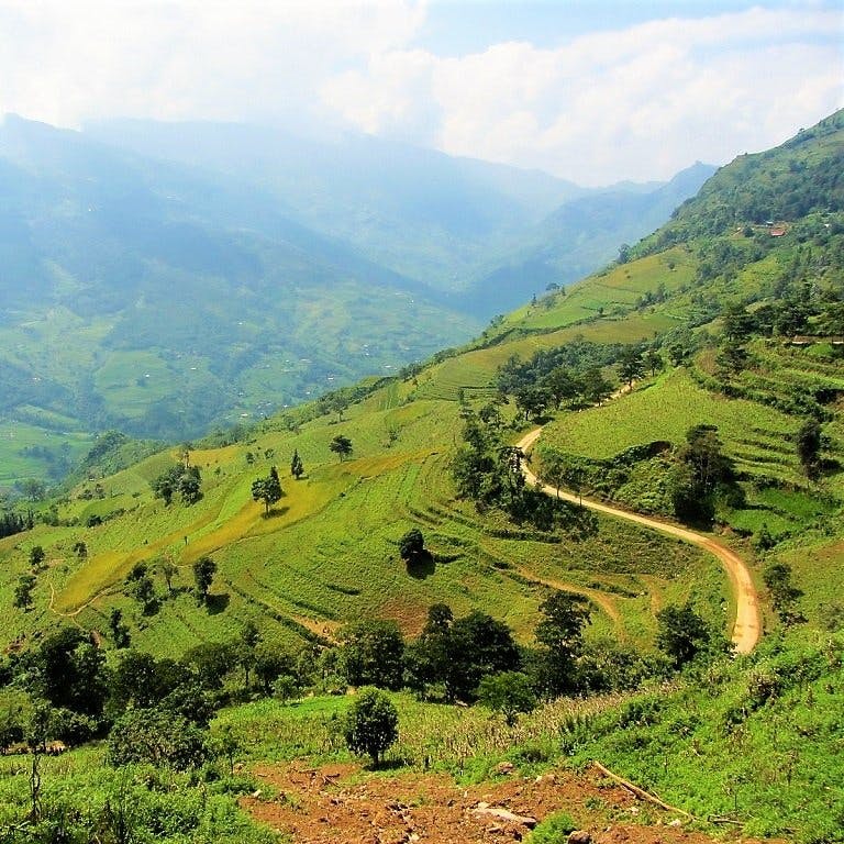
3. Cooking over a flame at breakfast in Ha Giang City [MAP]

4. Rice terraces seen from Heaven’s Gate Pass, Hoang Su Phi District [MAP]
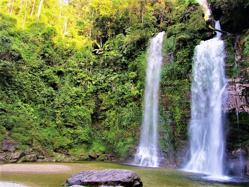
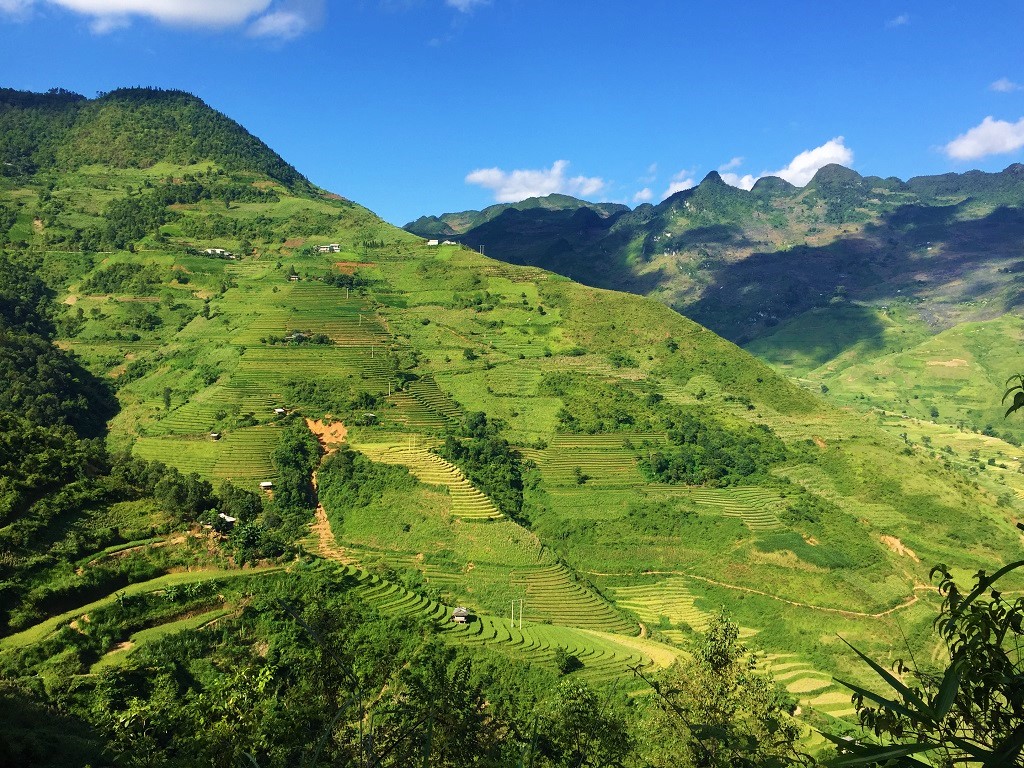
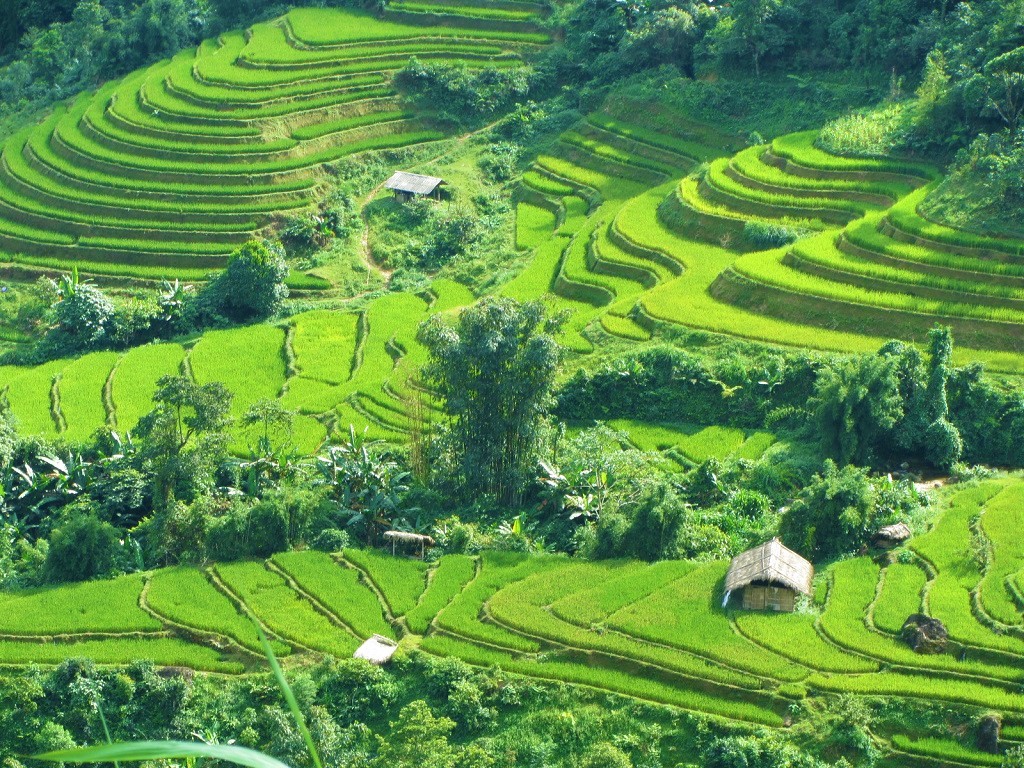
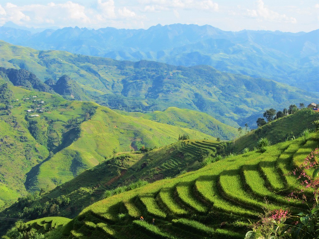
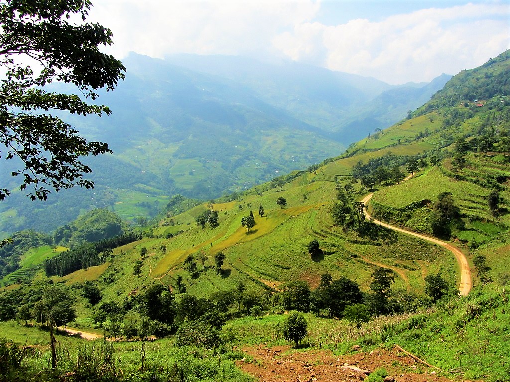
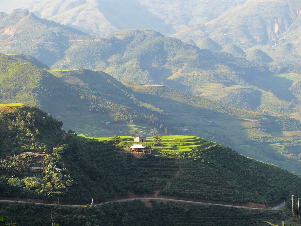
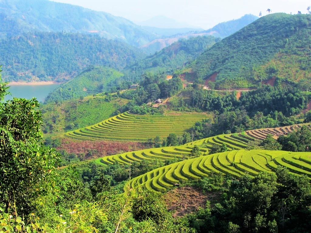
5. Thác Tiên (Fairy Waterfall), Xin Man District [MAP]

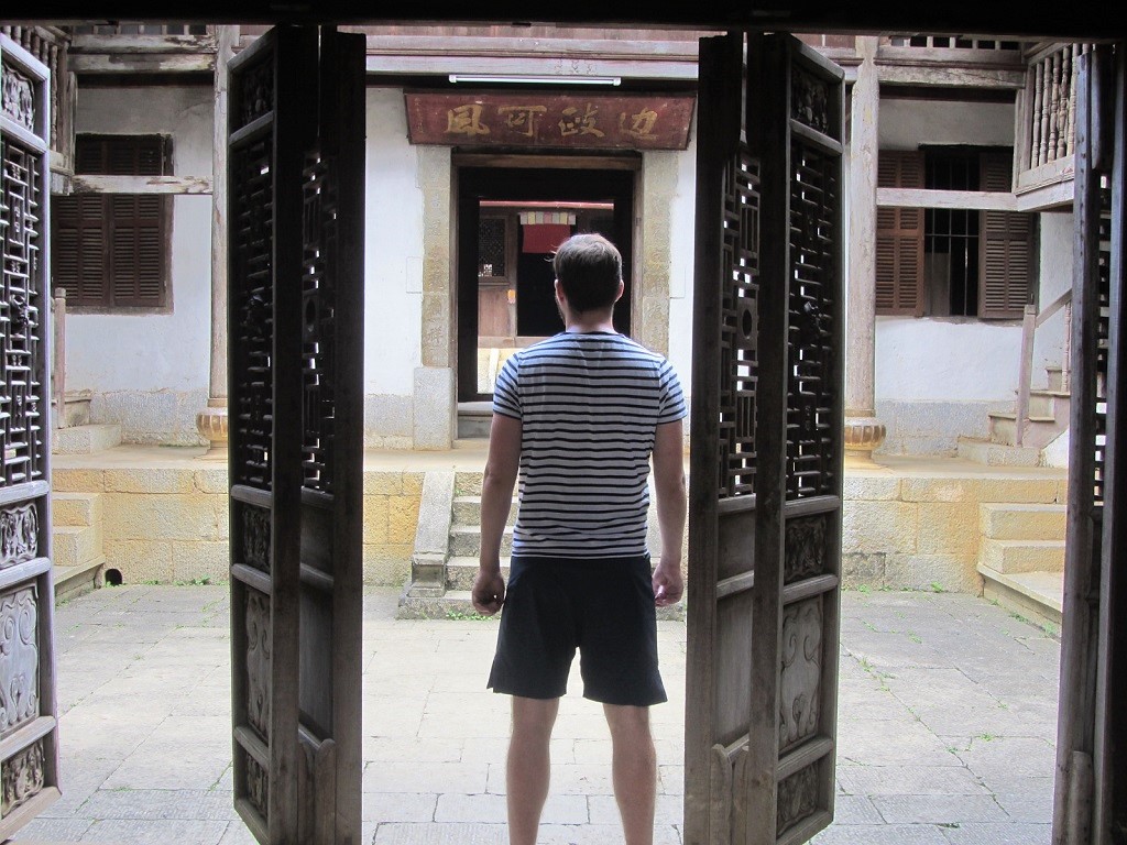
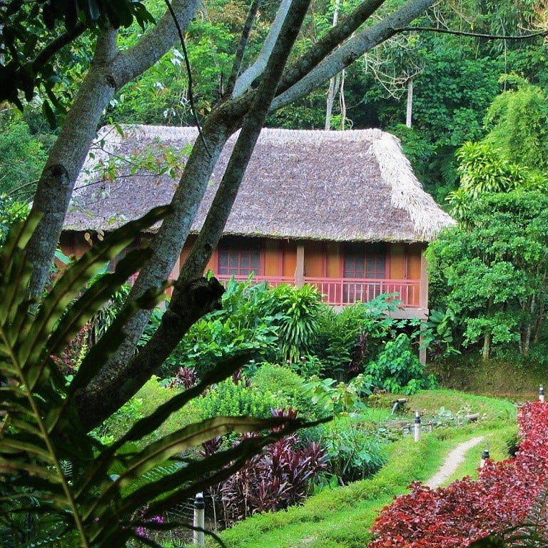
6. Panhou Village Ecolodge, Hoang Su Phi District [MAP]
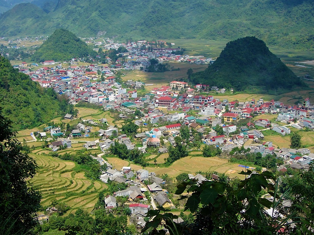
7. Tam Son Town seen from the Quan Ba Pass, Ha Giang Loop [MAP]
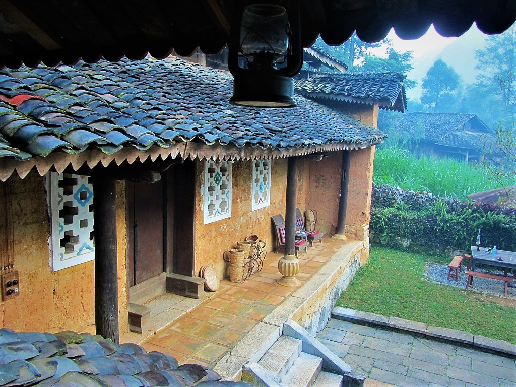
8. Pass west of Xin Man (Coc Pai) [MAP]

9. Pumpkins & squash piled outside a local home [MAP]
10. Limestone karsts on the Dong Van Plateau, Ha Giang Loop [MAP]
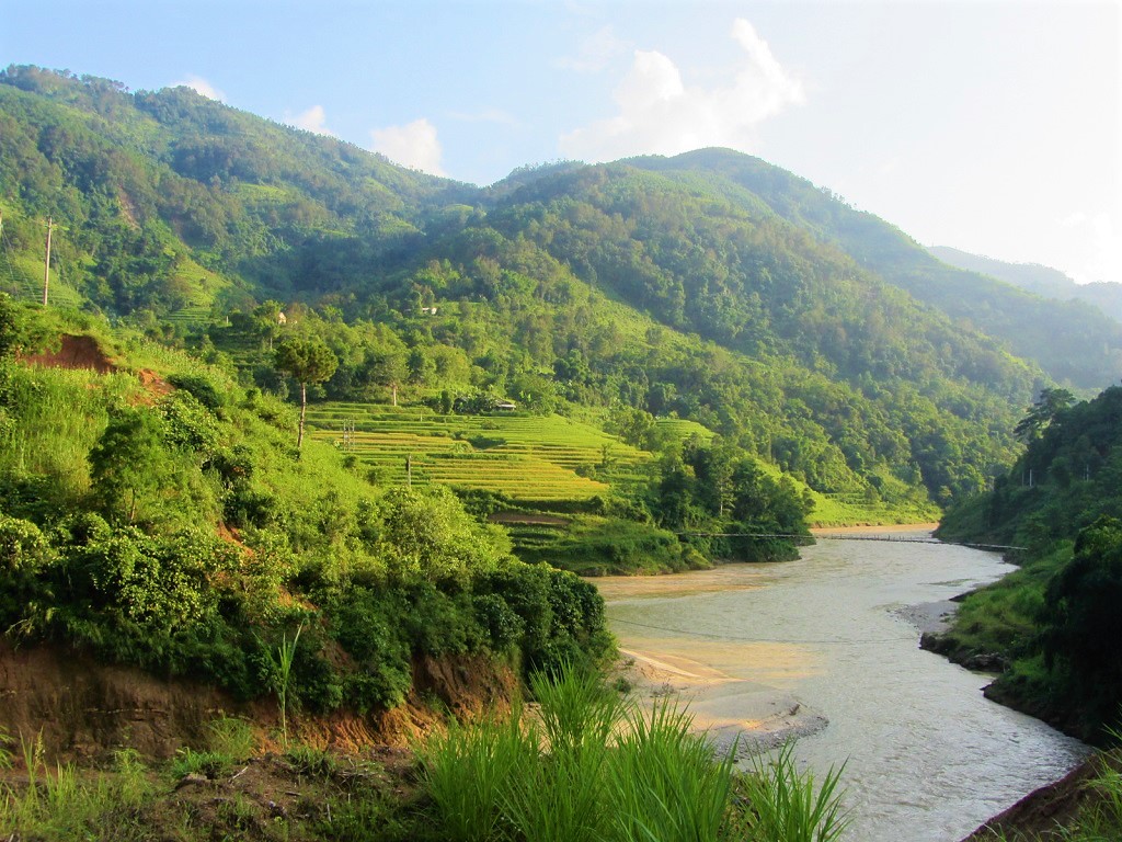
11. Ha Giang City on the Sông Lô (Blue River) [MAP]
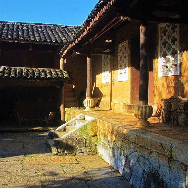
12. View from Road QL4C, Ha Giang Loop [MAP]
13. Lush valley from Road DT178 toward Xin Man [MAP]

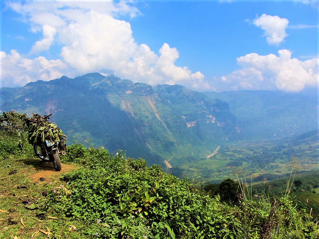
14. A woman sits for breakfast at Hoang Su Phi Market [MAP]
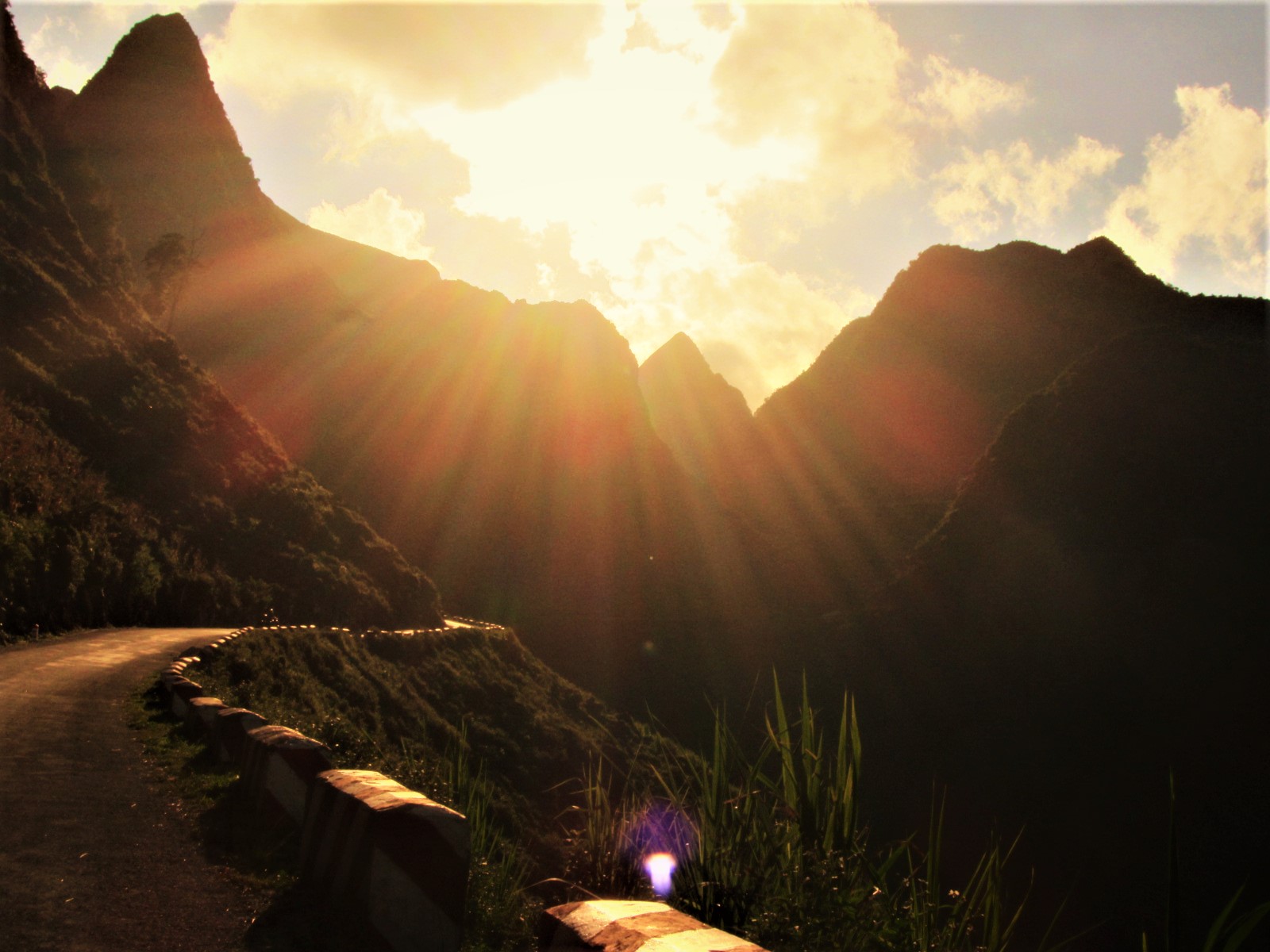
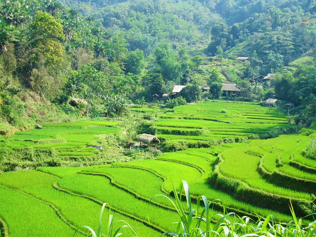
15. Rice terraces in Hoang Su Phi District [MAP]
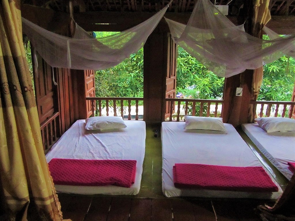
16. Dinh Vua Meo, H’mong King’s Palace, Xa Phin, Ha Giang Loop [MAP]
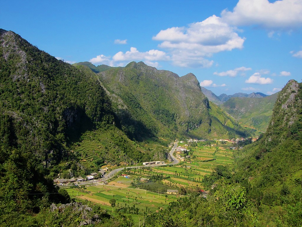
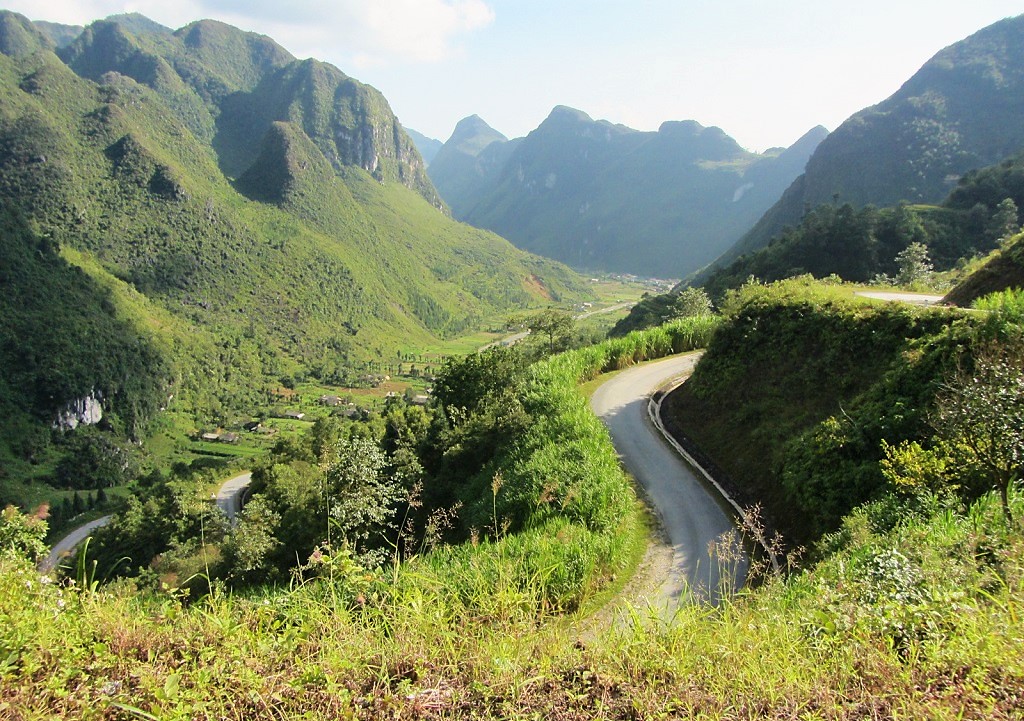
17. Gorge on the Nho Que River, Ha Giang Loop [MAP]

18. Old tile rooftops in Meo Vac, Auberge de Meo Vac [MAP]
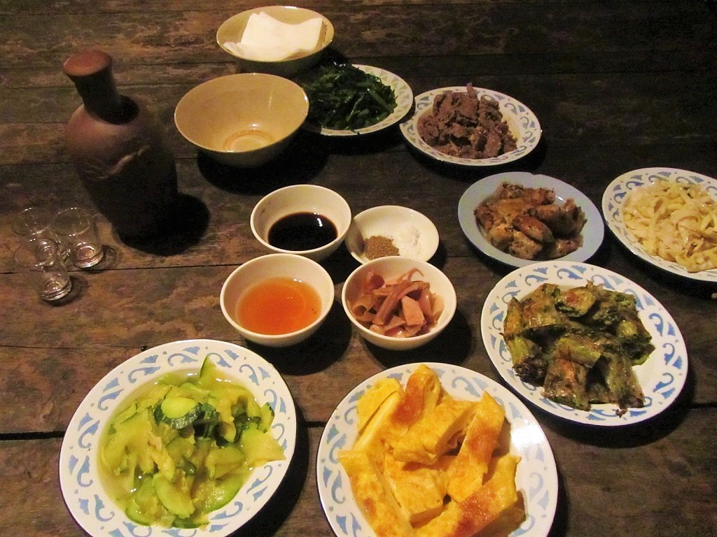
19. On the road to Du Gia, Ha Giang Loop [MAP]
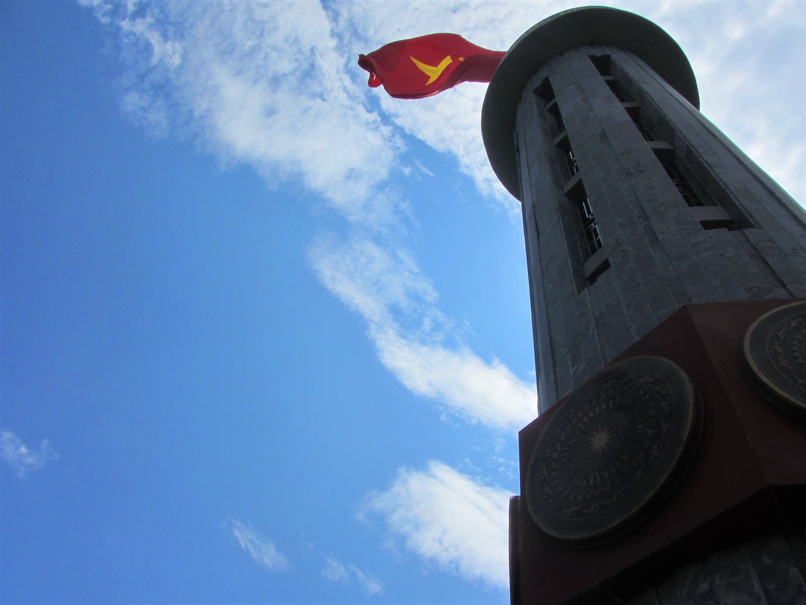
20. Lung Cu ‘North Pole’ flagstaff, Ha Giang Loop [MAP]
21. The Chay River valley between Xin Man & Hoang Su Phi [MAP]
22. Old stone courtyard of Auberge de Meo Vac Mountain Lodge [MAP]

23. Earth walls at Auberge de Meo Vac Mountain Lodge [MAP]
24. Mountain scenery south of Meo Vac on Road QL4C, Ha Giang Loop [MAP]
25. Dusk on the Ma Pi Leng Pass, Ha Giang Loop [MAP]
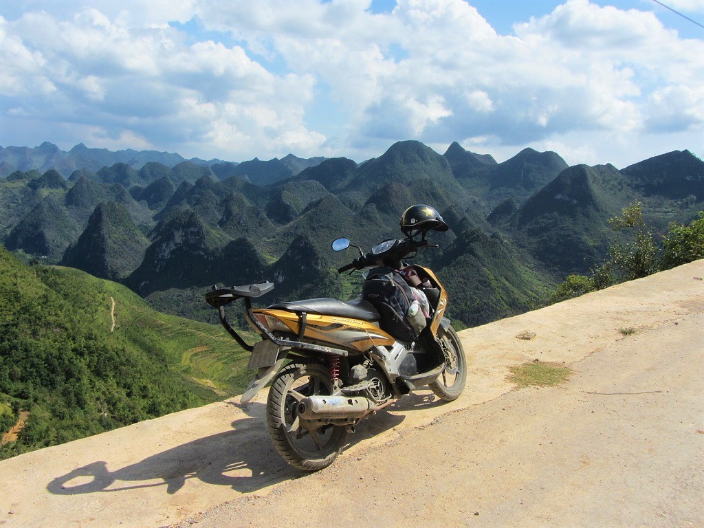
26. Homestay rooms in Du Gia, Ha Giang Loop [MAP]
27. Looking into Lung Cam valley, Ha Giang Loop [MAP]
28. Somewhere on the Dong Van Karst Plateau, Ha Giang Loop [MAP]
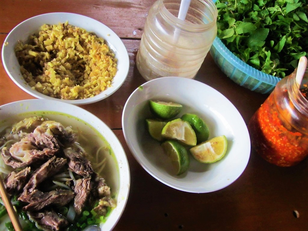
29. A homestay meal in Dong Van, Ha Giang Loop [MAP]
30. Road out of Xin Man, Borders & Back-Roads Loop [MAP]
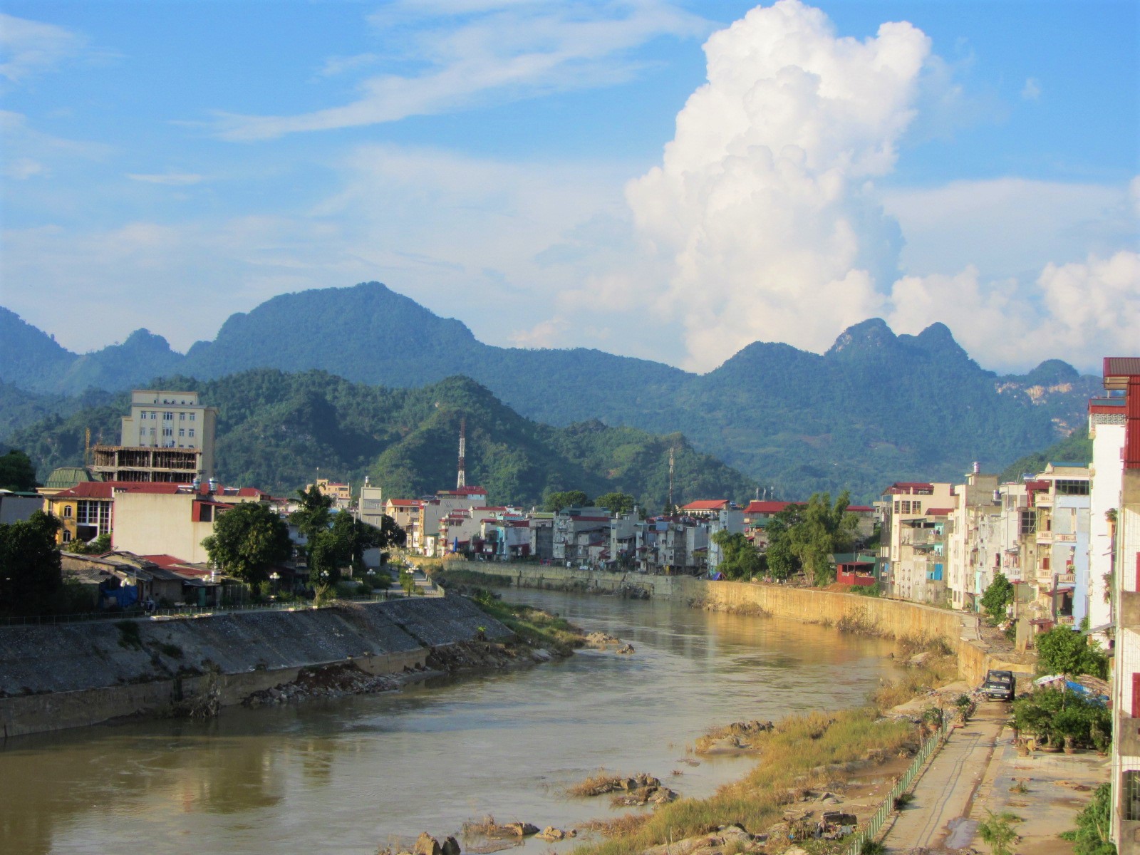
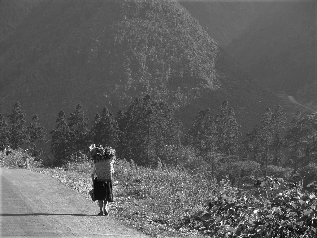
31. Ha Giang City on the Lo (Blue) River [MAP]
32. Top of the pass to Du Gia, Ha Giang Loop [MAP]
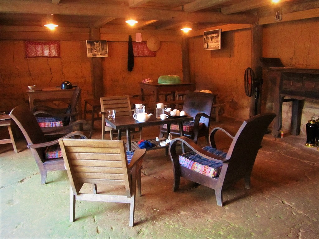
33. Limestone karsts on the road to Lung Cua, Ha Giang Loop [MAP]
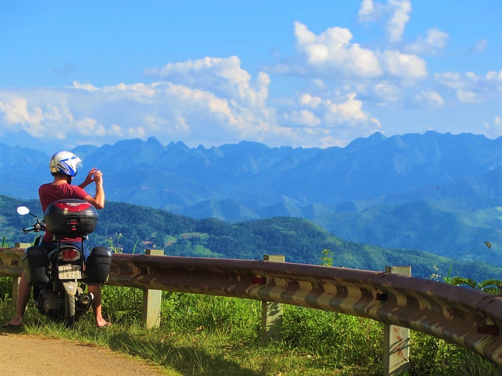
34. Preparing breakfast in Ha Giang [MAP]
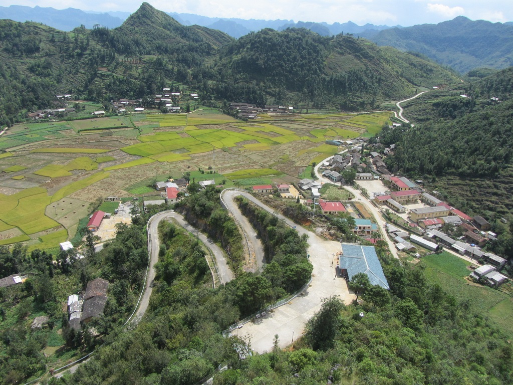
35. Top of the Chín Khoanh Pass, Ha Giang Loop [MAP]
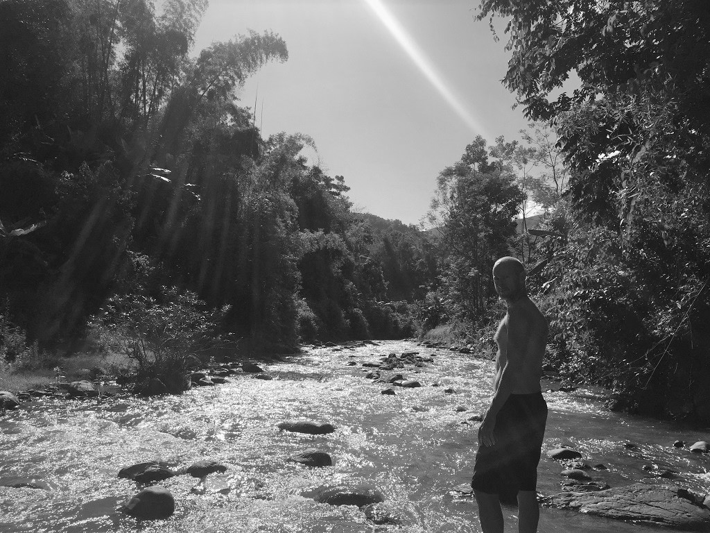
36. Stopping for a swim on the Ha Giang Loop [MAP]
37. Looking towards China o the Borders & Back-Roads Loop [MAP]
38. Rice terraces on Road QL279, Borders & Back-Roads Loop [MAP]
39. Breakfast at Xin Man market, Borders & Back-Roads Loop [MAP]

40. Crossing the bridge to Panhou Village Ecolodge [MAP]
41. Local woman carrying a heavy harvest on her back, Ha Giang Loop [MAP]
42. Rice terraces seen from Road DT178, Borders & Back-Roads Loop [MAP]
43. Common room at Auberge de Meo Vac Mountain Lodge [MAP]
44. Stopping for a photo south of Meo Vac, Ha Giang Loop [MAP]
45. Road to Khau Vai, Ha Giang Loop [MAP]
46. Dong Van Town, Ha Giang Loop [MAP]
47. Road to Lung Cu ‘North Pole’, Ha Giang Loop [MAP]
48. Top of the pass to Du Gia, Ha Giang Loop [MAP]

49. Rice terraces near Hoang Su Phi, Borders & Back-Roads Loop [MAP]
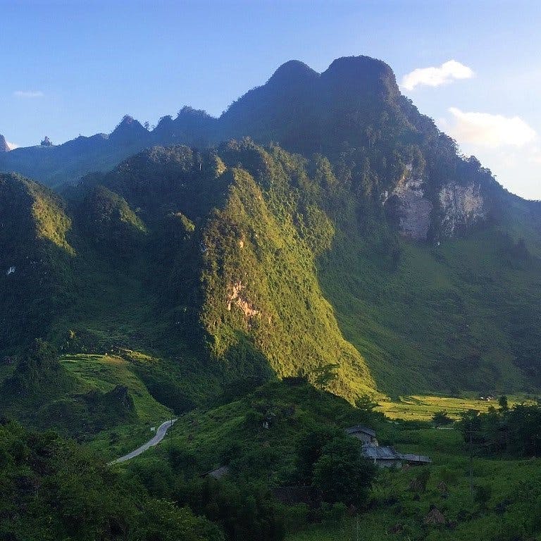
50. Mountains towards China, Borders & Back-Roads Loop [MAP]
Please Support Vietnam Coracle: I never receive payment for anything I write on Vietnam Coracle: all my content is free to read & independently financed. There’s no sponsored content whatsoever. If you liked this picture book of Ha Giang, please consider supporting the work I do. See my Support Page for details. Thank you, Tom
[Back Top]

Great pictures, thanks for sharing, definitely on top of the list for my next Vietnam adventure ! What would be the best time of the year for green rice terraces and clear skies ?
Hi Andre,
In general, April/May and September/October are the best times to visit this region of Vietnam, but the weather can be very changeable and unpredictable. Sometimes it can still be quite cold in April and sometimes there can be a lot of rain in September. The rice fields usually look best between May-September.
I hope this helps,
Tom
Thanks for posting such stunning photos. Can’t wait to get back to Vietnam. Always excited when i open my yahoo mail and receive your posts.
Hi David,
Thank you, that’s nice to hear. I hope you’re able to return to Vietnam soon.
Tom