
Last updated August 2025 | Words and photos by Vietnam Coracle | Read time 20 minutes | 485 comments

Tom Divers is the founder and creator of Vietnam Coracle. In 2005 he moved from his native London to Vietnam, where he has been living, working and travelling ever since. He pays rent in Ho Chi Minh City but is more often on the road, riding his motorbike a quarter of a million kilometres across Vietnam to research guides to the farthest-flung corners of the nation. When he’s not in the saddle, you’ll find him on a beach with a margarita, in a tent on a mountainside or at a streetside noodle house: in other words, at the ‘office’. Read more about Tom: Q&A, About Page, Vietnam Tourism website.
7 Itineraries for the Ultimate Independent Travel Experience in Vietnam
[Get the full Offline Guide & Map Package for $15]
An independent motorbike road trip between Saigon (Ho Chi Minh City) and Hanoi is an iconic, bucket-list experience that gives travellers a genuine sense of the entire nation and is unquestionably one of the most exciting things to do in Vietnam. Connecting Vietnam’s two largest cities – the commercial hub of Saigon in the south and the capital of Hanoi in the north – gives riders a defined goal and a real sense of achievement at the end. Noticing the changes that occur along the way as you move from province to province – landscape, climate, dialect, food, architecture – is utterly compelling and plugs you into the nation like no other travel experience. Thanks to a constantly growing network of spectacular roads criss-crossing the country, there are more potential route configurations for traversing the length of Vietnam on two wheels than ever before. I’ve ridden Saigon to Hanoi dozens of times and the following routes and maps are all based on my own first-hand experience. Browse the 7 suggested routes below to decide which one is best for you, and see General Information for some more useful tips.
CONTENTS:
Route 1: THE CLASSIC (2,863km)
Route 2: THE EPIC (5,775km)
Route 3: BEACH BUM (2,015km)
Route 4: OFF–BEAT (2,810km)
Route 5: HELTER–SKELTER (3,930km)
Route 6: UNCLE HO’S ROAD (1,880km)
Route 7: THE MASOCHIST (1,725km)
*
If you enjoy this article, please support Vietnam Coracle with a donation or become a member of our Patreon community or consider purchasing one of our Offline Guides & Maps from the shop. Thank you, Tom


Support My Site
Free | Independent | No Sponsored Content
“Hello, if you enjoy my website, please support it.
Thank you.” Tom
General Information:
Each of the Saigon-to-Hanoi routes on this page has a separate route map, a bullet-point list with at-a-glance details, a brief overview and description of the route, and a title image. I’ve designed each route specifically to appeal to different riders based on their interests and priorities. Browse the routes on this page from the Contents above to find out which one best suits your needs. Below are some notes about a handful of general considerations and frequently asked questions:
Route Maps: I’ve created separate maps for each of the seven routes in this guide. My maps show the full riding route (blue lines), all major cities and towns (red pins), and some of the sights and scenic sections (orange cameras). You can use my maps to navigate the routes. However, I highly recommend purchasing the accompanying Offline Guide & Map ($15), which includes all 7 route maps and step-by-step instructions to use and follow the maps on your phone at all times, even without an internet connection.
Duration: I’ve included estimates of duration in my descriptions of each route. However, this will vary wildly from one rider to the next. A good way to work out a general time-frame for each route is to divide the total distance by the number of days that you have for the road trip, thus finding out the necessary average daily distance that you’ll need to cover in order to complete the route. For example, if the total distance of the route is 3,000km and you have 3 weeks to complete it, that means you’ll need to average 143km per day (3,000÷21=143). But, of course, this doesn’t take into account any rest days during which you can relax, see the sights and give your backside a break from the saddle. So this needs to be factored into the equation too. As a general rule for most riders: anything under 150km is a short/manageable day on the road; anything over 150km is a long day on the road; and 250km+ is a very long day in the saddle, especially if you’re not used to riding, let alone riding in Vietnam.
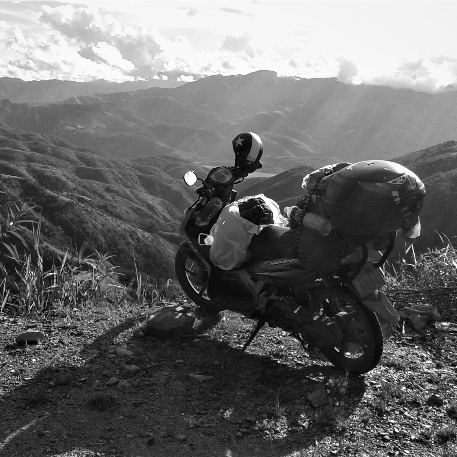
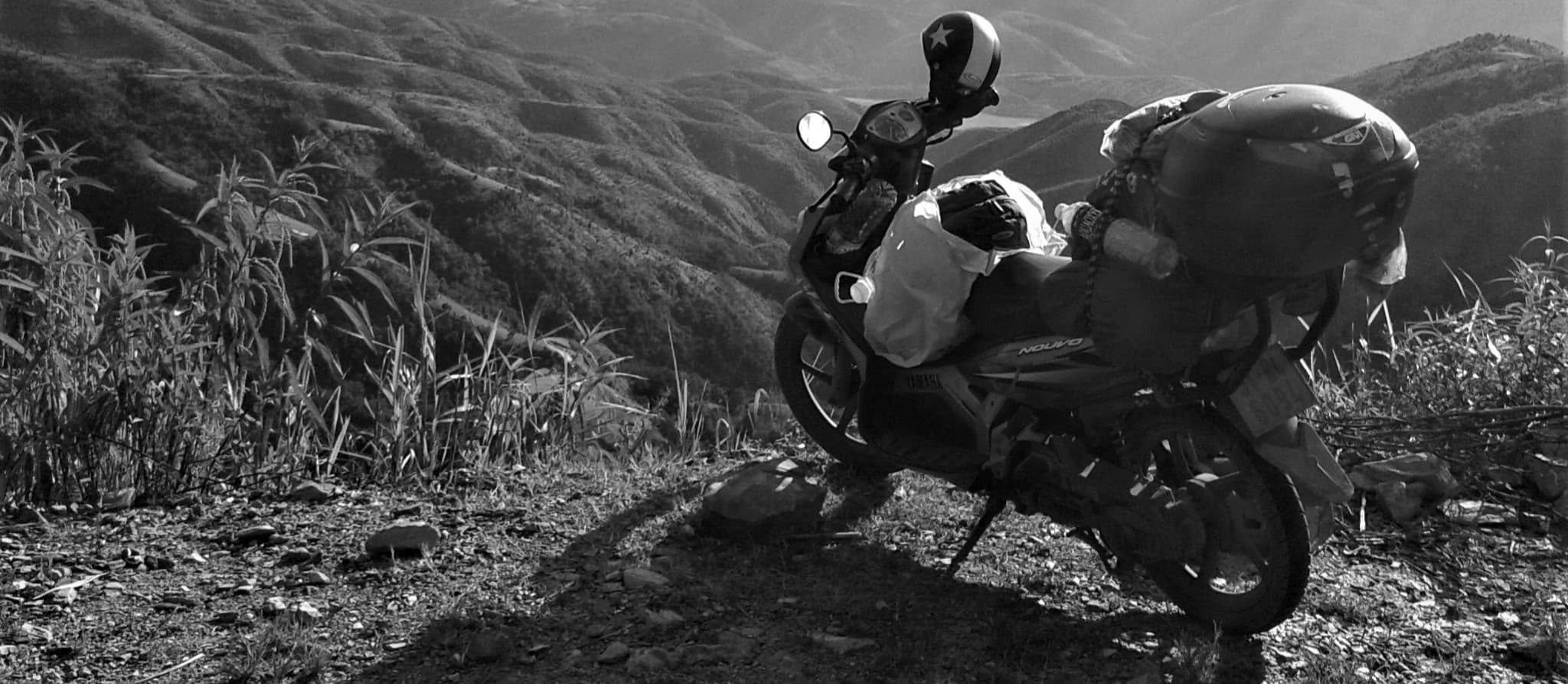
Type of Motorbike: The routes on this page can be ridden on any type of motorbike – automatic, semi-automatic, manual, even a bicycle – as long as it is in good condition. Some riders prefer larger, comfortable bikes, some like sporty models, some prefer smaller, easy-to-ride scooters. It doesn’t matter which motorbike you choose to ride these routes on, just so long as it’s well-maintained and you are comfortable riding it. As an example, I have ridden all these routes on my old Yamaha Nouvo automatic scooter, known as Stavros.
Road Conditions & Traffic: Most of the routes in this guide try to stay on good roads, passing beautiful scenery and avoiding traffic-clogged arteries as much as possible. While some of the cities and surrounding industrial suburbs can be busy, most of the time traffic is reasonably light. Road conditions are generally good, but riders should expect some roadworks here and there as Vietnam’s road network is constantly being upgraded.
Direction of Travel: All the routes can be ridden in either direction. Whether you ride south-to-north or north-to-south makes no difference to the navigation or to the route. The only reason to consider which direction to ride is weather conditions (see below).
Weather & Time of Year: Although these routes can be ridden at any time of year, in general the best period is from March to September, when weather conditions are most likely to be favourable across the nation. (See my Weather Guide for more information about Vietnam’s complex climate.)
Accommodation: The red pins on my route maps denote major cities and towns, all of which offer accommodation. As a general rule, accommodation along the coast is plentiful; in the highlands, accommodation is available in all towns and villages, but can be limited to local guest houses and homestays in some of the more rural, isolated areas.
Food & Drink: Because this is Vietnam, you will never go hungry on the road. Towns and cities are full of restaurants, street food and cafes; even remote hamlets have at least one cơm-phơ (rice and noodle) eatery. Of course, if you have specific dietary needs, then you need to plan accordingly.
Petrol Stations: For the majority of all routes on this page, gas stations are dotted at regular intervals. However, it’s still best to fill up before your fuel gauge gets too low. There are only really two stretches of road included in some of the routes on this page where filling stations are few and far between: the Western Ho Chi Minh Road and parts of the Ghost Road.
Beyond Saigon & Hanoi: Note that the routes on this page are concerned solely with roads between Saigon and Hanoi; not with any regions south of Saigon or north of Hanoi. If you would like to extend your route beyond Saigon and Hanoi, see my Mekong Delta Routes and Northern Routes.
Other Resources: For more useful resources that will help you plan and undertake your Saigon to Hanoi road trip, see Related Guides and browse my Motorbike Guides Archive where you’ll final dozens of helpful articles. In addition, I have linked to relevant guides in the descriptions of each route on this page.

Route 1: The Classic
DETAILS:
- Total Distance: 2,863km
- Average Duration: 3-4 weeks or more
- Navigation: easy to follow for most of the route, but some tricky sections
- Road Conditions & Traffic: smooth highways, paved mountain roads, coastal lanes, some bumpy sections, fairly light traffic but some busy sections
- Scenery & Attractions: coastal plains, beaches, agricultural plateaus, jungle, mountains, limestone karsts, river valleys, highland villages, coastal cities, war remnants, caves, waterfalls, spectacular passes, good riding
- Accommodation: lots of options along the coast, plenty in highland towns, but limited to local guest houses & homestays in between
- Best Time: March-September
- Useful Resources: lots of relevant guides & resources in Motorbike Archives & Destinations Archives
- Offline Guide & Map: offline map package available here ($15)
OVERVIEW:
Designed specifically to include some of the most famous stretches of road in the nation, as well as taking in some of the country’s most popular sites, The Classic route is aimed at riders who want to hit up as many of the best-known spots on the map as possible, while also experiencing a fair dose of lesser-known roads and destinations. Weaving a course between coast and highlands, The Classic route is equal parts beach and mountains. Stunning stretches of coast road yield to mighty mountains, connected via twisting passes, bridging the tropical lowlands and the temperature highlands. Offering a mesmerizing variety of landscape – from the jagged limestone karsts of Phong Nha, Ninh Bình and Cát Bà Island to the gentle coastal scenery either side of Phan Thiết (Mũi Né), Quy Nhơn and the Hải Vân Pass – this route combines the best of Vietnam’s diverse scenery. Famous destinations, such as Nha Trang, Hội An, Đà Nẵng, Huế and Hạ Long Bay, are all covered, but so too are far less-visited sites, such as Kon Tum, Măng Đen and the Western Ho Chi Minh Road. It’s the perfect balance of must-see sights and hidden gems. (Buy the Offline Map) Enjoy the ride!
ROUTE MAP: The Classic (2,863km) | Buy the Offline Map package ($15)
TITLE IMAGE: The Classic

Route 2: The Epic
DETAILS:
- Total Distance: 5,775km
- Average Duration: 4-8 weeks or more
- Navigation: a lot of twists, turns, changes of direction & regular map checks
- Road Conditions & Traffic: a mixture of smooth highways, paved mountain roads, coastal lanes, some rough patches & dirt road sections, mostly light traffic but some busy stretches
- Scenery & Attractions: everything that Vietnam has to offer: remote mountains, borderlands, jungle, agricultural plateaus, limestone karsts, river valleys, highland villages, waterfalls, caves, war remnants, beaches, cities, islands, swimming, spectacular passes & great riding
- Accommodation: plenty in coastal & highland cities & towns, but limited to local guest houses & homestays in some rural inland areas
- Best Time: March-September
- Useful Resources: a lot of relevant guides to specific sections of this route in my Motorbike Guides Archive; you can use the sub-categories & search function for keywords to find what you’re looking for
- Offline Guide & Map: offline map package available here ($15)
OVERVIEW:
If time is no object and you want to see and ride everything – both on and off the beaten path – between Vietnam’s two major cities, then The Epic route is the one for you. A vast and meandering road trip covering nearly 6,000km, The Epic is the ultimate south-to-north (or north-to-south) itinerary for riders with time, stamina and a thirst for adventure. While no route could possibly cover everything, The Epic comes as close as possible without ludicrously backtracking to the point that you’re not making any progress from A to B. Weaving a course between the coast and the highlands, The Epic hits some of Vietnam’s best-known sights, cities and roads, balancing these hotspots with plenty of off-grid exploration along fantastic, empty roads in remote and beautiful parts of the country that most riders never explore. There are a few bumps along the way and even some dirt sections, but the vast majority of this route is on good (or at least decent) paved roads. So, if you’re the kind of traveller that suffers from FOMO, take The Epic and rest assured that you are not missing out. (Buy the Offline Map) Enjoy the ride!
ROUTE MAP: The Epic (5,775km) | Buy the Offline Map package ($15)
TITLE IMAGE: The Epic

Route 3: Beach Bum
DETAILS:
- Total Distance: 2,015km
- Average Duration: 2-4 weeks or more
- Navigation: fairly simple for most of the route, but some tricky sections
- Road Conditions & Traffic: new highways, good back-roads, some rough patches, generally light traffic, some busy sections
- Scenery & Attractions: swathes of empty beach, fishing villages, lively beach cities, secluded bays, dramatic, coastal passes, swimming, seafood, historic sites, pontoon bridges, good riding
- Accommodation: plenty: from beach hostels to luxury resorts, local guest houses to international hotels
- Best Time: March-September
- Useful Resources: Beach Bum Coast Road Motorbike Guide & Map
- Offline Guide & Map: full guide & map package available here ($15)
OVERVIEW:
Echoing Vietnam’s curving coastline – stretching for over 2,000km along the country’s eastern seaboard – the Beach Bum is the route to choose if you enjoy sand between your toes, playing in the surf and the sound of the sea at night. Utilizing jaw-dropping new coastal highways and rarely-ridden back-roads, this route takes you to countless deserted beaches, sleepy fishing villages and hedonistic beach towns. Two common misconceptions about riding Vietnam’s coast are: 1) that you must take Highway 1 (QL1A) most of the way and 2) that it’s a busy and not very scenic route compared to the highlands. Neither of these are true. Only 15% of the entire Beach Bum route is on Highway 1. What’s more, some of the coastal scenery is sensational and some of the riding is sublime. Riding Vietnam is not all about the mountains. If you love the sea, salty air, the endless horizon, sandy beaches, wide open spaces, fresh seafood, fishing villages, beach towns and swimming in the ocean, then this is the route for you. (Read the complete Beach Bum Coast Road Motorbike Guide or buy the Offline Guide & Map) Enjoy the ride!
ROUTE MAP: Beach Bum (2,015km) | Buy the Offline Guide & Map ($15)
TITLE IMAGE: The Beach Bum

Route 4: Off-Beat
DETAILS:
- Total Distance: 2,810km
- Average Duration: 3-4 weeks or more
- Navigation: easy to follow for the majority of the route, but some tricky sections
- Road Conditions & Traffic: smooth highland highways, paved mountain roads, some rough patches, very light traffic
- Scenery & Attractions: remote mountains, borderlands, jungle, agricultural plateaus, limestone karsts, river valleys, highland villages, waterfalls, caves, war remnants, excellent riding
- Accommodation: mostly limited to local guest houses & homestays in small towns & villages, but some hotels in the bigger highland towns
- Best Time: March-September
- Useful Resources: the following guides cover most sections of the route: Đắk Nông Geopark Loop | Trường Sơn Đông Road | Ho Chi Minh Road | Mường Lống Loop | Ghost Road | Limestone Loops
- Offline Guide & Map: offline map package available here ($15)
OVERVIEW:
Using less-travelled roads and staying in the mountains for the entire route, the Off-Beat itinerary is designed for riders who want to stay off the beaten path as much as possible, avoiding tourist hotspots, popular destinations and famous stretches of road in favour of empty backroads, ‘unexplored territories’ and adventure. This route is for travellers who are comfortable finding food and accommodation in areas where locals rarely encounter foreign visitors and where there are long stretches with no traffic, no shops and no people: just you, your motorbike and the landscape. Following the rugged, mountainous spine of Vietnam for nearly 3,000km, the scenery is vast and magnificent: from plateaus blanketed in coffee and cashew plantations to flooded valleys, misty jungles, soaring peaks and crenulated walls of limestone karsts forming the border with Laos. After spending several weeks riding this route, you may find it difficult to adapt to life at low altitude, not to mention a dose of agoraphobia upon re-entering an urban environment. (Buy the Offline Map) Enjoy the ride!
ROUTE MAP: Off-Beat (2,810km) | Buy the Offline Map package ($15)
TITLE IMAGE: Off-Beat

Route 5: Helter-Skelter
DETAILS:
- Total Distance: 3,930km
- Average Duration: 3-5 weeks or more
- Navigation: lots of turns & changes in direction so regular map checks necessary, but mostly easy to follow with some tricky sections
- Road Conditions & Traffic: a mixture of smooth highways, paved mountain roads, coastal lanes, some bumpy sections & construction, generally very light traffic but some busy sections,
- Scenery & Attractions: spectacular passes, remote mountains, borderlands, jungle, beaches, coastal plains, agricultural plateaus, limestone karst scenery, river valleys, highland villages, coastal cities, war remnants, caves, waterfalls, good riding
- Accommodation: plenty of options along the coast & in highland towns, but very limited in several sections along the Lao border: local guest houses & homestays
- Best Time: March-September
- Useful Resources: lots of relevant guides to specific sections of this route in Motorbike Archives
- Offline Guide & Map: offline map package available here ($15)
OVERVIEW:
A meandering route designed specifically to utilize as many of Vietnam’s east-west roads – linking the coast and the highlands – as possible, the Helter-Skelter zig-zags up and down the mountains on no fewer than 14 separate occasions, each time via winding passes with sensational views. At nearly 4,000km, this is a long and indirect route that’s more concerned with great scenery, spectacular roads and thrilling riding than with time and efficiency. The Helter-Skelter route gives riders a real sense of Vietnam’s dramatic topography: how the lowland eastern seaboard rises to a mountainous western spine that runs along the length of the entire country, often going from sea-level to peaks as high as 2,600m (8,530ft) in the space of just 50km. While some sections are already well-known, much of the route is off the beaten path, such as the remote northwestern portion following the Mường Lống Loop and the Ghost Road, as well as the eerily empty Trường Sơn Đông Road in the Central Highlands. Traffic is light, scenery is superb, riding is fun and the route is peppered with stops at popular towns for some sightseeing and home comforts along the way. (Buy the Offline Map) Enjoy the ride!
ROUTE MAP: Helter-Skelter (3,930km) | Buy the Offline Map package ($15)
TITLE IMAGE: Helter-Skelter

Route 6: Uncle Ho’s Road
DETAILS:
- Total Distance: 1,880km
- Average Duration: 2-3 weeks or more
- Navigation: simple & straightforward for the majority of the route
- Road Conditions & Traffic: good two-lane highways, paved mountain roads, mostly light traffic, some busy sections
- Scenery & Attractions: agricultural plateaus, jungle, limestone karsts, river valleys, borderlands, highland villages, war remnants, caves, waterfalls, spectacular passes, great riding
- Accommodation: lots of options in major cities & towns, but limited to local guest houses & homestays in between
- Best Time: March-September
- Useful Resources: Ho Chi Minh Road Motorbike Guide & Map
- Offline Guide & Map: full guide & map package available here ($15)
OVERVIEW:
One of the most evocative road names in the world, the Ho Chi Minh Road is now a fully paved passage along the mountainous western spine of Vietnam, abutting both Cambodia and Laos as it covers 1,880km from south to north through some of the most spectacular scenery and riding that the country has to offer. Named after the father of the Vietnamese revolution, affectionately known as Bác Hồ (Uncle Ho), this route is punctuated by sites and villages with hauntingly familiar names, like Khe Sanh, Đăk Tô, Ia Đrăng and A Shau valley, where major battles took place during the wars of the 20th century. Although littered with war remnants, today it is the majesty of nature along this route that makes the deepest impression. Thick jungles coat mountains like melted wax, blue rivers fill valleys like veins of cobalt and limestone pillars rise like crenellated fortifications along remote borders. At its best, the Ho Chi Minh Road is a thread of asphalt winding into the distance with such organic grace that it appears part of the natural landscape. (Read the complete Ho Chi Minh Road Motorbike Guide or buy the Offline Guide & Map) Enjoy the ride!
ROUTE MAP: Uncle Ho’s Road (1,880km) | Buy the Offline Guide & Map ($15)
TITLE IMAGE: Uncle Ho’s Road

Route 7: The Masochist
DETAILS:
- Total Distance: 1,725km
- Average Duration: 10 days to 2 weeks or more
- Navigation: easy to follow for most of the route, but bypassing major cities can be confusing
- Road Conditions & Traffic: mostly good two-lane dual carriageway, some bad sections, heavy traffic around major towns, some quiet sections
- Scenery & Attractions: some good coastal stretches & famous passes, vibrant cities, beaches, swimming, some good riding sections, rice fields & agricultural landscapes
- Accommodation: lots of hotels, guest houses & resorts in every town & city along the route
- Best Time: March-September
- Useful Resources: Hải Vân Pass Motorbike Guide, Cả Pass Motorbike Guide,
- Offline Guide & Map: offline map package available here ($15)
OVERVIEW:
Highway 1 (QL1A) is an iconic road traversing the length of the nation along its coastal plain from south to north. It is also the country’s main transportation artery, passing through nearly all of Vietnam’s biggest cities and industrial hubs. As such, Highway 1 is a major trucking route and there are numerous bottlenecks along its length where traffic is heavy and the air is thick with exhaust fumes. Once a favourite north-to-south route for road-trippers, today Highway 1’s status among riders is low. Having said that, this much-maligned route has recently been upgraded to a good dual carriageway for most of its length, and traffic has been reduced thanks to the opening of a parallel expressway (CT01), which is closed to motorbikes but takes the lion’s share of cars and trucks. What’s more, parts of Highway 1 are far more scenic and enjoyable to ride than many seasoned Vietnam riders would like to admit. It’s also the shortest, fastest and most easily navigable south-to-north route, making it ideal for riders who want to check Saigon-to-Hanoi off their bucket list don’t have time to dilly-dally. Like many riders in the 2000s, my first time driving Saigon to Hanoi was on Highway 1 – it took me just 6 days to complete. I’ve highlighted some of the more pleasant, scenic sections of the route on my map, as well as marking major cities. But, be warned, it’s called The Masochist for a reason: it can get busy, hectic and very unpleasant, especially when entering, exiting or bypassing large cities during the morning and late-afternoon rush hours. (Buy the Offline Map) Enjoy the ride!
ROUTE MAP: The Masochist (1,725km) | Buy the Offline Map package ($15)
TITLE IMAGE: The Masochist

Support My Site
Free | Independent | No Sponsored Content
“Hello, if you enjoy my website, please support it.
Thank you.” Tom
*Disclosure: I never receive payment for anything I write: my content is always free and independent. I’ve written this article because I want to: I like these routes and I want my readers to know about them. For more details, see my Disclosure & Disclaimer statements and my About Page


Hi Tom,
Thanks for the guide. I want to attempt the big one, I was just wondering if there has been any changes/ new roads etc since the guide was released that I may need to be aware of.
Hi Aidan,
Yes, the Big One route is still good – most, if not all, road conditions are good.
However, you can also explore other route possibilities by browsing my Motorbike Guides category and adding any routes to the Big One as and when you want.
Best,
Tom
Hello Tom, my name is Katarina. My husband and I are travelling to Vietnam in four weeks and want to cover the distance from Ho Chi Minh to Hanoi by bike within three months. So we have plenty of time. I came across your blog and would first like to say thank you for the great information.
I have a question for you: which of the Ho Chi Minh/The Road East of Long Mountains/Beach Bum Coast Road routes would you recommend, namely between Dalat and the heights of Quang Ngai.
The idea is to go from Dalat first to Nha Trang, then a bit along the coast and back inland. But how far along the coast? I saw from your suggestions that the route from Buon Ma Thuot to Kon Tum would not be that interesting. On the other hand, it is much more interesting for us cyclists to take non-touristy, quieter routes. It is important for us to have good supplies on the way: food, drink, sleep, as we can do stages of up to 70-120 km a day. So less than on a motorbike.
I would be happy to receive some inspiration from you.
Best wishes from cold Germany.
Katarina
Hi Katarina,
Well, for scenery the Ho Chi Minh Road is best from Kon Ton and beyond: see sections 3-6 of this guide, which also includes information about food, drink and accommodation. But there are some long ascents on this road.
The Road East of the Long Mountains is best from A Yum Pa and beyond: see sections 4-6 of this guide. (Note that section 6 is now complete). This route has fewer places to stay, eat and drink, but has slightly less steep ascents than the Ho Chi Minh Road.
The Beach Bum Coast Road is best from south of Nha Trang, but north of Nha Trang around Tuy Hoa is nice and also to Quy Nhon: see section 3 of this guide, which also includes information about food, drink and accommodation. Although there are some ascents on the Beach Bum Coast Road, they are nothing compared to the mountains.
Any of the east-west roads connecting the coast to the mountains are necessarily steep because they are going from sea level to the highlands, but QL25 from Tuy Hoa and QL19 from Quy Nhon are slightly less so that other alternatives.
It terms of traffic, there is very little traffic on the Road East of the Long Mountains at any stage of it; there is a fair amount of traffic on the Ho Chi Minh Road until you get to Kon Tum, after which it fades away quickly and after Kham Duc there’s hardly any traffic at all; for most of the Beach Bum Coast Road traffic is fairly light because the route uses back road as much as possible, except for short sections where it uses QL1A when traffic can be moderately heavy.
Best,
Tom
I am traveling to Hanoi on the 18th February and meeting up with 3 other friends. We will be hiring bikes in Hanoi and considering one or 2 of the Saigon-Ho Chi Minh rides.
We are flying out of Hanoi on Tuesday 4th.
I’m thinking about either the Beach Bum or Uncle Ho’s. Can you recommend which town/ village to stop in over night to make the trips the most interesting, and have somewhere decent to stay, eat and have a couple of beers each night?
Thanks, Alan
Hi Alan,
For full details about both of those routes, please see the following guides: Ho Chi Minh Road and Beach Road Coast Road.
Best,
Tom
Thanks for this post! It’s been the most informative of any I’ve come across. I’ll have two weeks for the trip so was leaning towards Uncle Hos but also I’m a very experienced rider who loves a challenge and more technical riding (have ridden all over the world). Will this route still be satisfying? I don’t want to sell myself short. I love culture and small villages.
Thank you!
Hi Jarob,
For much more detail about the Uncle Ho’s Road route, please see my complete guide to the Ho Chi Minh Road.
As a technical ride, it is a very easy route. The central part is particularly spectacular.
For more technical rides and opportunities to get off road, it might be better to look at my Northern Routes.
Bear in mind that time of year is an important consideration: see my Weather Guide.
Also, two weeks isn’t actually a very long time for riding in Vietnam: in reality, you will only have time to either ride Saigon to Hanoi or to ride all around the north.
Note that all my routes try to stay on paved roads as much as possible and avoid busy main roads. There are dozens of potential routes, so please take some time to browse through my Motorbike Guides archive. No one has ‘the perfect’ route, and many riders find that their most memorable part of a Vietnam road trip is actually the part that didn’t go according to plan 🙂
Best,
Tom
Hello me and my friend are gonna drive your classic route. Is there a way i can load it in google maps?
Hi Seppe,
You can export the map to Google Maps but you can’t get step-by-step navigation unless you input each waypoint manually. Another option is to load it to maps.me.
You can either search how to do this online or you can purchase any of my Offline Guide & Map packages, which includes a how-to PDF for exporting my maps and using them offline with Maps.me. For example, you could purchase the Beach Bum Coast Road or the Ho Chi Minh Road.
Best,
Tom
Hello Rob,
first off, thanks for the detailed routes and descriptions! much appreciated.
I was wondering if the timeframe of 3/6 weeks for ” The big one ” include routes like the golden loop and Ha Giang loop. Or does it just take 3/6 weeks to do the main route you made in google maps?
I’ve got about 30 days, and I’m quite inexperienced on the motorcycle/scooter. I did ride a lot of 150cc scooters in Thailand, but that’s 4 years ago. I also owned and drove a scooter here in the netherlands for about a year. I’m planning on taking it slow and steady. By reading this, would you recommend me doing the big one?
Thanks in advance,
David
Hi David,
The Big One includes the Golden Loop but not the Ha Giang Loop. The time estimate of 3-6 weeks is just for the route shown in the Big One map.
For other routes, such as the Ha Giang Loop, see the specific guides, which all have time estimates in them.
With 30 days I would suggest taking one of the shorter Saigon-Hanoi routes and then adding a northern route to it if you have time.
Please note that I will be completely updating these 5 Saigon-Hanoi routes and adding new ones later this year.
Best,
Tom
Hey Tom
Is October is good month for do this classic road ? Your website is amazing
Hi Jean-Charles,
For more information about weather and when to go, please take a look at my Weather Guide.
Best,
Tom
Hi Tom
how safe is it to travel alone? on motorbike north to south?
regards John
Hi John,
Vietnam is a very safe country in which to travel solo – people are friendly, helpful and hospitable.
Best,
Tom
Hi Tom,
I’ve never ridden before but really eager to do the Easy Rider over the course of 3-4 weeks from mid-July onwards.
I was planning on doing the UK’s Compulsory Basic Training (CBT) before heading out to get my legs under me but having read about the dangers of beginners riding on Vietnamese roads I’m having some doubts. A few questions:
1) Do you think it’s too dangerous for a complete beginner or will it be safe as long as I ride carefully?
2) If doable, is the Easy Rider the best / safest route for a beginner?
3) Do you know if passing the UK CBT (which allows for riding up to 125cc in the UK as long as you use an L Plate) would enable me to get a Vietnamese license? Will only do it if licensed so I can be covered by health insurance.
Amazing website by the way & appreciate any advice.
Cheers,
Darius
Hi Darius,
1. Yes, it is doable, but you would of course need to be extremely careful.
2. The Easy Rider is OK, but perhaps it might be a better idea to start/end your road trip somewhere else where roads aren’t so busy. For example, you could base yourself in Phong Nha and ride the routes there instead. Or base yourself in Hoi An or Hue and ride the Golden Loop.
3. You should contact the bike rental agencies to ask for more information about that: I suggest some rental companies on this page.
Best,
Tom
Hi tom,
love these routes! My partner and I Are going to drive south to north in june, we are going to go moutaineous dalat, to bun ma thoat and stay mountaineous until around hoi an move out coastal. I was wondering do you have any advice on driving to khe san to phong nha caves, we can see online its a 10 hour drive with no fuel stops and I am wondering if you made this journey? As i plan on driving a semi automatic which does not have the biggest fuel tank.
Thanks so much any advice is really appreciated! we live in ho chi minh 🙂
Hi Jane,
For the Western Ho Chi Minh Road (that’s the section between Khe Sanh and Phong Nha), please see the following posts and also read the recent comments on them: Ho Chi Minh Road: Section 5 | The Hotel on the Western Ho Chi Minh Road | Ho Chi Minh West is Best route.
Best,
Tom
Hi Tom,
My two friends and I love the idea of doing a road trip from south to north but we are 19 and have only had a some experience of riding bikes from our trip so far. We are planning to get some lessons on how to ride mopeds properly and especially how to deal with traffic once we arrived in Ho Chi Minh City. Do you think this is enough for us to do this journey or is it realistically just asking for trouble?
Hi Luca,
As long as you are very careful and ride sensibly then you should be able to do it safely. However, if you don’t feel comfortable, you can always choose to do a shorter route instead.
Best,
Tom
Hi,
I was wondering if anyone has followed the coastal road recently. There is currently a lot of construction going on for the highway connection between Hanoi and Saigon and i was wondering if it impacts the travel a lot. I’m especially worried on the section between Tuy Hoa and Nha Trang where the QL1 coincides with the new highway so there’s no alternative. Is it still and will it remain accessible for motorbikes/bicycles?
Kind regards
Hi Maikel,
Yes, it’s fine. I was just riding there recently. They are constructing a separate expressway (CT) parallel to the original QL1, so that shouldn’t be a problem.
Best,
Tom
Hi Tom, thanks for the great info. Is it possible to ride south to north on a 50cc bike? To eliminate any issues with police and insurance? I’ve heard of some who’ve done it, and others who say it’s not possible. If possible, which route would you suggest?
Hi Jono,
You could do it, yes. But the bike would need to be in good condition and it would take you longer because you’d be riding slower. If you decide to do, it’s probably best to stay away from very mountainous roads where the bike might struggle with steep ascents, so perhaps the Beach Bum route would be best. Another option would be for you to ride an electric bike instead.
Best,
Tom
Hello Tom,
I will be traveling to Vietnam this Sunday. I will rent a bike in Ho Chi Minh City on the 21st of February and return it in Hanoi on the 20th of March.
I am a expierenced Motorbike traveler only on european roads so far, therefore I would like to know your approx. how long will it take on the roads in Vietnam for about 100km pure riding?
Because I am calculating if I will do your Classic Route or the big one and in the End thought about adding Ha Giang loop.
Also are your cards downloadable as a route for nav system?
Thanks ahead!
Best Regards,
Manuel
Hi Manuel,
Distance and time depends entirely on the road conditions, terrain, weather and motorbike model. As a very general guide: 100km will take 90-140 minutes. For most people, riding between 250-350km a day in Vietnam is a full day on the road.
For downloading maps to navigation systems, you can search online for how to download a google map to a navigation system.
Best,
Tom
Which one of the routes have the fewest check/border points? Basically less likely to get stopped by the police
Thanks so much for this website
Hi William
No one knows if/where police check points might be, so I can’t answer that question.
Try Uncle Ho’s Road – it is the most direct and easiest to follow and the scenery in the central section is fantastic.
Best,
Tom
Thanks so much
Any book suggestions to read while in Vietnam 🤣
Hi William,
Yes, sure: take a look a my Vietnam Reading List.
Best,
Tom
Hi tom,
My friend and i have 24 days in Vietnam.
We want to do the classic but before that, since we arrive in Hanoi we want to do the ha gian loop before going into the classic.
Is it doable or it’s gonna feel way to rushed?
Hi Alex,
It depends really on how much you want to ride each day and how long you want to stop off at places along the Classic route.
Personally, I think Ha Giang is best left for another trip. However, it is a wonderful region to ride. Or perhaps you could do Ha Giang and then just limit yourselves to only half of the Classic route.
Best,
Tom
Hello
My partner and I are planning to riding the coast from the north to the south of vietnam. We are a bit worried about police checks though. Have you had any experience with the police checking your license? Is it common on the route?
Many thanks
Leah
Hi Leah,
In general, police checks for foreign riders happen mostly in touristy areas – such as Mui Ne and Ha Giang – or border regions. But they can potentially happen anywhere. If you’re stopped, be patient, polite, smile and try your best to resolve the situation.
Obviously, the best way to avoid these situations is the ride legally, if possible, and not to ride recklessly.
The vast majority of foreign riders do not have major problems, but yes it is a possibility.
Best,
Tom
Thanks Tom! Thats very helpful and good to know.
Hi Tom,
What route would you suggest for a first time traveller to Vietnam? I’ll be in the country the beginning of January and I have 4 weeks to travel in either direction. The route with the least amount of traffic would be ideal, but not necessary.
Thank you,
Damian
Hi Damian,
Try the Classic or Uncle Ho’s Road. With 4 weeks you’ll have plenty of time, so you can take it slow and modify the route if/when you like.
Bear in mind that the weather north of Danang at that time of year can be surprisingly cold and quite bleak.
Best,
Tom
Thanks for the info Tom.
Are there benefits to going in a particular direction, or is it just preference?
Damian
Hi Damian,
No, you can ride any of these routes in either direction, it doesn’t matter. The only thing that might influence your decision on that is weather: see my Weather Guide.
Best,
Tom
Thanks for all the info Tom. Much appreciated!
Damian
Hello,
I am leaving from Ho Chi Minh City to Da Nang via motorbike tomorrow. I would love to use your specific route but I am struggling to get it into google maps. I tried using KML but google maps just resorts to the fastest route when I click go. Do you have any tips, tricks, or applications that would help me stick to the route as best as possible?
Thank you!
Hi Cody,
Try the following steps:
1. Install the MAPS.ME application on your mobile device from the app store
2. Download the country map for Vietnam
3. Get the KMZ file for the Vietnam Coracle map you want to take with you offline.
4. Open the KMZ file on your mobile device
5. Locate the KMZ file on your mobile device using the “Files” app and open it. If your device asks you to
select which app to open the file with, select MAPS.ME. The map should now appear in the “Favorites” tab
in the MAPS.ME app
Best,
Tom
How would one go about getting the kmz file for the map? For instance I want to import the easy rider map into my maps.me, but can’t figure out how to download the info from Google maps
Hi Casey,
You can open the Easy Rider map in a new window then click on the three vertical dots in the top left of the map next to the map title, then select ‘Download KML/KMZ’ from the dropdown menu.
Best,
Tom
Hi Tom,
I followed these instructions and 5 folders for the different sections of the beach bum were created, but they don’t contain any bookmarks and nothing happens when I click on the folders under favorites?
Hi Ashley,
Sorry for the slow reply.
If you’re referring to using the map offline, you can either google around for instructions about exporting the KMZ file and loading it to your phone, or you can buy one of our Offline Map packages ($15) which comes with step-by-step instructions of how to do it. For example, open the Hai Van Pass guide here and scroll down the first paragraph and you’ll find a link to buy the Offline Map package.
Best,
Tom
21F travelling from HCMC to Hanoi.
I have a month, I want to do it slow.
1. Can I rent a geared motorbike and drop it off at Hanoi? What would that budget to?
2. How do you figure out stay and Wi-Fi on the road? Which route is most friendly for slowmading?
3. Currently more inclined towards Uncle Hos road, but I’m open to other suggestions.
4. Need to stop in Da Nang. Does the road pass through there?
Thanks. This website is amazing.
Hi Aditi,
For motorbike rental please see this page.
For Wifi, you should get a Vietnamese SIM card when you arrive here and get data on the phone.
For places to stay on the road, all towns has mini-hotels.
Going slow on the Ho Chi Minh Road is fine.
The Ho Chi Minh Road does not pass through Danang, but you can easily detour down to Danang from the Ho Chi Minh Road.
You might fine my Resources archive helpful.
Best,
Tom