
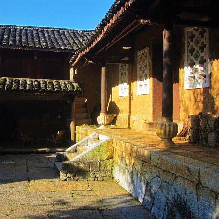
Last updated December 2019 | Words and photos by Vietnam Coracle | 136 comments
This post was last updated 5 years ago. Please check the comments section for possible updates, or read more on my Updates & Accuracy page.
INTRODUCTION | GUIDE | MAP | RELATED POSTS
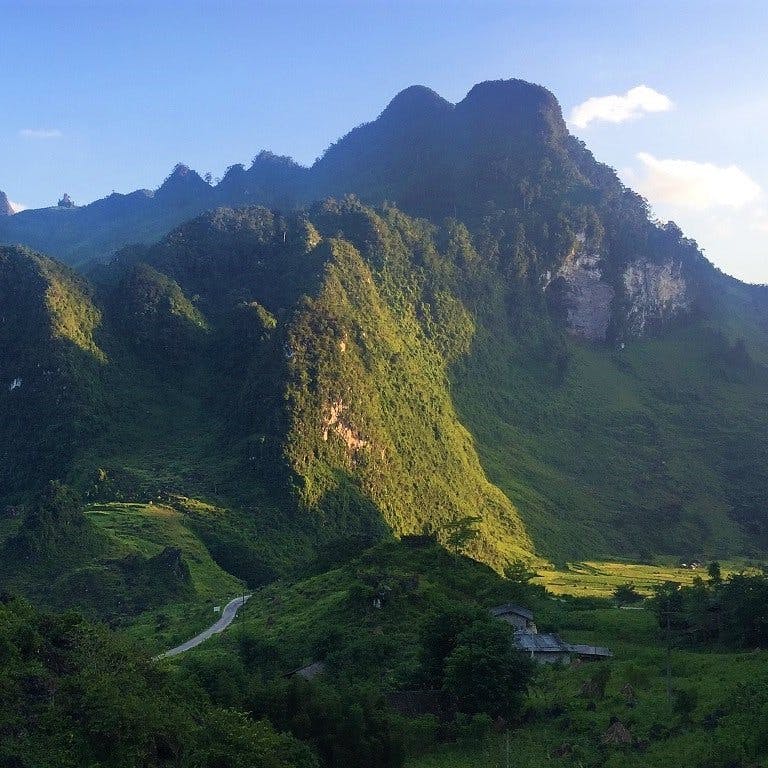
The roads linking the three northern provinces of Ha Giang, Cao Bang and Bac Kan travel through some of the most spectacular and remote regions of Vietnam. The landscape around here is extraordinary: many travellers consider this their favourite place in Southeast Asia. Connecting two of the most scenic motorbike routes in the country (the Extreme North Loop and the Northeast Loop), a handful of incredible mountain roads corkscrew their way through a complex terrain of steep valleys, limestone karsts, and raging rivers. There are several different route options for riding between Ha Giang, Ba Be Lake (in Bac Kan Province), and Cao Bang; all of which are stunning, but none of which are particularly straightforward. In this guide, I’ve mapped three routes that connect the extreme north with the northeast.

Three spectacular (but unpredictable) routes lead over the mountains from Ha Giang to Cao Bang
[Back Top]
GUIDE: HA GIANG→BA BE→CAO BANG
ROAD TRIP DETAILS:
- Total Distance: 360km/370km/310km
- Duration: 1-3 days
- Route: three scenic routes linking Ha Giang with Ba Be Lake & Cao Bang [MAP]
- Road Conditions: back-roads & mountain highways, rough sections, light traffic
- Scenery: limestone karsts, mountains, deep valleys, jungle, terraced rice fields, minority villages
Selected Resources What’s this?
ROAD TRIP CONTENTS:
- CLASSIC ROUTE: Ha Giang→Meo Vac→Bao Lac→Cao Bang: 360km
- BORDER ROUTE: Ha Giang→Meo Vac→Bao Lac→Pac Bo→Cao Bang: 370km
- BA BE LAKE ROUTE: Ha Giang→Da Vi→Ba Be Lake→Cao Bang: 310km
ABOUT THESE ROUTES:
The map below shows three alternative routes between Ha Giang, Ba Be Lake, and Cao Bang. The Classic Route (the blue line) is the most popular and easiest to follow; the Border Route (the red line) is the most remote and least travelled; and the Ba Be Lake Route (the green line) is a combination of rarely used roads and national highways. The purple lines are connecting roads between the three routes, so you can mix and match as you please to create a route that suits you best. Although all of these routes are extremely scenic, they’re not necessarily easy to ride. The difficult, mountainous terrain, and frequent bad weather, mean that road conditions often deteriorate, resulting in treacherously muddy sections. What’s more, roadworks to upgrade and maintain these routes are ongoing. I’ve marked sections of rough road as best I can on my map. But, when riding any of these routes, take note of recent weather conditions (heavy rain, for example, can lead to serious landslides which can block roads for hours or even days), and try to ask locals or other riders you meet about current road conditions. Below, I’ve written a brief description of each route. For accommodation, there’s at least one mini-hotel or local guest house (nhà nghỉ) at each of the places marked with a red pin on my map. (For more details about accommodation in Ha Giang and Cao Bang see my Extreme North and Northeast guides.) Any time of year is good, but the heaviest rains occur during the summer months (June-August), and it can be bitterly cold during the winter months (December-February). Although any of these routes can be completed in one (long) day, the winding roads make riding a lot slower than you might expect. Alternatively, you can turn this into a scenic round trip by connecting the upper, lower, and middle routes and making a loop.
ROUTE MAP:
Ha Giang→Ba Be Lake→Cao Bang | 3 Routes
Blue line: 360km | Red line: 370km | Green line: 310km
View in a LARGER MAP
The Classic Route:
BLUE LINE: Ha Giang→Meo Vac→Bao Lac→Cao Bang: 360km [MAP]
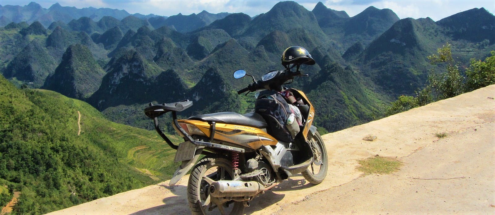
Starting out on the famous Ha Giang Extreme North Loop via the limestone landscapes of the Dong Van Karst Plateau, the Classic Route then heads southeast from Meo Vac on road QL4C down to the Gam River Valley. Out of Meo Vac there are some fabulous views over a vast and sparsely populated landscape. Although mostly upgraded, parts of the southern half of QL4C to the Ly Bon intersection with QL34 are still undergoing repairs. However, these should be finished by the time you read this. After crossing the bridge at Ly Bon, turn onto QL34 due east towards Bao Lac. Ly Bon is at the confluence of the Nho Que and Gam rivers, and the ride to Bao Lac affords some picturesque views of riverine scenes. However, there are currently (2019) major road works on the section of QL34 between Ly Bon and Bao Lac, so ride very carefully. Bao Lac has plenty of guest houses if you need them.

Road QL4C between Meo Vac & Bao Lac offers some extraordinary views over rice terraces & mountains
From Bao Lac, continue southeast all the way to Cao Bang city, via the mining town of Tinh Tuc and Nguyen Binh (both of which have a couple of nhà nghỉ guest houses). It’s a long ride to Cao Bang, and, although the scenery is superb (particularly around Tinh Tuc), the road conditions to Nguyen Binh are unpredictable. Expect a few rough patches, potholes and, if there’s been rain, landslides. Between Tinh Tuc and Nguyen Binh, there’s an intersection with a turning due south on road DT212 to Cho Ra: use this excellent back-road if you want to go to Ba Be Lake. If not, continue east along the meandering QL34 to Cao Bang City.

Road QL34 southeast from Bao Lac to Cao Bang has some rough patches but the scenery is excellent
The Border Route:
RED LINE: Ha Giang→Meo Vac→Bao Lac→Pac Bo→Cao Bang: 370km [MAP]
After following the Extreme North Loop from Ha Giang to Meo Vac, head southeast on road DT217 towards the famous ‘Love Market’ of Khau Vai (usually held in April). This meandering road soars over a limestone plateau before descending sharply through Khau Vai village and down to the banks of the Nho Que River. Road conditions deteriorate severely before crossing the river on a bamboo raft ferry and continuing the other side. From here, it’s a twisting ride over barren mountains (with incredible views) all the way down to Bao Lac in the Gam River Valley. The road surface is very inconsistent on this section, and it may prove challenging for riders on automatic motorbikes. Bao Lac has a few local guest houses if you need to stay the night.


Road DT217 winds up the hillside leaving Meo Vac & then heading southeast to Khau Vai & Bao Lac
Follow the Gam River east of Bao Lac on an as yet unnamed road. This road is currently the talk of many riders in Vietnam. Hugging the Chinese border for much of its length, the road passes through some extremely remote landscapes. As if the fabulous scenery weren’t enough, the road itself is quite a sight. A narrow asphalt lane, it’s full of contortions and knots; constantly switching back on itself as it negotiates the difficult terrain. Just look at it on the map: it looks like the path of an agitated dragon, shifting violently from left to right, as if trying to shrug an assailant off its back. One pass in particular is breathtaking: Ascending what is essentially a vertical wall of rock, the road passes 14 (by my count) consecutive switchbacks. I call this the ‘Roller Coaster Pass‘, although it has recently been named đèo Mẻ Pia on Google Maps. And while we’re randomly namely things, let’s call this unnamed road the ‘Agitated Dragon’.

Looking down on one of the 14 switchbacks of the ‘Roller Coaster Pass’ on the ‘Agitated Dragon’ road
And so, the Agitated Dragon continues east along the Chinese border (with some extended rough, gravelly sections in the middle) until it hits the Ho Chi Minh Road (DT208), just south of Pac Bo Cave. (To visit the cave – which is well worth it – turn due north on road DT208 for 10km). Turn onto the Ho Chi Minh Road (DT208) and ride its smooth course south for 40km to Cao Bang city.

Pac Bo Cave on the Chinese border is a fascinating historical sight in a beautiful natural setting
The Ba Be Lake Route:
GREEN LINE: Ha Giang→Da Vi→Ba Be Lake→Cao Bang: 310km [MAP]
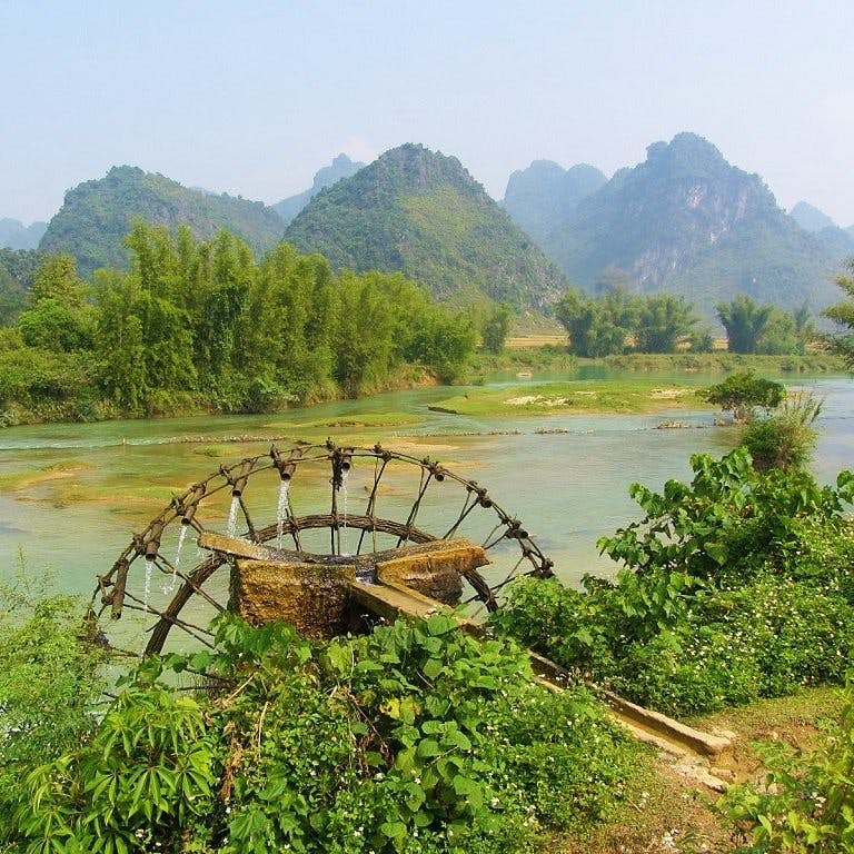
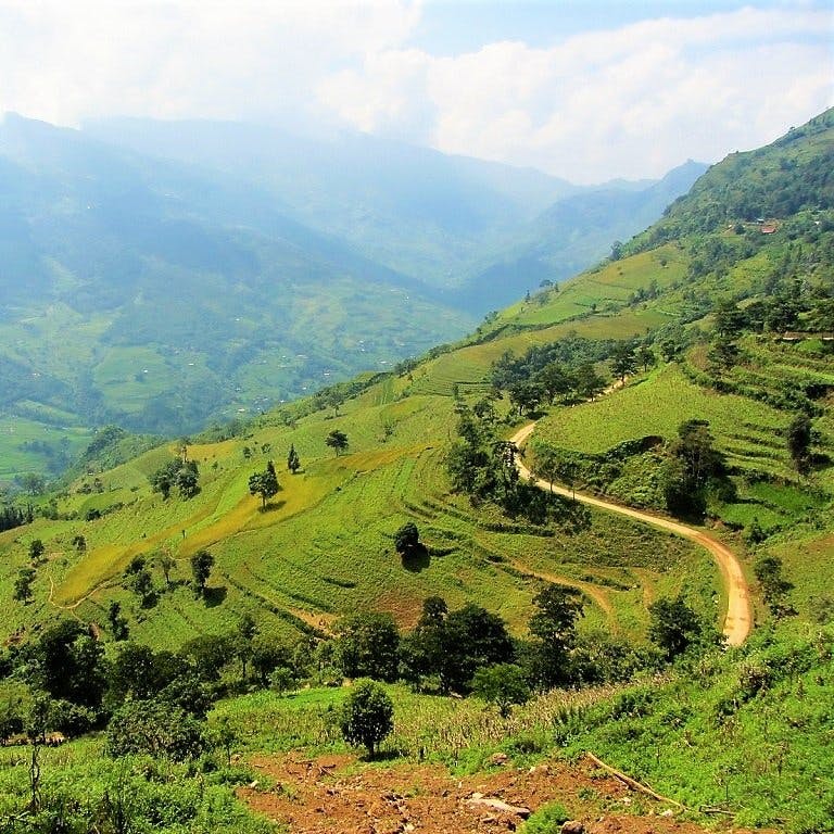
This southerly route between Ha Giang and Cao Bang, via Ba Be Lake, can be joined at any point along road QL34: you don’t necessarily have to begin it on QL34 right out of Ha Giang city (see the purple lines on my map for connecting roads with the green Ba Ba Lake route). This route comes in two halves: the first half passes through lovely landscape on QL34 along the Gam River Valley; the second half, from Ba Be to Cao Bang, is a smooth ride mostly on QL3 through fantastic mountainous landscape.

The southerly route between Ha Giang & Cao Bang, via Ba Be Lake, passes particularly lush scenery
Take QL34 east out of Ha Giang along the very pretty Gam River Valley. This section of road was in poor condition for years, but now (2019) is in much better shape. Eventually you’ll reach the intersection with road DT176 heading south to Da Vi. This is an isolated, beautiful road: a narrow paved lane slicing along valleys and over mountains. It’s a gorgeous ride in good weather, but again you will have to contend with some pretty awful road conditions. In dry weather it should be OK, but if there’s been heavy rain it’s likely to cause landslides and mud pools. Take a look at the photo below to get an idea of what I’m talking about. Having said that, the bad patches are short (but difficult), and if you have a decent bike, it shouldn’t be any problem.

Some sections of QL34 & DT176 can be very tricky conditions, but the bad patches are generally short
DT176 ends at the small village of Da Vi, on the edge of a giant reservoir. It’s a very off the beaten path place, but there’s a nhà nghỉ guest house here if you need it. From here, bear east onto an unnamed road leading over some spectacular mountains and through dense jungle all the way to the crossroads near Ba Be Lake. To go to the lake and the homestays on its southern shores, turn due west. Otherwise, take road QL279 east towards Cho Ra village, where there are several guest houses. From Cho Ra, it’s a lovely, lush ride to the intersection with QL3 at Na Phac. National Highway QL3 is a great road ploughing through marvellous scenery all the way to Cao Bang city.

Stay at one of the homestays on Ba Be Lake before continuing on the excellent road QL3 to Cao Bang
[Back Top]


Hi – we want to do the Ha Giang→Meo Vac→Bao Lac→Pac Bo→Cao Bang: 370km route. How long would it take total for round trip? Is it possible to go one way? Are there one way motorbike rentals? Thanks!
Hi Adrianna,
For one-way rental, try Style Motorbikes and QT Motorbikes.
The route in one direction would take a minimum of 2 days if you are an experienced rider. If not, 3-4 days. In addition, it might take longer if the weather is bad.
Please also look at my guide to the Ha Giang Loop for more information.
Best,
Tom
Hi – Thank you for your reply! I just called QT and they said they can do 1 way! Yay hahah. Do you know of any nice homestay’s along this route? We looking for family homestay’s not really party ones.
Thanks!
Hi Adrianna,
You’ll find some recommendations of good places to stay in each of the sections of the Ha Giang Loop guide
Best,
Tom
Hi – We had not considered Ha Giang because research indicated a motorbike route – but have since discovered we can enjoy by jeep since we are not experienced motorbike riders. We initially thought of visiting Sapa after Ha Giang, but you have us seriously wanting to do Ha Giang-Ba Be Lake-Cao Bang route instead. For your 3 routes from Ha Giang – Ba Be Lake – Cao Bang, are any (or all) not suitable for car or jeep travel? We would be doing this mid-November 2025.
Hi Barrett,
Yes, you don’t have to ride the Ha Giang Loop on a motorbike: you can take a 4×4 tour, hire a car and driver, or ride pillion on a motorbike tour. See my Ha Giang Loop Guide for details.
In other regions, such as Sapa or Cao Bang or Ba Be, you can usually arrange a car and driver (roughly $100 per day – ask at your accommodation) to take you on whatever route you like. So if you wanted to follow any of the Ha Giang-Ba Be Lake-Cao Bang routes, that would be fine. Or, if you prefer Sapa, then the Sin Ho Scenic Loop is also excellent.
In general, all the motorbike routes on my website stick to paved roads as much as possible, and can therefore be driven by car too. If this is not the case – such as a bamboo raft over a river – then I will say so clearly in my guide. Of course, road conditions can change, so there’s no guarantee that a good road last year will still be a good road this year. You can check the comments section at the bottom of any of my guides to see if there are any recent updates from readers on any of the routes.
Best,
Tom
Hi Tom, It’s a great guide, I’m currently near Ba Be lake and intend to take a green road towards Ha Giang on Yamaha NVX. I wonder if conditions have improved since you wrote this article and this road is doable on this scooter. How much time do you think it might take? Google maps suggest about 5 hours of driving.
Hi Ivan,
The first section on QL279 is definitely in good condition, but I can’t be certain about the central section of road linking QL279 and QL34, because I haven’t ridden it recently.
Best,
Tom
Hi Tom, so it took me about 6.5 hours in total ride this road with one overnight stop. The road in decent condition, so now it can be done on any bike (except electric scooters I guess)).
Hi Ivan,
Thank you very much for this update – it’s great to know that the road is in good condition now.
Best,
Tom
Hello, thank you for your work with this very appreciable map and these tips. I plan to make a loop starting from Ha Giang to Cao Bang following your blue and red itinerary. For the return I would use your green line itinerary . I have 7 days and 6 nights, is this possible depending on the stops and distances? Thank you so much.
Clem
Hi Clem,
Yes, you can potentially complete that loop in 7 days on the road, but you should expect to spend essentially a full day on the road everyday. Also your progress will depend on weather conditions: if it is rainy, then this may slow your progress considerably.
In addition to this guide, please also see the Ha Giang Loop guide.
Best,
Tom
Hi Tom, This is all so amazing and helpful. I am planning a trip with my dad for his 70th for us to go early May. (I did the Ha Giang loop back in 2018 and have always wanted to take him back as it was just so spectacular!) However have been put off from hearing about all the big tourist groups and police stops etc so we have decided to start in ha giang and then make our way over to Cao Bang and explore more around there and the more rural parts. We have about 6 days in total. My question is out of all those routes – which is your favourite? and why? Thanks so much 🙂
Hi Lexi,
Thanks for your comment.
Yes, the Ha Giang Loop has changed a lot since you rode it in 2018. It’s still amazing, of course, but it is much more popular than it used to be. A good alternative is to ride the Northeast Loops instead – you could start in Cao Bang and rent a bike there. Alternatively, the Limestone Loops are excellent and perfect for a few days on the road – I’ve done those loops with my 70+ parents too. So I would recommend checking those out, if you haven’t already. Also the Sin Ho Loop in the northwest is great too.
As for the 3 routes in the guide on this page above, they are all highly scenic and good to ride. The Classic route (blue) follow the standard Ha Giang Loop for the first half, so it might be busy. The Border route (red) uses some sections of road that can be muddy or difficult to ride, so maybe best to avoid if travelling with your dad. The Ba Be Lake route (green) is the least travelled, but the road conditions are good and the landscape beautiful.
Best,
Tom
We are heading to Cao Bang area around 8 October 2024. Just wandering if there are any road condition updates for this area after typhoon Yagi and where the best place would be to get such information?
Hi Bert,
In general, the clear up after a storm or typhoon is amazingly swift, so I wouldn’t expect there to be much serious impediment left from Yagi by early October. However, there’s always the possibility of another storm, of course.
For updates, you can check the comments sections in relevant guides such as this one and the Northeast Loops guide. Asking locals and other riders – at your accommodation, on the side of the road, etc – is the best way to get really current information. You could also check local online news sites for the province, such as this one, and just use Google to translate it.
Best,
Tom
Thanks for the quick reply Tom. I’ll also reach out to some of the accommodation providers. Your blog and information you provide on this website is amazing and very comprehensive. Thanks for the effort you made putting all this together. I’ll definitely purchase some of your guides before we come over.
Regards
Bert
Thank you, Bert. I appreciate the kind words.
Best,
Tom
Yesterday I drove the long and winding roads from Ha Giang to Ba Be Lake. No roadworks at all, no rough sections except for one 200 m long one in Ba Be Village. But be aware: There are not that many gas stations on the route. Sometimes there are 45 km between two stations.
Hi Frank,
Thank you for this update – it’s really great to hear that all the roads on that route are in good condition: great news!
Best,
Tom
Thank you so much for alle the work you have put into this website!
I wish to contribute a bit by giving an update on the roads I have just completed:
DT176 connecting the North with Da Vi is in perfect condition by now. It seems like the construction works have finished. I highly recommend this road because it is very lonely. Also, I recommend anyone going from Da Vi to Ba Be Lake to take a short cut: leave QL279 at Cao Thuong and turn right towards Dong Puong (Puong Cave). The road is in good condition and you will have a lovely ride through jungle, over a suspension bridge and a great view on Puong Cave.
Hi Josephine,
Thank you very much for this useful update – it is a great help to me and, I’m sure, to other riders.
Best,
Tom
Hello Tom and team!
Thank you so much for this article! Together with a friend we followed your itinerary and had an absolute blast!
Regarding the “unnamed road” or “the road of the agitated dragon”, on the way to there we passed in front of a signage that clarified the name of the 15 loop pass. It’s official name is “Khau Cốc Chà”! More-over at the time of riding it (November 2023) the whole 15 loops were a muddy and rocky construction site. Fun for sure.
Thanks again and keep riding and writing about Vietnam!
Best,
Hi Pierre,
Thanks. I’m glad to hear you enjoyed your ride.
Thanks for the update about Khau Cốc Chà pass – a couple of other readers have also mentioned that the pass is undergoing repairs – hopefully they will be finished sometime later this year.
Best,
Tom
Hello Tom, thanks for everything you’ve done with this site, it’s been an invaluable resource for a couple of my trips in Vietnam. I’ve just gotten back from taking a mixture of the routes mentioned here, I hope the following information can be of some help to your readers.
Day 1: Ha Giang to Yen Minh
Rented 3 XR150s from QT in Ha Giang. The shop is popular with renters, so do take note that choosing your bike and processing your paperwork can take quite awhile. The route is the blue one mentioned in the article. Pretty standard stuff in terms of riding and the roads, it’s the same one being taken by the big tour groups.
Day 2: Yen Minh to Dong Van
Followed the blue route once again, but with a detour to the Lung Cu flagpole. Great views as expected.
Day 3: Dong Van to Du Gia
The blue route once again, going through the Ma Pi Leng pass and detouring off to the boat ride at the Nho Que river, finally reaching Meo Vac. From Meo Vac, took the purple route to Du Gia. Large portions of the roads leading out of Meo Vac to Du Gia remain heavily under construction, so expect plenty of gravel, sand, rocks, and dusty roads. Eventually the roads get better, the last 15-20km into Du Gia was a nice ride.
Day 4: Du Gia to Bao Lac
Followed the purple route out of Du Gia to link back up with the QL34. As mentioned in the article, a fair bit of the road remains under construction and you will encounter similar road conditions as to the previous day’s journey from Meo Vac. Once back on the QL34 (green), road conditions are great and it was an easy and scenic ride over to Bao Lac. This also seemed to mark the start of the route getting off the main backpacker route and we didn’t see any more tour groups.
Interestingly whilst planning our journey, Google Maps routed us through a backroad starting off around Lung Ho and linking back up to the QL34. Compared to our taken route, this would have apparently saved about 30km. We contemplated this but decided against it eventually as we could not get any info about the route online nor would any of the locals we talked to recommend it.
Also, QT recommended us to stay off the purple route linking back up to the QL34 due to the road works. Even if you’re headed back to Ha Giang, they will recommend that you backtrack and take a detour. My take is that at the present time, the roads are in no worse condition than what you would have encountered from Meo Vac to Du Gia, save for the very initial stretch once you pass the scenic viewpoints coming out of Du Gia. You’ll have to ride over larger rocks and this portion lasted around 1km if my memory serves me correctly. The road workers initially signalled to us that we could not pass, but we soon saw bikes passing through as we pulled over and contemplated backtracking. Most of the time, the works do not actually stop for you to pass and it seems like you’re free to go as long as they do not explicitly stop you. Liberal horn usage is recommended.
Day 5: Bao Lac to Pac Bo
Took the red route, going over the Khau Coc Cha and Bong Nam passes. Google Maps may route a detour going around these passes, and we learned from our homestay that the Khau Coc Cha pass is under construction and closed on certain days. Thankfully, it was opened the day we visited and we rode through in conditions that by now, proved more of an annoyance than a hindrance. But do still exercise plenty of caution. After this, the road through to Pac Bo is an absolute delight. We passed through valleys surrounded by lush rice fields and many a smooth mountain road without another vehicle in sight.
At Pac Bo, we rode a mini-loop starting and ending from the gates to the Pac Bo complex. We headed south and turned off to the left where the ‘UBND Huyện Hà Quảng’ is. You’ll ride through some tranquil farming backroads and the road conditions are so-so.
Day 6: Pac Bo to Cao Bang
A short and easy ride over wide and good roads. We returned the bikes without a hitch.
All in all, a great adventure. The XR150 from QT was in good enough condition and held up well against the different types of terrain encountered on the journey. Our group encountered police checkpoints but did not get stopped at any of them, though this could have been because we could reasonably pass off as local. For what its worth, we all had prior experience with manual motorbikes and riding mountain roads in semi automatic/automatic bikes, but it was our first time riding manual motorbikes in the mountains.
Thanks again Tom for the article!
Hi Daryl,
Thanks for your trip report and road updates – it is very helpful and useful to me and other readers/riders. I appreciate it.
There are so many roads and alternative routes now in Ha Giang that you can make a number of different loops. Conditions get better each year.
Yes, Ha Giang is now a popular stop on the backpacker trail. But Cao Bang, Lang Son and Bac Kan in the northeast remain mostly off the beaten path.
Best,
Tom
Many thanks for the report Daryl, very complete. I´d like to ask you or Tom if you know any reliable source to ask about which days is open the Khau Coc Cha pass. We are planing to go in a couple of weeks and it would be very helpful to know this info to plan our trip as we don´t have a lot of time. The alternative is to ask on-site to our homestay but the problem is if we are unlucky and the road is closed the day we want to take it. P.S Thanks for the blog Tom, the info you provide here is amazing. I used the blog 8 years ago in a one-month trip solo and I am happy to be back and follow your advice again
Hi Lucas,
Thanks for your kind words.
I think the best option is to ask when you get there – preferably the night before you plan to ride the pass at your accommodation. No doubt it will depend on changing factors, such as weather conditions etc.
The good thing is that, even if you find you can’t take that pass, every route in that region offers great riding and scenery.
Best,
Tom
Thanks for your reply Tom, I will do that.
I would appreciate if you can check out our itinerary and let me know if you think is viable or if you have any comment/suggestion
Date Departure Stops Sleep at Kilometers Hours
10/11/2023 Hanoi Hanoi
11/11/2023 Hanoi By bus Ha Giang 300 6h
12/11/2023 Ha Giang Yen Minh Dong Van 146 4h
13/11/2023 Dong Van Meo Vac, ferry Bao Lac 96 3h30
14/11/2023 Bao Lac Roller Coaster, Cave Cao Bang 125 4h
15/11/2023 Cao Bang Kolia, Cho Ra Ba Be Lake 125 3h30m
16/11/2023 Ba Be Lake QL3 Cao Bang 125 4h
17/11/2023 Cao Bang via DT 207 Ban Gioc 108 2h30m
18/11/2023 Ban Gioc CB (via DT 206) Bus to Hanoi 83 2h
19/11/2023 Hanoi Madrid
I did 45 days by motorbike following your guides 7 years ago, my favourite were Ha Giang Extreme Loop, Pastoral highways, Sapa-SinHo and Pu Luong but if I had to choose just one I think it would be Ha Giang. Now, I am returning with two friends and I have thought in this route although I am a little bit worried about the development/tour groups in the Ha Giang Loop from what I am reading in the blog. Is it that bad? you think in this time of the year will be crowded? I did not like at all Sapa so I hope it is not the new Sapa… In any case, I have included new routes/detours that I didn´t do such as the China border loop or the Ba be Lake loop that looks much more off the beaten path. My last question is that we are thinking about renting the bikes in Ha Giang and drop them off at Cao Bang but other option would be to rent at Hanoi and do an stop with your Magic 8 loop and look for another stop on the way back from Cao Bang but maybe it is too rushed. Many thanks for your great work once again!!
Hi Lucas,
Firstly, although of course everyone needs/wants to plan their itinerary, but overplanning is one of the biggest mistakes travellers make in Vietnam. On the one hand, it is almost certain that at least something won’t go according to plan, so you will have to readjust; on the other hand, very often people’s most memorable moments of their Vietnam trips, is the time when their itinerary didn’t go to plan and they had to improvise. So that’s something to bear in mind.
All your days are doable in terms of distances, but it will depend entirely on the road conditions and weather conditions: if roads are muddy or flooded or under repairs that can add hours to a journey.
Yes, I think renting in Ha Giang and returning in Cao Bang is a good idea.
There’s no question that Ha Giang is much more popular than it was 7 years ago. November is usually the end of the high season for the loop so hopefully it won’t be too busy.
Best,
Tom
Hi Daryl,
I’m looking to do a very similar route in January 2025. Do you think this route is possible on a 150cc semi automatic bike?
Also do you think this route is possible in 5 days if I skipped Du Gia?
Cheers! 🙂
Hi Tom,
Yes, a 150cc bike is fine. I have done all my riding in Vietnam on a 110cc bike, including the routes on this page.
5 days is OK to complete one or two of the routes on this page, but you would be riding most of the day.
Best,
Tom
Hi! Love your site. I’m looking to do either one of the Ha Giang routes or the Sa pa – Sin Ho route in November. Of the two, would you say is the more interesting ride? I’m experienced on a bike but can’t do anything too intense. Just looking for good scenery, interesting roads, and not so much on the backpacker circuit. If you (or any of your readers who have done both) have an opinion I’d appreciate it!
Hi Chris,
Both Ha Giang and the Sapa-Sin Ho Loop are highly scenic rides. However, bear in mind that in November the temperatures can be surprisingly cold up in those mountains – bring warm riding clothes.
Ha Giang is very popular these days, so if you want to avoid the ‘backpacker’ crowd, I’d suggest the Sin Ho Loop. Another alternative is the Tuyen Quang Magic 8 route.
Best,
Tom
Hello, I am trying to create a Google Maps route from Bao Lac to Cao Bang via the Me Pja Pass but it will no longer route me through the Me Pja Pass and instead routes me on a big detour around the pass. I was able to create a clockwise route with no problems a couple months ago but when I recently tried to create an anti clockwise route I ran into this issue with routes in both directions. Has anyone driven this recently and is it open to traffic?
Hi Greg,
There have been reports that the pass is currently undergoing major repairs, so perhaps that is the reason. By the sound of it, the pass is difficult to ride at the moment, so it’s probably better to take another route at the moment.
Best,
Tom
Thanks for update. I will be riding there in October counter-clockwise. So from Cao Bang to Dong Van the major roadworks are on your Blue route (road QL4C) and you recommend to take the Red route (road DT217)? cheers
Hi Cris,
The roadworks are currently on the Me Pia/Khau Coc Cha pass, also marked as the ‘Roller-Coaster’ pass on my map. That is on the red line on my map – The Border Route.
You can take QL34 on the blue line instead – The Classic Route.
Best,
Tom
Hi Tom, great resource you have created, just wanted to let you know I made a small contribution to support your efforts.
I am looking at options from Du Gia to Ha Giang and was writing to see if you knew anything about the road that you go left on from DT181 that goes by A Boong Waterfall and Little Ma Pi Leng Canyon before joining with QL4C. I don’t see a road number so guessing it could be a little “adventurous”. We are two experienced riders that will be on Honda 150s. Thanks again!
Hi Greg,
Thanks for your kind words and donation – it’s very much appreciated.
Yes, that road is apparently very nice and in good condition – I think it has been mentioned a couple of times in the comments section of my Ha Giang Loop Guide. I haven’t ridden that road yet myself so I can’t personally vouch for it, but it seems from people’s feedback and updates that the road is good.
Best,
Tom
Hi! Thank you so much for all the tips above. I am back from a 5 days loop on northern roads. I rented from QT Motorbike in Ha Giang, I was about to follow their route recommendations, and then I found your site: you saved my trip!
First, I am an experienced driver, and the routes suggested by QT are made for people who have never rode a motorbike. A good average of distance in one day is more like 100-175km. Also, be prepared if you rent in Ha Giang: QT and similar renters are very big companies, more than 50-75 people are leaving shops around 9am each morning, some with “easy riders”, others with guides. If you rent by yourself, be sure to be prepared to inspect and rig your luggages on the bike by your own. Arrive early to avoid crowds of tourists at the shops and on the road when leaving Ha Giang.
We were two people on a Honda XR150. Not the fastest bike, but I think it is the perfect bike for this type of roads. This is the trip I did, following your routes:
DAY ONE: Ha Giang to Dong Van, following the blue route.
DAY TWO: Dong Van to Bao Lac, following the blue route and the red route from Meo Vac to Bao Lac. Be prepared: near Khau Vai, the road becomes a single track sandy lane. Follow the red route only if you’re an advanced rider. The reward: beautiful scenery, and a unique bamboo ferry to cross the river near Khau Vai. This was my favorite part. Be careful, after the ferry, there is a lot of road construction on the DT217.
DAY THREE: Bao Lac to Ba Be lake, using the blue route and the purple crossroad. There is a lot to see as well and at this point, you are definitely out of the crowded traditional “Ha Giang loop” roads used by all tourists and their guides.
DAY FOUR: Day off at Ba Be lake and exploring surroundings with the motorcycle.
DAY FIVE: Ba Be Lake back to Ha Giang to return the bike at the shop, using QL279. 225 km, long day but as you get closer to Ha Giang, the road becomes faster (left Ba Be Lake at 8am, arrived in Ha Giang at 3.30pm).
If you are an experienced rider, don’t hesitate to build the trip you like and go to your pace. Personally, I am really happy of my “custom trip” and for not falling into the “tourist trap” by following the routes we see everywhere in various backpackers blogs.
Thanks again for this useful article!
✌️
Hi Francis,
Thank you for your trip report and updates on road conditions. I’m glad you rode independently and had a good time. Yes, you’re right, Ha Giang is exploding in popularity and changing very quickly indeed.
Best,
Tom
Yes, it sounds very busy at Ha Giang Loop now. Apparently a lot of police on the roads handing out heavy fines.
Hi Rob,
Yes, I’m sure Ha Giang will continue to get busier and more popular with travellers. As for police and fines, they are technically just doing their job: lost of foreign riders in Ha Giang aren’t riding legally. Hopefully, it won’t be long before Vietnam recognizes foreign driving licenses.
Best,
Tom
Thank you so much for your update! My girlfriend and I are going to do a similar route in mid-May and this is helpful. Do you feel like 5 days was enough time for this experience without feeling like you were rushing too much? Do you think renting one way and returning your bike in Cao Bang would have been a good way to do it? Was the stretch from Ba Be Lake to Ha Giang not to be missed?
Hi Stephen,
In my opinion, with only 5 days, I would suggest one-way rental is be the better option. Even though the distances aren’t far, the roads are very windy and progress can be slow, especially if there’s rain. Also, the scenery is so spectacular that you’ll want to ride slowly and stop regularly to take it all in.
Best,
Tom