
First published February 2024 | Words and photos by Joshua Zukas | 4 comments

Joshua is a contributing writer for Vietnam Coracle. A freelancer whose body of work focuses primarily on travel & architecture, Joshua covers Vietnam regularly for Lonely Planet, Michelin Guide, Insider, Ink Global & many of Asia’s top inflight magazines. He also writes intermittently for publications such as The Economist, Wallpaper & Interior Design Magazine. He holds an MSc in sustainable tourism….read more about Joshua
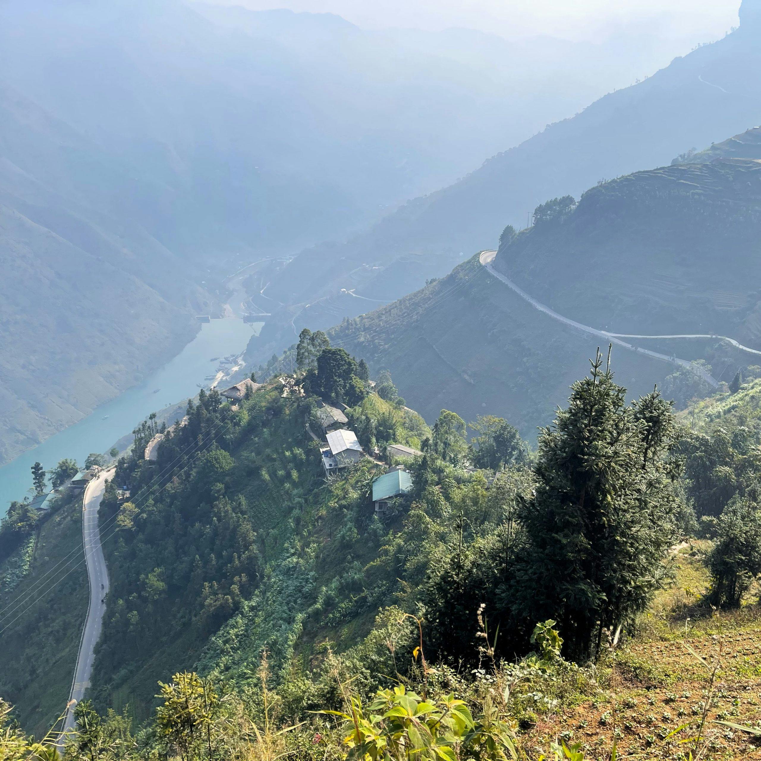
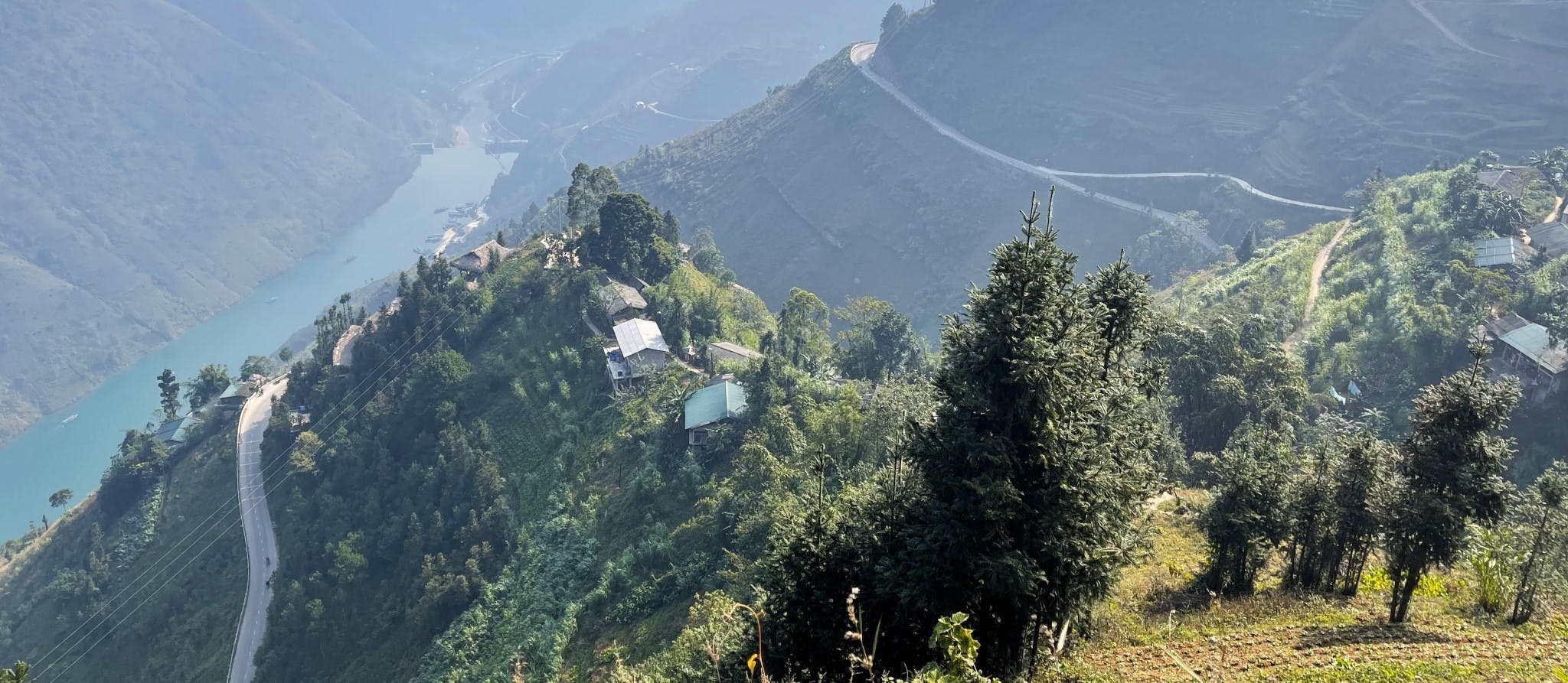
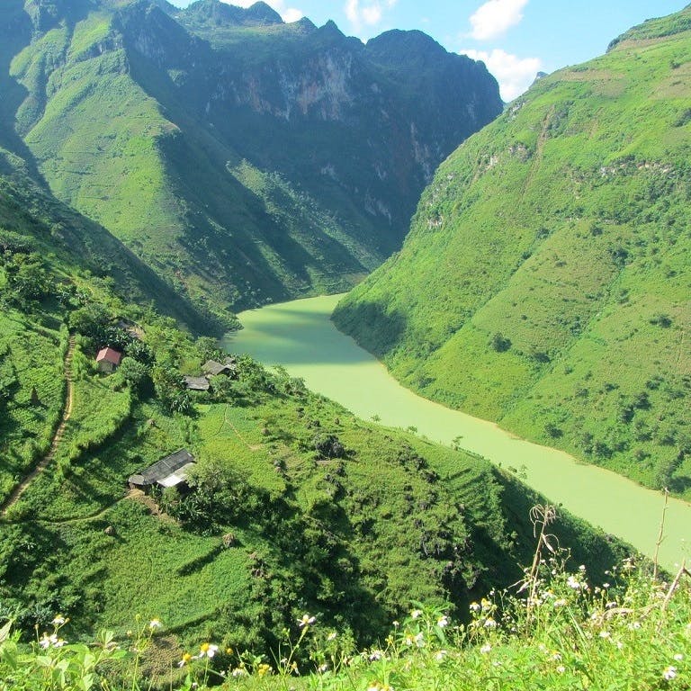
In the far north of Vietnam, the Sky Path is a soaring walkway clinging to the cliffs many hundreds of metres above the Nho Quế River as it pushes through the limestone pillars of Tu Sản Canyon in Hà Giang Province. The Sky Path echoes the course of the legendary Mã Pí Lèng Pass, one of the most spectacular roads in Southeast Asia, which snakes around the steep slopes below the hiking trail. Whereas the Mã Pí Lèng Pass has become busier and noisier in recent years thanks to the increasing popularity of the Hà Giang Loop, the Sky Path remains virtually unknown. Beginning on the main road, the trail wraps around craggy karsts before climbing through farmland to a chain of white cliffs affording sensational views over the Mã Pí Lèng Pass, Tu Sản Canyon, and Nho Quế River. The Sky Path just goes to show that, even on Hà Giang’s best-known stretch of road, escaping the crowds is just a few steps away.

[Back Top]

SKY PATH HIKE HA GIANG
A Cliff-hanging Trail above the Mã Pí Lèng Pass
This relatively easy hike takes around two hours depending on how long you spend enjoying the vistas from the many viewpoints along the way and whether you choose the shorter or slightly longer hike. The trailhead is easy to find and there’s no need for a guide. If you’re staying in Đồng Văn or Mèo Vạc, you’ll need transport to get to the trailhead and back. This guide assumes that you’re travelling with your own wheels and therefore includes parking instructions. Another option is to stay at Mã Pí Lèng Homestay, just 100 metres from the trailhead, the night before, but note that the homestay has clearly been designed to accommodate very large groups. You can tackle the Sky Path at any time of year, though it may be hot in the summer (May–August) and cold in the winter (December–February). The only unwise time to walk the trail would be during a storm or very heavy rain as landslides are possible. The Sky Path may also be disappointing during times of heavy fog as you’ll see so little. In damp conditions, be mindful of slippery rocks and muddy patches. Bring water, sunscreen and comfortable walking shoes. Note that the trail marked on my map is only approximate.
*Warning: Do not attempt the Sky Path on a motorbike. Although the beginning sections are rideable & you may see locals coming & going on motorbikes, there are signs to deter visitors for a reason: the path is narrow, dangerous & the last thing the communities need is motorbikes racing up & down their roads. Besides, the best part of the Sky Path – where the white cliffs begin – is only accessible on foot.
CONTENTS:

MAP:
Sky Path Hike | Hà Giang
Please Support This Website
Make a donation or become a patron if you enjoy Vietnam Coracle. This website is totally free & independent. I do not receive payment for anything I write.
Thank you, Tom
Sky Path Hiking Trail
Difficulty: easy-moderate | Time: 2-3 hours | Entry: free | Guide: not necessary
[View Map]
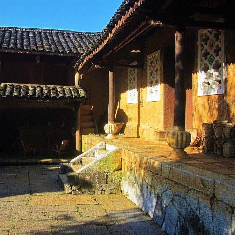
For the slightly shorter hike, park at Mã Pí Lèng village, one of the biggest settlements on the pass, at Mã Pí Lèng Homestay. There are English-speaking staff here so you should have no trouble navigating this, but the friendly team are unlikely to charge parking fees so consider giving them your business. If you’re doing the trail in the morning, you can order a simple breakfast and coffee (which is what I did) before starting the trail or book lunch for when you return. The Vietnamese coffee here is surprisingly good and if you walk through the dining room you’ll find a narrow balcony with a few seats and mountain views.


For the longer hike, you can instead park at the Bảo Tàng Con Đường Hạnh Phúc, which translates to “Happiness Road Museum”, but is usually referred to in English as the Youth Monument. This monument, built in 2017, celebrates the 1,200 people, apparently mostly young volunteers from provinces across northern Vietnam, that built the so-called Happiness Road from Hà Giang to Mèo Vạc. Fourteen of these workers died clearing and building the Mã Pí Lèng Pass. A plaque reads (in English): “The Youth Monument, standing beside the Happiness Road, in harmony with the magnificent scenery, will surely stir in the hearts of visitors the pride and gratitude to the previous generations.” This start point is much closer to Đồng Văn, but when I arrived at the monument there was nobody to look after my bike and bag. If you do start at the Youth Monument, the beginning of the trail is straightforward as you can follow the white road on Google maps, passing the Mỏm Đá Tử Thần viewpoint (sometimes mobbed by the selfie brigade) until you reach the trail turnoff. If you do decide to do this, skip the next paragraph.


If doing the shorter hike, starting from Mã Pí Lèng Homestay, walk up the road (towards Đồng Văn) and after two tight hairpin bends you’ll see a narrow path branching off from the main road on the opposite side to the homestay. Take this path, which quickly becomes a traffic-free and pleasant walkway that moves away from the main road and snakes around a few karst pinnacles. In the shallow valleys you’ll see remote hamlets and farmland. This trail forks a few times and it’s not always obvious which path to take, but if you make a mistake then you’ll very quickly hit a dead end. If this happens, simply retrace your steps and take the other way.


Eventually you’ll reach a small village and then a turning on the left (on your right if coming from the Youth Monument), at which point Vách Đá (where you are headed) is conveniently signposted. Take this left and the trail climbs behind the village and through more farmland until the vertical cliff faces of Vách Đá come into view. At this point you’ll get a sense of how high you’ve climbed, as the motorbikes and cars meander along the Mã Pí Lèng Pass far down below. You’ll be able to hear the traffic unfortunately, but the trail gets quieter as it progresses.


At the Great White Cliff Viewpoint, the walker-only trail splits from the path to the left, which is easy to spot thanks to the metal handrail. From here the trail is easy to follow, as the forkless path zig-zags towards the Vách Đá Trắng White Cliff with patches of wild jungle and cultivated corn above and below. Soon you’ll reach the White Cliff, a particularly dramatic and geologically interesting grotto. Here, stalactites protrude from the cliff face like the deformed fingers of a giant reaching down to pluck unsuspecting hikers from the path. It’s also a good shelter to have a water break and take in the views.


Continue with the concave cliff face on your right and panoramic views on your left. Some locals have taken advantage of the Sky Path to plant corn and other hardy crops on the mountainside, and you may run into some on your way. Your descent is signalled by the Tu Sản Viewpoint, a small pavilion that some locals use to make phone calls as the signal is better up here (or so I was told). A few steps later you’ll reach a fork in the trail, where you’ll take a left. This takes you through a small, lively village with clucking chickens, trouser-less children and the like. Once you hit the heart of the village, where the small stream meets the trail, you’ll be at a T-junction. If you go left, it will take you to the back of Mã Pí Lèng EcoLodge, which has a small café, on the main road. If you go right, you’ll skirt around the hotel and be back on the main road a little sooner.
In either case, you’re now about 2.5km south of where you left the road for the trailhead near Mã Pí Lèng Village, so you have two options: hitch (which is what I did without any issues) or walk (30 minutes) back to the village along the road. Note that if you parked at the Youth Monument for the longer hike, you’re about 5km away.


*Disclosure: Vietnam Coracle content is always free and independent. Joshua has written this guide because he wants to: he likes the Mã Pí Lèng Sky Path and he wants readers to know about it. For more details, see the Disclosure & Disclaimer statements and my About Page


Can it be done on a bicycle?
Hi,
You can try and give it a go 🙂
Best,
Tom
Is this different to the small trail that people used to ride to a rock ledge? Where a few accidents happened, and it got closed to motorised traffic?
Hi Greg,
What you’re referring to is only the first part (the northern part) of this hike: beyond the rock ledge it’s only a foot path.
Best,
Tom