


First published April 2025 | Words and photos by Phương Lê

Phương Lê is a contributing writer for Vietnam Coracle. Having lived in all three regions of Vietnam, she has a deep understanding of the country’s cultural diversity. Currently working as an independent photographer and writer, her work has been featured in various media outlets. As a photo tour guide, she provides not only photographic guidance but also meaningful connections for photography and culture enthusiasts with an authentic Vietnam.
If you’re looking for a quick escape from the frenzied pace and cacophonous din of Hanoi but don’t have time to go far, Hàm Lợn Mountain is a suitable and very agreeable destination. The hike up this forested mountain, just 40km north of Hanoi, offers a one-day trekking experience with the option to camp overnight in the pine forests at the foot of the hill or on the shores of the nearby lake.

Support My Website
Free | Independent | No Sponsored Content
“Hello, if you enjoy my website, please support it.
Thank you.” Tom
[Back Top]
HIKING HAM LON MOUNTAIN
A good hiking destination within easy reach of Hanoi
Below is a complete guide to hiking Hàm Lợn Mountain (see Contents). Although Hàm Lợn is a short and relatively easy hike, there are a few things to keep in mind. Wearing comfortable hiking shoes with good grip ensures a safer hike, particularly when the trail is wet. To stay hydrated, you should bring enough water and snacks, as there are no food stalls along the trail itself, although there are several cozy coffee shops near the starting point where you can relax and enjoy a refreshing drink before or after the hike. Also, a light jacket is needed because temperatures at the summit can be cooler than at the base. And remember to check the weather forecast before heading out, as rain can make the trail slippery – Windy.com is a decent weather app. Most importantly, to preserve the natural beauty of the area, and to set a good example for other hikers, make sure to dispose of your trash responsibly. (For more hiking guides see Related Guides, and if you enjoy this article, please support the site)

CONTENTS:
How to Get to Hàm Lợn from Hanoi
MAP:
Hiking Hàm Lợn Mountain
About Hàm Lợn Mountain:
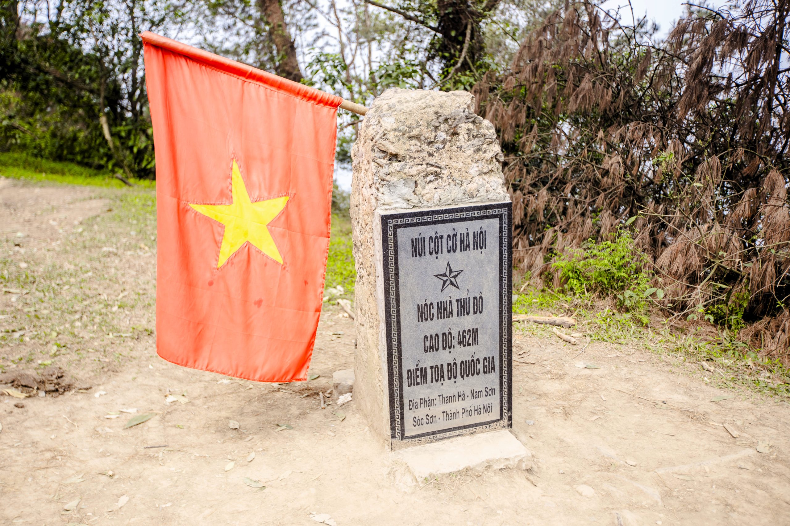
Located in Sóc Sơn, a rural district of Hanoi, Hàm Lợn Mountain is just 40km north of the centre of the nation’s capital city; only 1.5 hours away by road. Hàm Lợn is part of the Độc Tôn Range, which extends northwest towards the better-known Tam Đảo Range. The mountain stands at approximately 462 meters (1,516 feet) and was considered the highest peak in the Hanoi region until the administrative expansion in 2008 incorporated Hà Tây province. Indeed, Hàm Lợn Mountain is still often referred to as “the rooftop of Hanoi”, even though technically the highest peak in the capital’s metropolitan area is now Núi Vua in Ba Vì National Park.
Hàm Lợn Mountain stretches 7.2km from north to south. From a distance, the peak resembles a pig’s snout, which is how the mountain got its name: ‘Hàm Lợn‘ means ‘Pig’s Jaw’ in Vietnamese. Viewed from above, the ridgelines branch out in four directions like a bird’s footprints, giving it another name: ‘Núi Chân Chim‘ (Bird Footprint Mountain). Some locals also call it ‘Flagpole Mountain’ (Núi Cột Cờ).
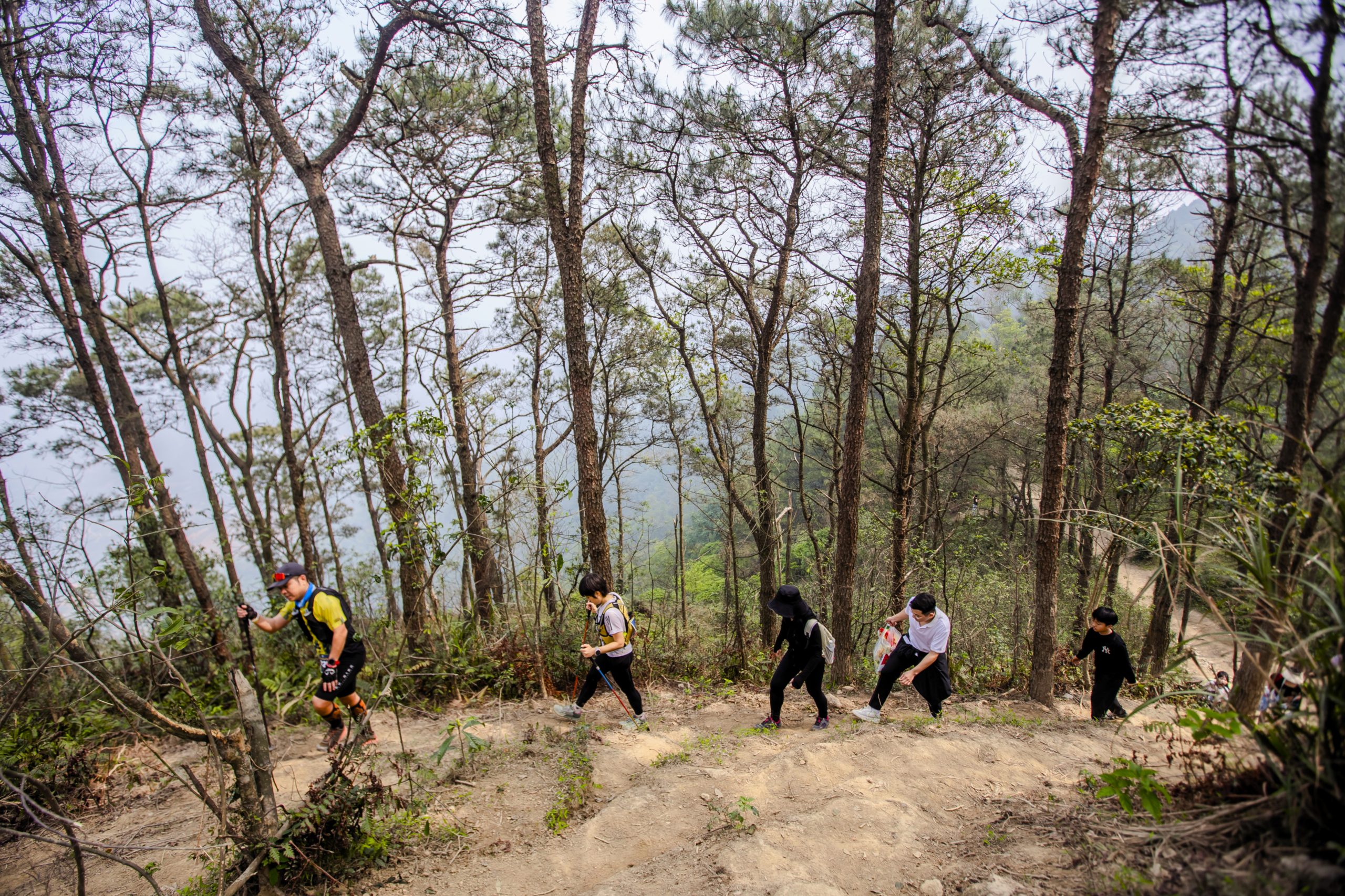
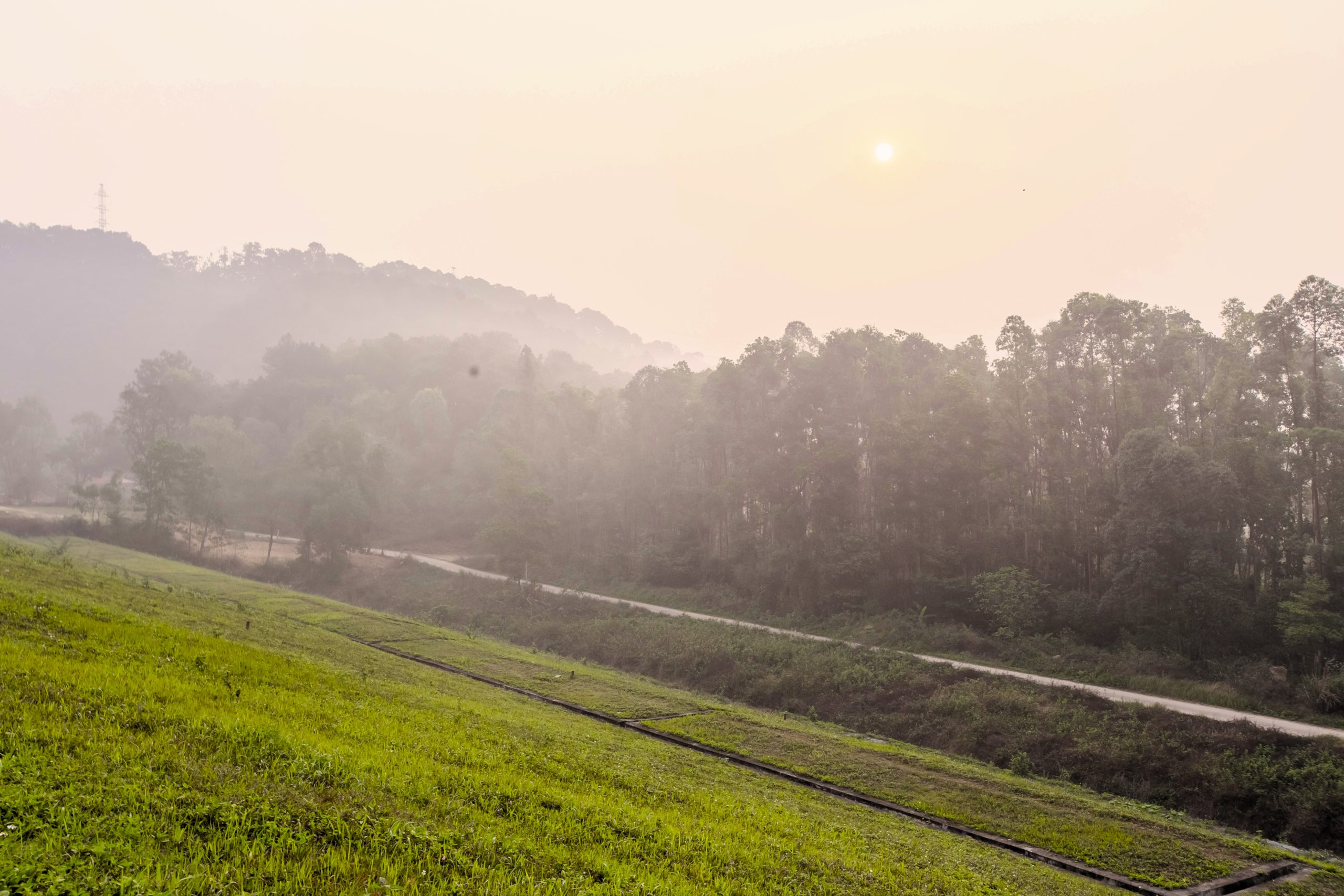
With its scenic landscapes, fresh air, and relatively easy trails, Hàm Lợn Mountain is an ideal getaway for both amateur hikers with moderate physical fitness and experienced trekkers looking for a light outdoor workout. Even kids can complete this hike, making Hàm Lợn a great nature-filled outdoor activity for families. Although it is a relatively short hike, it offers good views of lush pine forests, misty hills and tranquil lakes. Hàm Lợn’s forest is a blend of natural woodland and planted pine groves, some dating back to the 1960s. As part of Hanoi’s protected watershed forest system, it plays a crucial role in environmental preservation. In recent years, Hàm Lợn has gained popularity among Hanoi’s running community, as many trail runners train here for ultra-trail races.

Weather & Best Time to Visit:
Hàm Lợn is accessible year-round, but the best time to visit is October and November when the weather is cool and dry, and visibility is good and clear. Winter (December to March) is also OK, though it can be extremely cold and misty, and visibility is limited. During the hot and rainy season (May to September), the trails can become muddy and slippery, requiring extra caution, and the humidity can be punishing.
For a pleasant day hike, start early in the morning thus avoiding the midday heat and limiting chances of dehydration. If visiting in the rainy season, be extra careful, as the trail can become treacherous when wet. For safety reasons, avoid descending after sunset. The area tends to be busier on weekends, while weekdays offer a quieter, more peaceful experience.
How to Get to Hàm Lợn from Hanoi:
Hàm Lợn is conveniently reachable from Hanoi by motorbike, car, or even a long cycling trip, as well as by bus. The journey takes approximately 1.5 hours, making it an ideal destination for a day trip.
With a personal vehicle, you can take the Nhật Tân–Nội Bài Highway (AH14) or QL3 due north of Hanoi towards Sóc Sơn. Then wiggle northwest following the signs to Hàm Lợn Lake (Hồ Hàm Lợn) near Trang Thiều Camping. The roads are generally in good condition, but it’s far from a pleasant journey because most of it passes through the sprawling industrial suburbs of Hanoi. (If riding a motorbike, parking is available at the campsites near the trailhead for about 10,000vnđ per bike.) If travelling by bus, you can take the number 64 from Hanoi’s city center to Hàm Lợn Lake (Hồ Hàm Lợn). Get off at this bus stop, then walk 2km due west along Thanh Hà 1 Road to reach the lake.

Staying Overnight at Hàm Lợn:
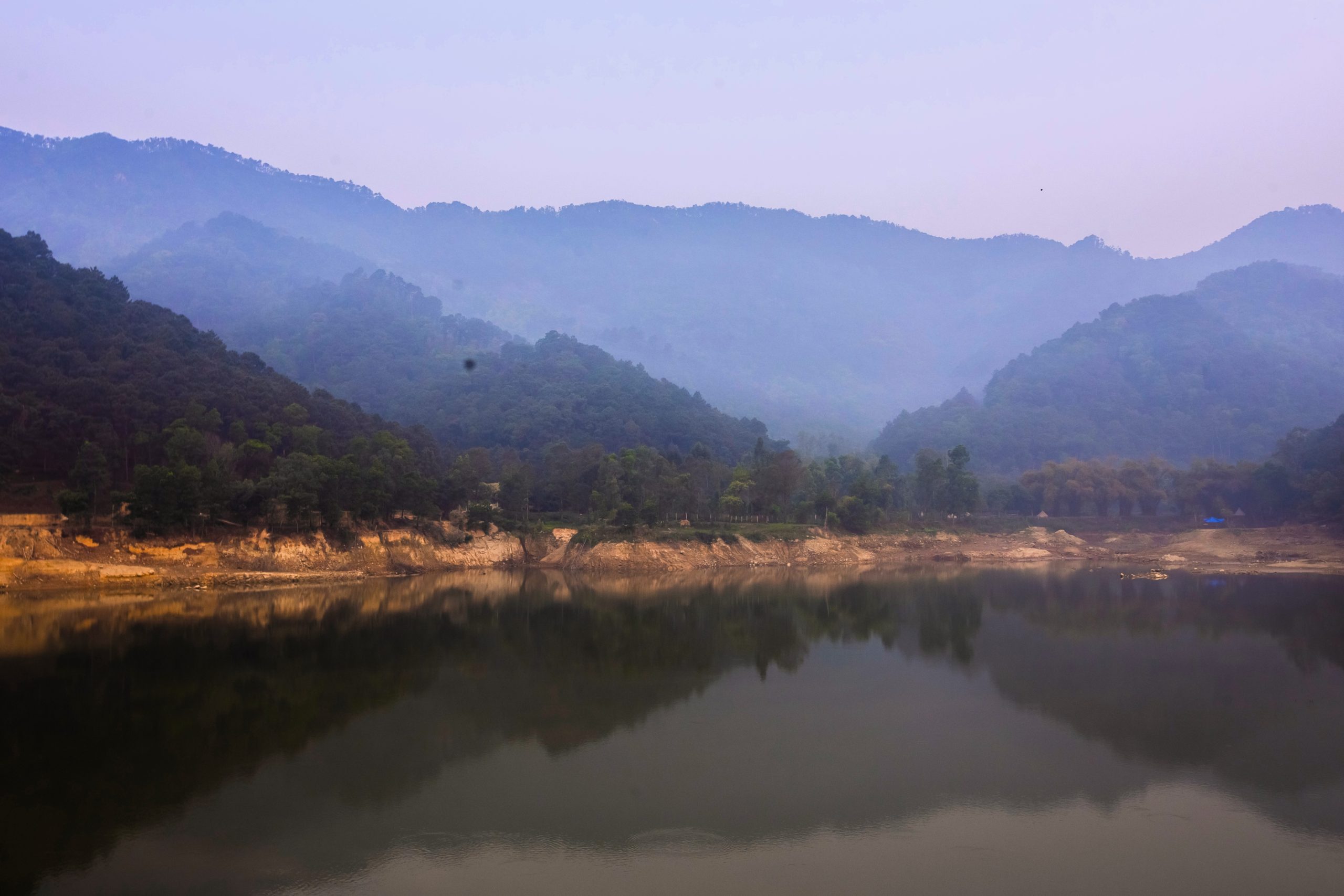
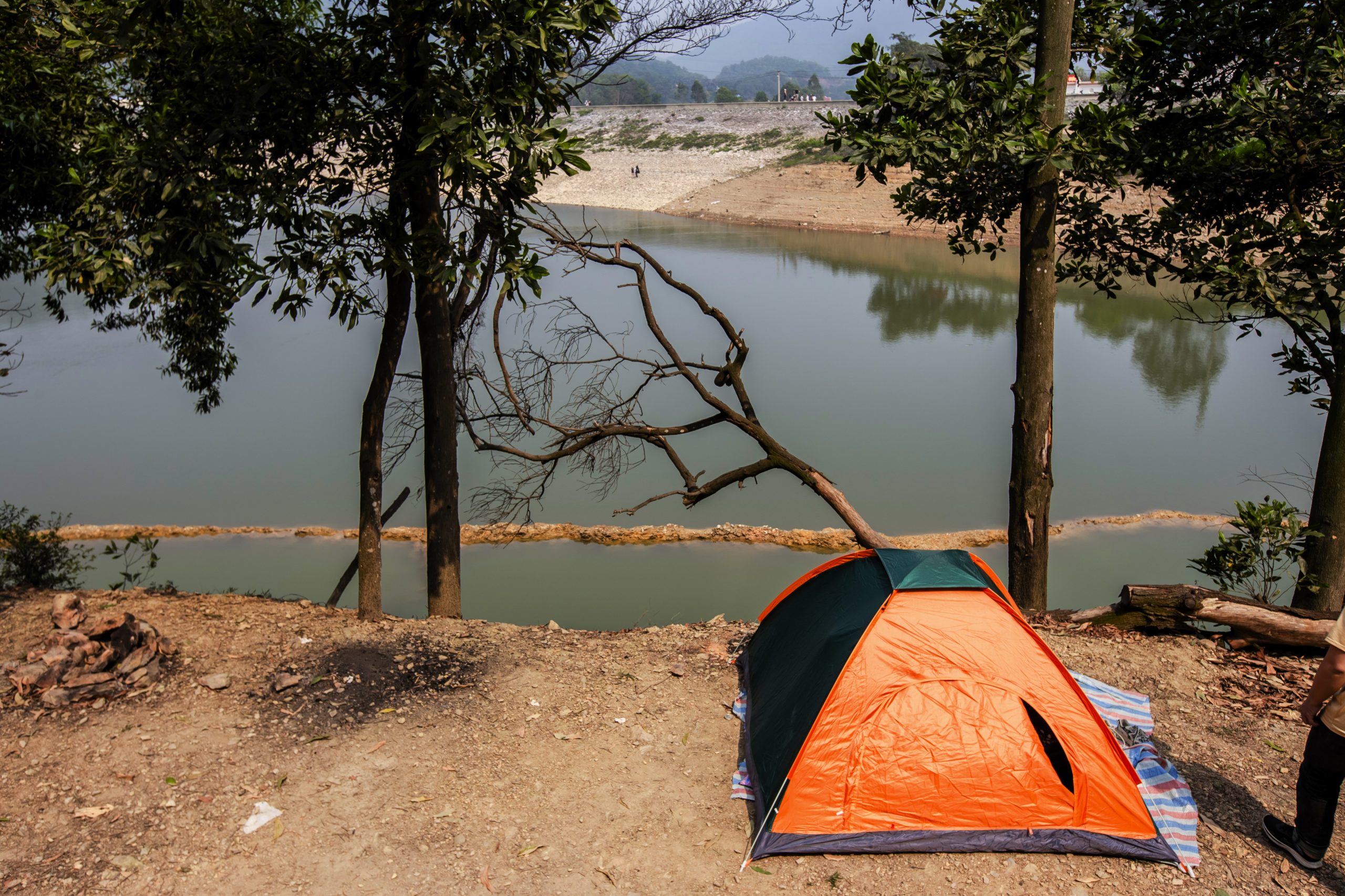
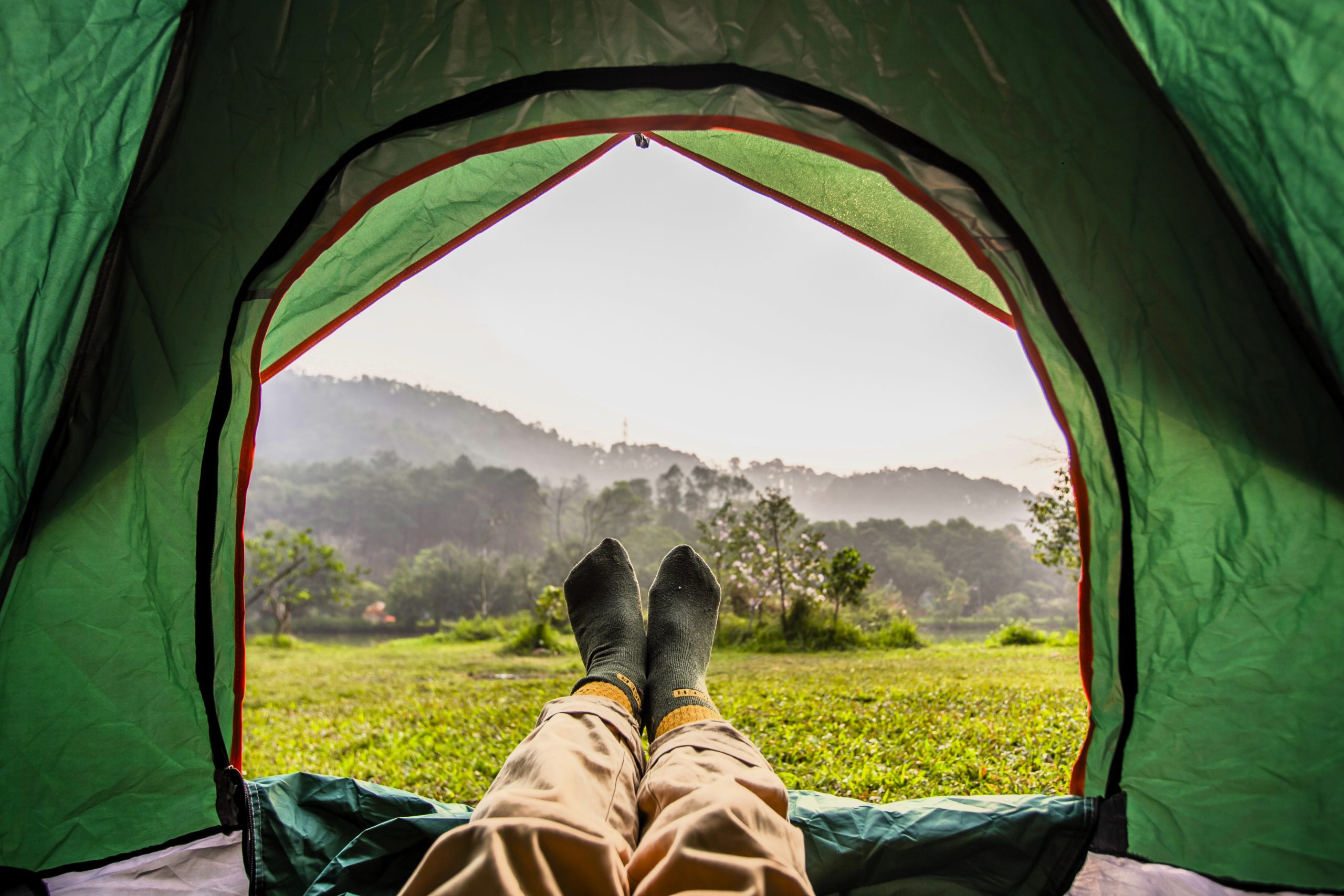
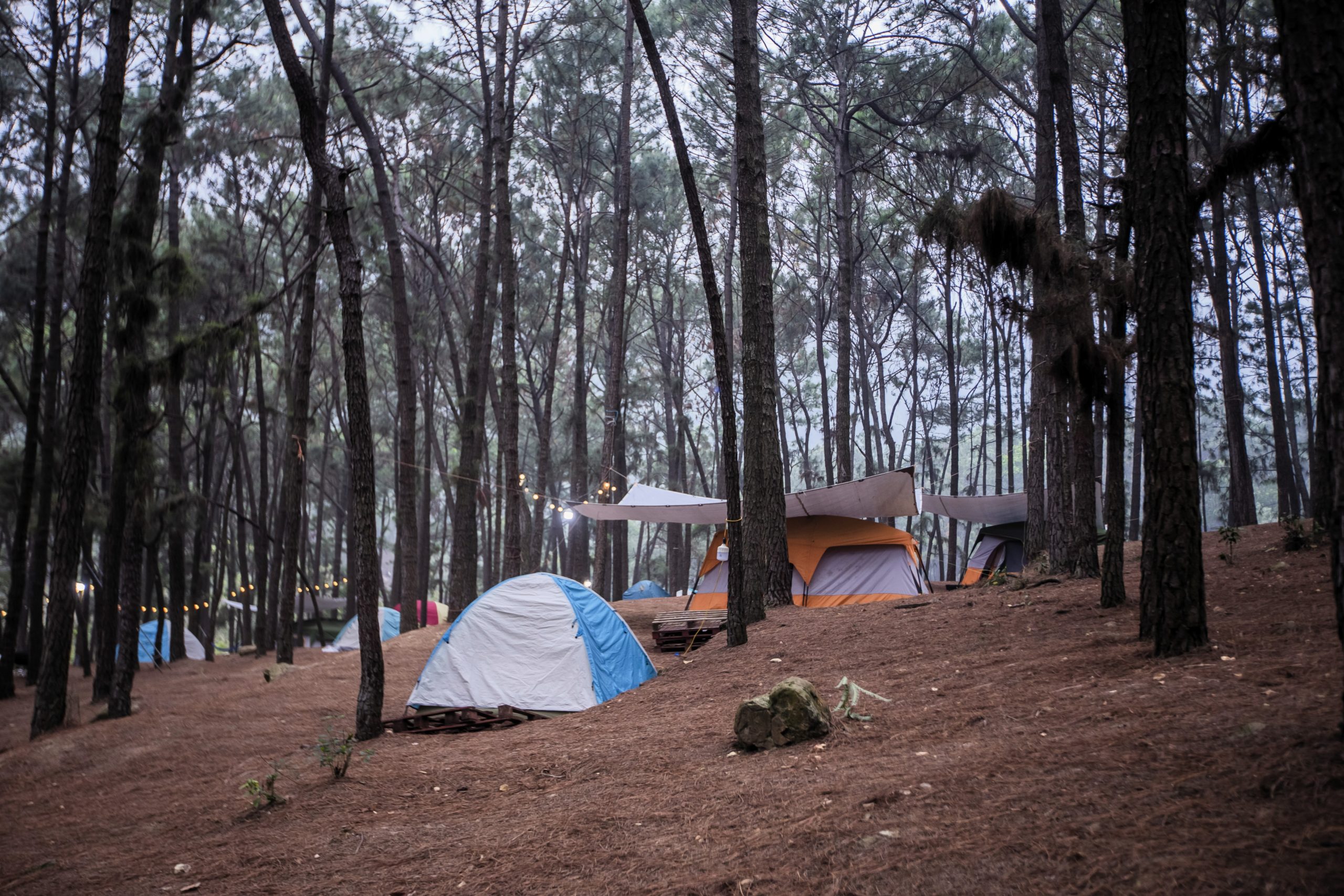
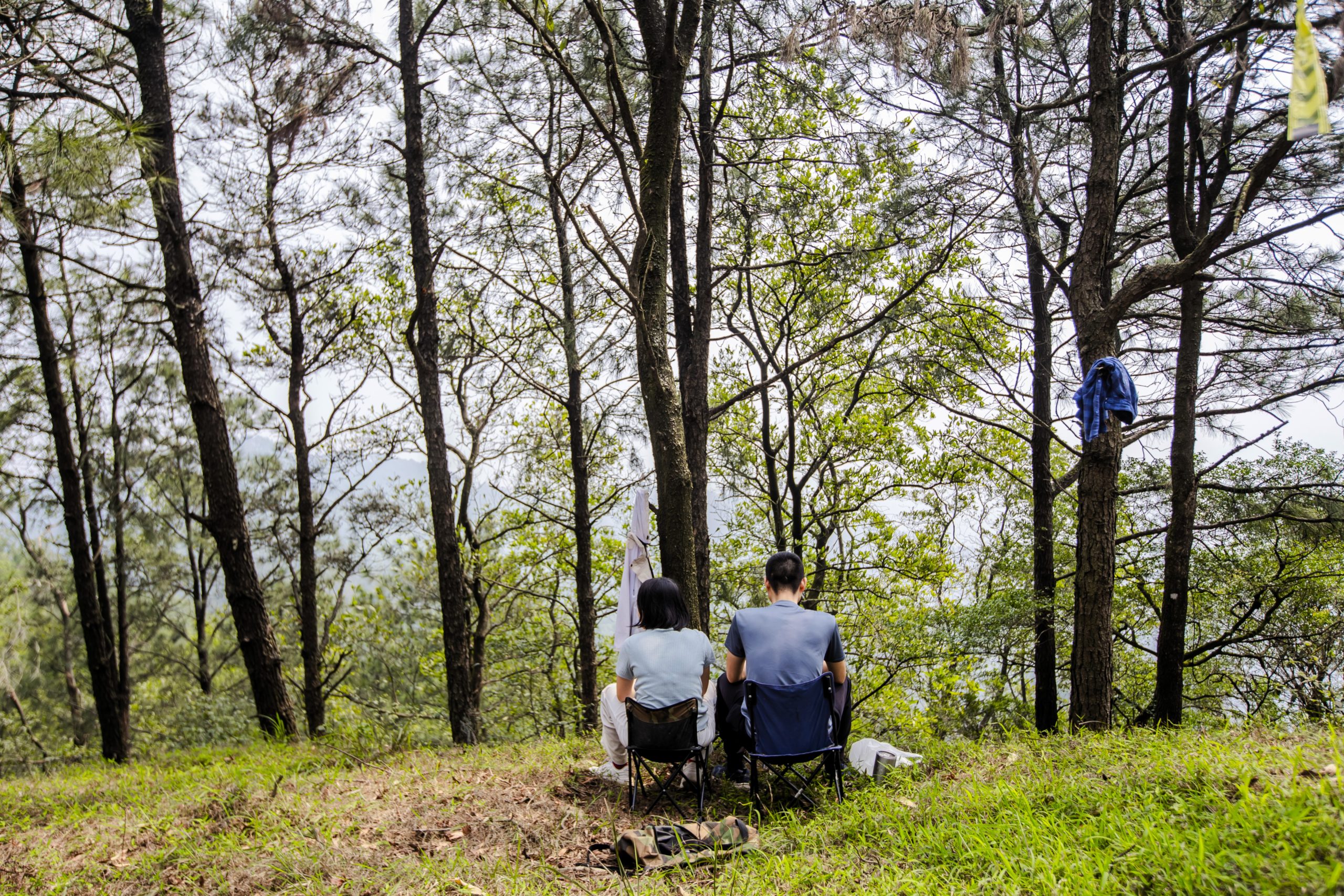
While many visitors complete the hike in a day-trip from Hanoi, camping allows for a deeper connection with the natural surroundings. If you have your own camping equipment, you can set up camp by the pine forest at the mountain’s base or near Hàm Lợn Lake, where the calm waters reflect the surrounding peaks. If you don’t have camping gear, there are many camping and glamping sites around the lake offering tent rentals, food and drink. These include Trang Thiều Camping, Chú Thiện Camping, Cô Tám Camping, and Boar Glamping among others. The campsites are set in spacious grassy areas with a pine forest backdrop. Alternatively, homestays, guesthouses and villas are available within 8km of the mountain foot.
The Hike to Hàm Lợn Peak:
- Difficulty: easy to moderate
- Trail: easy-to-follow dirt path loop
- Hiking Time: 3-4 hours roundtrip
- Entry: free
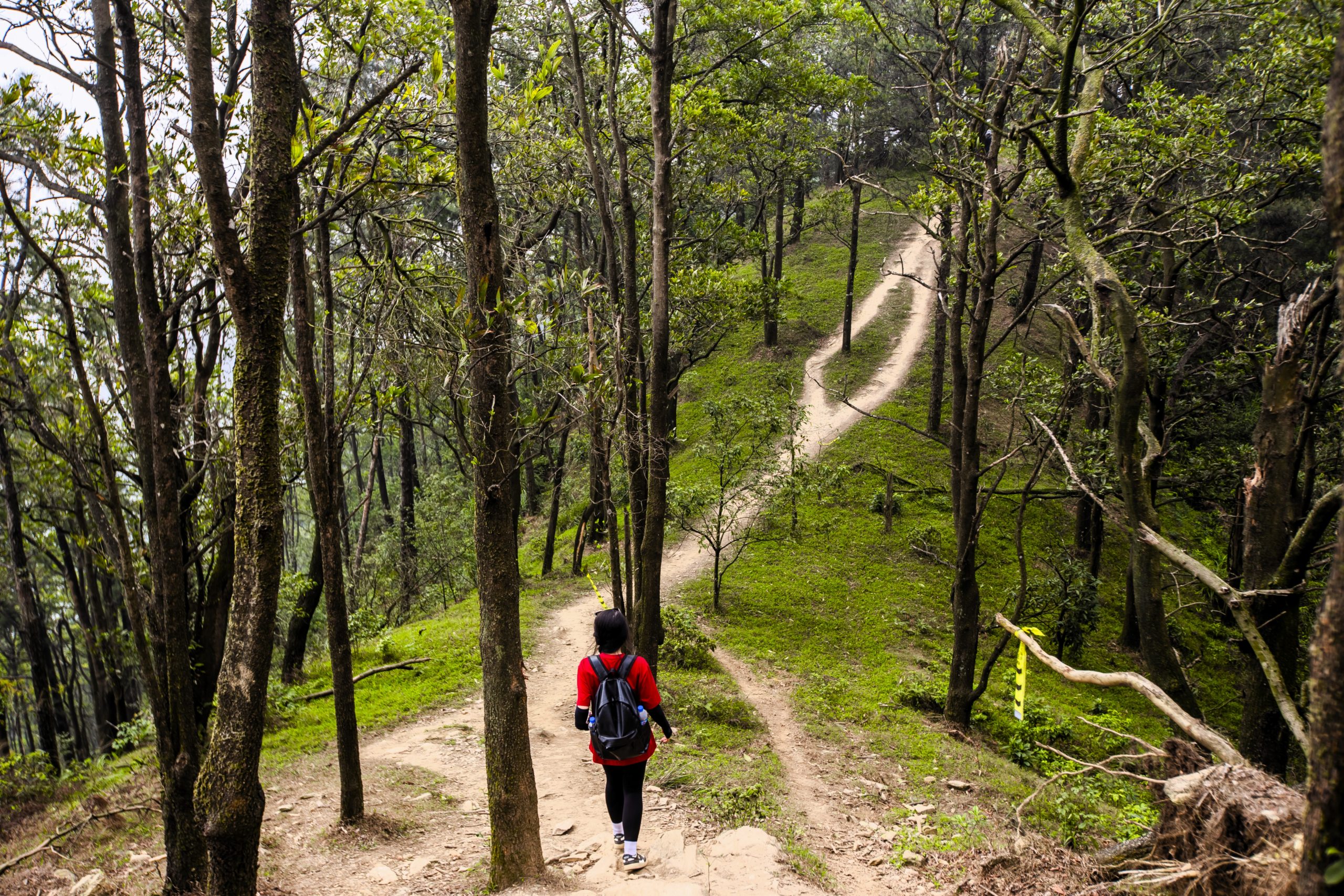
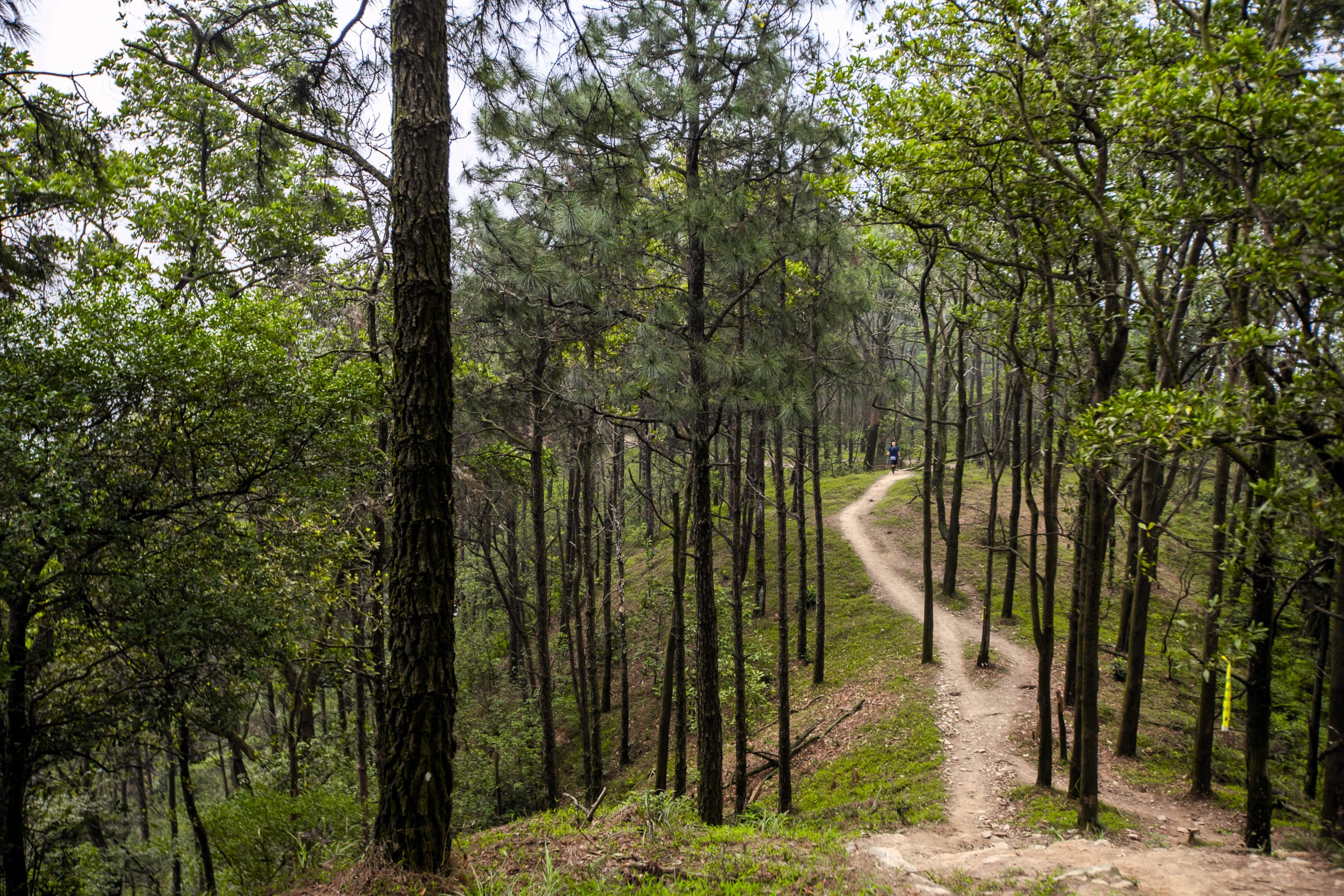
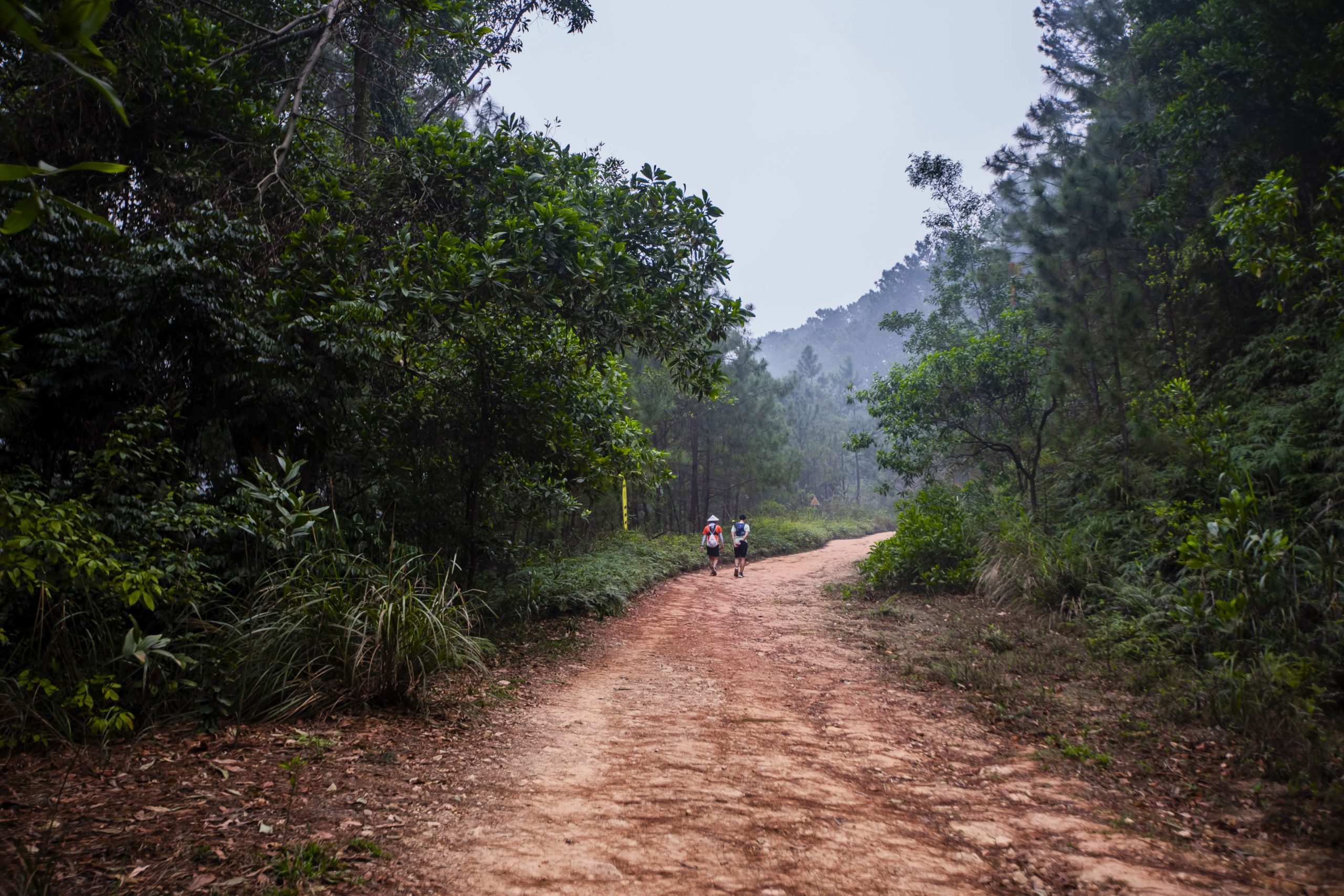
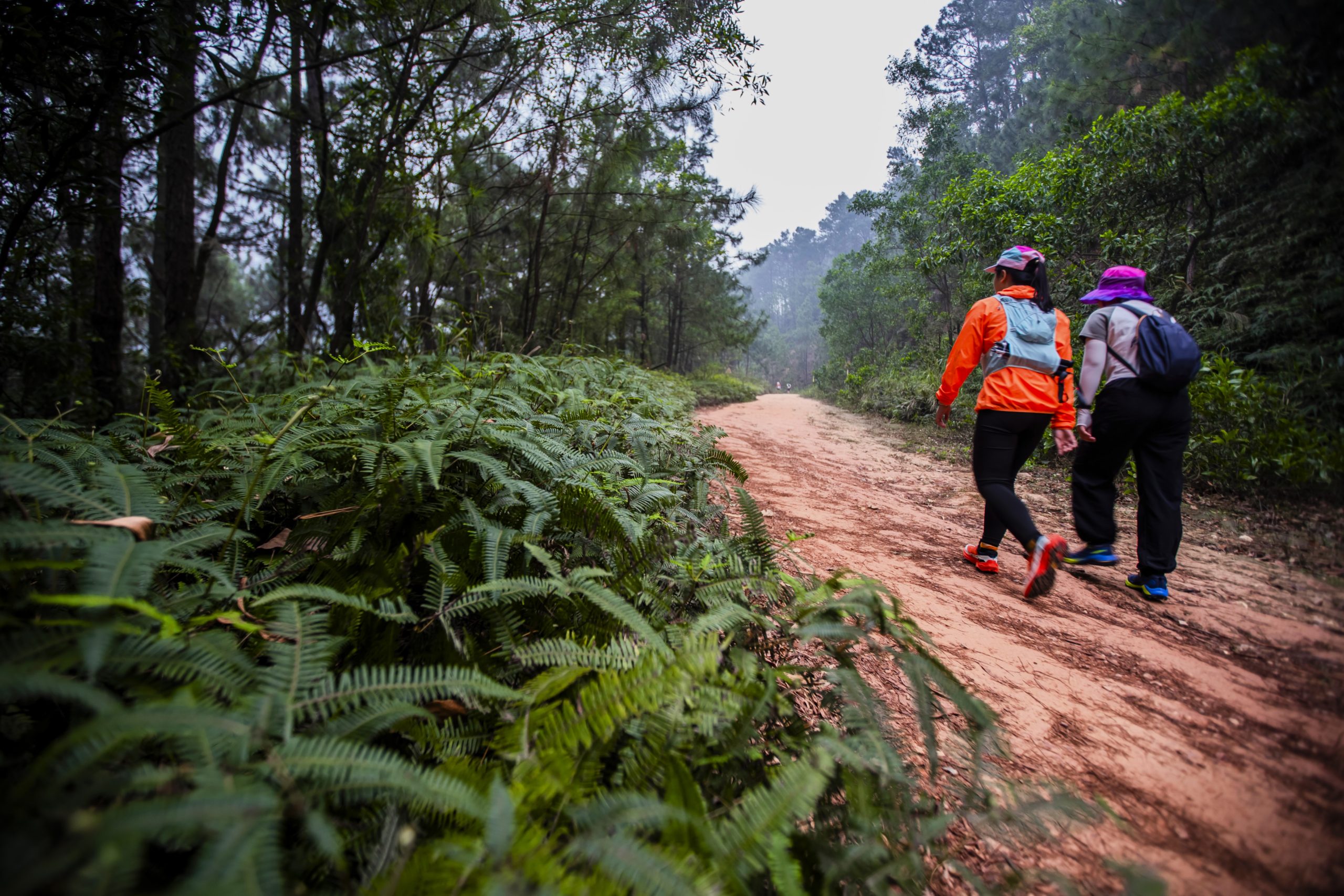
About the Trail: Although there are several trail options, the most popular and beginner-friendly route is a well-marked dirt trail starting near Hàm Lợn Lake, meandering through lush forests, ascending to Hàm Lợn peak and then descending on the other side of the mountain back to the lake, thus completing a loop. This route is suitable for anyone, from solo hikers to families to first-time hikers to group tours.
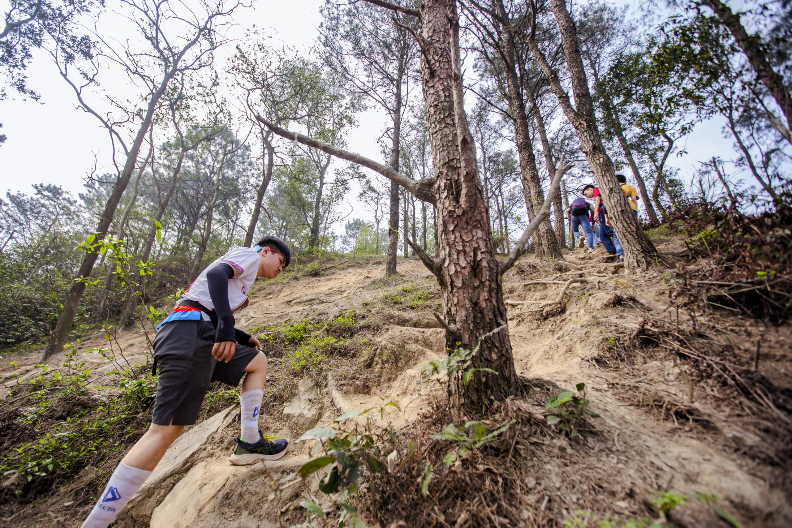
Reaching the summit takes approximately 1.5 to 2 hours, with the roundtrip lasting 3 to 4 hours, depending on your pace and time spent enjoying the scenery. The total round-trip distance is about 15km. The terrain consists of packed dirt with some rocky sections and gradual inclines. There’s one short, steep climb near the summit, but the rest of the trail is relatively gentle and easy to navigate.
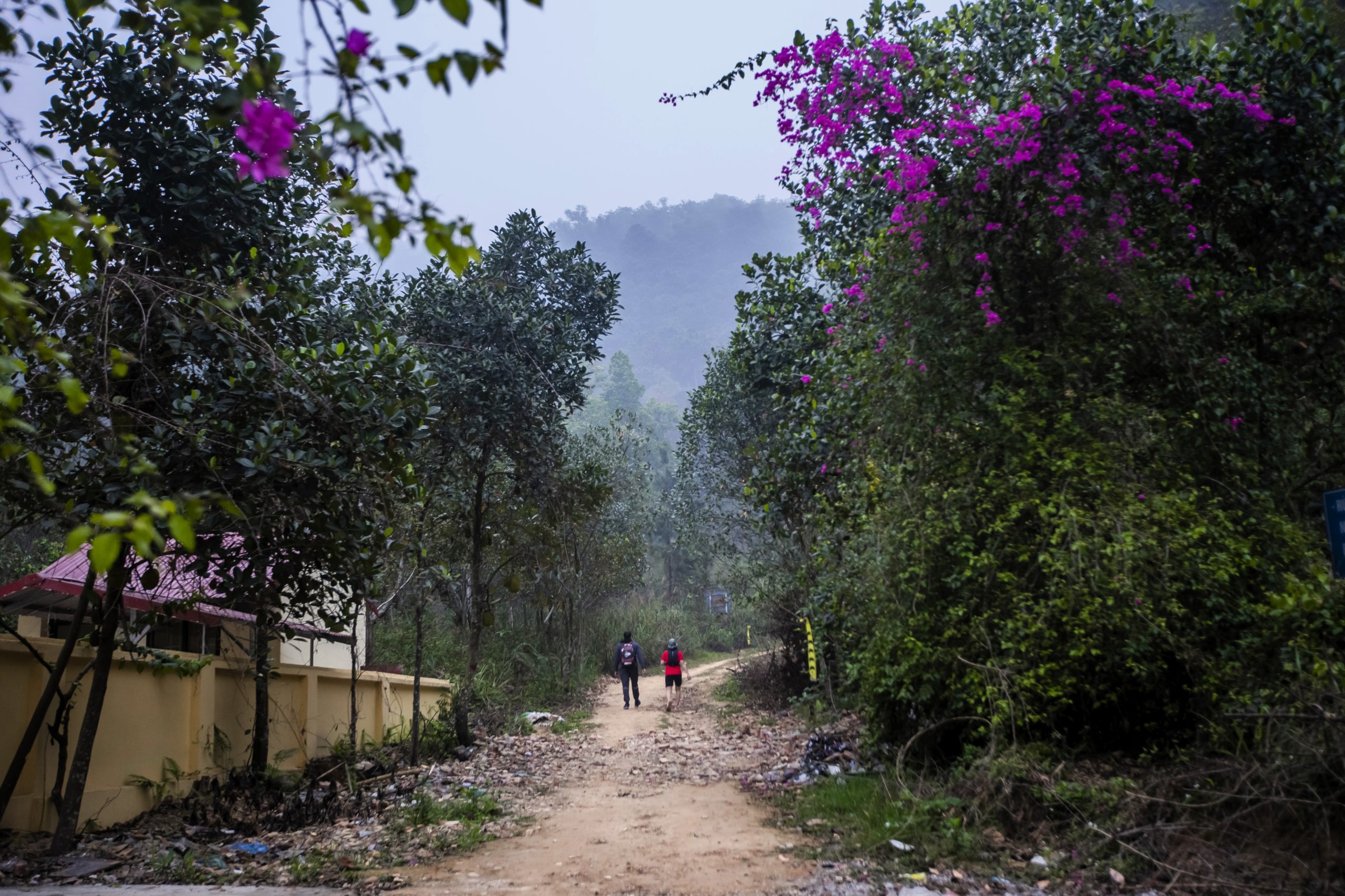
The hiking loop begins opposite Xuhao Homestay near Hàm Lợn Lake, where most of the campsites are located. From here, you can follow the loop going anti-clockwise (see the red line on my map). You should have a strong phone signal for most of the hike, so Google Maps will help with navigation.
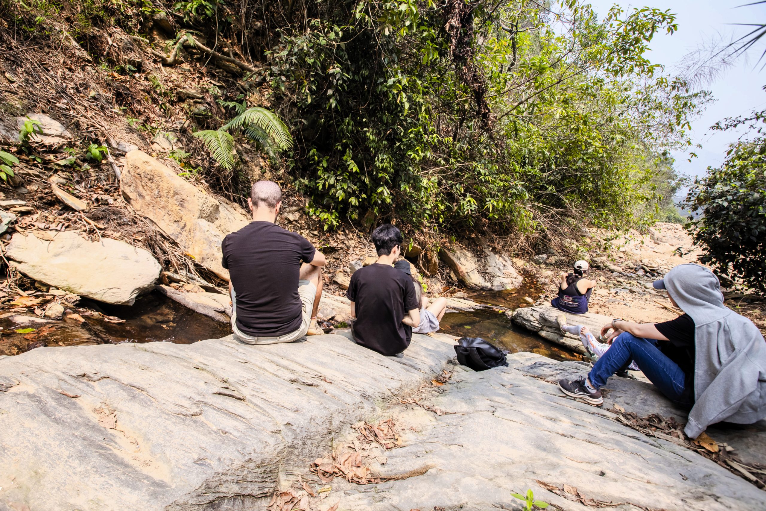
Other Trails: There’s a more adventurous route that follows a rocky stream bed. It requires careful footing and takes 3 to 4 hours to reach the summit, depending on water levels and weather conditions. In addition, many trail runners have explored new, more challenging paths through the dense forest. If you want to try one of these alternative routes, it’s best to ask around at the campsites and cafes near Hàm Lợn Lake.
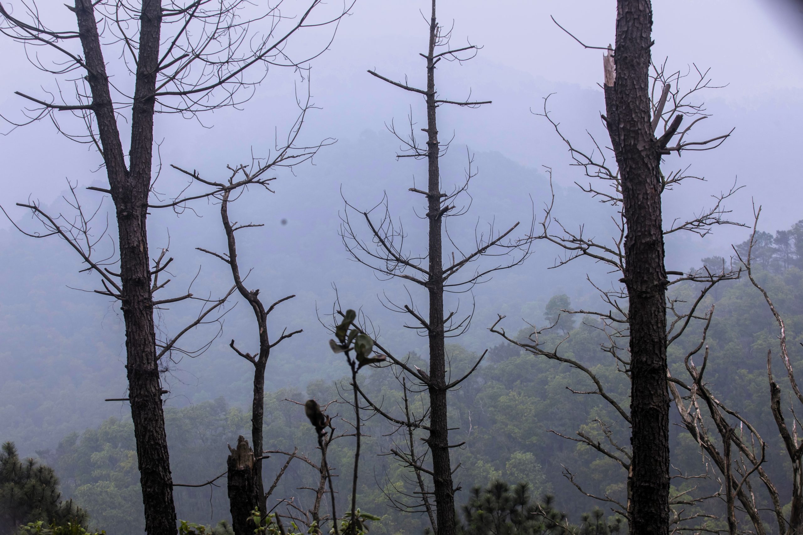
The Hike: Start opposite Xuhao Homestay and follow a wide dirt path due north for 2km. After about 30 minutes, turn off and enter the forest: this is the trailhead for the mountain hike. Here, the route becomes steeper, passing through tall pine trees. The air is fresh with the scent of pine resin and damp earth, accompanied by birdsong. After another 1km, the trail arrives at a resting spot (altitude: 393m), which takes about 45 minutes to reach. This is a good place to take a few minutes to hydrate and enjoy the misty, mysterious atmosphere. Just a short distance from here, the trail passes Đồi Sim Hàm Lợn (Myrtle Hill), which blooms with purple flowers from May to June.
The final stretch due southwest to the summit is mostly easy, except for one steep climb requiring extra caution. At the peak, the summit marker stands with a Vietnamese flag, and there’s ample space to rest while admiring the panoramic views of Sóc Sơn’s forests and lakes, weather permitting.
After spending some time at the top, continue due south, following the pathway down the mountain. The landscape along this route is much like the rest of the mountain, with dense pine forests and a serene atmosphere. When the trail exits the forest, a winding dirt path leads eastwards, eventually running alongside Hàm Lợn Lake and finishing back at the campsites near the beginning of the hiking route, thus completing the loop.
*Disclosure: Vietnam Coracle content is always free and independent. Phương has written this guide because she wants to: she likes this hike and she wants readers to know about it. For more details, see the Disclosure & Disclaimer statements and my About Page


