

First published April 2026 | Words and photos by Luke Digweed | Read time 25 minutes | 3 comments

Luke Digweed is a staff writer for Vietnam Coracle and has lived in Vietnam since 2011. He holds an MSc in Social Anthropology from the London School of Economics where he wrote his dissertation on Vietnamese male migrants working in UK nail salons. He has worked on the production of several podcasts, including LSE’s Phelan US Centre show ‘The Ballpark’. While living in Huế, he ran the Huế Grit Tour from 2017–2020. His current Vietnam-centric interests include ceremonies and festivals, food, motion and mobility….read more about Luke
Stop-by-Stop Guide to Riding Ho Chi Minh City’s First Metro Line
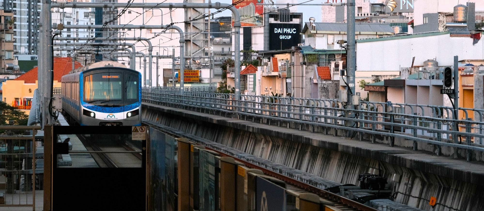
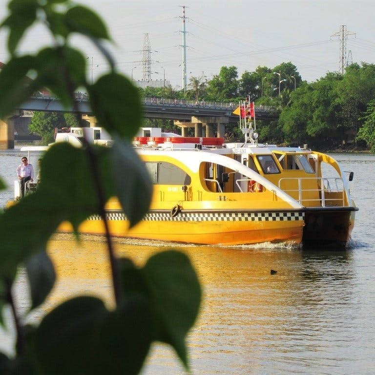
Metro Line 1 is Hồ Chí Minh City’s first urban railway. Opened at the turn of 2025, Metro Line 1 runs nearly 20 kilometres from Bến Thành in the city centre due northeast to Suối Tiên and the new Eastern Bus Terminal (Bến Xe Miền Đông Mới). Line 1 represents the first milestone of a much broader metro network long-promised as part of Hồ Chí Minh City’s infrastructure overhaul and modernisation. A single metro line cannot transform a metropolis of nearly ten million people, but it has already reshaped how parts of the eastern corridor connect and how the city is seen by those moving through it. For travellers, Line 1 offers three big advantages: a practical way to sidestep traffic along the main highway leading northeast in and out of the city, safe and convenient access to neighbourhoods beyond the central districts, and an elevated vantage point over a portion of Hồ Chí Minh City’s rapidly evolving skyline. Line 1 is still a bit rough around the edges and its design has some limitations but this should not deter people from using it. This guide provides a brief history of Line 1, a practical how-to guide for using the Metro, and a rundown of each of its different stations, helping travellers decide where and when to use the metro during a visit to Hồ Chí Minh City. ❤️If you enjoy this guide, please support Vietnam Coracle with a donation or join the Patreon community or purchase an Offline Guide & Map. I run this website at a loss. Thank you, Tom
Contents:
🧐 History & Reflection on the Metro
↗️ Finding & Entering the Metro
❤️ Support Us
❤️If you like this guide, please support Vietnam Coracle with a donation or become a member of my Patreon community or purchase an Offline Guide & Map. This website relies on reader support to maintain its independence & quality. Thank you, Tom


Support My Site
Free | Independent | No Sponsored Content
“Hello, if you enjoy my website, please support it.
Thank you.” Tom
📍MAP:
Hồ Chí Minh City Metro Line 1
🧐 History & Reflection on the Metro:
[View Metro Map]
History & Background: At the turn of the 21st century, Hồ Chí Minh City’s Department of Transportation acknowledged the need for improved public transport infrastructure as road traffic increased alongside rapid population growth. Plans for a metro system were swiftly drafted and approved. The network’s modern-day incarnation emerged from a revised master plan adopted in 2006, which proposed six metro lines linking different parts of the city. Bến Thành Market, long regarded as Saigon’s symbolic and geographical centre, was designated as the system’s main hub, connecting all six planned lines. This is where Line 1 begins today, before running northeast across the city, through Thủ Đức City (essentially a district of Hồ Chí Minh City) and finishing at the new Eastern Bus Terminal (Bến Xe Miền Đông Mới).
Line 1 was the first route to enter construction, with groundbreaking taking place in 2008. The project was funded primarily by Japan International Cooperation Agency, with the remainder financed by the city government. Initially scheduled for completion in 2014, the project suffered repeated delays due to cost overruns, delayed payments, contractual disputes and the Covid-19 pandemic. Over time, these delays became something of a painful joke among city residents, many of whom endured years of disrupted commutes caused by torn-up roads and prolonged construction works. The prospect of a functioning metro felt no more than a vision beyond grasp for well over a decade.
Line 1 finally opened in December 2024 – twelve years later than originally planned – to widespread jubilation. Residents and visitors alike flocked to the system, eager to experience this long-awaited new mode of transport, take in its unfamiliar aesthetics and celebrate what felt like another large step forward in the city’s ongoing transformation.
Marking Line 1’s first anniversary in December 2025, official reports stated that the line had carried more than 19 million passengers during its opening year, averaging around 52,000 riders per day, well above initial projections. This early success has helped renew momentum behind future projects, including Metro Line 2 (Bến Thành–Tham Lương), which, at the time of writing, is scheduled for completion in 2030 (fingers crossed).

Thoughts & Reflection: Hồ Chí Minh City’s first metro line has not entirely transformed the city’s transport infrastructure. It has not solved the city’s congestion, nor does it yet offer a fully viable alternative for most daily commuters. In several places, it exposes how far the city still has to go in designing infrastructure that allows passengers to move sustainably and comfortably on foot. Ticketing remains clumsy and public access is underthought in areas. Advocates may suggest that the city’s first operating line can only achieve so much. Yet Line 1 is undeniably appealing. It has already transformed the lives of people that live, work and study along the line. It also signals a future in which moving across the city does not require bracing for traffic and gridlock. From its elevated track, the metro reveals the city’s socio-economic fabric in motion.
For now, Line 1’s greatest contribution may be symbolic. After years of delay and scepticism, Line 1 materialised. It stands as proof that large-scale transformation, however slow, is possible. The creases in its design may well smooth out as the network expands and the surrounding city adapts to it. After my first ride, I felt something close to optimism: six lines criss-crossing the city and the possibility of navigating Hồ Chí Minh on foot. What tempered that excitement was not doubt about whether it would happen, but how old I might be by the time it does.
❤️Like this guide? Support Vietnam Coracle with a donation or join my Patreon to help keep this website free & 100% independent. Thank you, Tom
🚆 Stations & Open Times:
[View Metro Map]
Line 1 of the Hồ Chí Minh City Metro runs for 19.7km and consists of 14 stations in total: three underground stations in the city centre and eleven elevated stations further east. From west to east, the stations are:
[L1-01] Ben Thanh Station (Ga Bến Thành)
[L1-02] Opera House Station (Ga Nhà Hát Thành Phố)
[L1-03] Ba Son Station (Ga Ba Son)
[L1-04] Van Thanh Park Station (Ga Công Viên Văn Thánh)
[L1-05] Tan Cang Station (Ga Tân Cảng)
[L1-06] Thao Dien Station (Ga Thảo Điền)
[L1-07] An Phu Station (Ga An Phú)
[L1-08] Rach Chiec Station (Ga Rạch Chiếc)
[L1-09] Phuoc Long Station (Ga Phước Long)
[L1-10] Binh Thai Station (Ga Bình Thái)
[L1-11] Thu Duc Station (Ga Thủ Đức)
[L1-12] Hi-Tech Park Station (Ga Khu Công Nghệ Cao)
[L1-13] National University Station (Ga Đại Học Quốc Gia)
[L1-14] Suoi Tien Terminal Station (Ga Bến Xe Suối Tiên)
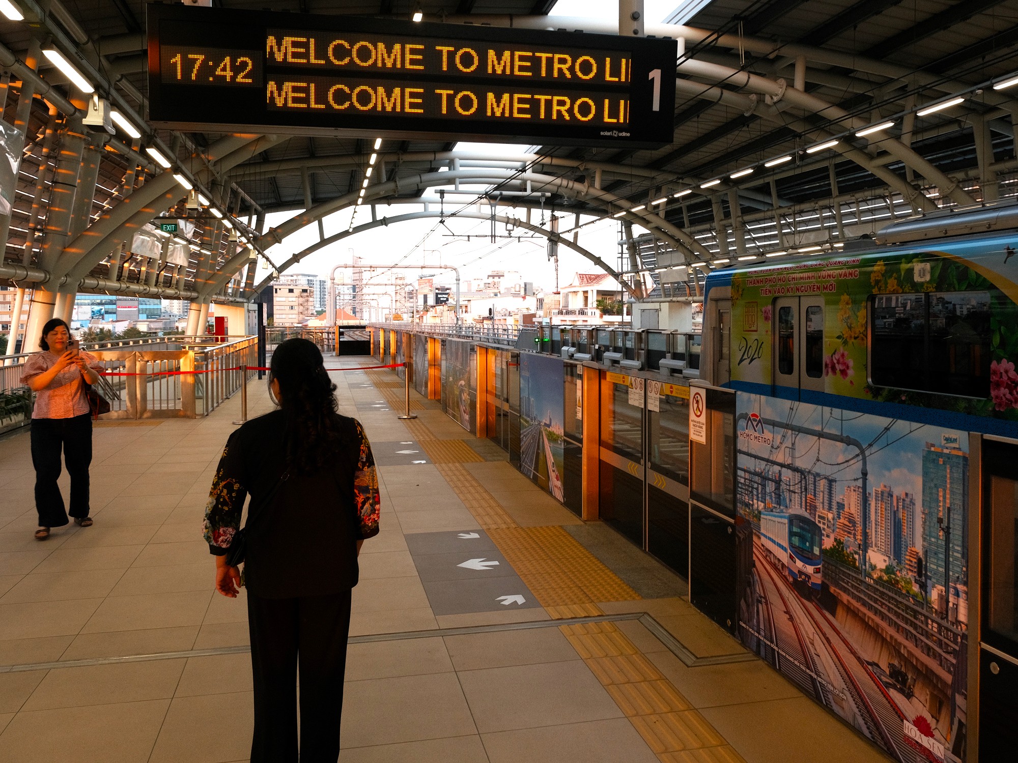
Line 1 operates daily from 05:00, with services ending at 22:00 from Monday to Thursday and 23:00 on Fridays, Saturdays, and Sundays. Trains run regularly at about 10 minute intervals. Single fares are distance-based and cost between 7,000vnđ and 20,000vnđ, depending on how far you travel. Multi-day and month passes are also available at flat fees (see Ticket Types for details).
The line is busiest during peak commuting hours, particularly in the mornings and late afternoons when passengers travel between home, work and school. While trains are often busy along most of the route, the most noticeable shift in passenger numbers occurs at National University Station (Ga Đại Học Quốc Gia), where large numbers of students and staff depart before the Suối Tiên terminal (Ga Bến Xe Suối Tiên).
All stations are equipped with elevators suitable for wheelchairs and pushchairs, but locating which entrance has these can be challenging. Depending on the entrance, access may be via stairs or escalators. Every station has a staffed ticket office (with varying levels of staffing) and public toilets. Some of the underground stations, most notably the Opera House station (Ga Nhà Hát Thành Phố), also incorporate cafés and exhibition spaces. These areas feel lightly used for now but suggest how the metro’s public spaces maybe shaped as the system becomes more embedded in the city’s everyday life.
There are several websites that appear to represent the Metro or at the very least give information on it. The official HURC (Ho Chi Minh City Urban Railway Company) website provides timetables, news features and a brief history of the company. This website is only in Vietnamese. However, HURC has also developed an app named HCMC Metro HURC which can be found on both Apple and Android app stores and is available in English and Vietnamese. Besides information on the metro schedule, some affiliate links for banking and commercial sales and more ‘news’, there is the oppprtunity to buy tickets (see Ticket Payment & Use for details).
❤️Like this guide? Support Vietnam Coracle with a donation or join my Patreon to help keep this website free & 100% independent. Thank you, Tom

↗️ Finding & Entering the Metro:
[View Metro Map]
Depending on where you are in the city, there are several ways to reach Line 1. A number of city buses connect different districts to metro stations, particularly in the central area around Bến Thành. Ride-hailing apps such as Grab and Xanh SM are, of course, the most straightforward options and will deliver you directly to your chosen station entrance.
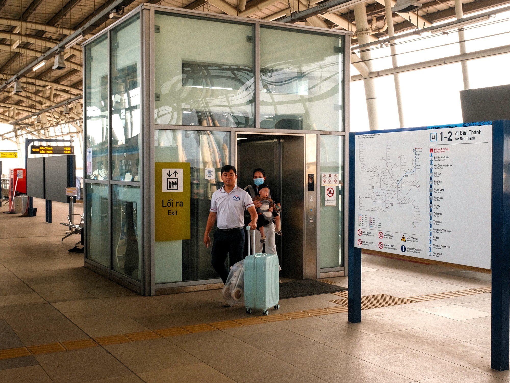
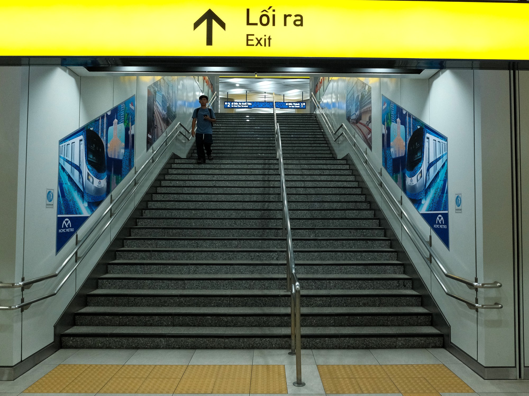
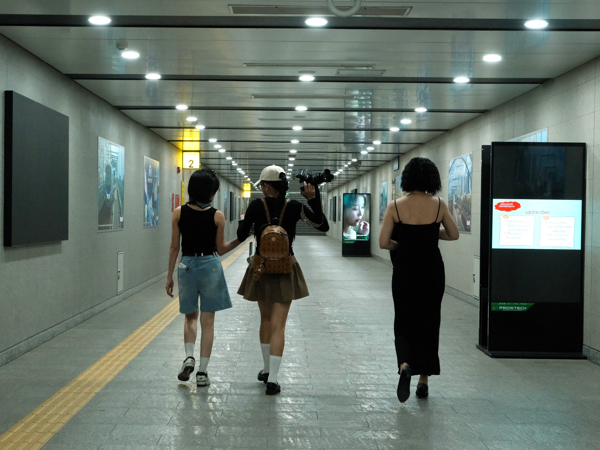
If you’re approaching the metro on foot, locating an overground station is relatively easy. Elevated stations and the tracks that link them are clearly visible from a distance and stand out from the surrounding streetscape. Finding the entrances to the underground stations, however, is a different matter. Signage at street-level, where you would most expect it, is often minimal or entirely absent. While this avoids cluttering already crowded streets with additional signs at eye-level, it can leave first-time users unnecessarily crossing traffic-heavy roads to find an entrance, all while contending with the city’s blistering heat or monsoon downpours. At the time of writing, metro entrances are not individually marked on Google Maps. It is largely up to the would-be passenger to identify where the actual entrances are.
Entrance staircases and escalators are usually roofed and marked with the station’s name above. All stations are also equipped with at least one elevator suitable for wheelchairs and pushchairs, although much like the entrances themselves these can be surprisingly difficult to locate from outside the station. Elevated stations often include pedestrian concourses that span adjacent roads, eliminating the need to cross busy highways at street-level to access the metro.
After passing through the ticket barriers, passengers descend – or ascend if boarding at an overground station – a series of staircases to reach the platform. Elevators are available and signposted within stations, making them far easier to locate once inside than from street-level. Maps and directions to each station’s elevator are at the station entrance, but you’ll need to go to the platform entrance to find the elevator. Furthermore, station entrances can be hard to locate at street-level due to other non-relevant signage and overcrowding in busier areas.
❤️Like this guide? Support Vietnam Coracle with a donation or join my Patreon to help keep this website free & 100% independent. Thank you, Tom
🎫 Ticket Types:
[View Metro Map]
Several ticket options are available on Line 1. However, ticketing can sometimes feel more complicated than it needs to be. Ticket options range from single journeys to monthly passes. Single and return fares are distance-based, meaning the price depends on where you start, where you finish, and how far you travel. Other options include 1-day, 3-day and monthly passes. Which tickets are available to you depends partly on how you choose to pay (see the table below and Ticket Payment & Use for further details).
Single and return tickets require you to select your destination at the time of purchase. If you buy the wrong ticket and attempt to exit at a different station, staff will require you to pay again at your destination.
A 1-day ticket and a 3-day ticket allows unlimited travel for 24 hours or 72 hours respectively, not simply for the calendar days from which it is purchased. These passes offer better value if you plan to make several journeys in a short period on Line 1. They will become even more useful once additional metro lines open.
A monthly pass allows unlimited travel for 30 days. At the time of writing, student discounts of up to 50% are also available.
Ticket & Payment Table (scroll left to right to see full information)👇
| Ticket Type | Where to Buy | Ticket Format | Payment Method | Best for | |
| Single | Cash ticket machine, card ticket machine & HCMC Metro HURC app. | Cash machine: reusable plastic fare card (deposit required, refunded when returned after the journey). Card machine: paper ticket with QR code. App: QR code stored on your phone. | Cash machine: cash only (notes up to 100,000vnđ). Card machine: international cards & domestic e-wallets (ZaloPay, MoMo, ShopeePay). | Most travellers making a one-off journey. | |
| Return | Available at the card ticket machine only. | Paper ticket with QR code. | International cards and domestic e-wallets (ZaloPay, MoMo, ShopeePay) | Visitors planning a same-day return trip. | |
| Stored Fare Card (SFC) | Cash ticket machine only. | Reloadable plastic fare card valid for one year. Deposit required. Top up as needed. | Cash only (notes of 100,000vnđ & under). | Regular users staying in the city longer term. | |
| 1-Day or 3-Day Pass | Cash ticket machine or HCMC Metro HURC app. | Cash machine: plastic fare card. App: QR code stored on your phone. | Cash machine: cash only (notes of 100,000vnđ & under). App: international cards & domestic e-wallets (ZaloPay, MoMo, ShopeePay). | Travellers making multiple journeys in a short period. | |
| Monthly pass | HCMC Metro HURC app only. | QR code stored in the app. | International cards & domestic e-wallets (ZaloPay, MoMo, ShopeePay). | Everyday riders: commuters, students & long-term residents. |
❤️Like this guide? Support Vietnam Coracle with a donation or join my Patreon to help keep this website free & 100% independent. Thank you, Tom
💰 Ticket Payment & Use:
[View Metro Map]
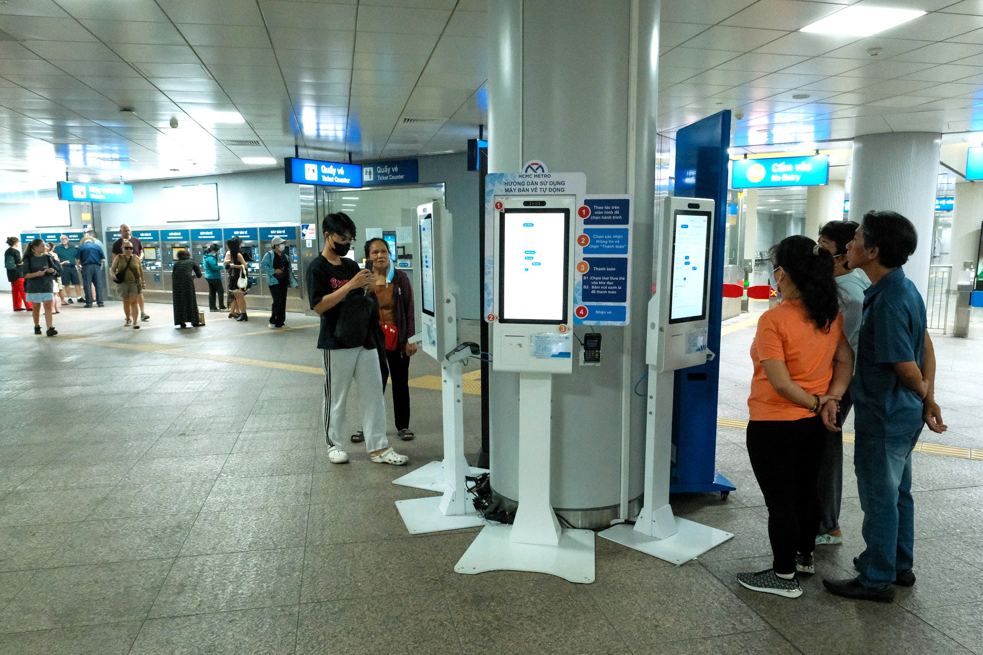
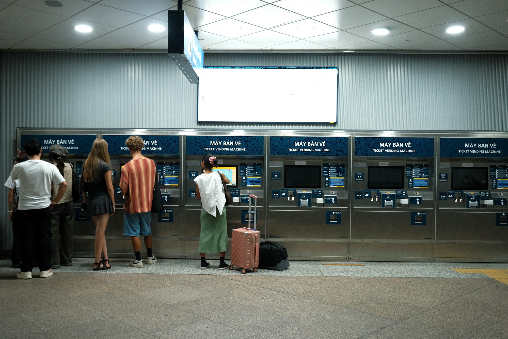
Buying and using a ticket is currently one of the more tedious aspects of riding the metro and often involves some trial and error. Much of the confusion stems from the system’s dual ticketing structure: different machines, different interfaces and different ticket formats depending on how you choose to pay. (See the comments section for other people’s experience of buying tickets.)
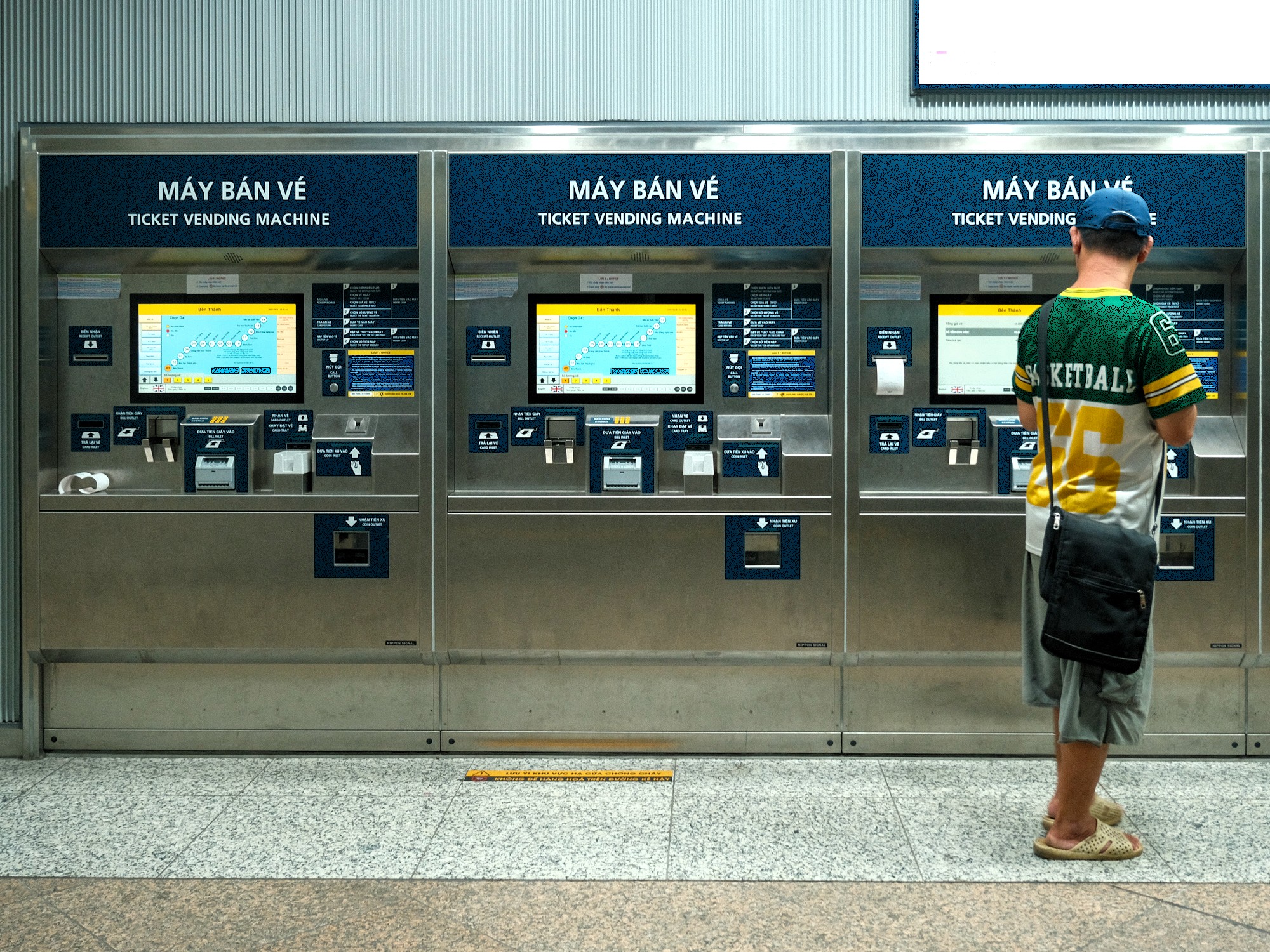
There are three main payment methods: cash, bank card, and selected domestic mobile apps. Vietnamese citizens may also be able to use their national ID card for access and payment. Each station is equipped with both cash machines and card/app machines, but there is often little signage to distinguish between them. It is easy to find yourself standing at a cash-only machine, tapping your card in vain and wondering why nothing is happening.
Like many unfamiliar systems when travelling abroad, the metro ticketing process takes a little patience. But after using the different methods several times, I still found the lack of signage and intuitive logic frustrating. People do not like being made to feel stupid. Running multiple ticketing systems side by side is a clear design flaw, and one that would benefit from being addressed sooner rather than later.
Paying by Cash:
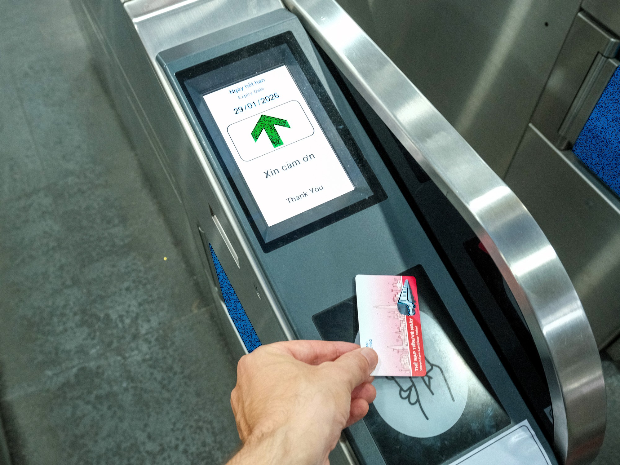
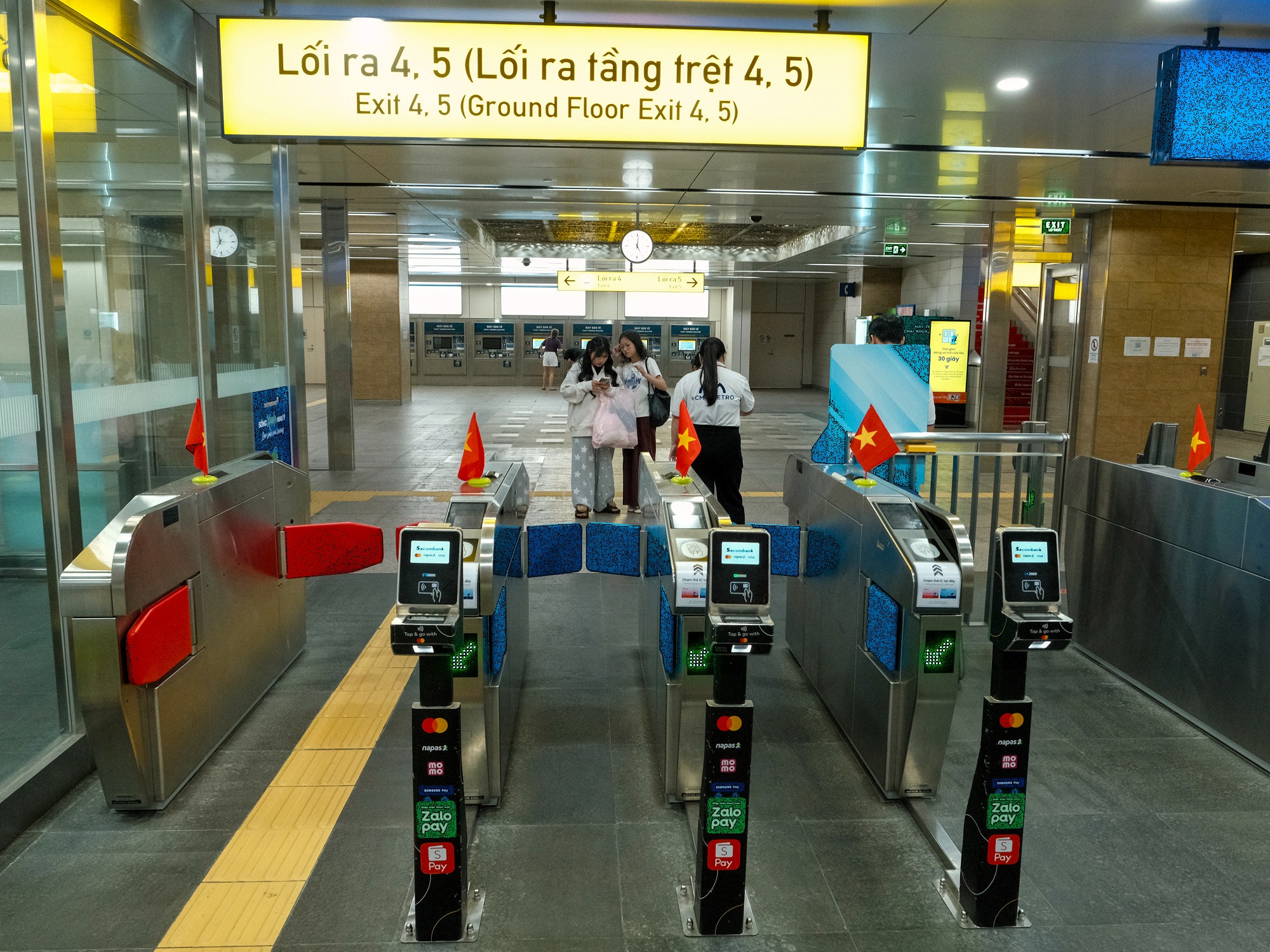
To pay with cash, use the more conventional-looking ticket machines. Select your destination, insert your money, and collect your ticket. Depending on the fare selected, the machine may issue a reusable plastic fare card. A small deposit is charged and refunded when the card is returned after use. The machines are not especially forgiving of crumpled banknotes, so it helps to keep your Vietnamese currency as flat and crease-free as possible. Cash machines accept notes up to 100,000VND. However, 200,000VND and 500,000VND are not accepted. At the gates, tap or swipe your card on the reader to enter and exit the platform.
Paying by Card or Domestic E-Wallet at a Machine:
Note: if you can pay by international card or domestic E-wallet at a machine, you may find it more convenient to pay for your ticket by the Metro App (see below for details).
To pay by international bank card or domestic e-wallets such as MoMo, ZaloPay and ShopeePay, you’ll need to find the tall, white ticket machines, which are less obvious than the cash machines and sometimes positioned elsewhere in the station. These machines use a different interface from the cash machines, meaning a second learning curve for what is essentially the same journey. When paying by card, you are also be required to tick a terms-and-conditions box before the ticket is issued; something few passengers are likely to read while trying to catch a train.
The machine produces a paper ticket with a QR code. This must be scanned at the gate. Be aware that the scanner is mounted on the underside of the gate unit and can be surprisingly difficult to locate the first time you use it. Also, try not to crumple your ticket: scanning a bent QR code can be an exercise in frustration, especially with a queue behind you.
Paying by the Metro App (via Bank Card):
The official metro app, titled HCMC Metro HURC, is available on both Apple and Android app stores. Through the app, users can purchase various tickets, including 1-day, 3-day and monthly fares.
The app accepts international cards as well as domestic wallets such as MoMo, ShopeePay and ZaloPay. In my experience, both local and foreign Visa cards worked, although additional security checks sometimes made the process slower than expected.
Once purchased, your ticket appears in the app as a QR code that can be scanned at the gates. One advantage of buying monthly tickets through the app is that time-based tickets are only activated when you choose to activate them, meaning you can buy in advance and use them later (within the app’s validity window). This does not apply to other ticket types. Another advantage is simple but significant: scanning a QR code from your phone is usually far easier than scanning one printed on paper. You cannot crumple a phone screen.
One major issue is that the app switches unpredictably between English and Vietnamese during the ticket-buying process. This is particularly problematic when selecting a ticket type, as those options appear only in Vietnamese with no option to change the language. It is an obvious flaw, and one the developers should address immediately.
Staff Assistance (A Saving Grace):
The ticketing system is infuriating. Few scenes are more common on the metro than a cluster of confused tourists huddled around a ticket machine, trying to navigate its clunky interface while their patience fades and the queue behind them steadily grows. One slightly redeeming feature is that stations are generally well staffed. Guards and metro employees are usually willing to help passengers struggling with ticket machines or gate access, and their presence goes a long way toward smoothing what is otherwise a needlessly awkward process.
❤️Like this guide? Support Vietnam Coracle with a donation or join my Patreon to help keep this website free & 100% independent. Thank you, Tom
🚄 Riding the Metro:
[View Metro Map]
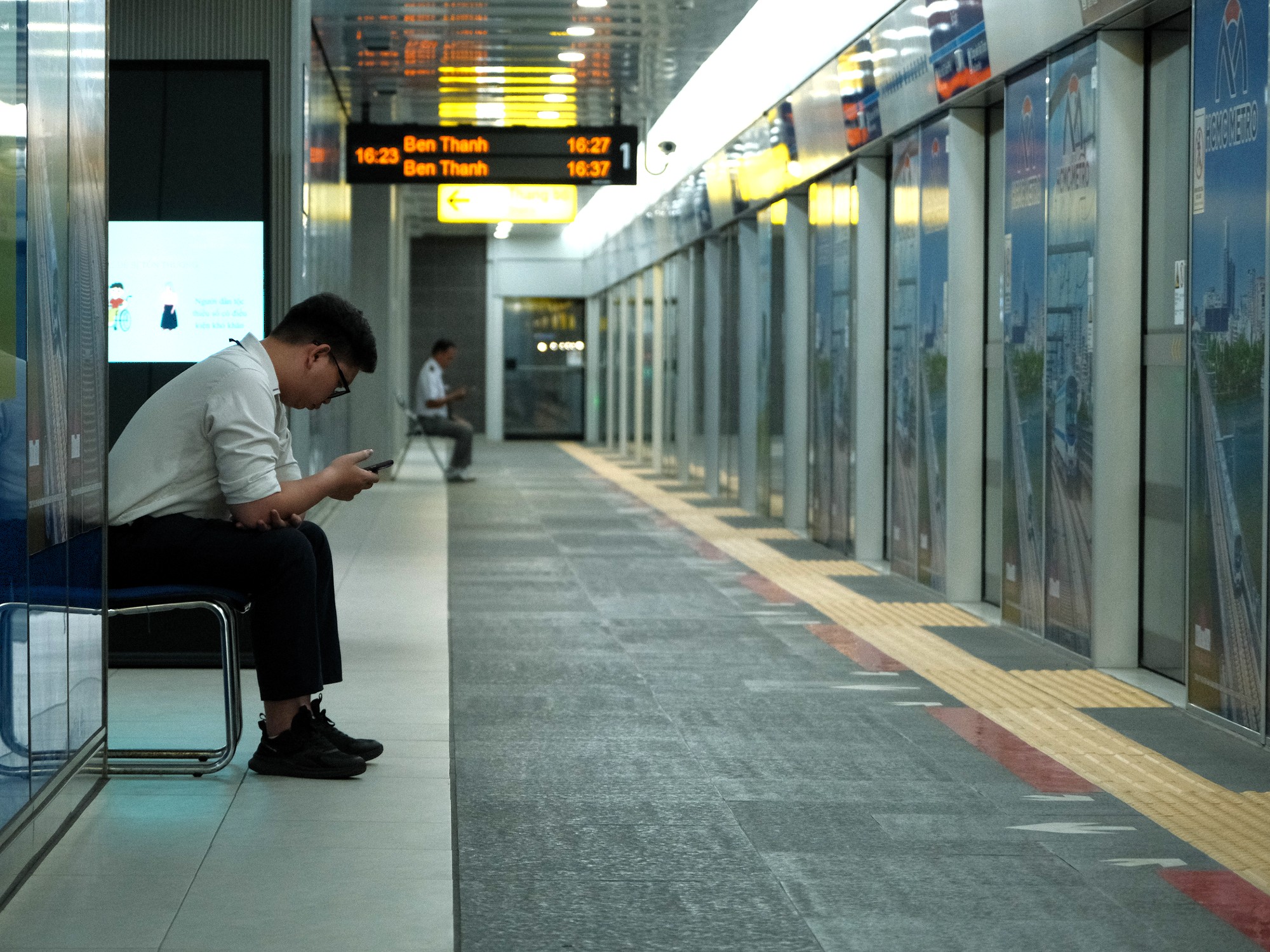
Waiting times at the platform are usually short. Trains arrive approximately every ten minutes. Benches line the platforms for passengers to sit and wait, doubling as occasional resting spots for staff during quieter moments. Rest assured that regardless of how hot and humid weather conditions are, platforms at the Metro are well air-conditioned. If you’re feeling hot and bothered, find a ventilation shaft in the platform’s ceiling and stand directly underneath.
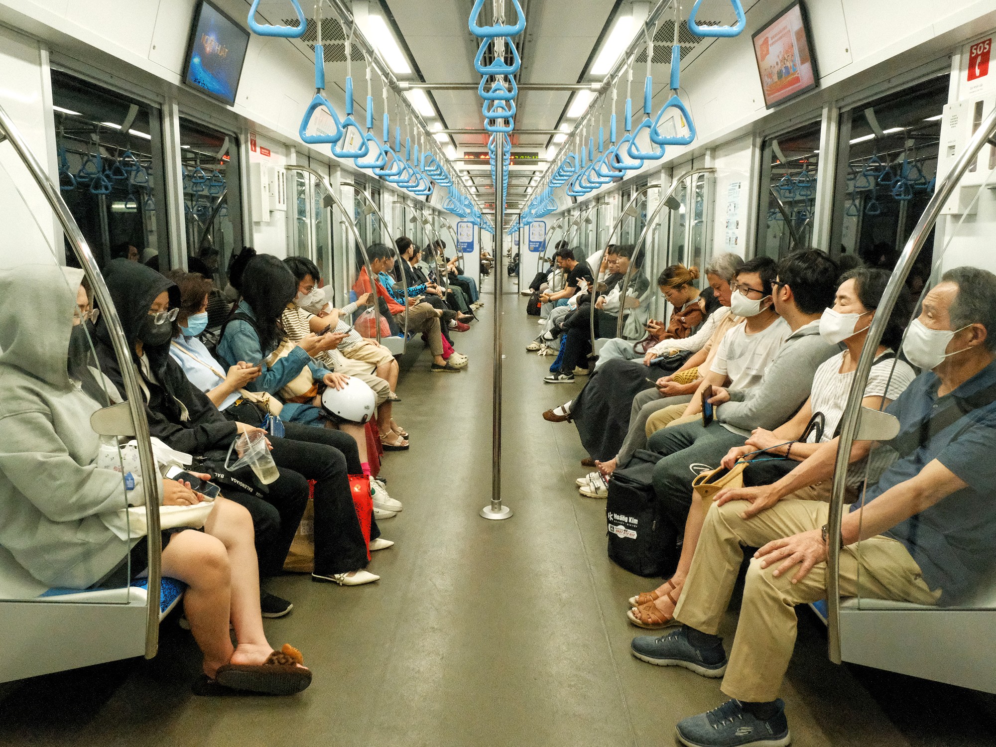
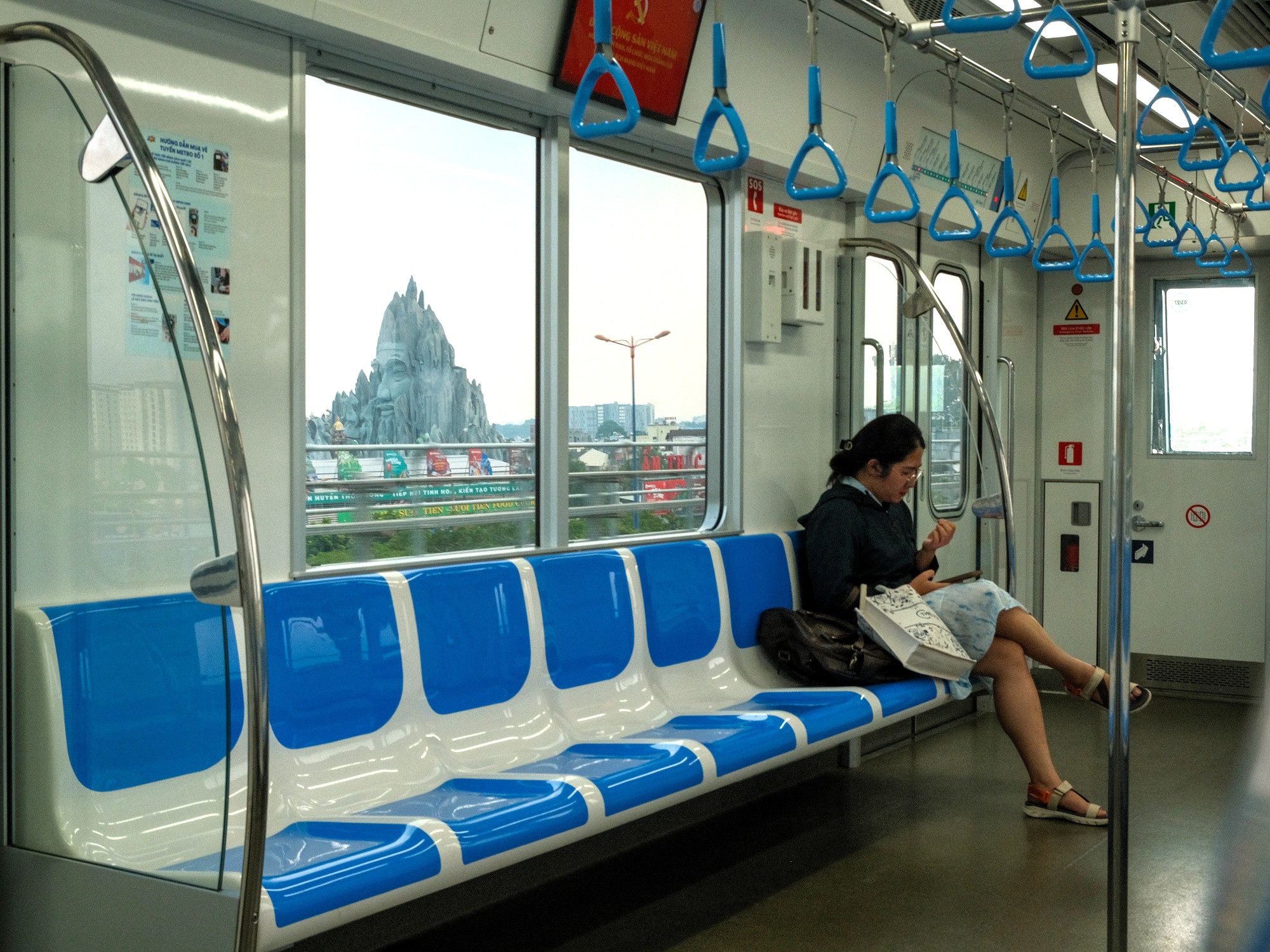
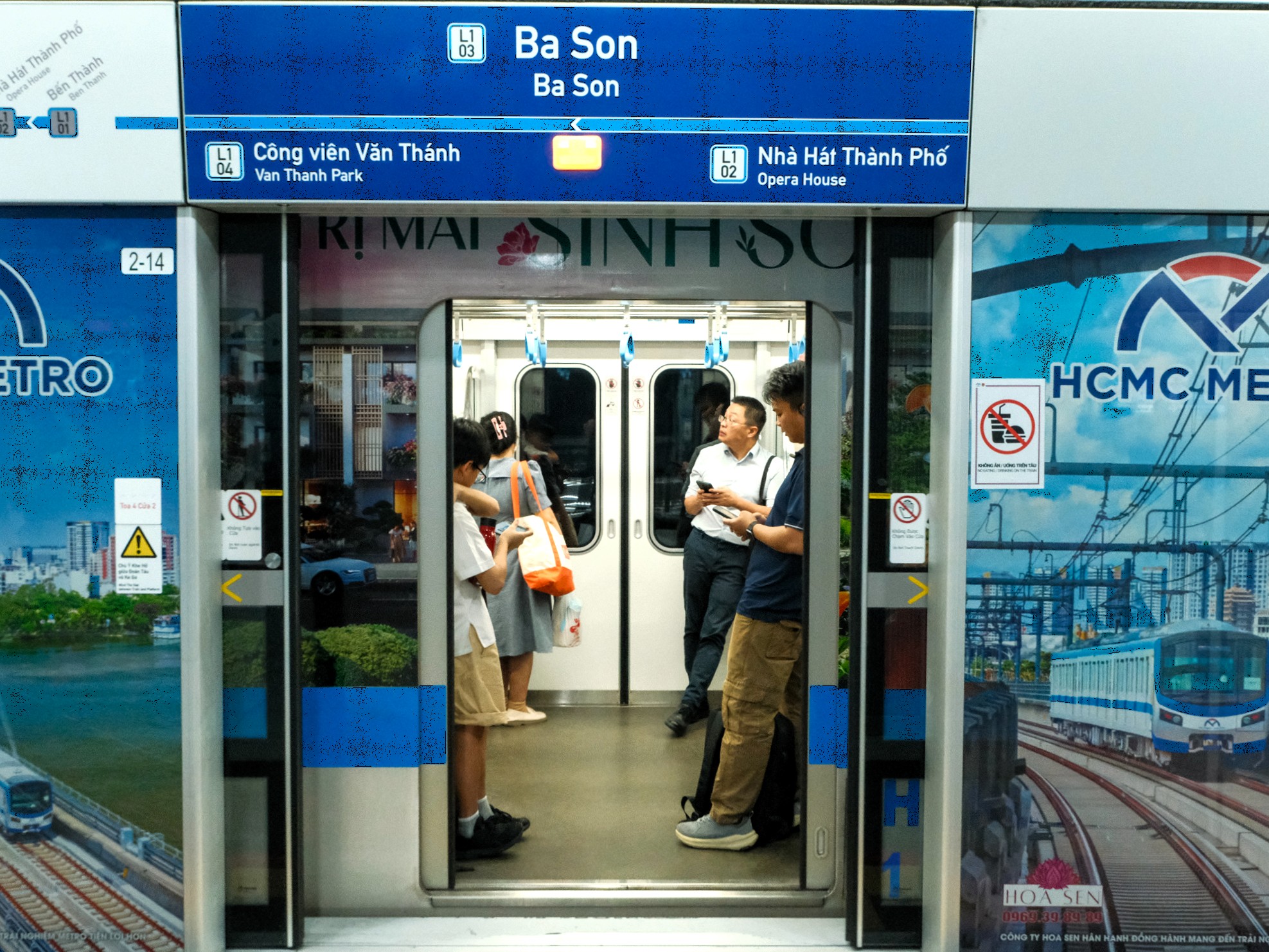
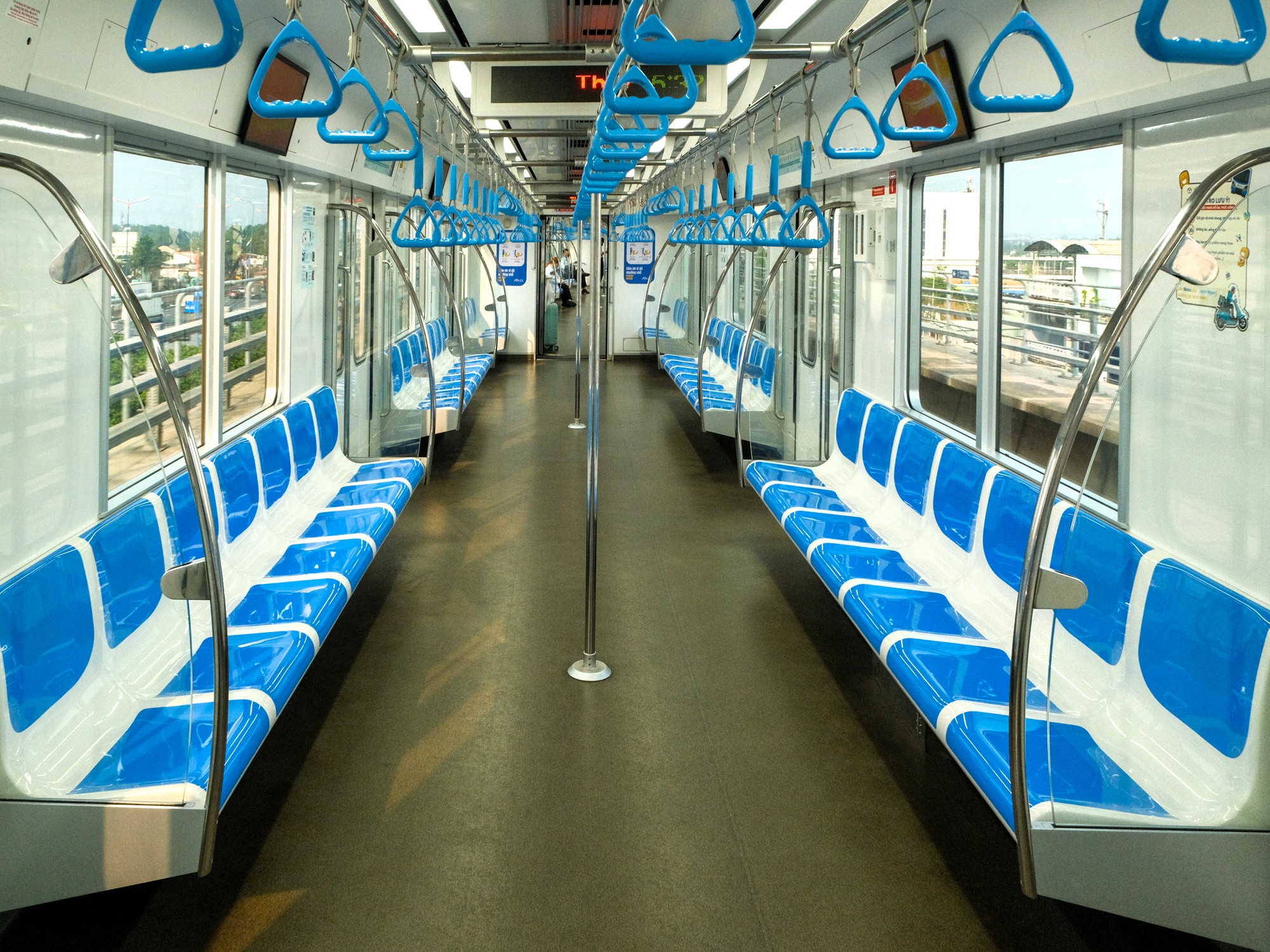
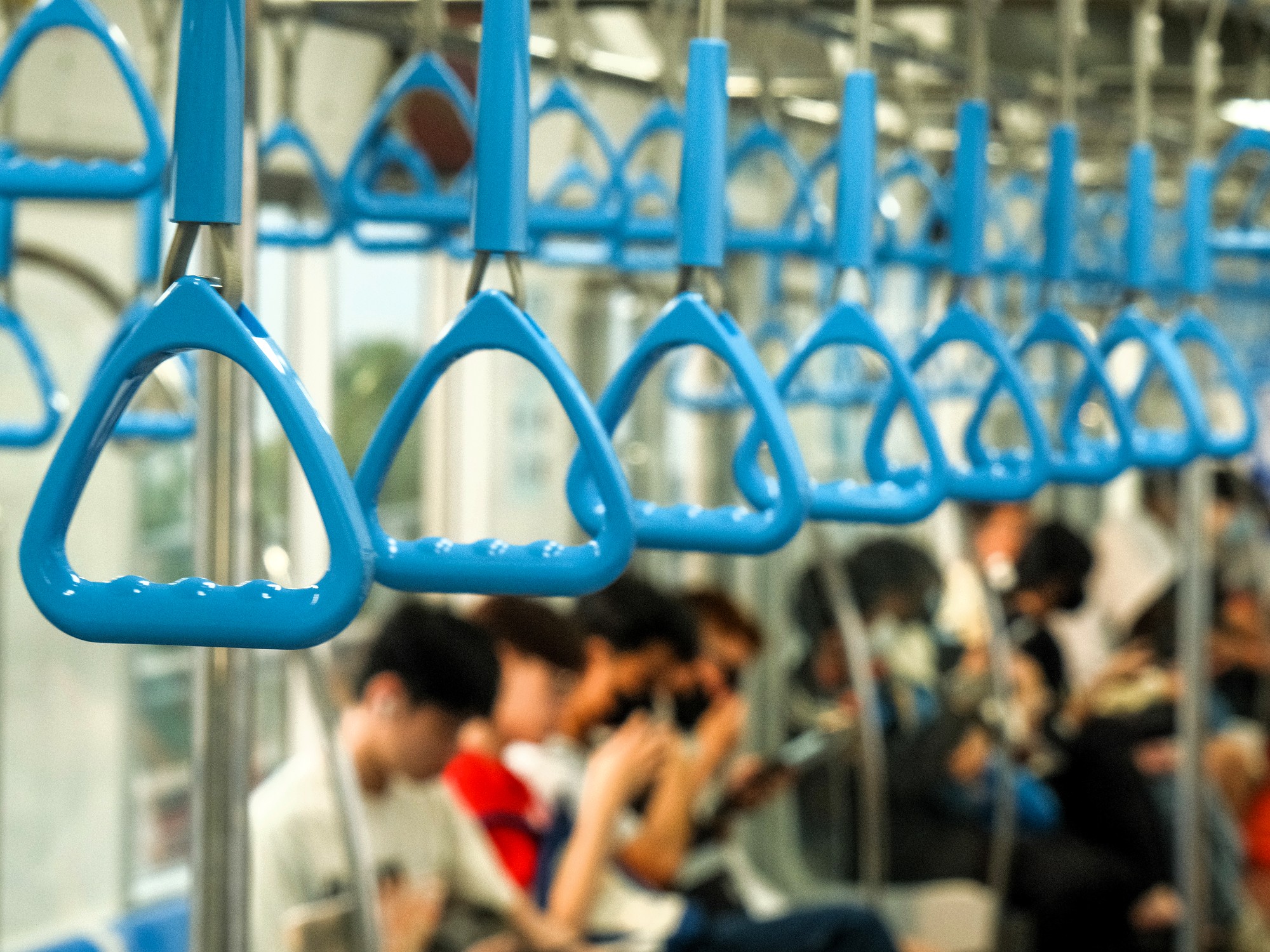
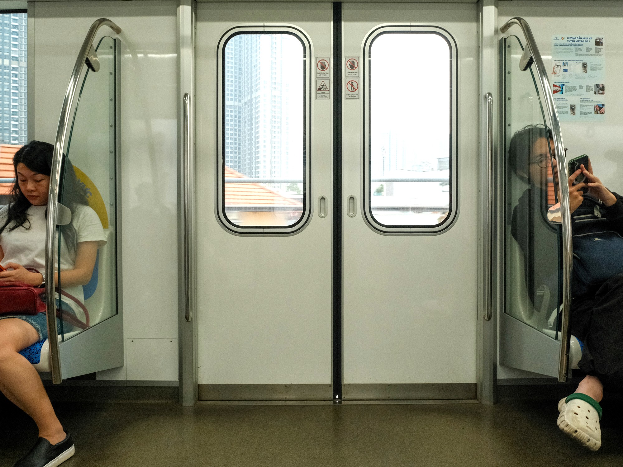
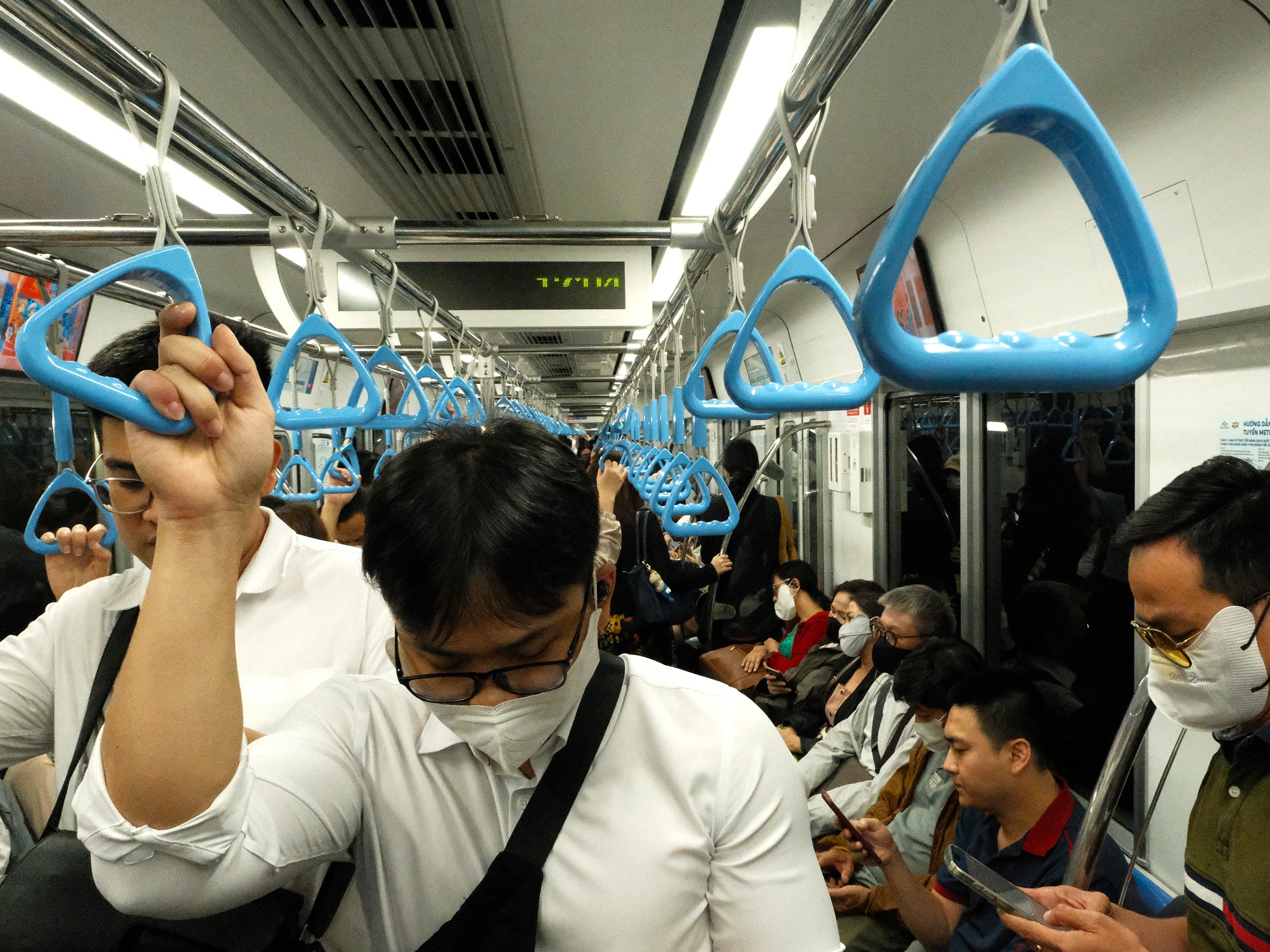
Platforms are separated from the tracks by safety barriers, with gates that open upon each train’s arrival. Floor markings indicate where boarding passengers should stand and queue while others exit. This system works in principle, though in practice it has yet to be fully adopted by all riders. Each train consists of three carriages with plenty of space for passengers to walk through when it isn’t busy. Seating is arranged in six long benches of seven seats facing each other, with two shorter benches of three seats at one end of the carriage. There is ample standing room, aided by the metro’s distinctive triangular strap hangers suspended from the ceiling.
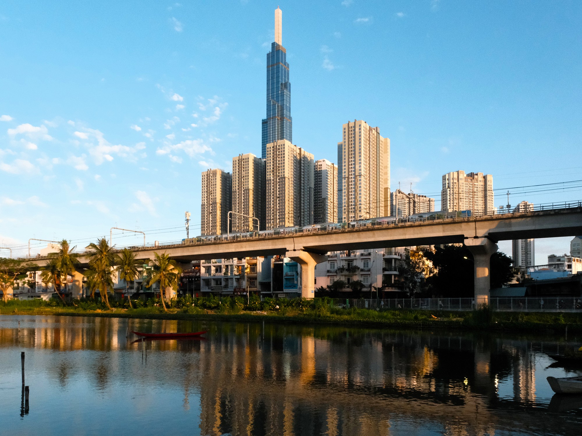
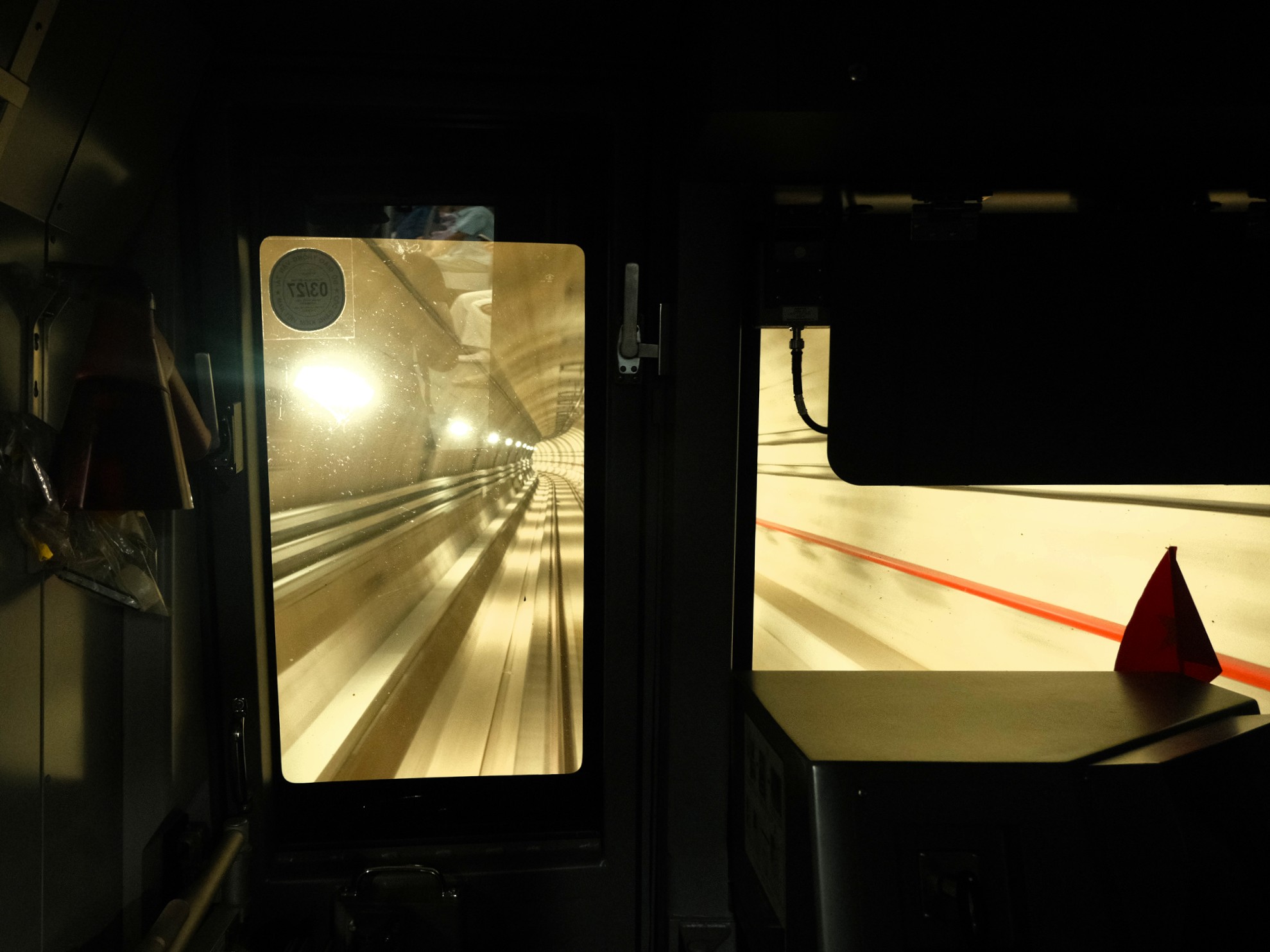
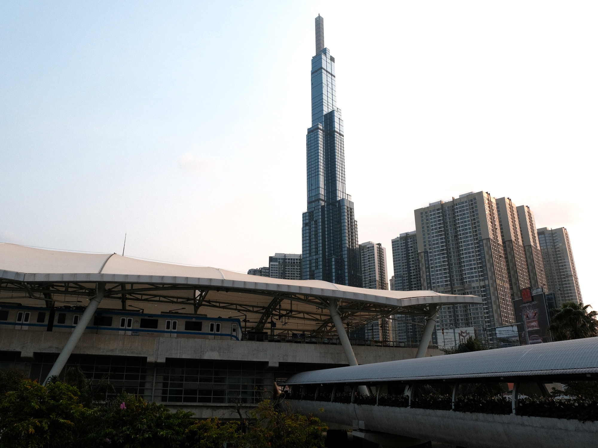
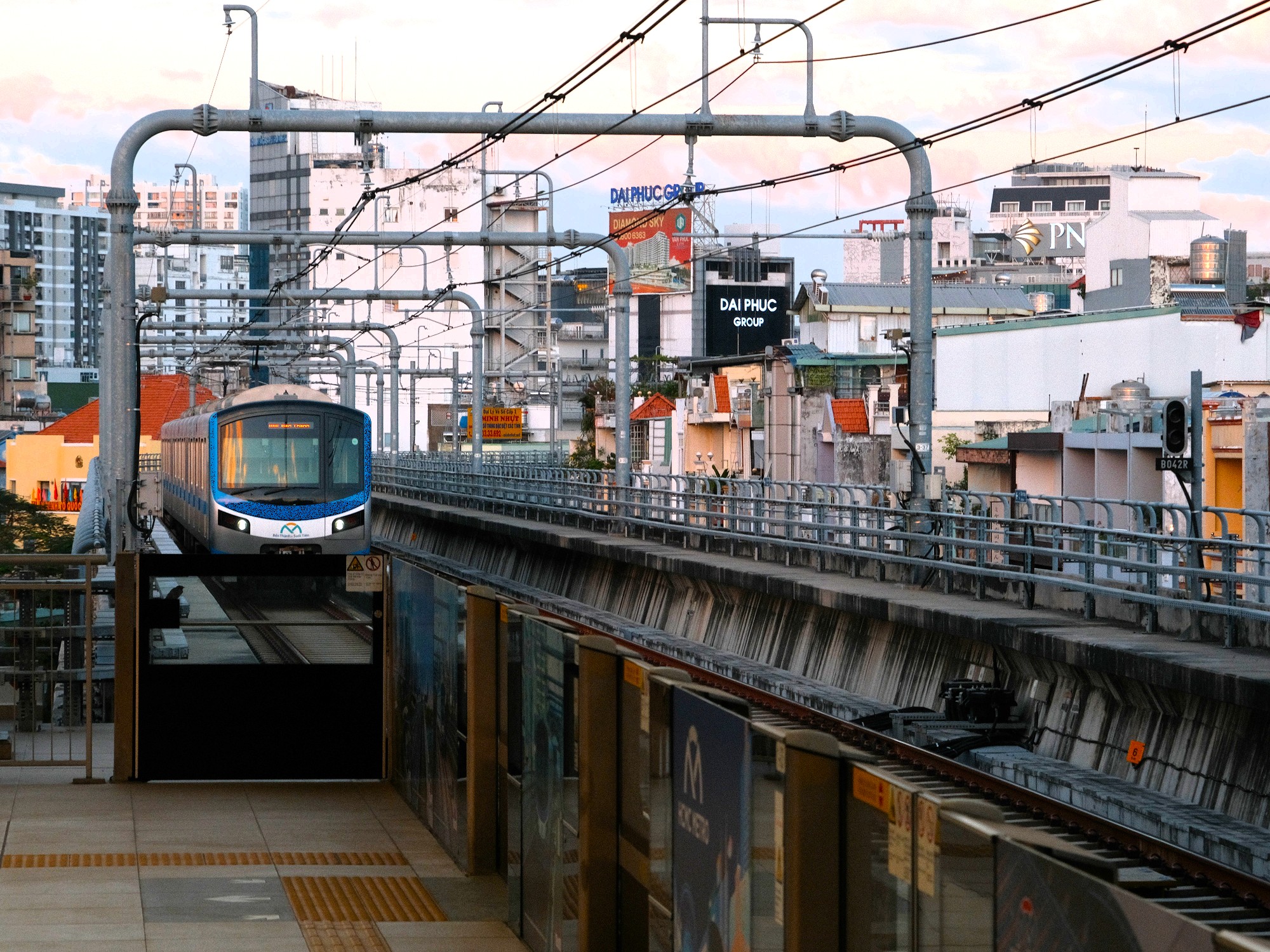
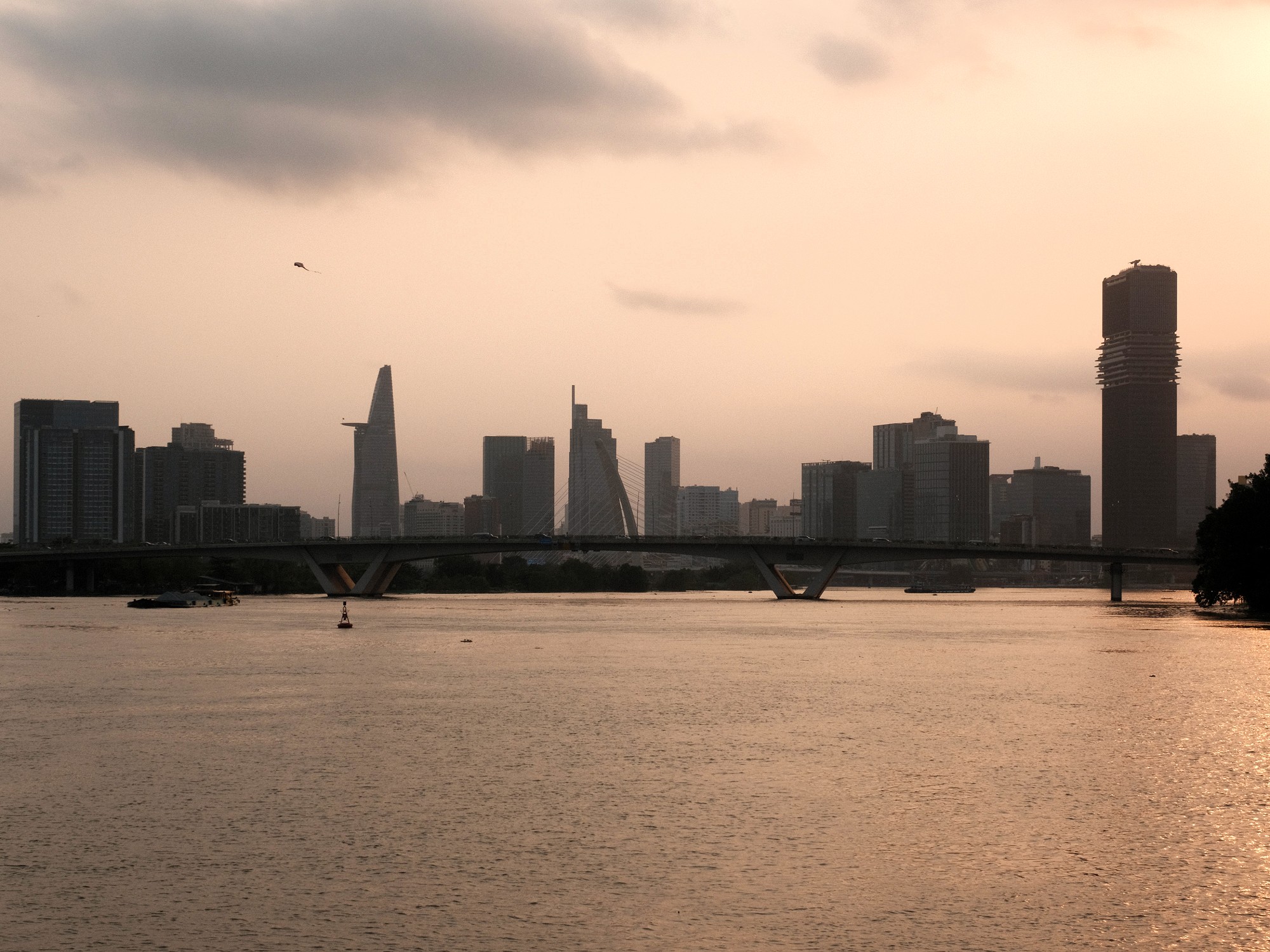
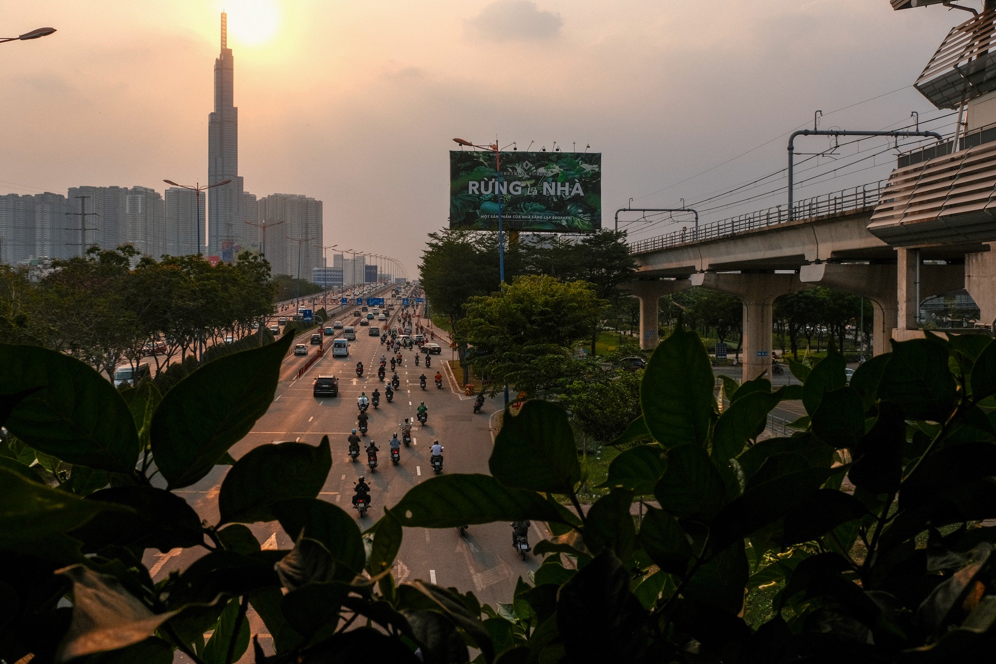
At either end of the train, a window looks into the driver’s cabin and out onto the tracks ahead. During the underground section of Line 1, there is little to see beyond passing platforms and fellow passengers, but the overground sections are very interesting. As the train heads east, it emerges from underground between its third and fourth stops (Ba Son and Văn Thánh Park respectively) and glides across the city skyline for the remaining eleven stations. Beyond the metro’s functional purpose, this elevated stretch is likely to be of greatest interest to travellers. The view recalls that of an office building, but in constant motion. From this mid-level vantage point, Hồ Chí Minh City appears perpetually in flux: new towers rising beside older structures, commercial architecture pressing up against audacious temples of worship and pockets of greenery punctuating the urban sprawl. For much of its length, the train runs alongside the highway (Xa Lộ Hà Nội), one of the city’s major arteries, mirroring the flow of traffic below. Neither ground-level nor bird’s-eye, the metro offers a perspective that feels distinctly human. An abstraction of the city’s lived realities, yet elevated to reveal how broader forces of change reshape the landscape.
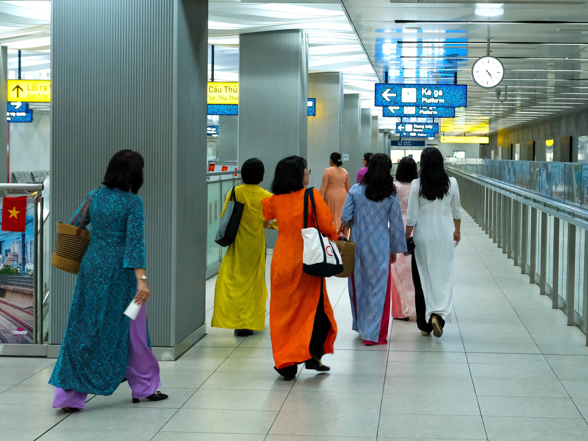
Unlike the more frenetic atmosphere of Vietnam’s national rail service, the metro feels notably subdued. Most passengers quietly thumb through their phones, and over time it becomes clear that the system has cultivated a shared conduct of silence. A small expression of top-down urban civility. Mobile data (4G/5G) appeared consistently available on all platforms and throughout my journeys.
❤️Like this guide? Support Vietnam Coracle with a donation or join my Patreon to help keep this website free & 100% independent. Thank you, Tom
🚇 Stop-by-Stop Guide:
[View Metro Map]
This section offers a brief overview of Line 1’s stations, their immediate surroundings and a few destinations that might otherwise go unnoticed when using the metro. Before we begin, a few things to consider. Firstly, it should be noted that this article emphasises the enjoyment of seeing the city from the carriage itself. This is best done during the daytime. After sunset (and presumably before sunrise), the interior lights of each carriage shine so brightly that very little of the outside can be made out. While this ensures excellent visibility within the train, it makes for a disappointing nighttime city view, overpowering much of the light from traffic and buildings beyond the windows.
Secondly, the original intention was to highlight the value of Line 1 in exploring different neighbourhoods using the metro alone, and then point out individual sites of interest at each stop. What became apparent, however, was that although there is real diversity across the 14 stations, not all of them justify disembarking. At several stops, limited pedestrian infrastructure and the dominance of the nearby highway make walking difficult. In some cases, additional transport (such as ride-hailing services) is necessary to reach anything of note. Thirdly, train services end at 22:00 or 23:00 depending on the day. If you intend to rely on the metro for an evening out, bear in mind that your return journey may require alternative transport.
That said, Line 1 still holds value for Hồ Chí Minh City’s visitors. How much value depends largely on what you are looking for. At the very least, it offers a distinctive vantage point over the city’s eastern neighbourhoods and their ongoing transformation. With luck, there is at least one stop along the line that speaks to you.
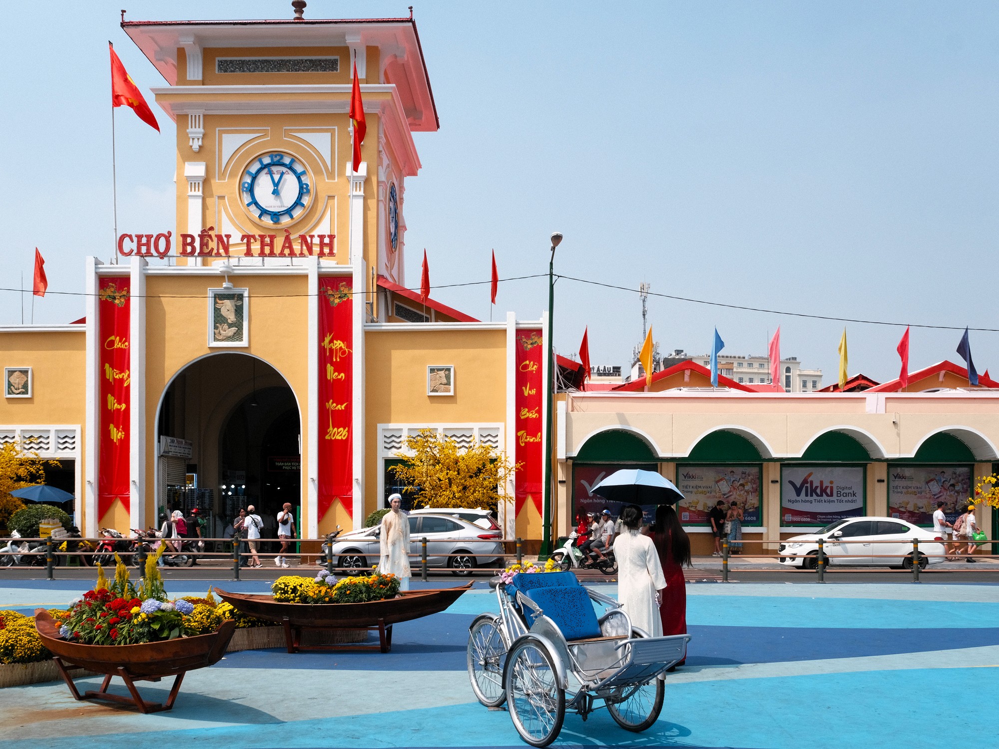
[L1-01] Ben Thanh Station (Ga Bến Thành)
One of the most popular areas for international visitors to Vietnam, Bến Thành likely needs little introduction. The station sits beside Bến Thành Market, long treated as Saigon’s symbolic and geographical centre. To the west lies the city’s infamous backpacker quarter, Bùi Viện, while surrounding streets such as Nguyễn Thái Bình and Lý Tự Trọng lean toward a more affluent and business-oriented Saigon. Within easy walking distance are several diversions of interest: the Ho Chi Minh City Fine Arts Museum, the idiosyncratic dessert spot Chè Mè Đen, and CỘI for understated evening jazz. Bến Thành Station itselft is set to become the interchange hub for all six proposed metro lines. For now, its tunnels and various spaces feel oversized and underused, but that’s likely to disappear as the wider network starts operating.
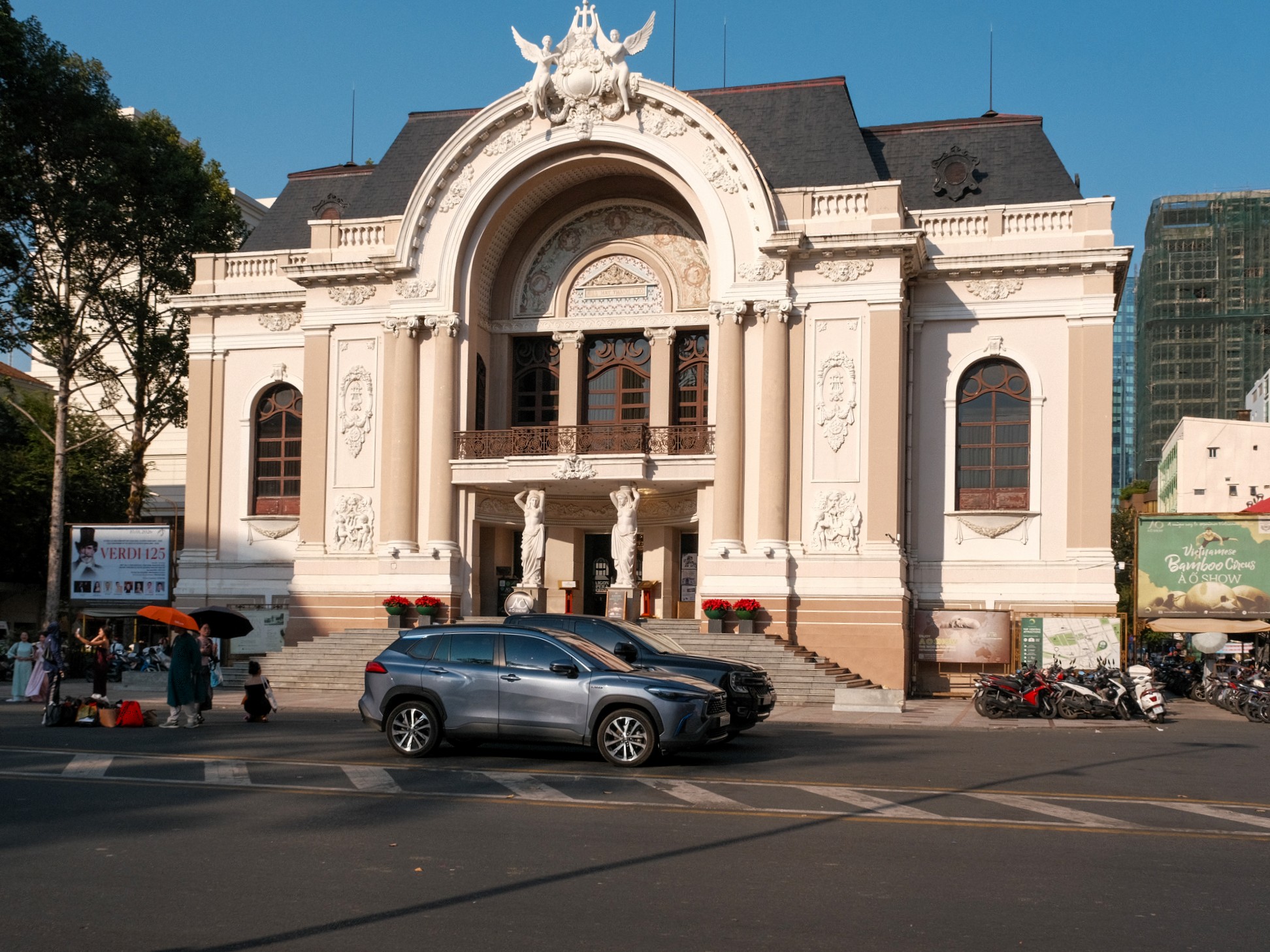
[L1-02] Opera House Station (Ga Nhà Hát Thành Phố)
This station opens out around the French-colonial Opera House, surrounded by shopping malls, flagship stores and polished sidewalks that project the city’s most capitalist-cosmopolitan face. One exit funnels passengers directly through Union Square, a luxury mall that can feel faintly humiliating if you’ve come in shorts and sandals. A short walk away is Nguyễn Huệ Walking Street and the much-photographed Cafe Apartment, both particularly pleasant in the early evening as the heat drops. To the northeast, a loose cluster of alleys often referred to as “Japan Town” is packed with sushi counters, izakayas and discreet shōchū bars. A few blocks northwest are Notre-Dame Cathedral, the Saigon Central Post Office and the adjacent Book Street. All pleasant for an evening stroll.
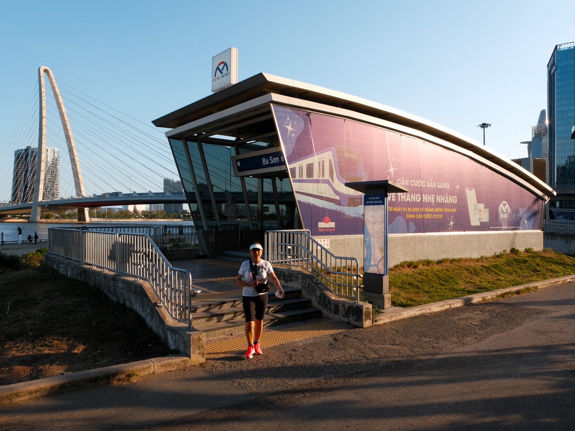
[L1-03] Ba Son Station (Ga Ba Son)
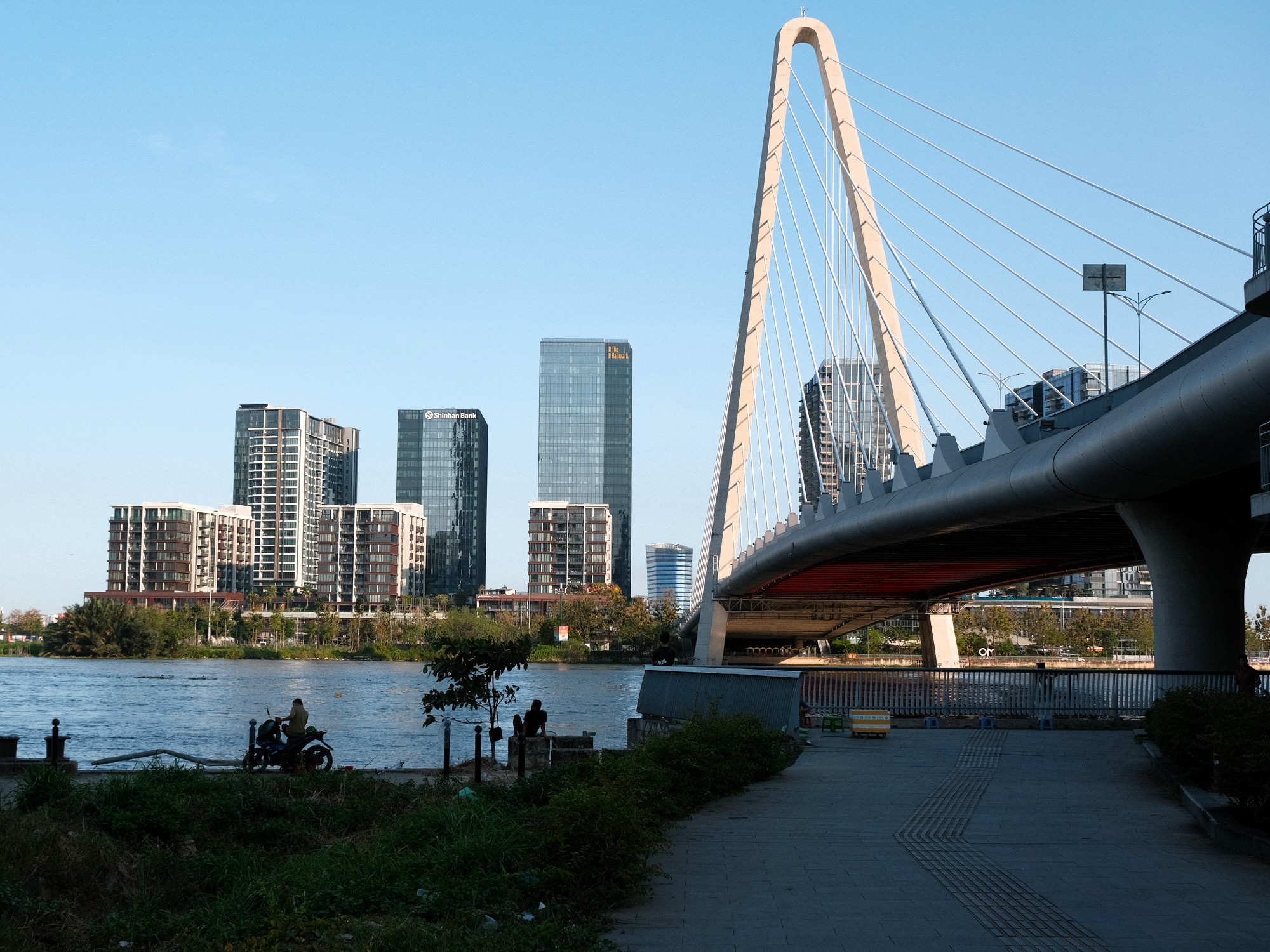
Ba Son was once a major French shipyard dating back to the late 18th century and instrumental in supporting the Nguyễn Dynasty to overcome the Tây Sơn uprising. The shipyard continued operating until 2015, when it was closed and eventually demolished, much to the frustration of historians and heritage advocates. Today, Ba Son is an area of high-end residential towers and hotels, commercial buildings and the impressive Ba Son Bridge, signalling the area’s full pivot toward development and renewal. Without lingering too heavily on what has been lost, Ba Son’s main appeal now lies in its riverfront. The walk along the Saigon River is broad and breezy, offering open views both upstream and back toward the city’s skyline. A landscaped promenade is taking shape here, with public seating and visual installations gradually appearing on the route. At the time of writing, ongoing construction means access is partial, with barriers interrupting longer walks. Still, even in its unfinished state, Ba Son works well as a brief stop, if just to stretch your legs and enjoy the view of the city from the water’s edge.
[L1-04] Van Thanh Park Station (Ga Văn Thánh)
Văn Thánh Park Station takes its name from the park that sits directly below its tracks. This is the first elevated station on Line 1, and the shift above ground opens up the joys of the metro, affording longer views across the surrounding cityscape. The park is best visited in the late afternoon. A small pond ringed by a restaurant, with shaded paths breaking off into grassy areas. In practice, the park feels less like a daily public hangout and more like a venue. Frequently used for small corporate functions and organised events rather than informal lounging. The nearby Văn Thánh Swimming Pool, one of the city’s more pleasant public swimming options, makes for a nice reprieve from the city. Beyond the park, the residential rows north of the Văn Thánh Canal and south of the station reward slow wandering with a bit of alley diving.
Note: Because of Văn Thánh Park Station and Tân Cảng Station’s equal proximity to Vinhomes Central Park, it’s hard to determine which is better for accessing the premises. Realistically, this station is the easier of the two to get to Vinhomes Park. But for the sake of evening out the article, I am saving that discussion for the next stop.
[L1-05] Tan Cang Station (Ga Tân Cảng)
Tân Cảng Station sits within walking distance of Landmark 81, Vietnam’s tallest building, and Vinhomes Central Park – though, Văn Thánh Park Station may be the slightly more walkable access point. Few places in Hồ Chí Minh City embody Vietnam’s pursuit of ‘modernity’ as clearly as Vinhomes. Over the past two decades, ideas of civility have played a central role in reshaping social values. Behaviours once framed as ‘backward’ or ‘disorderly’ have been replaced by ways of living aligned with how the country increasingly imagines itself on the global stage. From this paradigm, Vinhomes feels like a manifestation of policy, aspiration and ideology. It is only fitting that the metro now runs directly alongside it.
For a city escape within the city, Vinhomes Central Park succeeds. The grounds are manicured, calm and conspicuously orderly. The park itself leans toward the kitsch but it fulfils its purpose. Spaces to lounge, designated areas for children to play and green spaces where throwing a frisbee would not feel out of place. Even the most stubborn critics (myself included) would be foolish to dismiss it entirely, particularly after hearing how many residents describe owning an apartment here as their ultimate life goal, an ambition that says a great deal about the urban desires within many of Vietnam’s population.
Getting there, however, exposes a less polished reality. There are no direct concourses from the station to the park, meaning pedestrians must loop under the overpasses and navigate across multiple lanes of heavy traffic. My own attempt to leave Vinhomes toward Văn Thánh Station ended in frustration. Dead ends between apartment blocks and minimal signage with a dead phone battery led to an eventual retreat to Tân Cảng Station along the highway during rush hour. It was here that I began to question whether the metro genuinely improves Saigon’s walkability, or whether it risks functioning more as a performance of sustainability than a system designed to make the city meaningfully greener.
[L1-06] Thao Dien Station (Ga Thảo Điền)
On the opposite side of the Saigon River from Tân Cảng station is Thảo Điền, Hồ Chí Minh City’s most popular international enclave. It is the location of choice for many foreign residents in Vietnam. Thảo Điền is often referred to as a bubble, with some residents reportedly never leaving the area. The stark difference to most of Saigon, let alone Vietnam, is noticeable in the people that live there, the businesses and buildings and atmosphere of the streets.
North of the station, a peninsula-shaped stretch of land is packed with bars, cafés and restaurants, including some of the city’s better mid- to high-end Vietnamese and international dining. Scattered among them are music venues, art spaces and more idiosyncratic businesses that feel less constrained by consumer trends of the wider city. It’s a part of the city where experimental or niche ideas may find an easier foothold. In the opposite direction, you will find numerous cafes and areas running along the Saigon River which can provide a nice breeze and a view back over the city and Landmark 81 on sweatier days. Heading south and west from the station, the neighbourhood opens onto quieter riverfront pockets. Cafés line the waterfront, catching any breeze from the river and good city views.
[L1-07] An Phu Station (Ga An Phú)
An Phú Station sits close enough to Thảo Điền to risk being overlooked but it serves a slightly different slice of the neighbourhood. The station’s northern exit opens almost directly onto Vincom Mega Mall and a cluster of large apartment complexes, making it a practical stop for shopping and residential access rather than café hopping and street wandering.
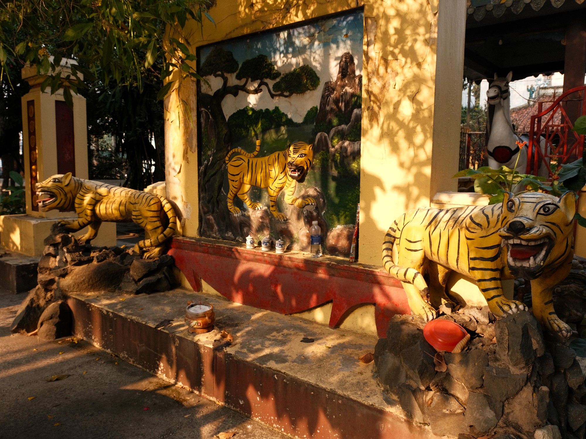
More rewarding is a short walk toward Minh Đăng Quang Buddhist Temple (Pháp Viện Minh Đăng Quang), located roughly between An Phú and Rạch Chiếc stations but easiest to reach from here from the station’s southern exit. The temple complex rises several storeys above the surrounding streets, its scale and calm presence forming a striking counterpoint to the malls, high-rises and roaring traffic nearby. From the upper levels, the view stretches across the An Phú skyline with the Metro snaking between buildings. At ground-level, gardens and shaded corners offer reprieve from the nearby highway. Minh Đăng Quang Buddhist Temple does comparatively elusive work, embedded within a landscape of consumption and existing alongside high-tech urban living. Hồ Chí Minh City’s residents share this co-existence evidenced by their presence at the temple, negotiating older ways of living with the incursions of technological innovation and deeper connectivity to world markets.
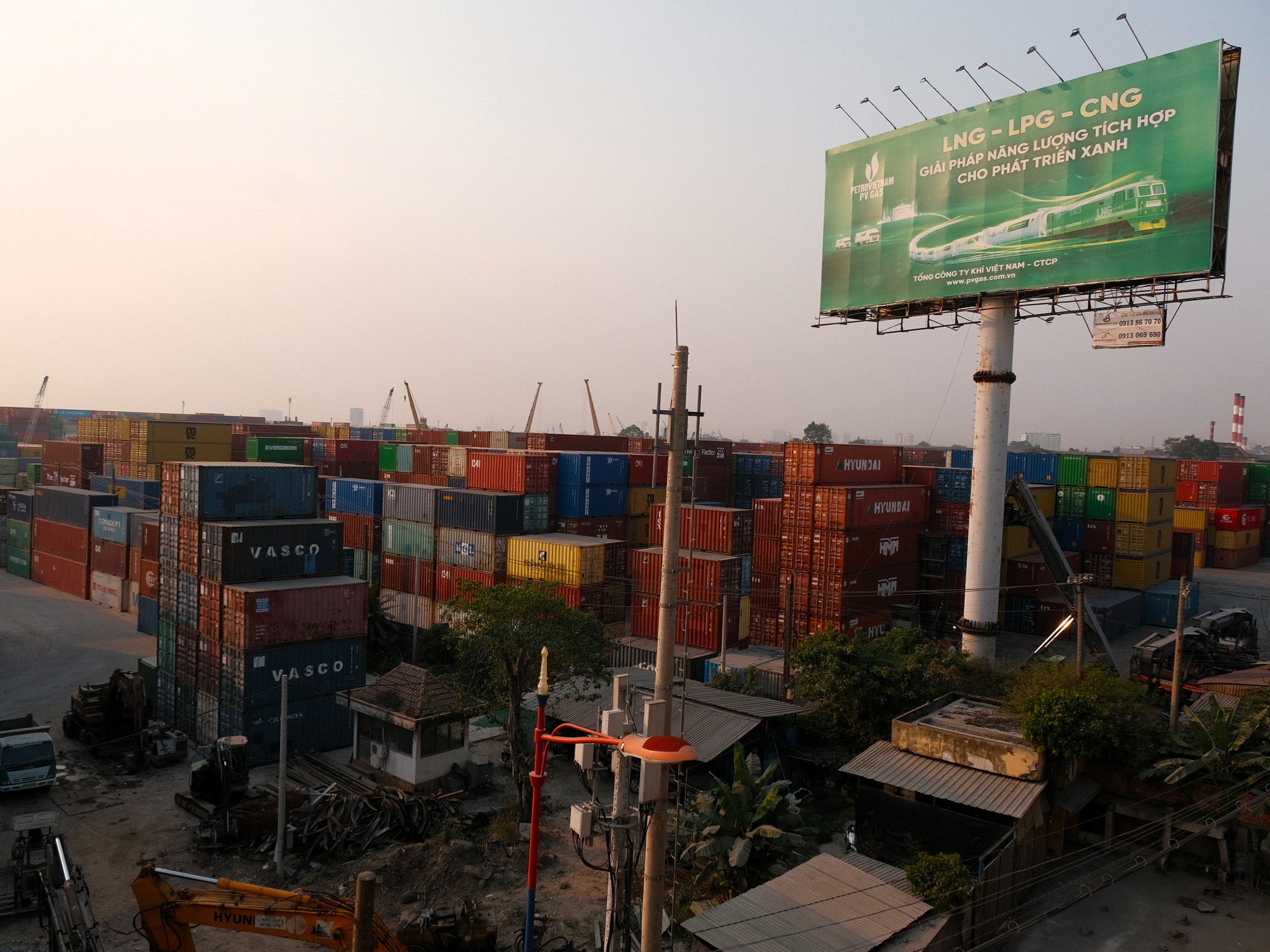
[L1-08] Rach Chiec Station (Ga Rạch Chiếc)
Rạch Chiếc feels like the periphery of An Phú rather than a destination in its own right. A handful of small cafés and eateries are scattered among welders, mechanics and unmarked workshops. The highway dominates the area’s tone. I had earmarked a specific place to visit here, but after a hot, dusty walk down a rubble-strewn lane, I discovered it had already closed. Defeated, I was not determined to find another space. I dare conclude that Rạch Chiếc works best as a station to pass rather than linger at. I hope someone will prove me wrong!
[L1-09] Phuoc Long Station (Ga Phước Long)
Phước Long is defined more by function than flourish. To the west lie factories, warehouses and stacked shipping containers all inaccessible to the curious passerby. To the east lie dense residential streets which are all built around proximity to the port and the city. It’s a useful contrast to Thảo Điền’s broader international and generally more affluent demographic. Here, the movement is largely domestic and industry-driven. The west-facing view from the station platform over the cargo yards is worth a brief pause. Beyond that, Phước Long works less as a place to explore and more as a reminder of the economic machinery that underpins the city’s eastern expansion.
[L1-10] Binh Thai Station (Ga Bình Thái)
Similar to Phước Long, Bình Thái is functional, residential, and built around commuting rather than lingering. If you want one cultural detour, Đình Trường Thọ is a traditional communal house about a 20-minute walk away – often closed outside festival periods, but atmospheric when open.
[L1-11] Thu Duc Station (Ga Thủ Đức)
Thủ Đức Station serves what was, until administrative reforms in 2025, Thủ Đức City, an area that has shifted from town to city to district over the course of its modern history. Once separate from Hồ Chí Minh City, it was gradually absorbed as urban expansion pushed eastward, folding older streets and public spaces into the wider region’s metropolitan fabric.
The area around Thủ Đức Market offers something increasingly rare in central Hồ Chí Minh City: a more recognisably southern urban cadence. Low-rise shopfronts, informal markets, and older civic spaces remain visible rather than concealed behind redevelopment. For those unlikely to venture into provincial towns further south or west, a wander here provides a modest but genuine glimpse of everyday life beyond the polished core seen on the Metro’s earlier stops. I found the walk around the market unexpectedly enjoyable. A reminder that, despite the skyline and the expressways of the Metro journey, Thủ Đức offers a slightly different pace of urbanism.
[L1-12] Hi-Tech Park Station (Ga Khu Công Nghệ Cao)
Hi-Tech Park Station serves the Hồ Chí Minh City Hi-Tech Park and its surrounding industrial zones. The landscape is all factory complexes and worker housing. Unless you are commuting here for work, neighbouring stations offer more compelling reasons to disembark.
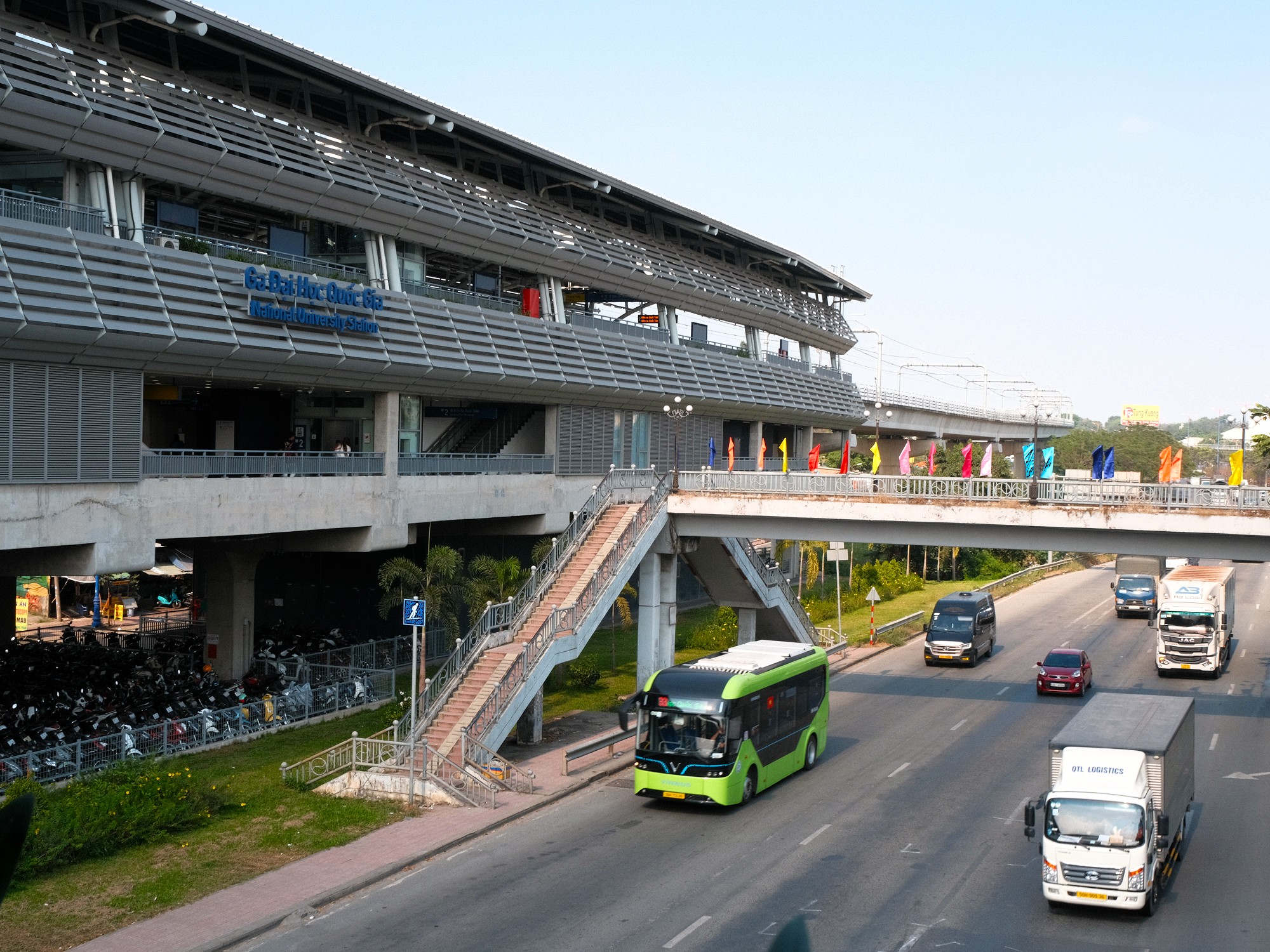
[L1-13] National University Station (Ga Đại Học Quốc Gia)
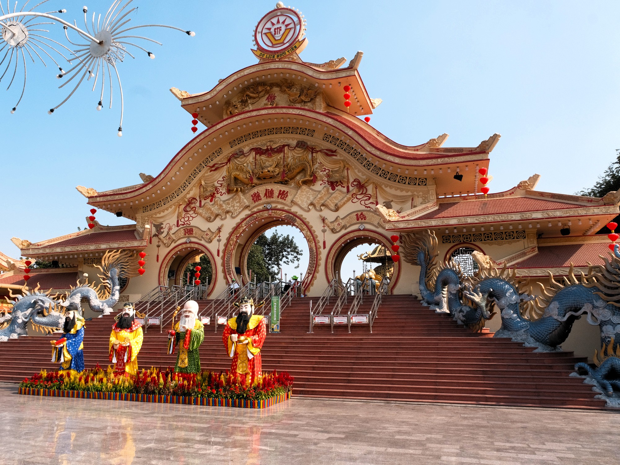
National University Station serves the campus of Vietnam National University in Hồ Chí Minh City, and is one of the most visibly student-heavy stops on the line. Passenger numbers noticeably thin out after this point, as large groups of students and staff disembark here each day. On the opposite side of the station lies Suối Tiên Theme Park, one of the city’s most distinctive theme parks. Its monumental sculptures of Vietnamese folk heroes and mythological figures loom over the grounds in an obtrusively theatrical fashion. The park blends cultural symbolism, water rides and amusement attractions that feel uniquely Vietnamese rather than merely imitating other international theme parks. It’s possible to spend half a day here without effort. While Suối Tiên Theme Park’s eccentricity may amuse adult visitors briefly, families with children are likely to reap the most enjoyment from visiting the park.
[L1-14] Suoi Tien Terminal Station (Ga Bến Xe Suối Tiên)
Despite its name, this station is not the most convenient access point for Suối Tiên Theme Park, which is better reached from the preceding stop. Instead, Suối Tiên Terminal Station is defined by connectivity. It sits beside the New Eastern Bus Station (Bến Xe Miền Đông Mới), making it the primary interchange for long-distance buses heading north and west out of Hồ Chí Minh City. The metro offers a cheap and relatively painless way to reach this terminal without navigating highways by motorbike or taxi.
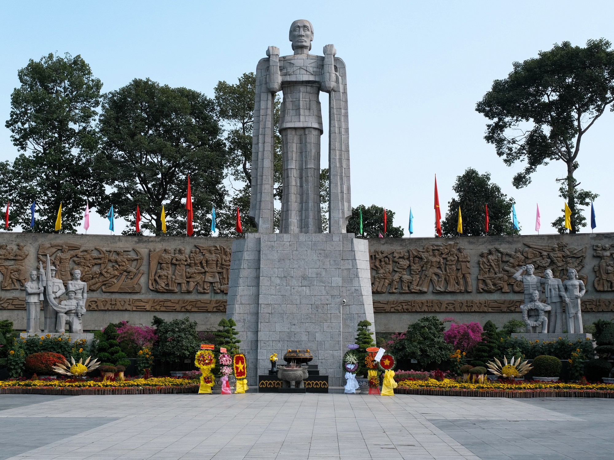
Less immediately visible is the station’s proximity to two large cemeteries. Around a kilometre north lies Bình An People’s Cemetery (Nghĩa Trang Nhân Dân Bình An), while roughly the same distance to the southwest is Hồ Chí Minh City Martyrs Cemetery (Nghĩa Trang Liệt Sĩ Thành Phố Hồ Chí Minh). The two sites commemorate soldiers from opposing sides of the war, offering an unusual spatial juxtaposition. It is rare to encounter such a direct physical proximity between different historical narratives, and rarer still to reflect on how remembrance, for both sides, is shaped in Vietnam’s present. Practicalities matter here. There are no pedestrian concourses across the highway and road crossings are limited. The Martyrs Cemetery is reachable on foot in around twenty minutes. However, accessing Bình An Cemetery, on the opposite side of the highway, appears impossible without the use of a ride-hailing service.
❤️Like this guide? Support Vietnam Coracle with a donation or join my Patreon to help keep this website free & 100% independent. Thank you, Tom
Support My Work
Free | Independent | No Sponsored Content
“Hello, if you enjoy my website, please support it.
Thank you.” Tom
*Disclosure: Vietnam Coracle content is always free and independent. Luke has written this guide because he wants to: he likes the metro and he wants readers to know about it. For more details, see the Disclosure & Disclaimer statements and my About Page


excellent post! it inspired us to buy a 24 hour pass and hop on and off most of the stations on the line. it is a great way to explore a bit of the city and also very comfortable outside of rush hour.
a payment method not mentioned is that at the entry/exit gates you can tap on and off your credit/debit/napas card or even use your phone/smart watch. this payment method is only good for single tickets, but the plus is you don’t need to pre-purchase a ticket. instead, the fare cost is calculated and charged after you tap to exit.
Hi DC,
Thanks for your message. I feel so disappointed I didn’t realise this. I don’t recall seeing any indication that this ‘tapping’ method was even possible nor did the staff member I spoke to mention it! I do wonder how this can all be better communicated at the metro. Anyways, thanks again and glad you enjoyed the article.
Best,
Luke
It’s not obvious at all!
While struggling on multiple occasions to read the QR on my phone, I saw the MasterCard logo above and wished I could have paid with card/NFC instead, but alas it only works for one way “open loop” tickets, and not the 1 day pass.
Many/most new buses in the city have similar readers and accept NFC. All part of the city’s push to go cashless and similar to many public transport systems in other countries.
MoMo is also accepted (and maybe some other mobile wallets/QR bank transfers) but we saw a large group all stuck behind the gate and staff telling them the system was down 😅