
Last updated March 2024 | Words and photos by Vietnam Coracle | 2 comments

Tom Divers is the founder and creator of Vietnam Coracle. He’s lived, travelled and worked in Vietnam since 2005. Born in London, he travelled from an early age, visiting over 40 countries (he first visited Vietnam in 1999). Now, whenever he has the opportunity to make a trip, he rarely looks beyond Vietnam’s borders and his trusty motorbike, Stavros. Read more about Tom on the About Page, Vietnam Times and ASE Podcast.
Historically, four great passes divided what is now Vietnam. These occur at the four points along the coast where spurs from the Trường Sơn Mountain Range spread east to the sea, creating natural barriers which once separated the land, people and cultures to the north and south of them. The Cả Pass (Đèo Cả) is the most southerly of the four passes, linking the provinces of Phú Yên and Khánh Hòa. This dramatic, highly scenic, 12-kilometre pass curves around the edges of jungle-clad mountains as they fall into a serene bay of placid blue water with rocky islets lying offshore. The Cả Pass used to be a bottleneck for heavy traffic on the busy national artery of Highway 1, but since the opening of two tunnels beneath the mountains in September 2017, the pass is now relatively quiet and traffic-free, leaving the winding asphalt and spectacular views for motorbikers and cyclists, who aren’t permitted to use the tunnels.

[Back Top]

THE CẢ PASS:
Historic, Scenic & Underhyped Pass on the South-Central Coast
The Cả Pass is 80km north of Nha Trang and 40km south of Tuy Hòa on the south-central coast. When the tunnels opened in 2017, the Cả Pass was rendered obsolete, and the pass is practically unused by large vehicles today. The Cả Pass is an underappreciated stretch of coast road that’s great fun to ride. The best way to enjoy the Cả Pass is to incorporate it into a wider coastal road trip itinerary, such as the Beach Bum or Coast Road routes. Several hammock cafes are strategically positioned on the roadside for customers to admire the views with a fresh coconut or an iced coffee. As with the other great passes in Vietnam, Cả Pass was once the boundary of kingdoms and the site of many battles between them: Đại Việt and Champa (1471-1653), Tây Sơn and Nguyễn Ánh (1771-1802), and the French and Viet Minh (1947). Historically, the Cả Pass was one of the most difficult and dangerous passes, second only to Hải Vân. As well as riding the pass, several other sights and activities in the immediate vicinity are well worth exploring, such as the Núi Đá Bia mountain hike, Bãi Môn bay and Đại Lãnh beach, which is also a good place to stay for a night.
CONTENTS:
Support My Website
Please donate or become a patron if you enjoy my work. Vietnam Coracle is totally free & independent. I do not receive payment for anything I write.
Thank you, Tom

ROUTE MAP:
The Cả Pass | South-Central Vietnam
The Pass:
[View Map]
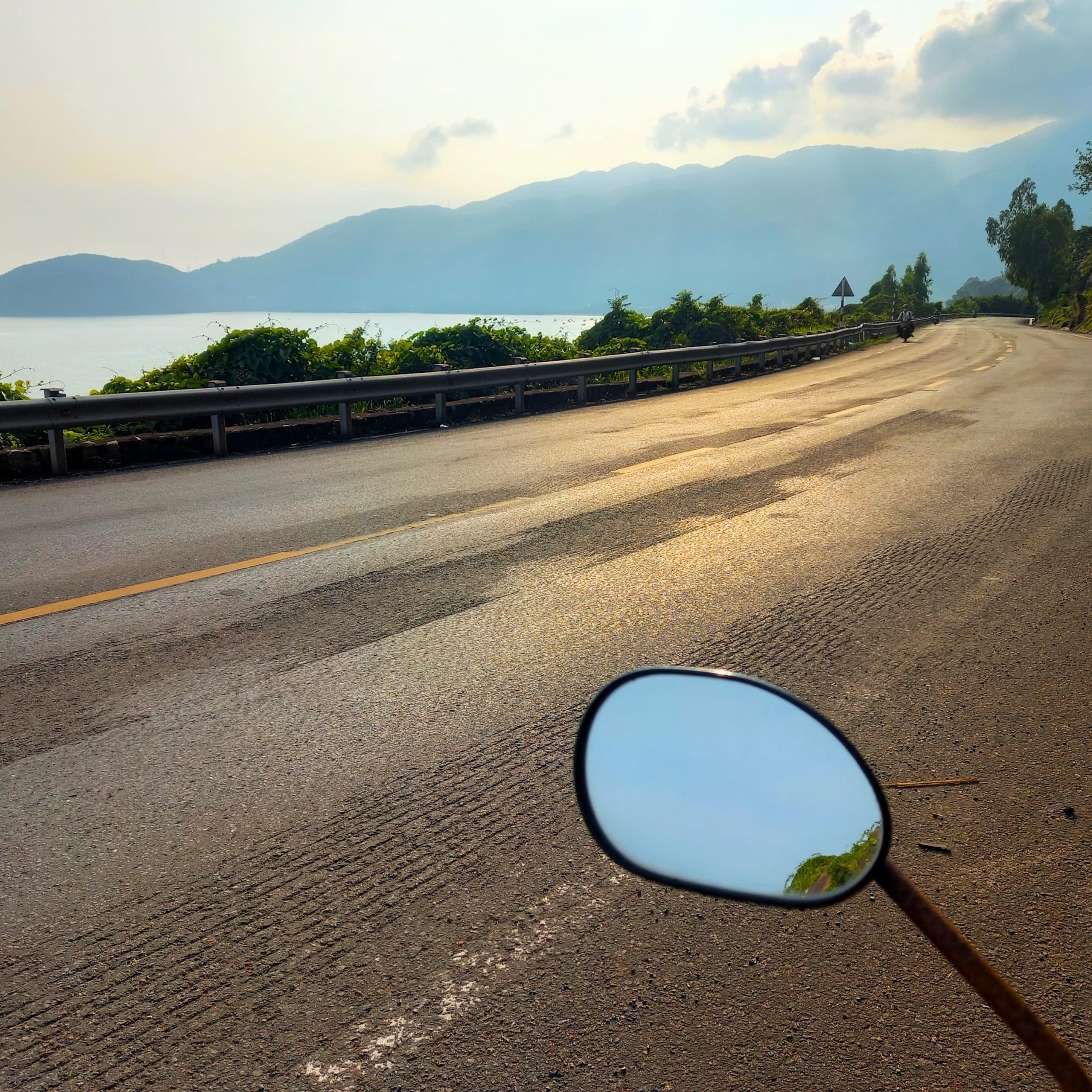
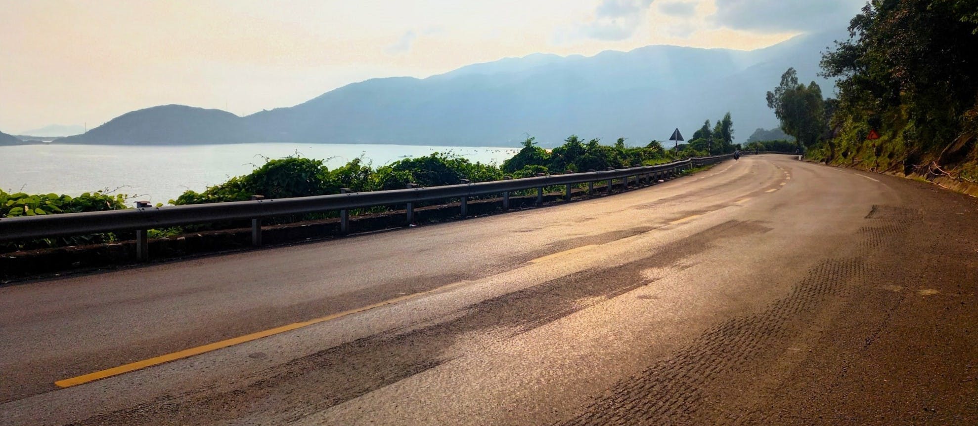
Approaching from the south, after passing the entrance to the tunnels leading under the mountains, a short pass (Đèo Cổ Mã) rounds a rugged headland and descends to Đại Lãnh, with sweeping views across the broad beach. Đại Lãnh fishing village nestles in the blue shadow of a mountainous spur, above which you can just make out the meandering course of the Cả Pass, cutting a route through foliage high above the sea. The Cả Pass begins where Đại Lãnh ends, rising steeply into the jungle, with the sea lapping at large rocks below. Almost immediately, pretty views open up back across the fishing community and dozens of blue boats bobbing in the surf offshore.


Lush foliage grows above and below the pass, sometimes reaching across the road and obscuring the expansive vistas out to sea, where a small island with interesting rock formations lies in the deep-blue water. This is the kind of enchanted isle where a Homeric creature might live, lying in wait for a shipwrecked sailor to be washed ashore. Breaks in the foliage afford glimpses of the railroad clinging to the mountainside dozens of metres below the pass, echoing its course. On the roadside, freshwater springs from the higher slopes are redirected in pipes and used as vehicle washing services by a few opportunistic locals. I once cycled the Cả Pass, in 2005. After pedaling to the top in 35°C heat, I took advantage of these freshwater jets by standing beneath one of them for 10 minutes to cool off.


The pass winds on, corkscrewing through hairpin bends straddling the green and rocky slopes, below which lies nothing but broken boulders and open sea. Despite the steep pitch of the mountainside, the lower slopes beneath the road are often cultivated: planted with mango, banana and star fruit trees. The higher slopes, however, look wilder, overgrown, threatening and untamed. There’s an interesting tension on big mountain passes like this, a clash of man and nature: the road and the mountain locked in a constant battle, with the man-made structure fighting to prevail over the relentless push of the elements. Along the central section of the Cả Pass, where flat, stable land is nowhere to be seen, giant black granite boulders threaten to roll off the mountain and tumble to the road: the crash barriers are dented from rockfalls and accidents, and roadside shrines mark the sites of past casualties.


The Cả Pass has always been spectacular. But, in the past, before the tunnels opened, it was spoiled by the traffic which used to slowly struggle up the bends before clotting completely and coming to a standstill. There would be a long convoy of stationary vehicles stretching all the way around the mountainside and the exhaust fumes were horrendous. It was also a dangerous pass because, when the vehicles weren’t piled up in a jam, they’d be flying down the road, taking blind corners at high speed with an extraordinary disregard for other motorists. Mercifully, this immediately changed when the tunnels opened, which now take the majority of heavy traffic away from the pass, leaving motorbikers and cyclists to enjoy it in relative safety. Sadly, over the years many hundreds of lives were lost on the Cả Pass due to traffic accidents prior to the opening of the tunnels.


Many more lives were lost on the Cả Pass in battles over several centuries. As a natural frontier between peoples, cultures and kingdoms, many wars were fought on and around the pass. The Vietnamese often clashed with Champa here, as the former pushed their way southwards, conquering what is now southern Vietnam; centuries later, Vietnamese rulers fought each other for power at the Cả Pass when the Tây Sơn fought against Prince Nguyễn Ánh, who would later become the first Emperor in Huế; and, most recently, skirmishes between the Viet Minh and the colonial French flared up along the pass as the former fought for their independence in the 1940s and 1950s, not to mention clashes involving the U.S during the ‘American War’.


As the pass turns due north, the mountainside becomes increasingly unstable, made up of loose rocks and large boulders. At one point, a wall of bare rock protrudes into the bay, creating a formidable obstacle for the pass to negotiate. Here, the road is chiseled out of a massive black granite boulder, producing an overhang which bears down on all vehicles as they pass through what is known as Cua Đá Đen. This point also serves as the provincial border between Khánh Hòa and Phú Yên.

Beyond Cua Đá Đen, a bright blue lagoon appears to the east of the pass. This fabulous sight is Vũng Rô Bay, a natural harbour circled by forested hills and dotted with fishing boats and floating fish farms. Vũng Rô Port shelters in the western corner of the bay, a slightly sinister sight with large oil depots, tankers anchored to a long jetty and queues of unmarked trucks covered in military-green tarpaulin waiting by the docks.


As the Cả Pass snakes up to it highest point (where there’s a scruffy cafe), the scene is presided over by Núi Đá Bia, a huge 80-metre-high pillar of freestanding rock at the top of the highest mountain in the region, looming above the pass like an colossal sculpture of an ancient god. At the cafe, you can gaze due north over green rice paddies in the valleys of Phú Yên province and due south back down over the blue bays and rocky promontories of Khánh Hòa province. (This is also where you can take a side road due east to Vũng Rô Bay and Bãi Môn Beach.)

The north side of the Cả Pass is a steep series of wide switchbacks, descending sharply until leveling out at the valley floor and running alongside the railway in a straight line before rejoining the highway at the tunnel exit. Halfway down the pass, a small parking lot indicates the beginning of the long, steep ascent to Núi Đá Bia peak, which is worth the hike if you have the time and energy: the views are extraordinary.

*Disclosure: I never receive payment for anything I write: my content is always free and independent. I’ve written this guide because I want to: I like this pass and I want my readers to know about it. For more details, see my Disclosure & Disclaimer statements and my About Page


Hi there!
My friend and I will be doing the Easy Rider in October. Can you confirm if these tunnels have opened up to make the Twin Passes less perilous? We’re both pretty experienced riders, but this is the one part that really has me nervous.
Thanks!
Paige
Hi Paige,
Yes, the tunnels are now open and it has dramatically transformed the Twin Passes – they’re very quiet, safe and beautiful now 🙂
I hope you enjoy it,
Tom