
First published August 2015 | Words and photos by Vietnam Coracle | 18 comments
This post was last updated 10 years ago. Please check the comments section for possible updates, or read more on my Updates & Accuracy page.
Introduction | Motorbike Guide | Map | Related Content
The first provinces I ever travelled to in Vietnam were in the Mekong Delta. Since then, however, I have tended to favour coastal and mountainous provinces for my motorbike road trips. This is why, after 9 years in the country, the last four provinces that I have yet to visit are all in the Mekong Delta. More specifically, these are the southernmost provinces in Vietnam: the Deep South or, as I like to call it, the Dragon’s Tail. I thought it was about time I made it to all Vietnam’s 63 provinces, so I finally set out to travel as far south as roads go. Below, I’ve written about this road trip in diary format, but I still include places to stay and eat along the way and a map, so that anyone who wants to follow my route can use this article as a guide.

Deep south: riding to the Mekong’s southern tip
[Back Top]
MOTORBIKE GUIDE:
- Route: the deep south: Saigon to Ca Mau loop
- Terrain & Scenery: Mekong Delta, flat, rivers, fruit plantations
- Road Quality: paved highways & rural back-roads
- Total Distance: 840km
Click on a day below to read more about it:
- DAY 1: Saigon to Bac Lieu
- DAY 2: Bac Lieu to Ca Mau (via Nam Can)
- DAY 3: Ca Mau to Vi Thanh
- DAY 4: Vi Thanh to Ben Tre
- DAY 5: Ben Tre to Saigon
[Back Top]
DAY 1:
Saigon to Bac Lieu: 250km [MAP]
As I live in Bình Thạnh District, I have to cross Saigon from east to west before reaching the highway to the Mekong Delta. Even at 5:30 in the morning this is a busy, noisy, dusty 45 minute drive – Saigon wakes up earlier than any city I’ve visited: even in Bombay the markets and the streets didn’t start to throb until way past 7:30am.

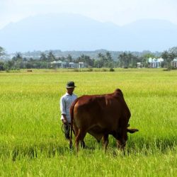
The long crawl along Highway 1, from the western edge of Saigon to Mỹ Tho, is still an arduous drive, even after a new expressway opened a few years ago, taking the bulk of large vehicles. This area is one of Saigon’s many industrial armpits: choked with traffic, trucks, smog, dust, and chemicals from the factories which line the route. Still, there are glimpses of beauty here and there, all the more potent for their ugly surroundings: the smell of fresh baked bread from bánh mì stalls; lotus ponds in-between truck depots; the sweep of a river; and, of course, life and food; there’s always life and food in Vietnam, no matter where you are.

First glimpses of the Mekong tributaries, near My Tho
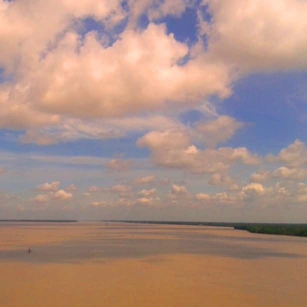
Beyond Mỹ Tho, two new bridges over the first two ‘arms’ of the Mekong River have really opened up Bến Tre to tourism and trade. The new highway is roaring with coaches and trucks. The bridges – built high above the water, so that large ships can pass beneath them – are great places to gaze at the river. It’s an immense waterway: with no highlands to contain it, the brown Mekong simply sprawls out over the vast, flat plain of the delta region, like a cup of coffee spilled over a tabletop.
Light and space; sky and water: the Mekong River near My Tho
Between Bến Tre and Trà Vinh, yet another brand new Mekong bridge has been constructed. A functional, no-frills piece of infrastructure, it takes me to my fifth province of the day. Landing on Trà Vinh Province, the landscape has changed: Mỹ Tho and Bến Tre are covered in lush fruit trees – coconut, banana, mango, jackfruit, durian, longan – but Trà Vinh is a network rice fields, interrupted by clumps of tall trees. Religion and ethnicity change too: this part of the Mekong has a large Khmer population, most of whom practice Theravada Buddhism, a more conservative branch than Mahayana, which is more commonly practiced in Vietnam. Facial features and, to my eye, skin tone are noticeably different here. The landscape is dotted with temples, wats, pagodas, and monasteries, all of which are surrounded by decorative walls and tall trees, shimmering with birdsong and cicadas.

Mekong gold: a Khmer temple near Tra Vinh
Before reaching Sóc Trăng – the first of the four ‘new’ provinces I intend to visit on this trip – I’m reminded of just how ‘useful’ all the new bridges are when, at the next Mekong crossing, I have to take a ferry. Now 200km from Saigon, I have crossed the many arms of the Mekong River on five separate occasions, but this is my first ferry. In fact, I take two ferries, each one separated by a 2km wide island. With a head wind, the two crossings take nearly three quarters of an hour. This is what travelling in the Mekong Delta used to be like: a series of short straight stretches of road, broken at regular intervals by ferry crossings. The slow progress used to make Mekong towns, like Trà Vinh, feel very isolated and remote: now they are just a few hours from Saigon.


Bridges over the Mekong River have dramatically reduced travel time
Sóc Trăng is a busy, concrete town. I choose to plough on south to Bạc Liêu for the night. As I rejoin Highway 1, a thunderhead rears up from the south. In the Mekong Delta, because the land is so flat, you can see weather rolling in from all directions for miles and miles. The huge skies and swathes of open space are both invigorating and threatening; inducing a kind of primordial agoraphobia in me. The torrent lasts half an hour, during which I shelter under a corrugated iron roof with a canine companion that barks for the duration. However, the storm saves my skin from sunburn, and by the time I roll into Bạc Liêu it’s dry and bright again.
250km from Saigon, Bạc Liêu is a typically fascinating Mekong town. Busy, tree-lined boulevards end at a riverfront promenade, lined with French colonial villas and old shophouses – some of them fading; some restored. Prosperous and lively but still rough around the edges, Bạc Liêu has a familiar Mekong ambience. I immediately warm to it: I want to stroll along the riverside, delve into the market, eat at the multitude of street food stalls, sip coffee and write at the street front cafes. So this is exactly what I do. I bag a clean simple room at Thành Đạt Hotel (145/2 Trân Phú Street, 0781 3540 999, 250,000vnđ) and fill up with good, cheap snacks at the thriving night market on Hai Bà Trưng Street.
Mekong ambience: Bac Lieu has a distinctive southern charm
‘Southern charm’ might seem like a meaningless catchphrase, but in Vietnam I think it’s safe to say that southern people – especially those in the Mekong – are the most open, warm, and sincere people you’ll meet. Each and every interaction today – from gas station attendants to roadside snack vendors, from ferry ticket inspectors to kids in the park – has been full of unguarded smiles and good-natured giggles. At dusk the sun glows bright against another southern thundercloud, bathing this rivertown in a sharp low light.

Rivertown: Bac Lieu bathed in southern twilight
DAY 2:
Bac Lieu to Ca Mau (via Nam Can): 175km [MAP]
I wake early for a run around Bạc Liêu at dawn, but just as I’m leaving my room, I see a long black wave of cloud breaking across the city. The rain sets in. Bạc Liêu is cold and damp, but there’s still enough life and food on the streets for it not to feel grim and grey.
I join Highway 1 for the 70km stretch of straight road along a canal to Cà Mau City, the most southerly in Vietnam. Cà Mau Province is a vast area of flat swampland and mangrove forest. The arrow-shaped ‘tail’ of Vietnam, Cà Mau has the lowest population density in the Mekong Delta. But it doesn’t feel that way on Highway 1, which is as busy, relentless, and fume-choked as any other stretch of this massively overused north-south artery. I would never have guessed that I was on the way to Vietnam’s remote, southern frontier. Grey skies and drizzle do nothing for the flat, featureless, semi-rural, semi-industrial landscape along the highway: the Mekong Delta really is much better seen by boat than bike; on waterways than roadways.

Better seen by boat: a Mekong barge ploughs the muddy waters
Feeling surprisingly cold, I wear my full rain gear, even though the sky is only spitting dusty drops of water. When I enter Cà Mau City, I head straight for one of the central bridges for a view of the town. The brown sluggish river – thick with trash and excrement – is lined with fragile corrugated iron homes, which look perilously close to caving in on themselves and joining the rest of the garbage floating downstream. It looks like a set from the movie, Waterworld. The miserable weather only adds to the depressing scene.

Bleak: Ca Mau is the most southerly city in Vietnam
However, even in the dull light and rain, it’s obvious that this far-flung city is, in fact, as booming as any other large Mekong town. Wide, tree-lined streets channel hundreds of motorbikes past busy shophouses, and there’s a fair amount of activity at the bleak-looking central market. Even so, Cà Mau does look supremely grim under today’s granite sky, and the musty hotel rooms that I’m shown make it an easy decision to leave after lunch, and head even further south.
Highway 1 reaches its southern limit at Năm Căn, 50km south of Cà Mau. At last some of the traffic fades away, but it certainly isn’t a scenic ride. Năm Căn, the southernmost settlement of size in Vietnam, is a suitably rough and forgotten-looking frontier town. Highway 1 ends in dust after passing over a new bridge, from which there’s another forlorn view of riverside tin can housing on water, viscous from raw sewage. For the moment, Năm Căn is a town undergoing renovation: much of it is a building site, and it really does feel like the end of the line. But soon, the ‘line’ will be extended to the very tip of the country which, it is hoped, will bring tourism to the area.

Renovation: Nam Can, Vietnam’s southernmost habitation, is currently a building site
In the far distance is a very strange sight: a hill. The only high ground for hundreds of kilometres, this is Khoai Island. And this is what the new road is really all about. An ambitious plan to build a port on the island that, after a canal is constructed through the Malay Peninsular in southern Thailand – linking the Andaman Sea with the Gulf of Thailand – will handle container ships on what is one of the busiest shipping lanes in the world.
Năm Căn is too sad a place to stay the night. I head back to Cà Mau and find a room without too much damp on the walls at Song Hùng Hotel (28 Phan Ngọc Hiển Street, 0780 3822 822, 250,000vnđ). I finally get to take a run: around the many parks, boulevards and government buildings in Cà Mau. After some good food at the waterfront night market on Quang Trung Street, I sit by the river at night with a milk tea from a cosy café run by a typically enterprising young Vietnamese man (TAKB Cafe, 85 Phạm Văn Ký Street). As we sit talking, a man from a riverfront shophouse steps into the river to wash some heavy-duty bags. When he disturbs the water, the smell of sewage is so powerful that I have to leave.

End of the line: Nam Can earns its reputation as a frontier town
DAY 3:
Ca Mau to Vi Thanh (via U Minh Forest): 160km [MAP]
It’s a bright morning in Cà Mau. I have coffee at a wonderful cafe in an old two storey shophouse full of birdsong, in the backstreets behind the market (Thanh Hùng Quán, corner of Nguyễn Hữu Lễ and Phan Đình Phùng streets). But even the sharp early light can’t quite make this city look appealing. During my less than 24 hours here, I’ve realized that it’s one of the poorest cities I can remember visiting in Vietnam. I’ve seen dozens of people sleeping very rough indeed, many with babies. In every café or eatery that I’ve sat down at, there have been several people making rounds of the tables, approaching diners with their hands out for money. This morning I remember that Cà Mau is where the current prime minister of Vietnam is from. Although the people have been welcoming, I’m not sad to leave Cà Mau as I hit the long, straight, flat Mekong roads towards Hậu Giang, the last province in Vietnam that I have yet to visit.

Ducks for market, Ca Mau City
Initially, the weather stays good, and the scenery is pretty: quiet villages with squat houses hiding behind neat hibiscus hedges; the canal on one side, the road on the other. However, the larger villages I pass through are appallingly dirty – both on land and in the waterways – and the people appear to treat me with suspicion. The rains come again. This time sweeping over what is left of the U Minh Forest, which is still supposedly the largest mangrove forest in the world, outside of the Amazon basin. I had intended to stop here to have a look around, but the weather is bad and I simply don’t have enough time to explore the forests, which would require organizing a boat.

The rains: weather changes fast in the Mekong Delta in August
The weather clears and I make good progress: yet more new roads have shortened the journey, one particularly scenic stretch cutting through a bountiful plantation of coconuts and pineapples. But it doesn’t last. The road is reduced to mud and rubble where construction is ongoing. It rains again, making the mud slippery and treacherous. Progress is extremely slow and there’s very little to get excited about as I reach Hậu Giang, thus completing all 63 provinces, a journey which started when I was 17 years old, visiting Vietnam for the first time with my parents. God celebrates by sending down a particularly vicious rain storm as I approach my night stop, Vị Thanh. The capital of Hậu Giang Province, Vị Thanh is a likable place with a long promenade along a canal, where large Mekong freight ships glide by. But the weather is awful so there’s nothing to do but sit in a café all afternoon. I find a decent room for the night at Thanh Xuân Guesthouse (34 Nguyễn Công Trứ Street, 0984 514 799, 180,000vnđ). An excellent noodle house is located on Hải Thượng Lãn Ông Street, opposite Nhà Khách Hậu Giang (government guesthouse).
Stavros drying out, after completing all 63 of Vietnam’s provinces
DAY 4:
Vi Thanh to Ben Tre: 150km [MAP]
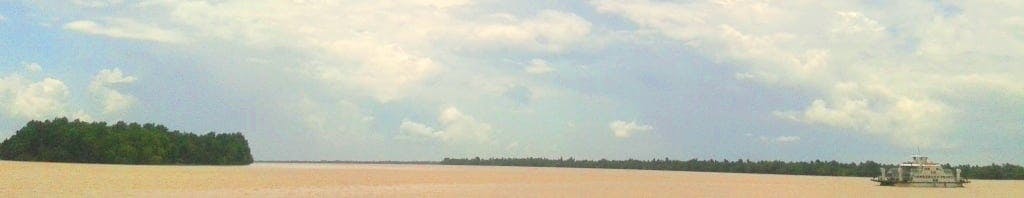
Vị Thanh is surprisingly quiet in the morning. I have a classic southern breakfast – baguettes and coffee – and head off towards Bến Tre. Thankfully, the roads are good and traffic is relatively light. I stop at Cần Thơ – by far the largest city in the Mekong Delta – for a drink. It’s a sprawling, concrete city, busy with motorbikes (there’s a noticeable absence of cars on the streets compared to Saigon), and buzzing with commerce, both on the roadways and waterways. I’ve always found it hard to have any particularly attachment to Cần Thơ: it has all the bustle of a large Vietnamese city, but not much charm; even the riverfront leaves me cold. It’s here that I see the first foreign travellers since leaving Saigon. The bridge over the Mekong River, just beyond Cần Thơ, is a particularly intimidating concrete structure that is neither beautiful nor ugly, but definitely impressive.
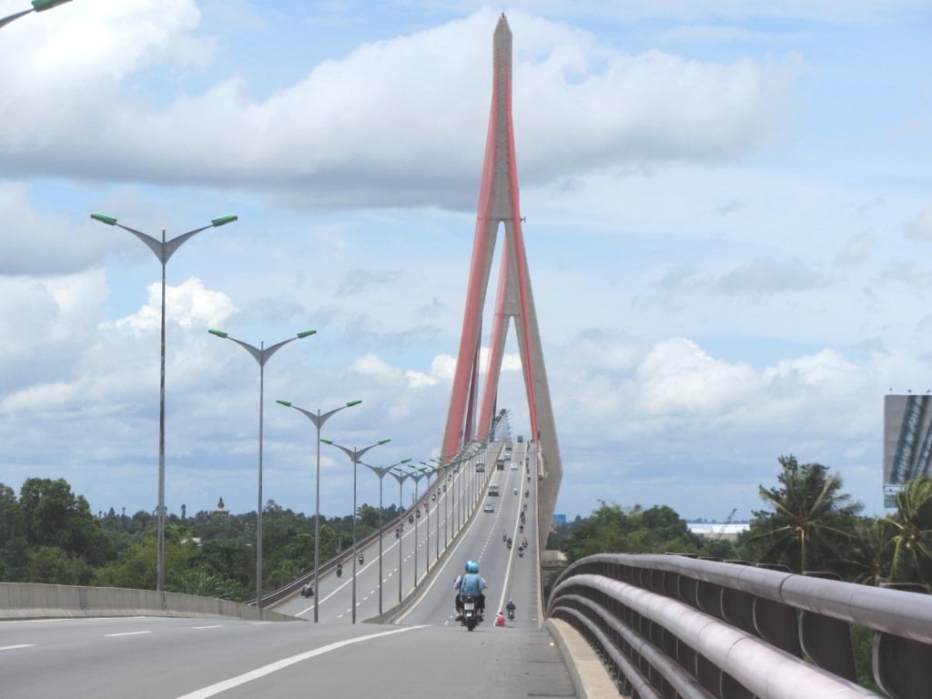
Impressive: Can Tho Bridge is nearly 3km long
In order to avoid the awful stretch of Highway 1 between Vĩnh Long and Mỹ Thơ, I try a new route. From Vĩnh Long I take a ferry, ride across an island in the Mekong then catch another ferry, before riding through acres of coconut, banana and rambutan plantations to Bến Tre. It works perfectly, cutting out the dust and trucks of the highway by threading through rural back-roads. I decide that, from now on, I’ll always take a ferry crossing over a bridge crossing if it keeps me off the busy highways.
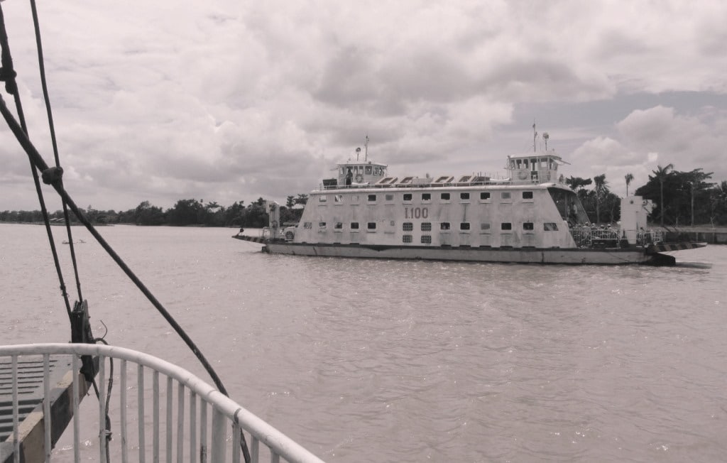
Slow and aging, but the ferry is a great way to avoid busy highways
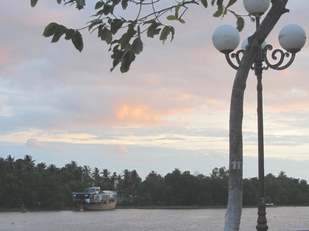
Bến Tre was the first place I ever travelled to in Vietnam. When I was 17, my parents and I stayed by the lake here. Our hotel no longer exists, and the town has been beautified with wide streets and a riverfront promenade. Despite growing much larger, Bến Tre is still surprisingly quiet and laid-back. I still wouldn’t call it an attractive town, but it’s a relaxing stop by the river, and the rooftop cocktails at Hàm Luông Hotel (200C Hùng Vương Street) are good and cheap. There’s good street food around the market, including the beef rolled in betel leaf (bò lá lốt) at 9/5 Nguyễn Trung Trực Street (view map). It seems fitting that my last stop, after visiting all 63 of Vietnam’s provinces, should be the first province I ever stepped foot in.
The riverfront at Ben Tre, where I first visited aged 17
DAY 5:
Ben Tre to Saigon: 110km [MAP]
I run along Bến Tre’s newly laid riverfront promenade before breakfast. The light is warm and tropical, and the coconut palms lining the river are lush and green. After yesterday’s successful attempt at a back route from Vĩnh Long to Bến Tre, I decide to try another today: from Mỹ Tho back to Saigon. I want to avoid the miserable stretch of Highway 1 back into the city – there’s no more depressing way to re-enter Saigon than the steady, slow, clogged, polluted crawl through the industrial suburbs.

Freshly baked: breakfast in Ben Tre
I cut east from Mỹ Tho along a good road with little traffic. Turning due north at Gò Công, the good conditions continue until I’m just 15km from Saigon. Then, suddenly, the road narrows, the air thickens, traffic swells, noise level rises, and progress grinds to a halt. It only takes about 20 minutes, but it’s still a sorry introduction to Saigon. Nonetheless, it’s better than Highway 1, so I’m in a good mood as I glide along the Bến Nghé Creek Expressway, skirting downtown, and sliding back home for lunch.
 Driving to Phu Quoc Island: Flying to Phu Quoc Island is easy, but if you want a real adventure, driving there by motorbike from Saigon (Ho Chi Minh City) is much more fun. This road trip takes you from Vietnam’s biggest city to some of the country’s best tropical beaches, via the waterways & highways of the Mekong Delta…..read more
 The Southeast Loop: If you’re looking for a road trip within reach of Saigon that takes you to beaches and mountains but stays off busy main roads; this is it. Saigon, Mui Ne, and Dalat are all connected by quiet scenic back-roads. Perfect for a Saigon getaway, this motorbike guide shows you how to do it. …..read more
 The Ultimate Vietnam Route Map: During the autumn of 2014, I spent two months travelling over 9,000km by motorbike across Vietnam. This annotated and illustrated map of my road trip is designed as a resource for other riders. On it I’ve included links to relevant motorbike guides for specific regions; all of my overnight stops; and my exact route…..read more
[Back Top]
MAP
The Deep South Road Trip:
View ‘The Deep South’ in a LARGER MAP
[Back Top]
Hi Tom, let me tell you what happened to me last year, but I guess things haven’t changed. I wanted to visit the southernmost point of Vietnam, Diem Cuc Nam to Quoc, and stay overnight beforehand at the Hoang Gia Bao Hotel, 25 km east. When I entered the lobby, the lady at the reception told me that this was a border area where foreigners weren’t allowed to stay (I thought Y Ty would call, but that’s a story from 2024). I was totally surprised and asked: What border? She said something about the Gulf of Thailand and that it was for my own safety??? So I had to go back to Nam Can, and since I couldn’t find a decent hotel there, a bit further north again. Since that day, I’ve suffered from PTBD (Post-traumatic Border Disorder). This means no China Border Crawl Loop, no Binh Lieu Border Loop, and so on. And every time I see the Border Area sign, I almost have a heart attack. Best regards, Frank
Hi Frank,
Yes, sea boundaries are also considered national border areas. And in general it pays to be careful when travelling close to border regions in Vietnam. But some borders are more sensitive than others and things are changing all the time. As an example of this, Ha Giang used to be considered a sensitive border area and all foreign travellers had to get a permit to visit there not that many years ago: today, it’s one of the most popular and famous regions in Vietnam for tourists.
Best,
Tom
Great piece of writing. I rode across the Mekong Delta twice back in 2019 on my trusted Honda Wave. The area reminded me of a tropical post-nuclear wasteland—but on the other hand, the tiny backcountry roads linking villages offered some of the most beautiful, lush scenes, straight out of Jurassic Park. Such a powerful contrast.
I recall that riding along the ocean from Ha Tien to Rach Gia wasn’t too bad, and the villages around Can Tho were remarkable. My general rule of thumb is to stay away from the main highways and explore the area using second-class routes—this offers a much richer experience!
Hi Greg,
Yes, you’re right: the Mekong Delta is definitely one of the regions of Vietnam where it is much more rewarding to stay off the main roads as much as possible, although this means that travel is much slower, mainly because you’ll be using vehicle ferries to cross all the branches of the river rather than the big new bridges.
Best,
Tom
Hi Tom, I combined Phu Quoc loop with Dragon Tail loop, which took for me about 2 weeks to complete. The best experience i got in tiny cozy cities close to Cambodian border and chilling on the tops of hills in the same area. At one of them I got even treated with free Cafe Den sitting in silence with local hikers watching the view. I also drove all the way down to Cà Mau Cape National Park, taking a stroll in the Mangrove forest (it took about 3 hours from Ca Mau one way and honestly, it doesn’t worth it)).
Hi Иван,
Yes, I prefer the area along the Cambodia border too: that’s part of my Mountains in the Mekong route. Also, the Temple-Hopping Loop in Tra Vinh is a lot of fun.
Best,
Tom
Hi Tom
I only had a few days to spare so decided to do an abbreviated dragon’s tail!
I rode Saigon- Bac Liêu in one (very long!) day.
Then took a lovely road north from there before finally succumbing to the dreaded Highway 1 into Can Tho where I spent night 2.
Then today to Ben Tre following your advice and tomorrow home to Saigon.
So just wanted to say thanks for the advice!
Also, the hotel you recommend for drinks in BT is pricy for a room (500) but there’s a cheaper option a few 100m’s west along the same road where I got a bed for 280 called the Dai An
There also an outdoor bar for drinking beer which sells Bottles of Saigon for 11,000 where I am currently happily ensconced 🙂
So I got exactly the same duck photo before I saw you had also done it!
Hi Kieran,
Sounds like a good road trip. Glad to hear you enjoyed it.
Thanks for the updates. The bar sounds very enticing! 🙂
I hope the return to Saigon goes smoothly.
Tom
Tom,
I’m in Can Tho and am hoping to make it all the way to Dat Mui (having followed your route to Lung Cu a few weeks back I like the idea of hitting the furthest south point on the main land as well). You mention that the road isn’t completed, does this mean there is a very rudimentary path to Dat Mui, or is it comparable to most of the (excellent compared to the north) back roads I’ve experienced in the south? Probably a bit late to message you as I’m heading down there tomorrow morning, but worth a shot!
Thanks,
Paul
Hi Paul,
I did this ride last year – August 2015, I think it was – so things may well have changed by now.
Last year, the road to Dat Mui ended in construction at the town of Nam Can. But, as far as I am aware, the road is now passable all the way to Dat Mui, although I can’t vouch for that, and I don’t know what condition it’s in.
However, the road all the way to Nam Can ass absolutely fine last year and, even if you find the road condition beyond Nam Can is no good, I’m pretty sure you can just take a boat from there down to the cape.
Either way, I’d really appreciate it if you could give me an update about the road to Dat Mui when you’re done – it’d be very useful, both to me and other readers.
I hope this helps,
Tom
Thanks Tom, and will do. I’m on the fence now as I have to be back into Saigon on the 25th and want to hit Phu Quoc still. So I’ll leave that decision to how I feel after the market tomorrow morning. Any thoughts on timeline? Settle for one or two days in Phu Quoc or head there immediately and see if I have time afterwards for Dat Mui? (realistically, the chances of making it to Dat Mui would drop significantly if I don’t go there first).
Well, you could ride from Can Tho to Nam Can in a day, and then from Nam Can to Rach Gia (for the ferry to Phu Quoc) in a day too. Then a few days on Phu Quoc, take the ferry back to Ha Tien for a night, and then a day or two to ride bike to Saigon: I would say you have enough time to do it all if you wanted to 🙂
Tom
Tom,
The road beyond Nam Can is still under construction, but very passable. About 50% is completed with the rest at stages varying from ripped up to basically finished. I should have timed it out better, but I left the market at Can Tho shortly after 6am. I believe I reached Dat Mui around noon. I was back in Ca Mau by 3 (moving quickly ahead of the storm clouds).
The land mark itself is nothing spectacular (drawing it’s worth by being the southern most point on the mainland). But the drive in was nice through the mangroves and the Dat Mui fishing village is really nice.
Hopefully catching the ferry tomorrow from Rach Gia, relaxing for a couple of days and completing my trip in Saigon.
The handful of foreigners I chatted with along the way (outside of the obvious areas) each mentioned your site. Literally, everyone. So for the information and, perhaps more important, the inspiration… Thanks!
Hi Paul,
Thanks so much for the update and additional information about the road to Dat Mui – that’s brilliant! Good to know you can get there relatively easily now – I’ll wait a couple more months before I give it a try; maybe it’ll be finished by then 🙂
That’s wonderful to know that other people mentioned my site – that’s exactly what it’s all about!
Very happy to hear you’ve enjoyed your big trip around Vietnam. I hope you have a relaxing time on Phu Quoc Island and a safe trip back to Saigon.
Tom
Hey Mate,
I am looking at doing a similar route from Saigon (start of my trip) to what you did here only difference is staying in Can Tho maybe 2 nights and heading across to Phu Quoc Island like you have detailed on your other post from Rach Gia then coming back to Ha Tien.
Do you have any route I could take on the way back that would bypass Ho Chi Minh (as I like to explore another area) as I make my way North I was looking at possibly riding upto Tay Ninh, Dau Mot or Ben Cat then down to Bien Hoa and onto Vung Tau so I can start a similar route to what you have taken to head up North, time is no issue and would rather a scenic route with less traffic then a highway.
Would love your suggestions / thoughts
Thanks
Hi Brent,
When you ride from Can Tho to Rach Gia, see if you can find out road conditions on Highway 80 first – because I heard that they are possibly resurfacing that road at the moment. Also, when I rode Highway 61B (south from Can Tho) a few months ago it was in an awful state – but perhaps it has been finished now.
To loop back from Ha Tien you could ride up to Chau Doc and then work your way across the rivers to Cao Lanh, and then up into Long An Province, then Thu Dau Mot and over to Bien Hoa before heading to Vung Tau. It’s not the most scenic or interesting part of the country, but it’s probably better than doubling back on yourself or taking Highway 1.
I hope this helps,
Tom
Wonderful images of the huge expanses of water but my favourite image was the ducks on the way to the market. Thanks Tom
Thanks, Vicki.
There were ducks all over the Mekong, most of them farmed. And lots of birds at this time of year, living in the swampy south.
Tom