
First published December 2025 | Words and photos by Vietnam Coracle | Read time 10 minutes

Tom Divers is the founder and creator of Vietnam Coracle. In 2005 he moved from his native London to Vietnam, where he has been living, working and travelling ever since. He pays rent in Ho Chi Minh City but is more often on the road, riding his motorbike a quarter of a million kilometres across Vietnam to research guides to the farthest-flung corners of the nation. When he’s not in the saddle, you’ll find him on a beach with a margarita, in a tent on a mountainside or at a streetside noodle house: in other words, at the ‘office’. Read more about Tom: Q&A, About Page, Vietnam Tourism website.
Old-School Ferry Crossing & ‘Hack’ for Riders Connecting the Delta with HCMC
This traditional, wooden ferry takes passengers, motorbikes and bicycles across the wide waters of the Soài Rạp River (also called the Nhà Bè River) marking the boundary between Ho Chi Minh City and Đồng Tháp Province (formerly Tiền Giang). The Lý Nhơn→Gia Thuận ferry thus links the green, mangrove-rich district of Cần Giờ (on the Ho Chi Minh City side) and the flat, agricultural district of Gò Công (on the Đồng Tháp side), gateway to the Mekong Delta. The ferry crossing is fun, off the beaten path and a throwback to old-school ferries that used to ply these rivers and backwaters. But the Lý Nhơn→Gia Thuận ferry is also a great ‘hack’ for riders on two wheels looking to sneak in/out of Ho Chi Minh City to/from the Delta without using the miserable, congested highways. The ferry can also be combined with the Cần Giờ→Vũng Tàu vehicle ferry as a way of bypassing Ho Chi Minh City completely when riding between the Delta and the southeast coast along the Beach Bum Route. Alternativelly, just use this ferry as a fun day trip from the city, linking up with the Cần Giờ→Cần Giuộc ferry to create a loop.

Support My Site
Free | Independent | No Sponsored Content
“Hello, if you enjoy my website, please support it.
Thank you.” Tom
[Back Top]
THE GUIDE:
Ferry Schedule, Ticket Prices, Map, Route Suggestions & More
This guide covers everything you need to know about taking the Lý Nhơn→Gia Thuận ferry. Take note of the ferry schedule because sailing times are infrequent, and be very careful when boarding and disembarking with your bike because it can be quite a balancing act! Click from the contents below for details. (For more useful guides like this, see Related Posts. And if you enjoy Vietnam Coracle, please support it with a donation or join my Patreon community)

Contents:
➤ Map
❤️If you like this guide, please support Vietnam Coracle with a donation or become a member of my Patreon community or purchase an Offline Guide & Map. This website relies on reader support to maintain its independence & quality. Thank you, Tom
MAP:
Lý Nhơn→Gia Thuận Ferry
Why Take this Ferry?
At first glance travellers might wonder why the Lý Nhơn→Gia Thuận ferry is worth mentioning. But for many independent travellers – especially those on two wheels – this ferry presents an attractive opportunity to travel between the Mekong Delta and the southeast coast while bypassing Ho Chi Minh City completely by connecting with the Cần Giờ→Vũng Tàu vehicle ferry. Alternatively, the ferry is a good way of exiting or entering Ho Chi Minh City and avoiding the ghastly, traffic-choked industrial suburbs south of the city. Besides this, the Lý Nhơn→Gia Thuận ferry route is quite simply a lot of fun: a mini, off-the-beaten-path adventure within shooting distance of the city, and a chance to experience the kind of ‘traditional’ local vehicle ferry that is fast disappearing in this part of Vietnam. In fact, this ferry could be combined with another crossing a bit further upstream (the Cần Giờ→Cần Giuộc ferry) to create a satisfying day trip loop from Ho Chi Minh City, taking in the sights of Cần Giờ mangrove forest along the way.
❤️Like this guide? Support Vietnam Coracle with a donation or join my Patreon to help keep this website free & 100% independent. Thank you, Tom
Ferry Schedule & Tickets:
❤️Like this guide? Support Vietnam Coracle with a donation or join my Patreon to help keep this website free & 100% independent. Thank you, Tom
The ferry leaves just once every hour in both directions. Sailings are every hour on the half hour between 6.30 in the morning to 17.30 in the evening. In other words, there’s a sailing from dawn until dusk from both sides of the river at 6.30, 7.30, 8.30, 9.30, etc. However, when I last did this ferry crossing, the sailing time was about 10 minutes later than advertised. Basically, if you get to either of the ports at a quarter past the hour, you shouldn’t have to wait too long until the next sailing. The voyage takes between 20-30 minutes. Note that because this crossing is so close to the river mouth and the open sea, weather conditions can affect sailings: if the water is rough, boats won’t sail. If you are travelling with your motorbike, be very careful when boarding and disembarking the ferry. The margins for error are extremely small and, although you might think you know how to handle your own bike, it’s probably better to let the ferry staff do it for you: they know what they’re doing. See the ferry schedule and ticket prices in the charts below:

Ferry Schedule:
| Route | Time | Journey Time | |
| Lý Nhơn→Gia Thuận | every hour on the half hour from 6.30 to 17.30 | 30 minutes | |
| Gia Thuận→Lý Nhơn | every hour on the half hour from 6.30 to 17.30 | 30 minutes |
Tickets Prices:
| Ticket | Pice | |
| Motorbike | 15,000vnđ | |
| Electric Bike | 10,000vnđ | |
| Bicycle | 4,000vnđ | |
| Pedestrian | 8,000vnđ | |
| Child | 4,000vnđ |
Departure & Arrival Ports:
❤️Like this guide? Support Vietnam Coracle with a donation or join my Patreon to help keep this website free & 100% independent. Thank you, Tom
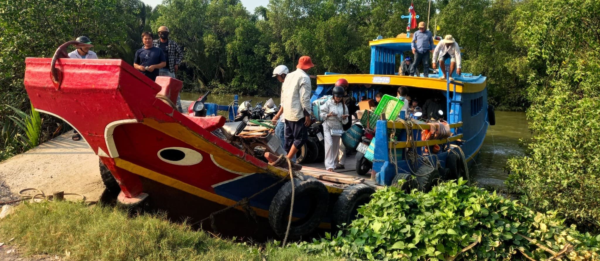
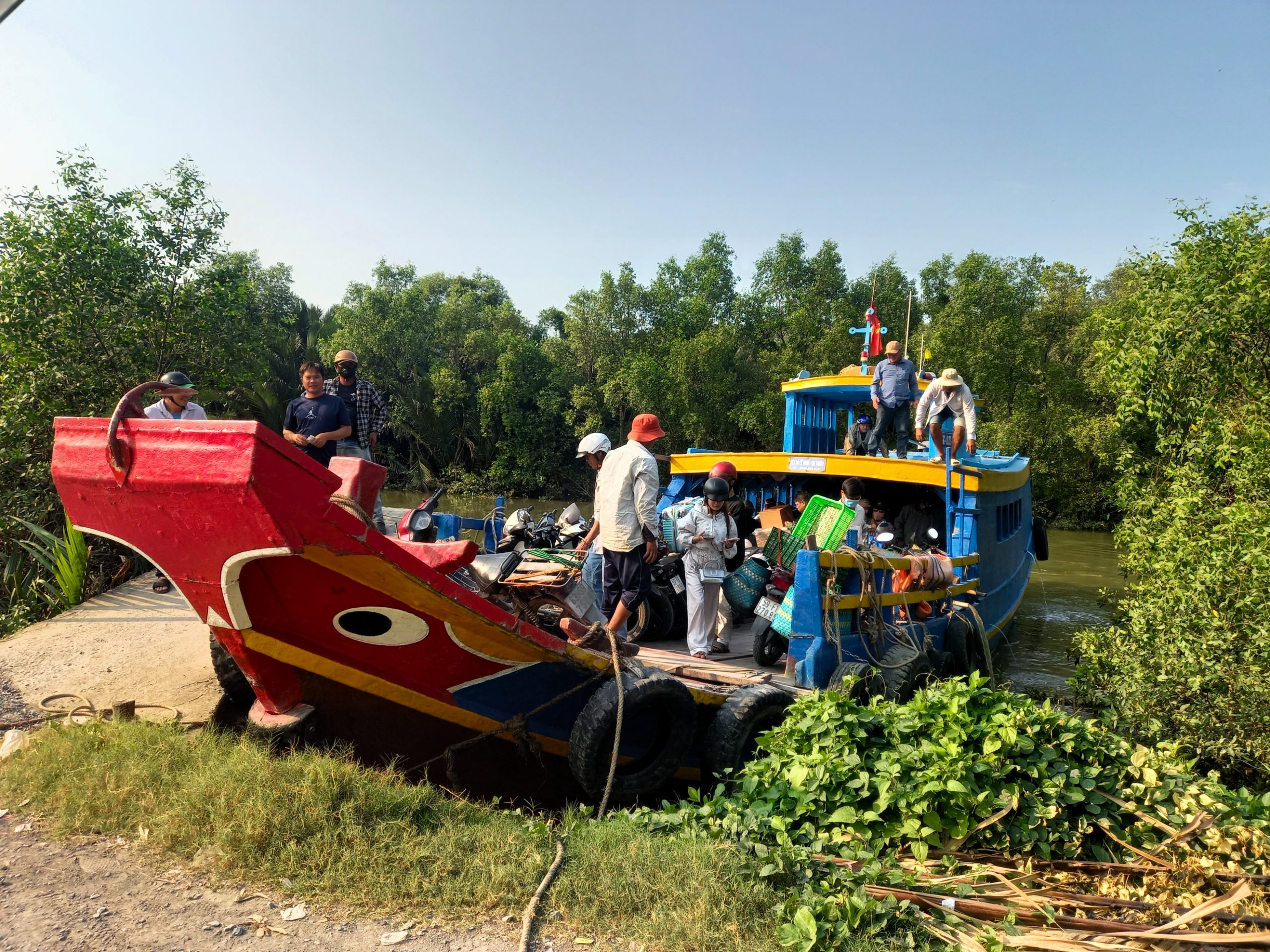
Both ports for this ferry are pretty remote and sparse. Lý Nhơn, on the east bank of the river, is connected to a small village and has good road access. But Gia Thuận, on the west bank of the river, is nothing more than a corrugated iron shack accessed via a narrow dirt road.
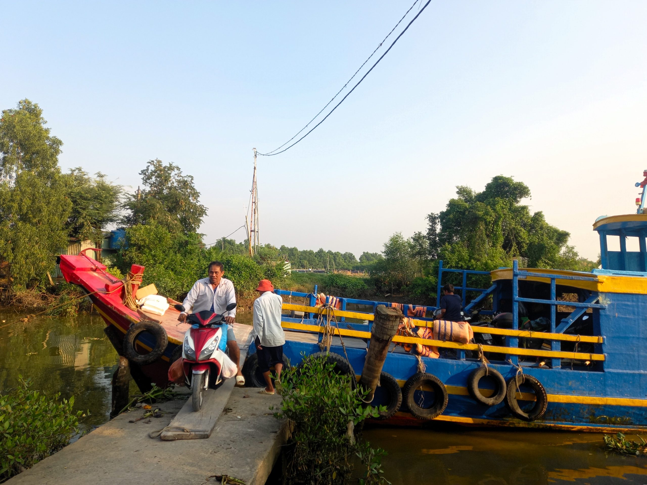
Lý Nhơn Ferry Port [MAP]
A small concrete pier, asphalt ramp and cafe/ticket office is all that makes up Lý Nhơn ferry port. There may be some refreshments available at the port; if not, a short ride due north into the village will bring you to some shops, cafes and noodle houses. The port has good road access to Vàm Sát forest tourist site (due northeast about 10-15 minutes) and to the main Rừng Sác Road (due north about 20 minutes) from where you can either turn north to the Bình Khánh ferry and into Ho Chi Minh City or turn south to Cần Giờ and on to Cần Thạnh for the ferry to Vũng Tàu.
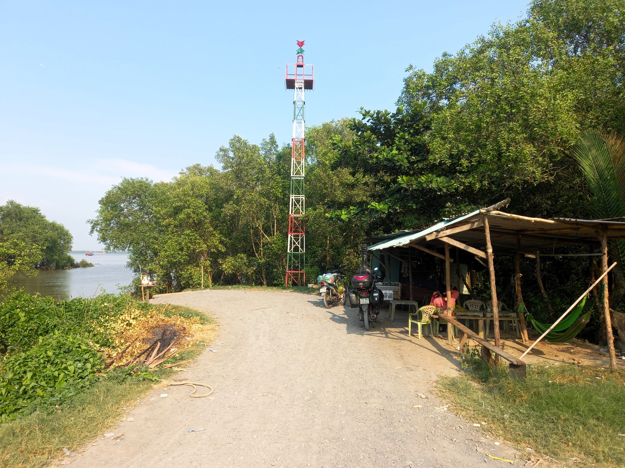
Gia Thuận Ferry Port [MAP]
Hidden at the end of a dirt road beside a narrow channel hemmed in by mangrove, the port at Gia Thuận is remote and bare-bones. A covered shelter functions as the ferry terminal, where you might find a travelling vendor selling drinks. Otherwise, there’s nothing else around. The port is accessed via a dirt path leading west to the KCN Gia Thuận road, which then links up to the main QL50 road heading south to Gò Công and then west to Mỹ Tho and the wider Mekong Delta region.

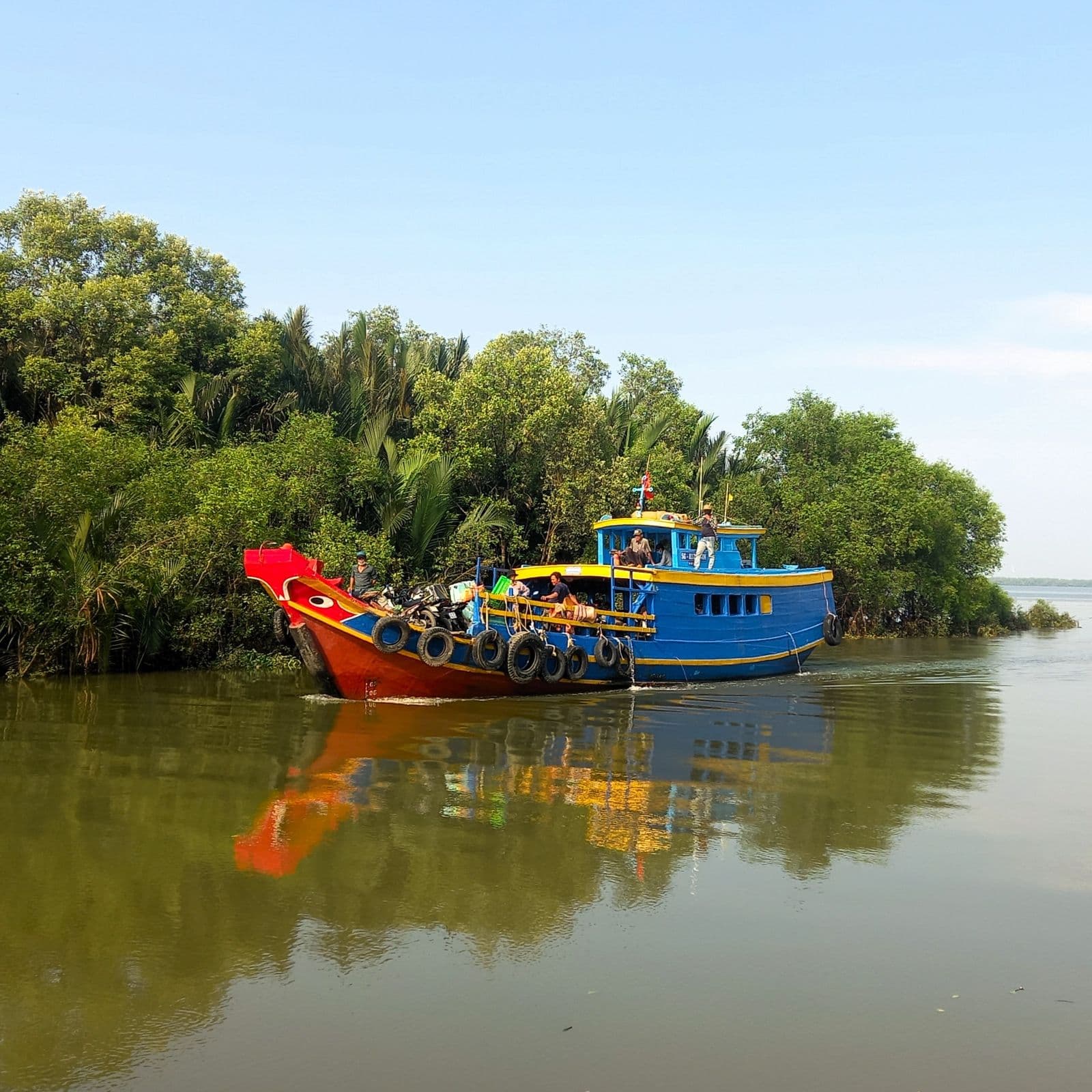
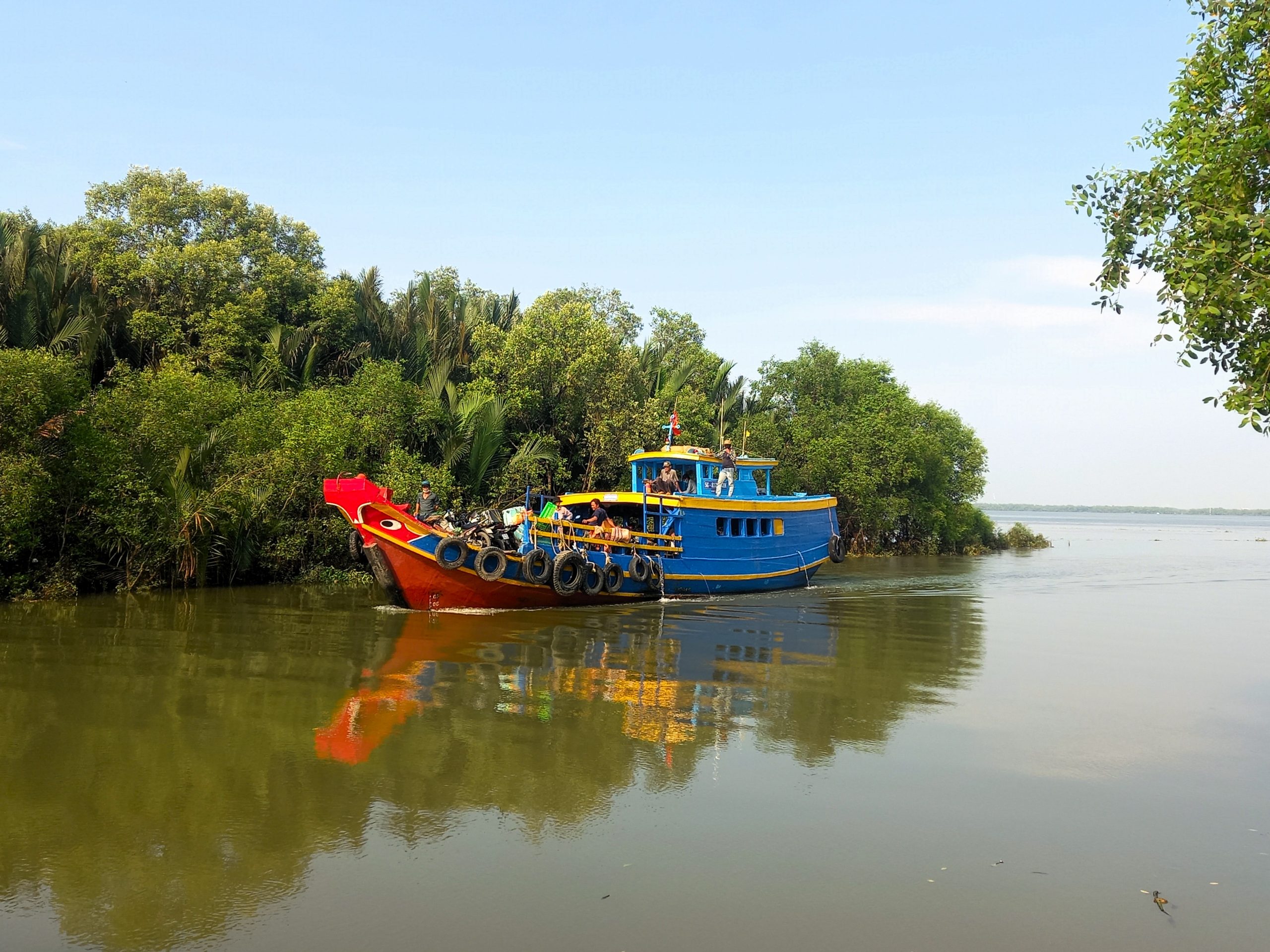
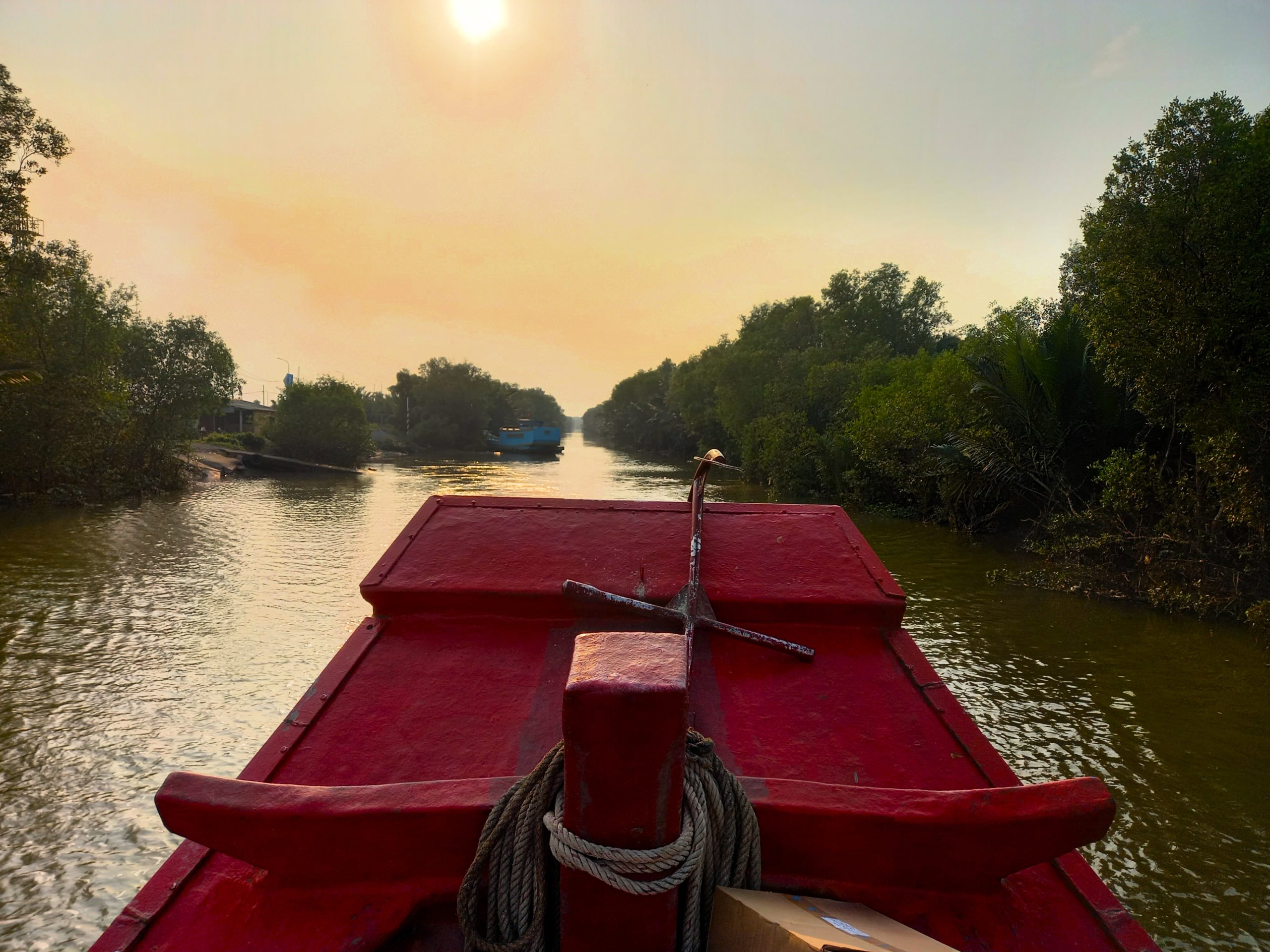
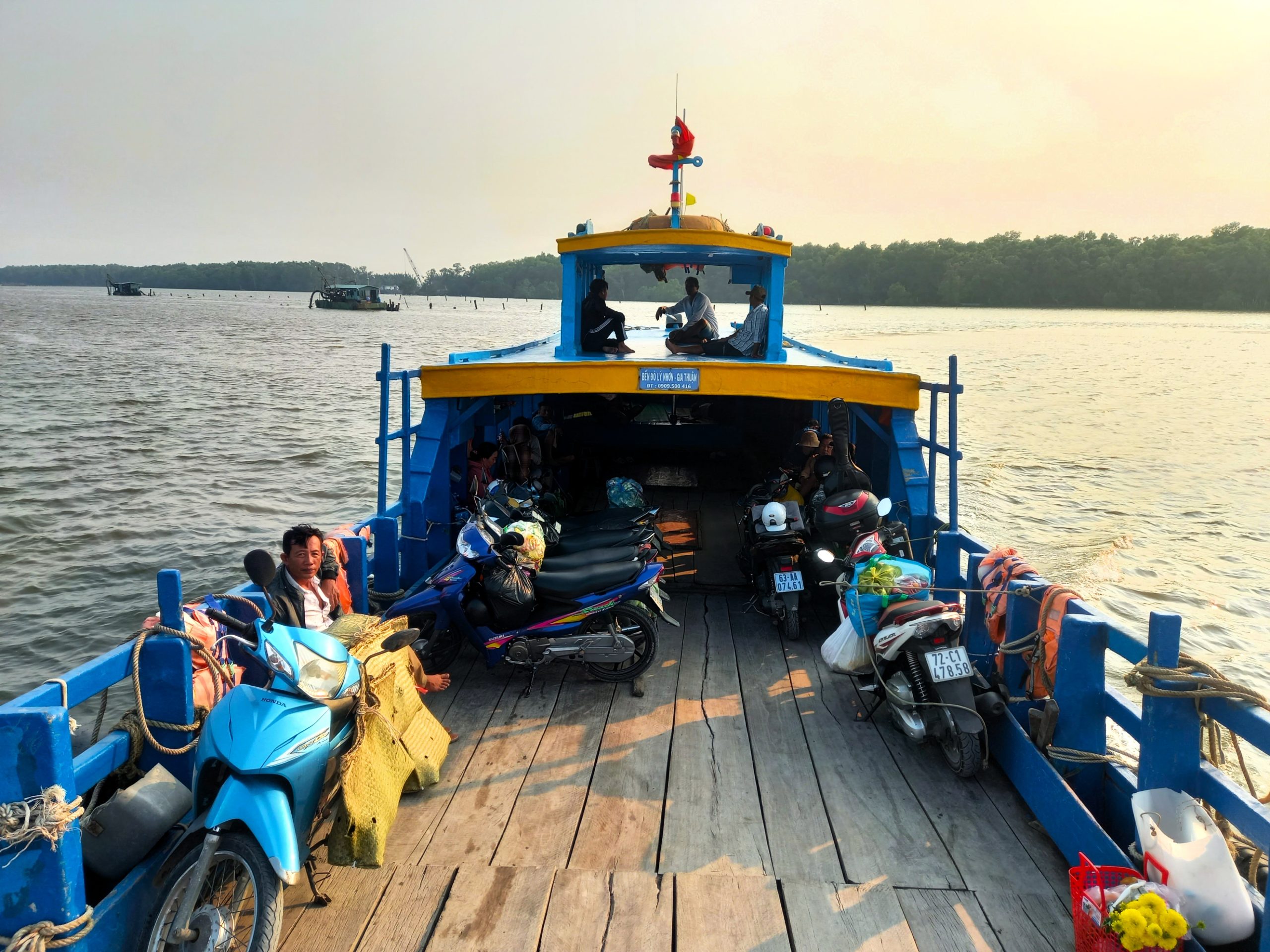
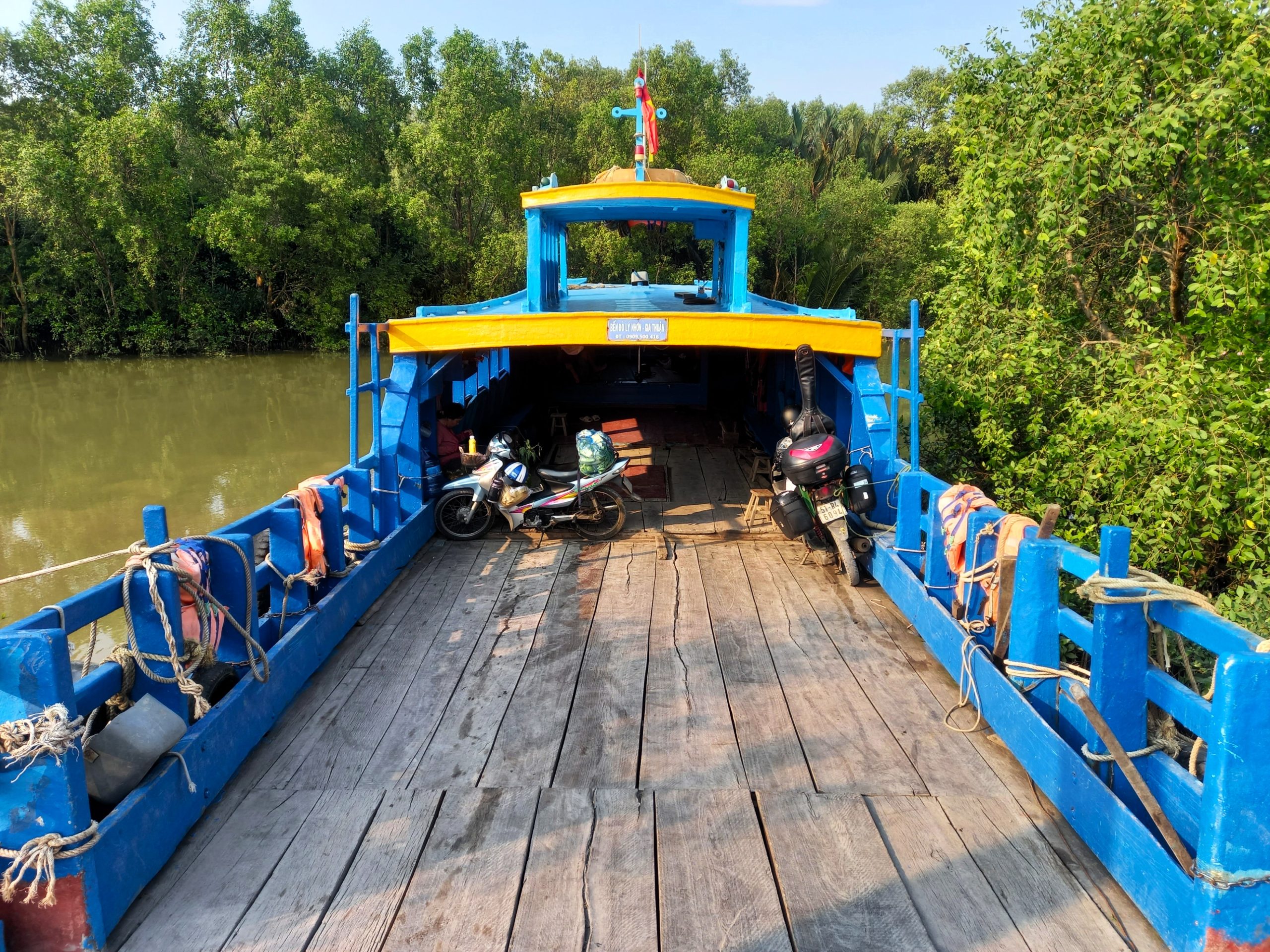
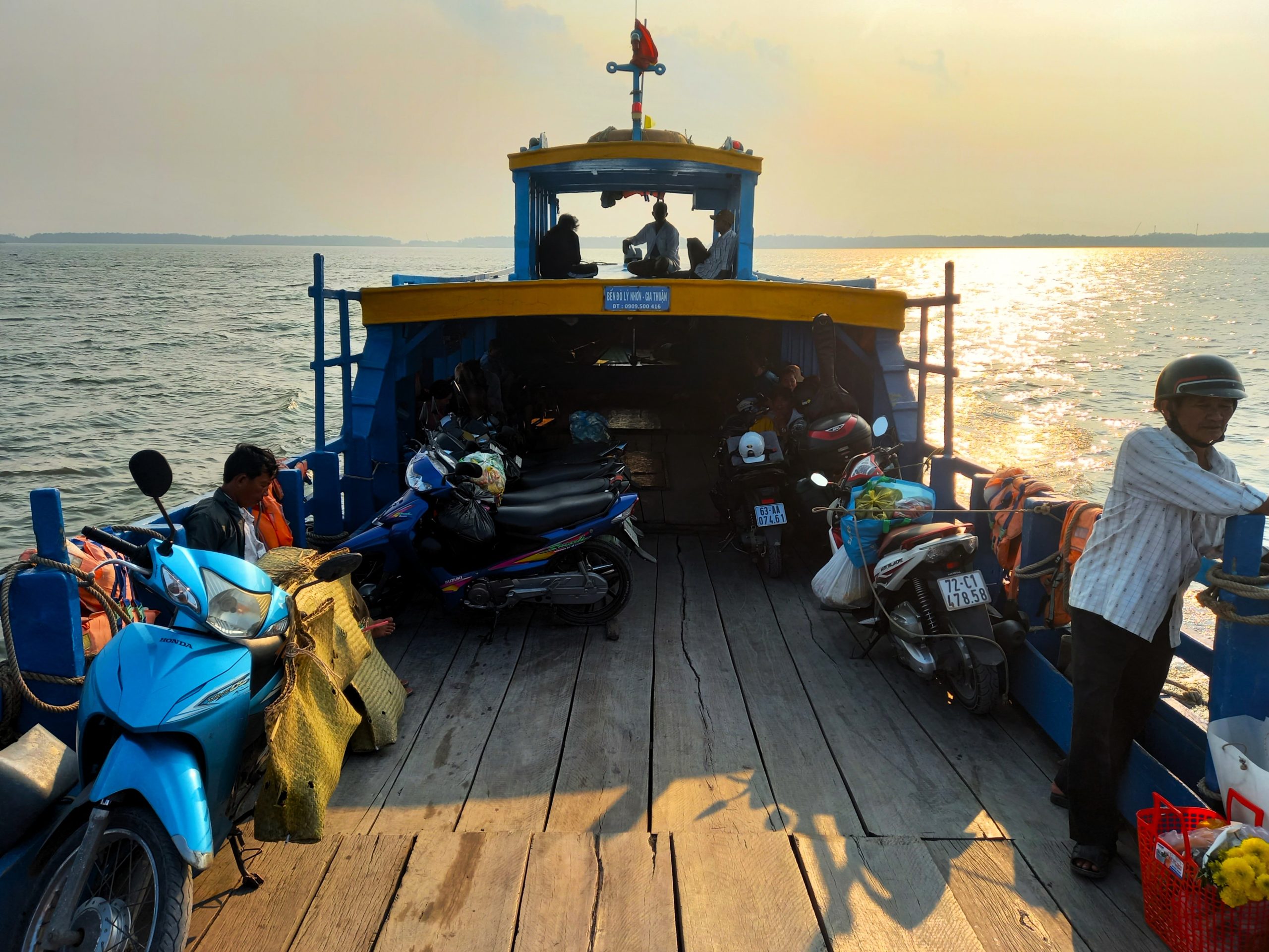
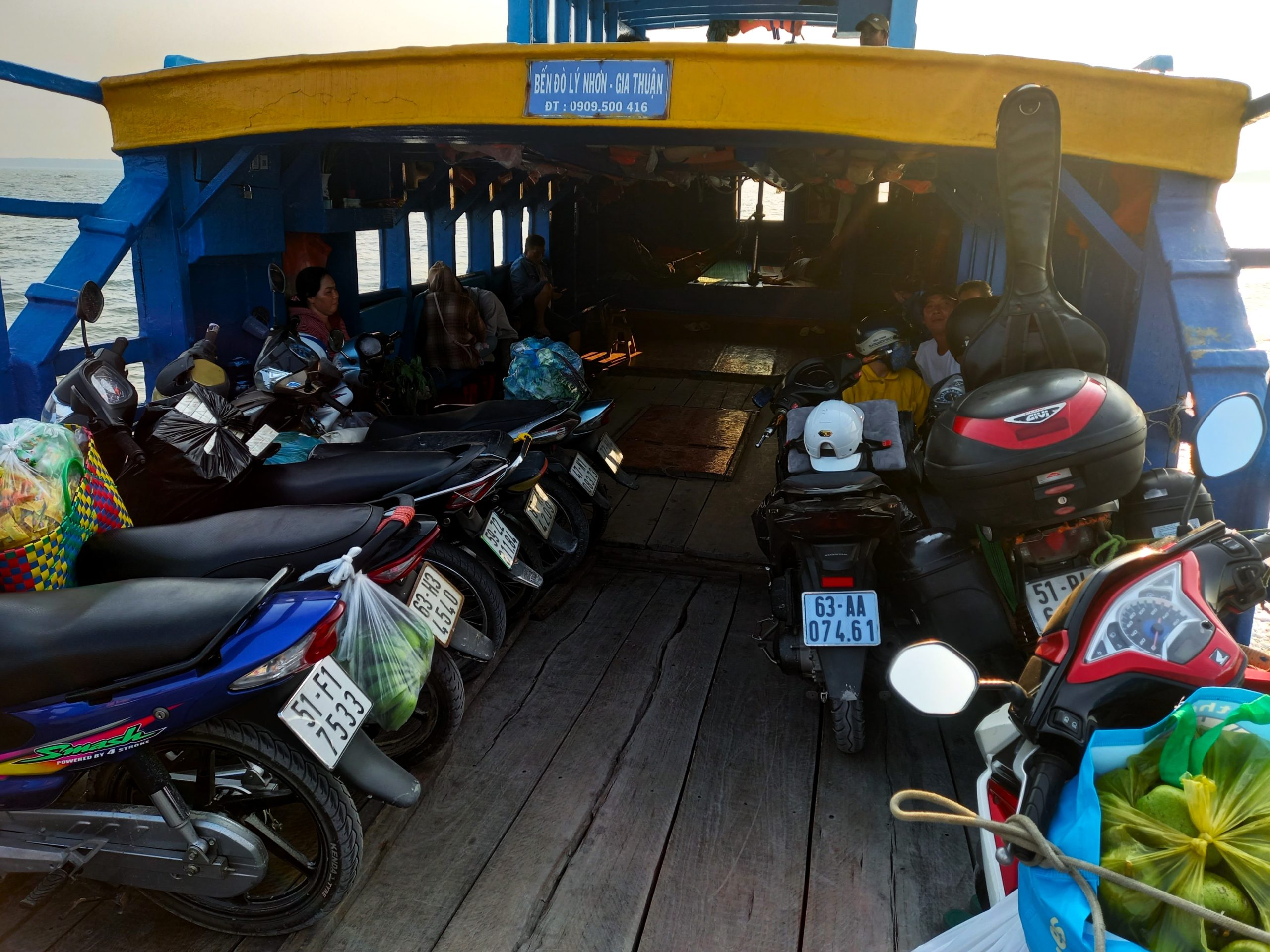
The Boats:
❤️Like this guide? Support Vietnam Coracle with a donation or join my Patreon to help keep this website free & 100% independent. Thank you, Tom
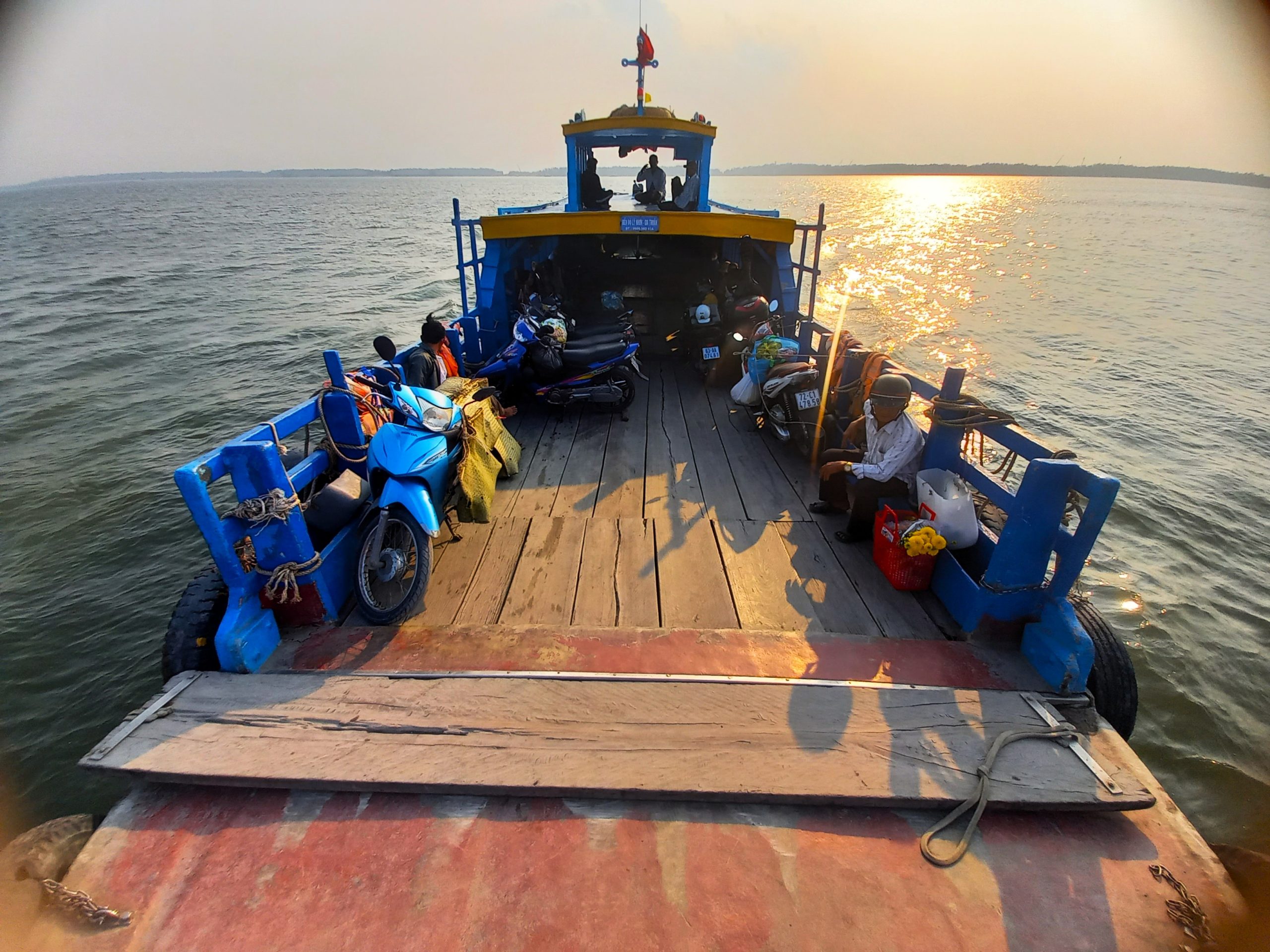
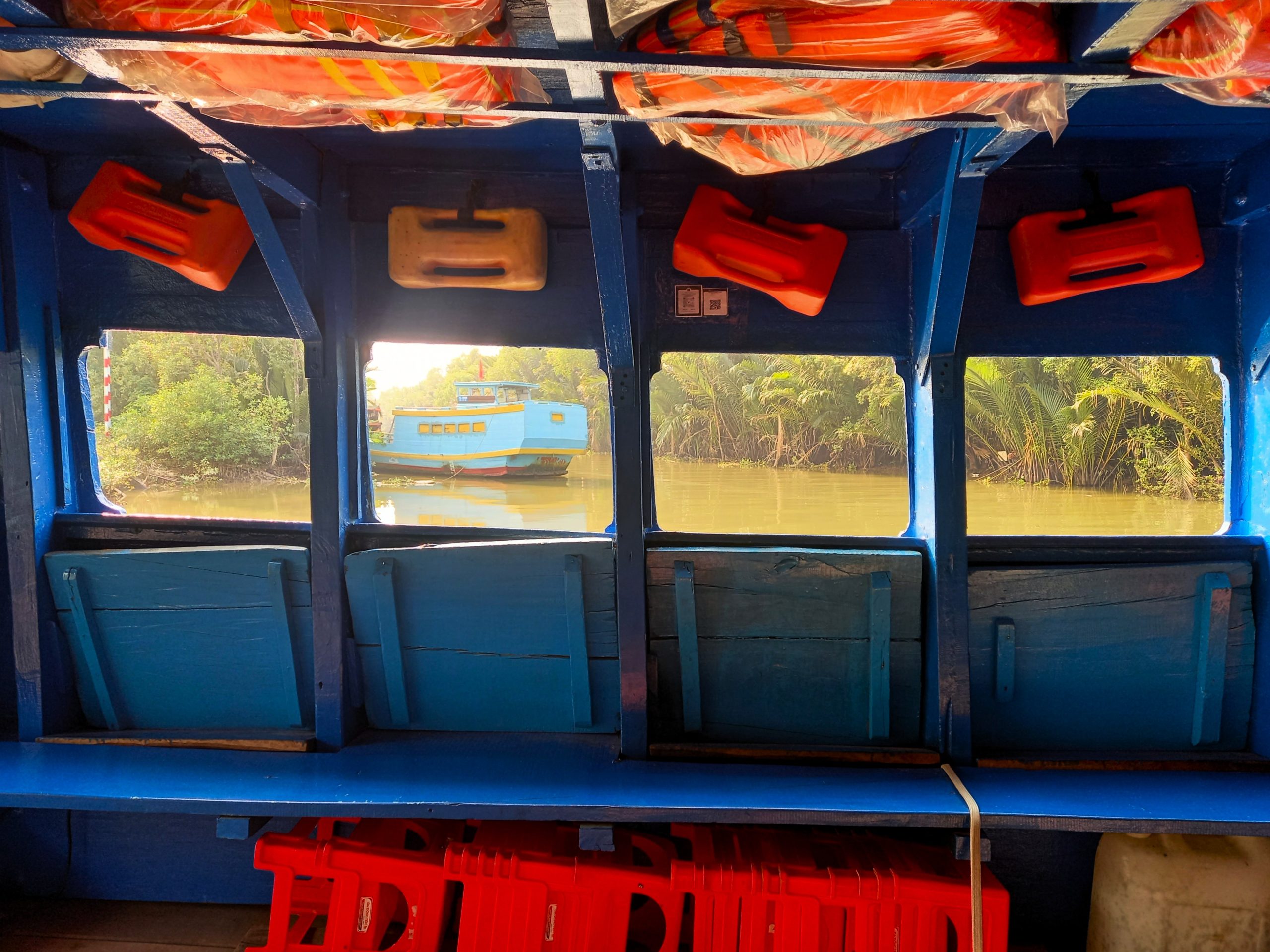
The vessels used on this ferry route are not the usual roll-on/roll-off steel hulks that you find on most river crossings in the Mekong Delta. Instead, the ferries on the Lý Nhơn→Gia Thuận route are narrow wooden fishing boats with an exposed bow where the vehicles are parked and a covered stern where the passengers are seated. Roughly 10-15 metres in length and only wide enough to fit two motorbikes end to end, the ferries can accommodate between 30-40 vehicles and passengers. There are plenty of life vests stored on board and, although the ambience is extremely relaxed and informal, the boat staff (a few youngish men) appear to be very organized and efficient. Being on a boat like this is far more exciting than travelling on the usual car ferries: you can sit right up on the prow, feeling the wind and the wash on your skin as the boat drifts further out onto the wide river. Seating is on wooden benches, but if it’s a busy sailing, you’re more likely to be standing on deck or sitting on your motorbike saddle. There’s no toilet on board so bear that in mind for the 20-30-minute voyage.
The Voyage:
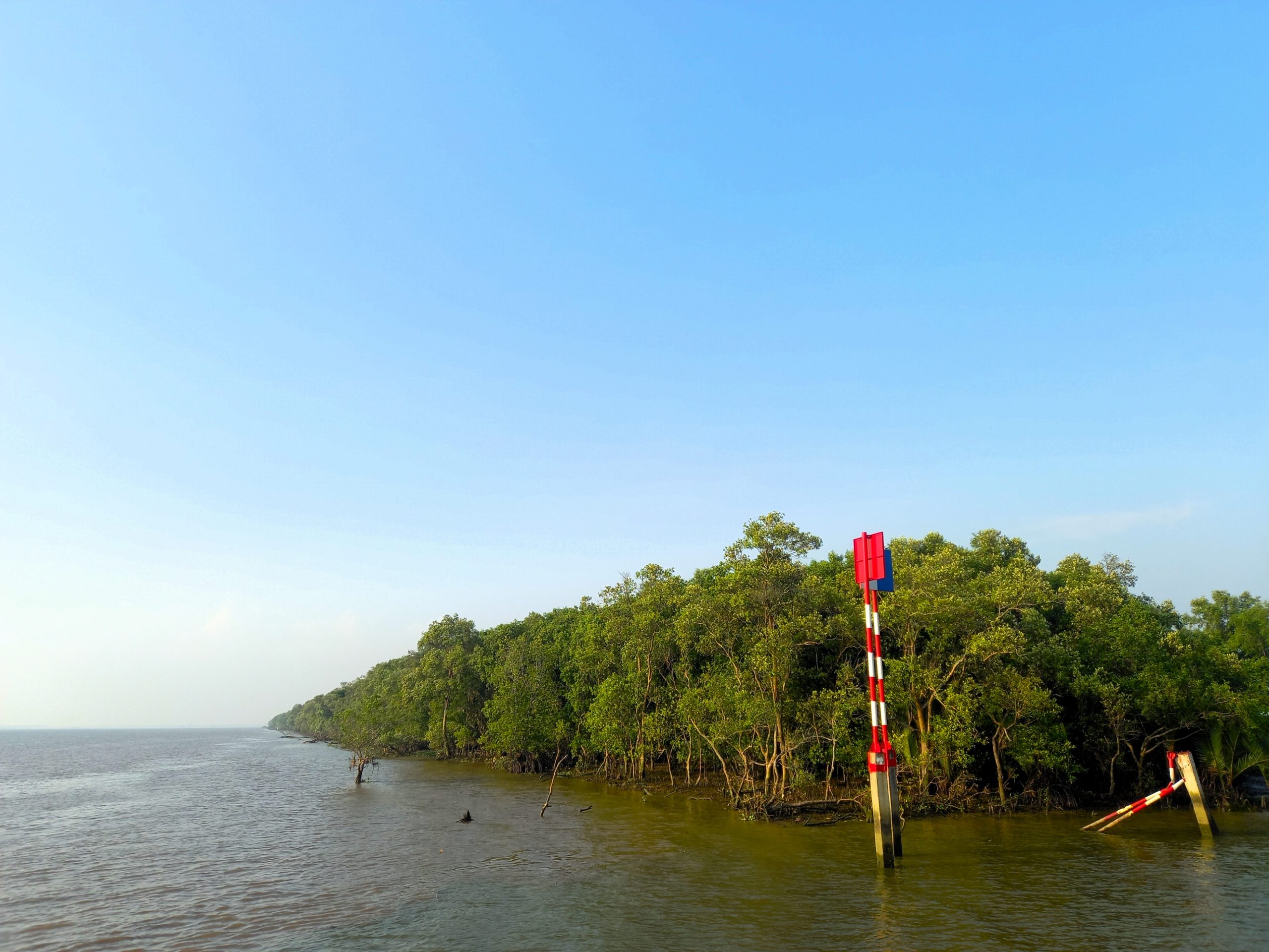
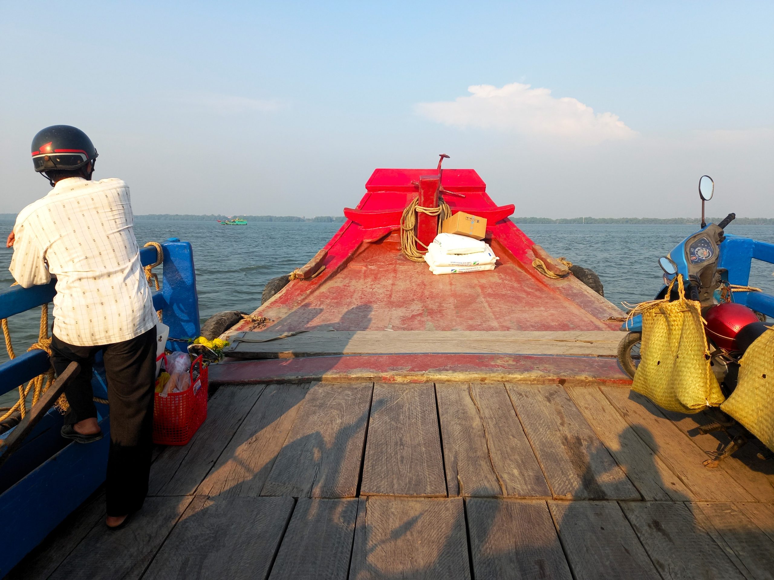
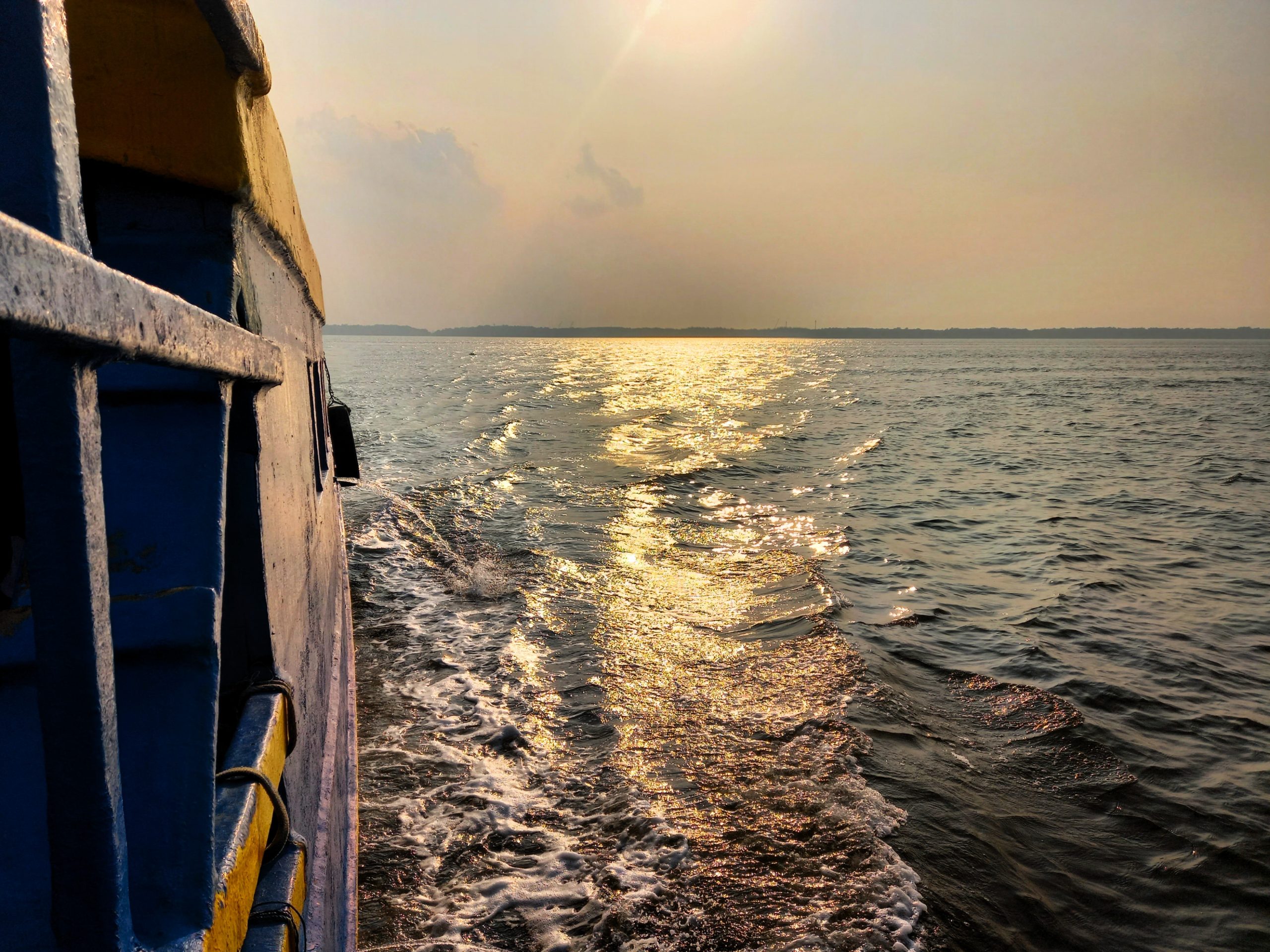
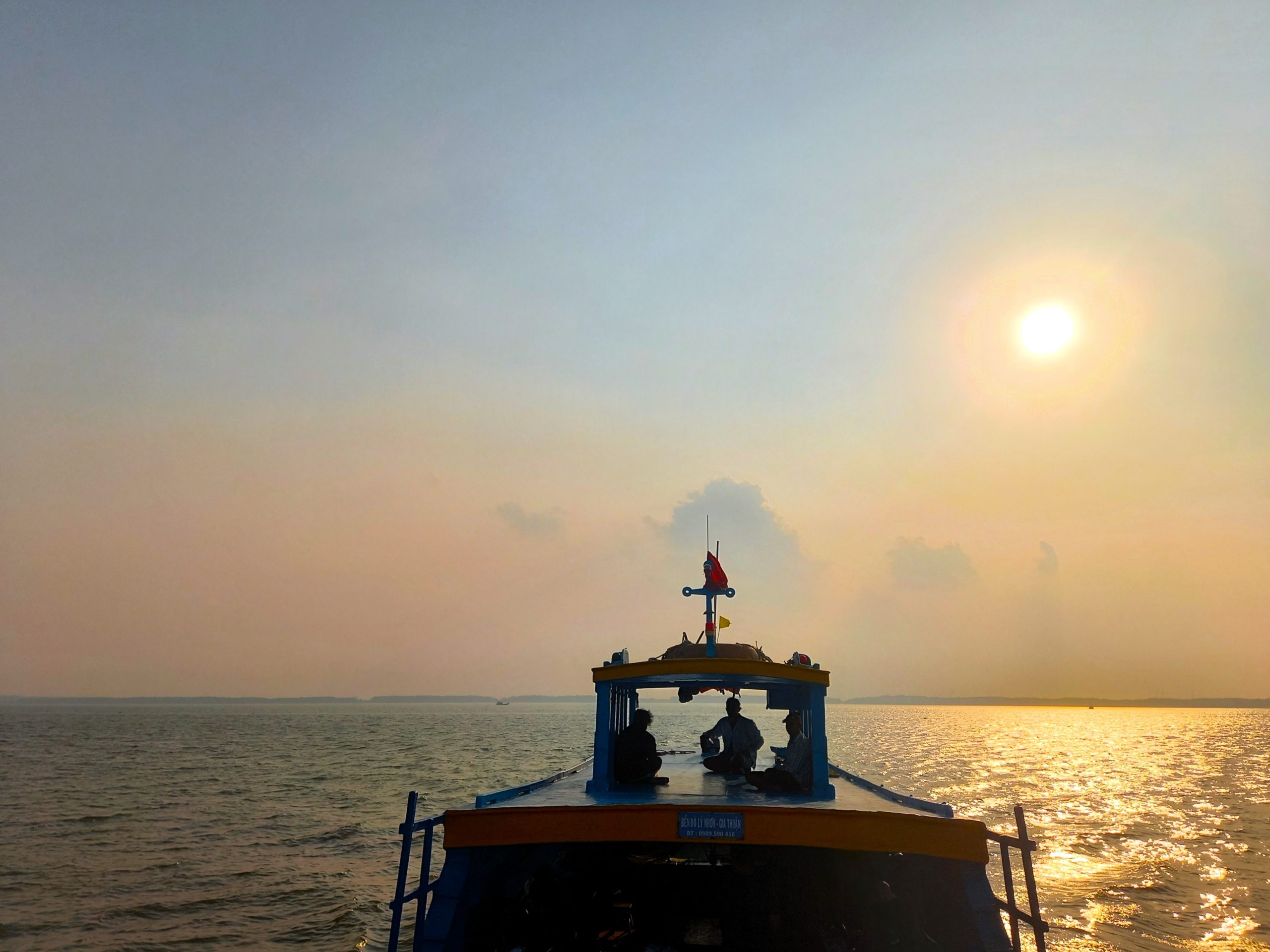
Slowly navigating the narrow channel between nypa palm-lined banks, the ferry sheepishly backs away from port before reaching the wide expanse of the Nhà Bè River. Emerging from the dense mangroves, the wind hits the vessel as it slices through the ruffled brackish water towards the opposite bank. The river is so wide here – not far from emptying into the East Sea – that it feels more like an ocean voyage than a river crossing. Weaving between cargo barges and freight liners, the ferry hums across the water in a surprisingly quick and serene manner. Passengers hide from the sun beneath the covered stern or brave the elements on deck when in need of a cigarette. The air out in the middle of the waterway is fresh, wholesome and invigorating and the breeze makes the temperatures mild and manageable. Somewhere during the voyage the ferry crosses the invisible border separating Ho Chi Minh City from Đồng Tháp Province, but out here it all feels like the Mekong Delta: sun, sky, water and green, tropical foliage. A wall of mangrove hides the channel of entry to the destination port. Engines cut, silence fills the air, the heat comes back and passengers jostle for space to disembark and continue their journey.
❤️Like this guide? Support Vietnam Coracle with a donation or join my Patreon to help keep this website free & 100% independent. Thank you, Tom
Support My Work
Free | Independent | No Sponsored Content
“Hello, if you enjoy my website, please support it.
Thank you.” Tom
*Disclosure: I never receive payment for anything I write: my content is always free and independent. I’ve written this guide because I want to: I like this ferry and I want my readers to know about it. For more details, see my Disclosure & Disclaimer statements and my About Page


