


First published December 2025 | Words and photos by Martin Misiak | Read time 20 minutes | 4 comments

Martin Misiak is a veteran science teacher born in New York City but based in Saigon (Ho Chi Minh City) since 2019. He grew up moving frequently, shaping his appreciation of history, travel and diverse cultures. An active meddler in analog everything – from cars and motorcycles to cameras – his photos and writing have featured in a variety of online magazines. Having visited most of Vietnam’s iconic sites, he now looks forward to discovering lesser-known destinations, aspiring to do them justice in pictures and prose.
Wild & Green Biosphere Reserve on Ho Chi Minh City’s Doorstep
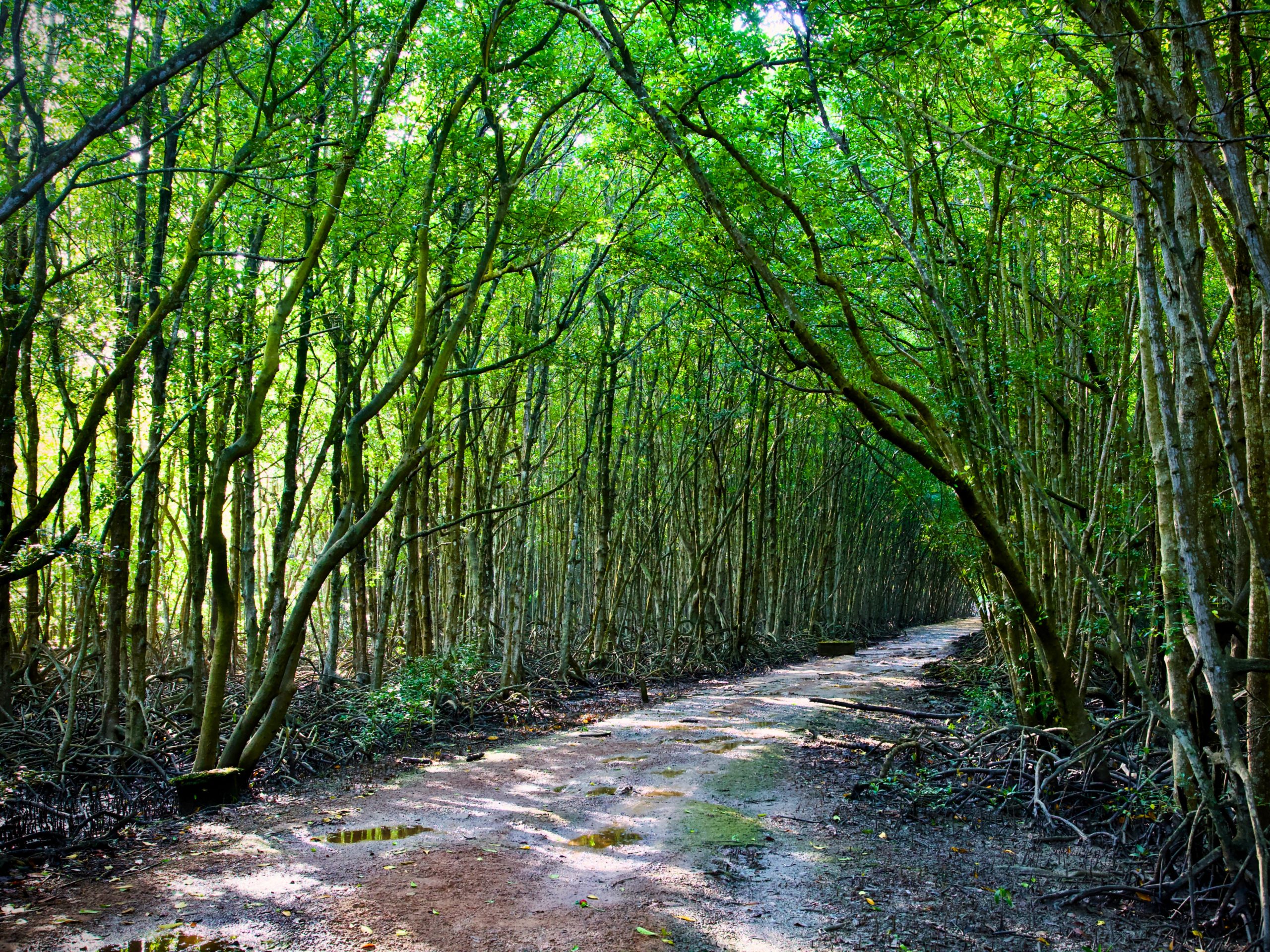
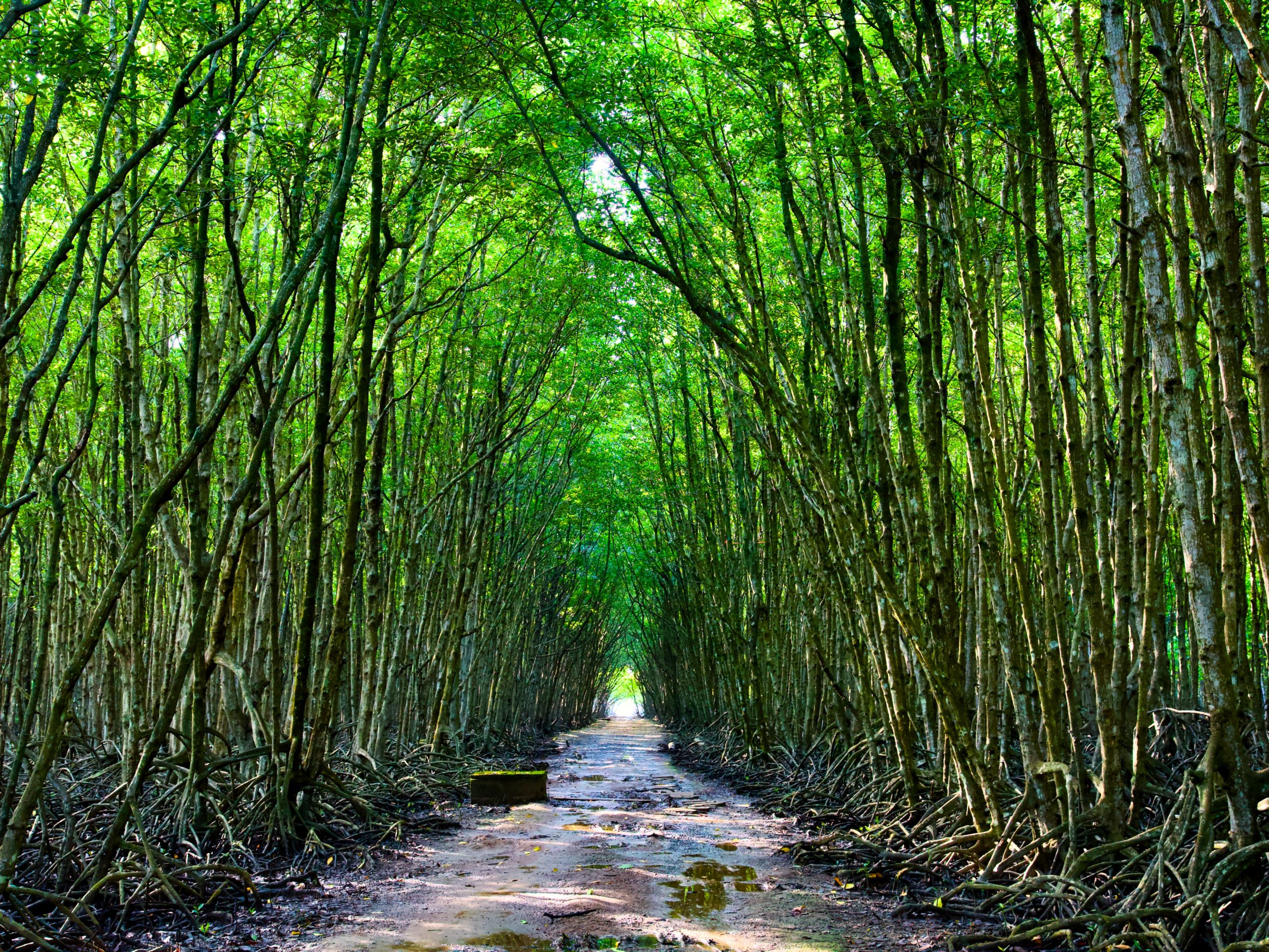
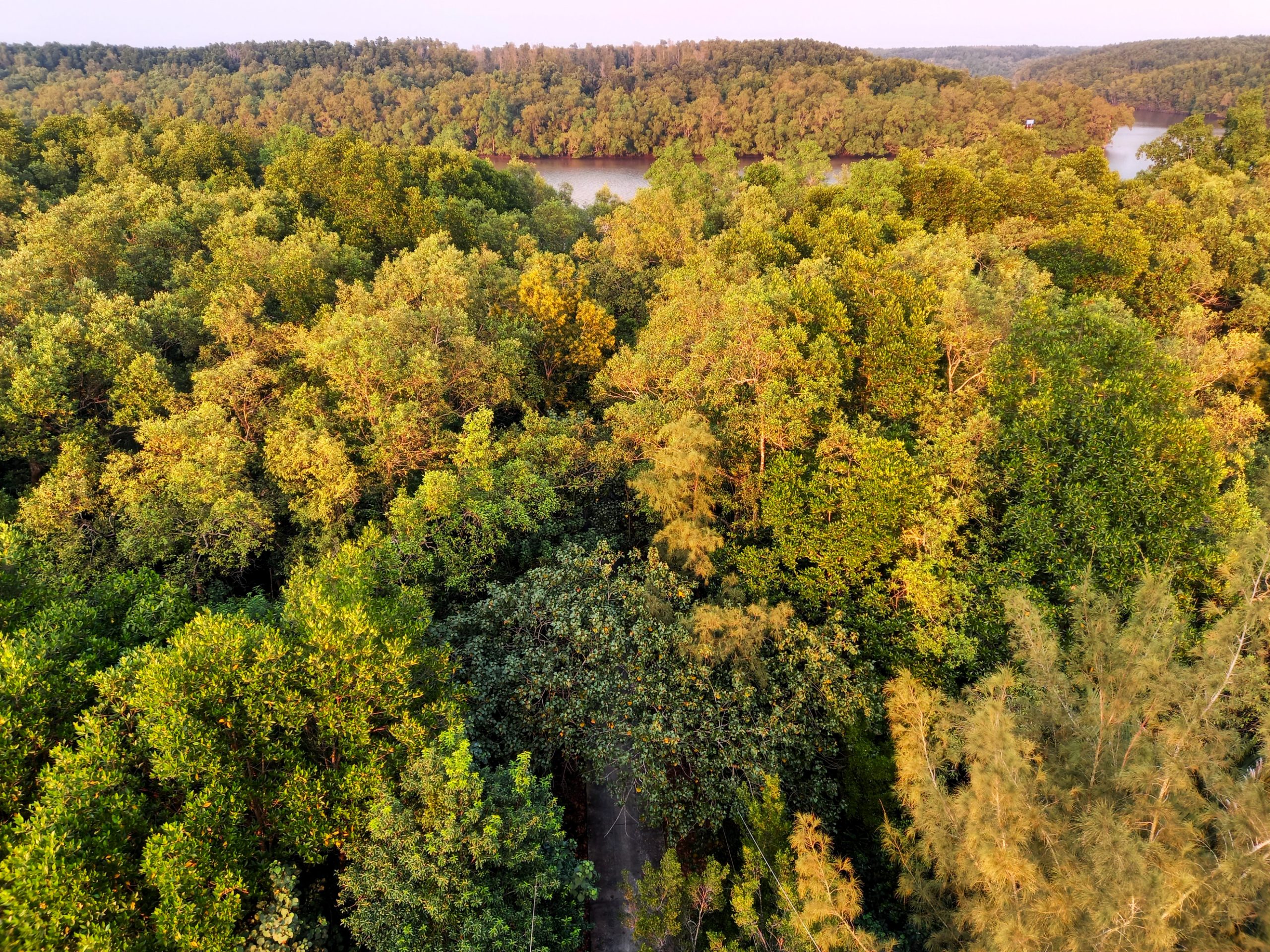
Select the satellite view on Google Maps and you’ll see a conspicuous, dark green patch just southeast of the grey urban sprawl of Ho Chi Minh City (Saigon). This is Cần Giờ Biosphere Reserve, an alluvial peninsula dominated by a vast mangrove forest interwoven with rivers and tributaries, leading all the way to the East Sea. Variously known as the “Lungs of Saigon” or the “Forest of Assassins” – depending upon whom you ask and which aspect of the area and its history they want to accentuate – Cần Giờ is the closest true wilderness to Ho Chi Minh City. Thanks to the Rừng Sác Road, a thread of smooth asphalt bisecting the peninsula from east to west, Cần Giờ is also the easiest, quickest and most enjoyable road trip getaway from the southern metropolis, taking you from the dusty, loud and congested chaos of downtown Ho Chi Minh City to the green, serene canopy and earth-scented air of the peninsula in just an hour. There are forest trails and observation towers, wildlife and war relics, boat trips and kayaking, fishing villages and delicious seafood.

Support My Site
Free | Independent | No Sponsored Content
“Hello, if you enjoy my website, please support it.
Thank you.” Tom
[Back Top]
THE GUIDE:
How to Explore Cần Giờ Forest & the Rừng Sác Road
Cần Giờ can be visited year-round. However hot it might be in the city during the dry season (November-April), Cần Giờ is several degrees cooler and offers abundant shade under the boughs of trees. During the rainy season (May-October), Cần Giờ experiences heavy downpours, but the forest is thicker and greener than at any other time and the sea breezes are refreshing. Although Cần Giờ is perfect for a weekend escape from Ho Chi Minh City, if possible try to avoid visiting on Saturday and Sunday because this is when the peninsula is at its busiest. By contrast, from Monday to Friday Cần Giờ and the Rừng Sác Road are virtually deserted. Click from the contents below to navigate this guide. (See Related Posts for more guides like this, and if you enjoy Vietnam Coracle, please support it with a donation or join my Patreon community)

Contents:
🗺️ Map
🌳 Cần Giờ Forest & Rừng Sác Road
📷 See & Do
🛌 Sleep
❤️If you like this guide, please support Vietnam Coracle with a donation or become a member of my Patreon community or purchase an Offline Guide & Map. This website relies on reader support to maintain its independence & quality. Thank you, Tom
MAP:
Cần Giờ Forest & Rừng Sác Road
Cần Giờ Forest & Rừng Sác Road:
Cần Giờ:
‘Forest of Assassins’: Cần Giờ is technically a “coastal suburban district” of Ho Chi Minh City, but you’d never guess that when driving through it: the peninsula is blanketed in forest and barely populated. There are several reasons for this. Firstly, the land is naturally challenging to access and difficult to tame for agricultural use. Also, as a result of more than a century of Western adventurism and colonialism, the region became a hotbed of conflict, guerilla activity and military resistance – hence the moniker “Forest of Assassins”. Right up until the early 1970’s, Cần Giờ was the site of the secret Chiến Khu Rừng Sác (Rừng Sác Resistance Base), which you can still visit today (see below).
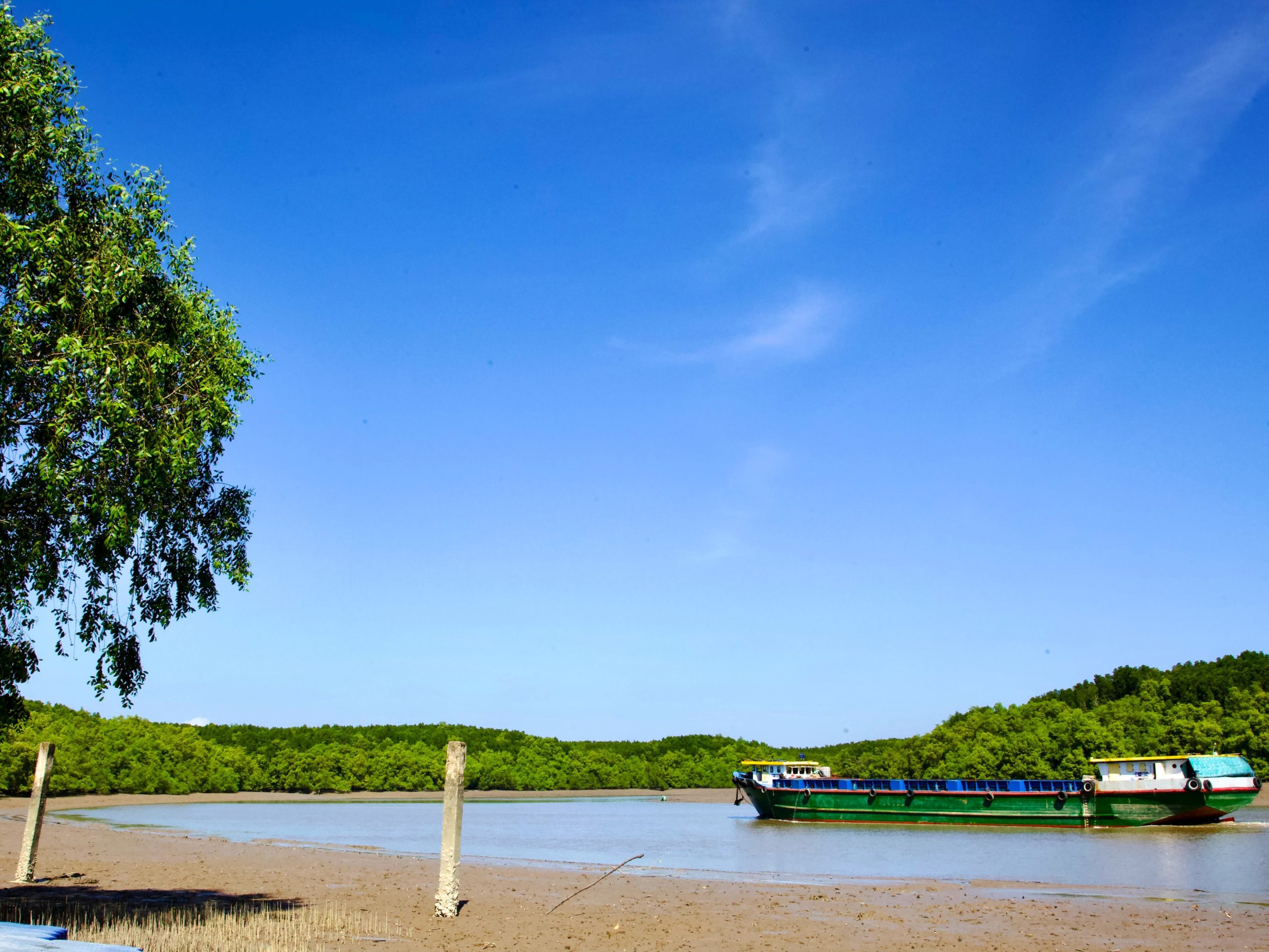
‘Lungs of Saigon’: In 2000, Cần Giờ was designated a Biosphere Reserve by UNESCO; not only for its biodiversity, but also because the area is both ecologically valuable and extremely vulnerable. The entire peninsula is a barely solid tract of land – a patchwork of mangrove swamps, wetlands, salt marshes, mud flats and sea grasses extending 60km southeast of Ho Chi Minh City, jutting out into the East Sea. The mangroves serve as storm barriers, natural soil and water filters, and erosion control mechanisms. This has prohibited new development and halted the urban sprawl creeping down from the southern metropolis…..until recently.

No More Beach: In 2025, construction began on an enormous new entertainment, residential and port development stretching along the length of Cần Giờ’s southern coast. Run by Vingroup, Vietnam’s largest private conglomerate, the project will take years to complete and is likely to transform the area beyond recognition. Cần Giờ beach, once a main attraction, is no longer accessible. In fact, it doesn’t even exist anymore. The entire southern shore has been blocked off with a blue, metal barrier behind which scores of cranes point in every direction and construction vehicles rumble day and night, belching smoke and dumping tons of sand as Vingroup systematically ‘reclaims’ land from the sea, laying the foundations on which to build their new development. The project, Vinhomes Green Paradise, is vast. Sadly, the many businesses along the coast – campgrounds, restaurants, homestays – that relied on their beachside location for their livelihoods have been cut off and are now withering away.
Rừng Sác Road:
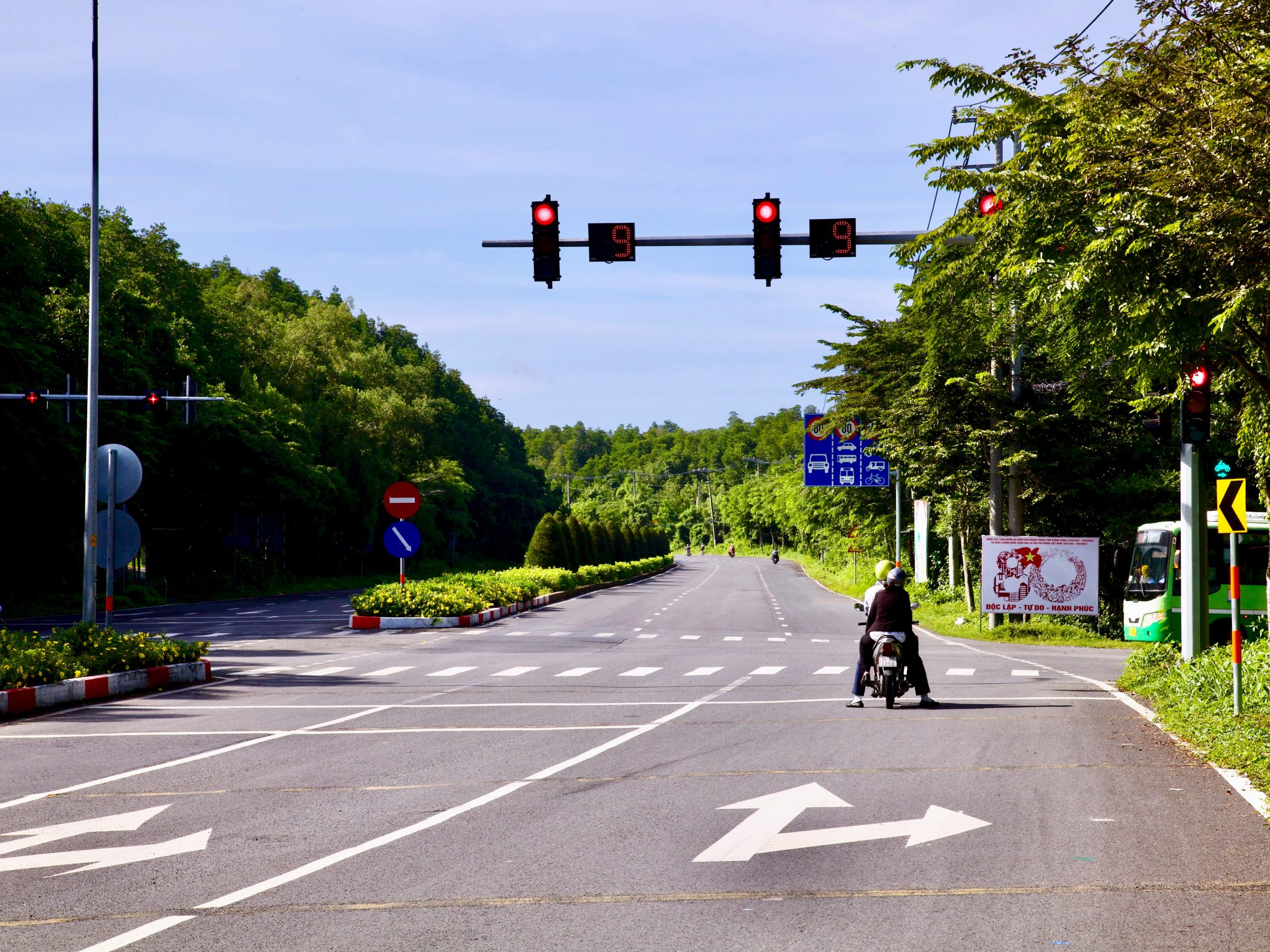
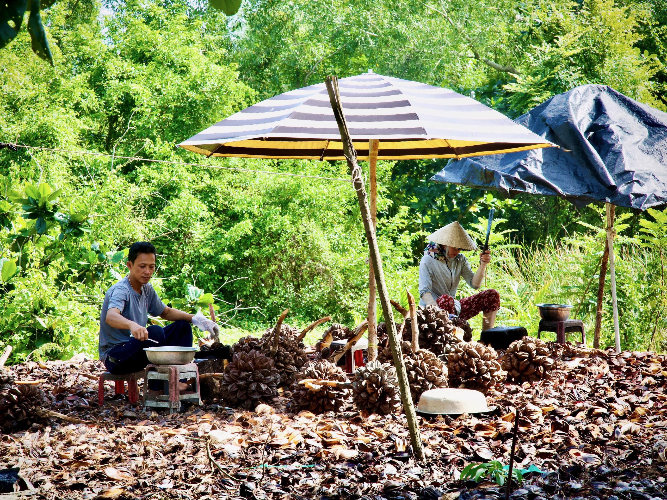
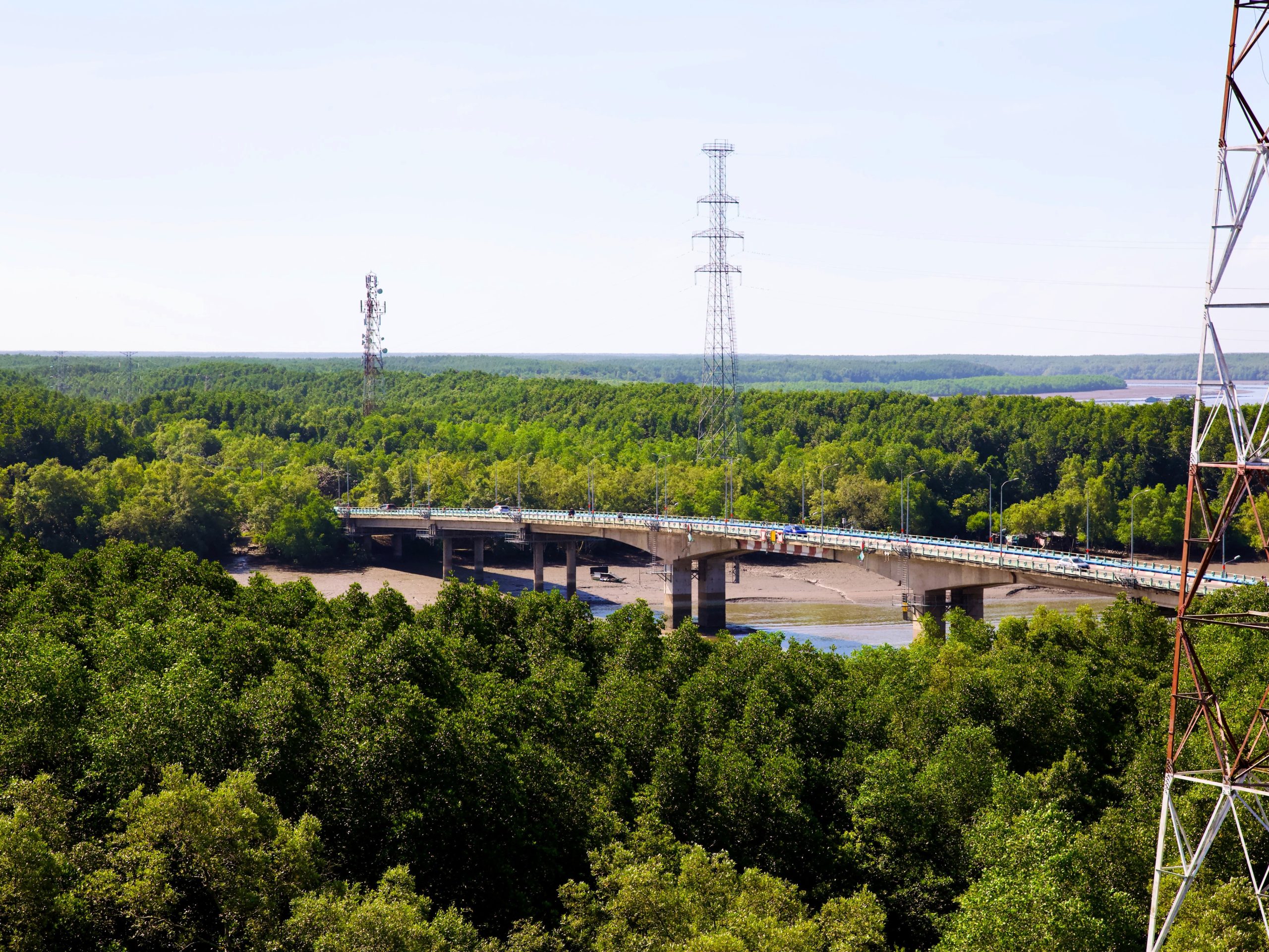
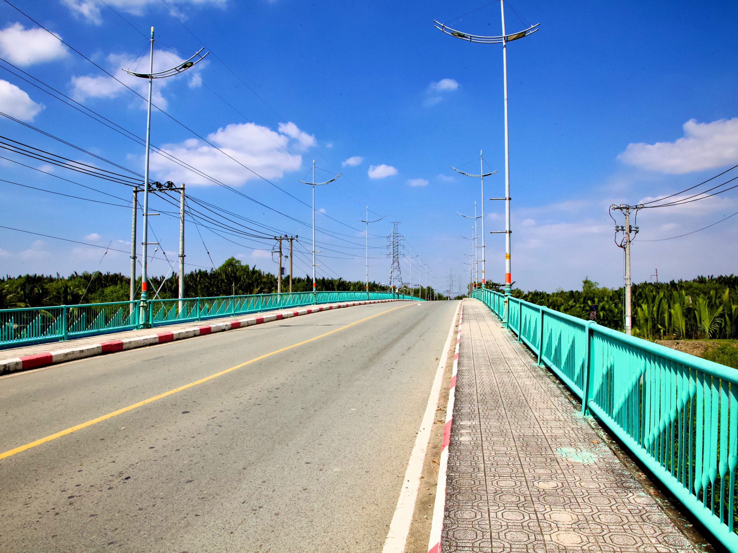
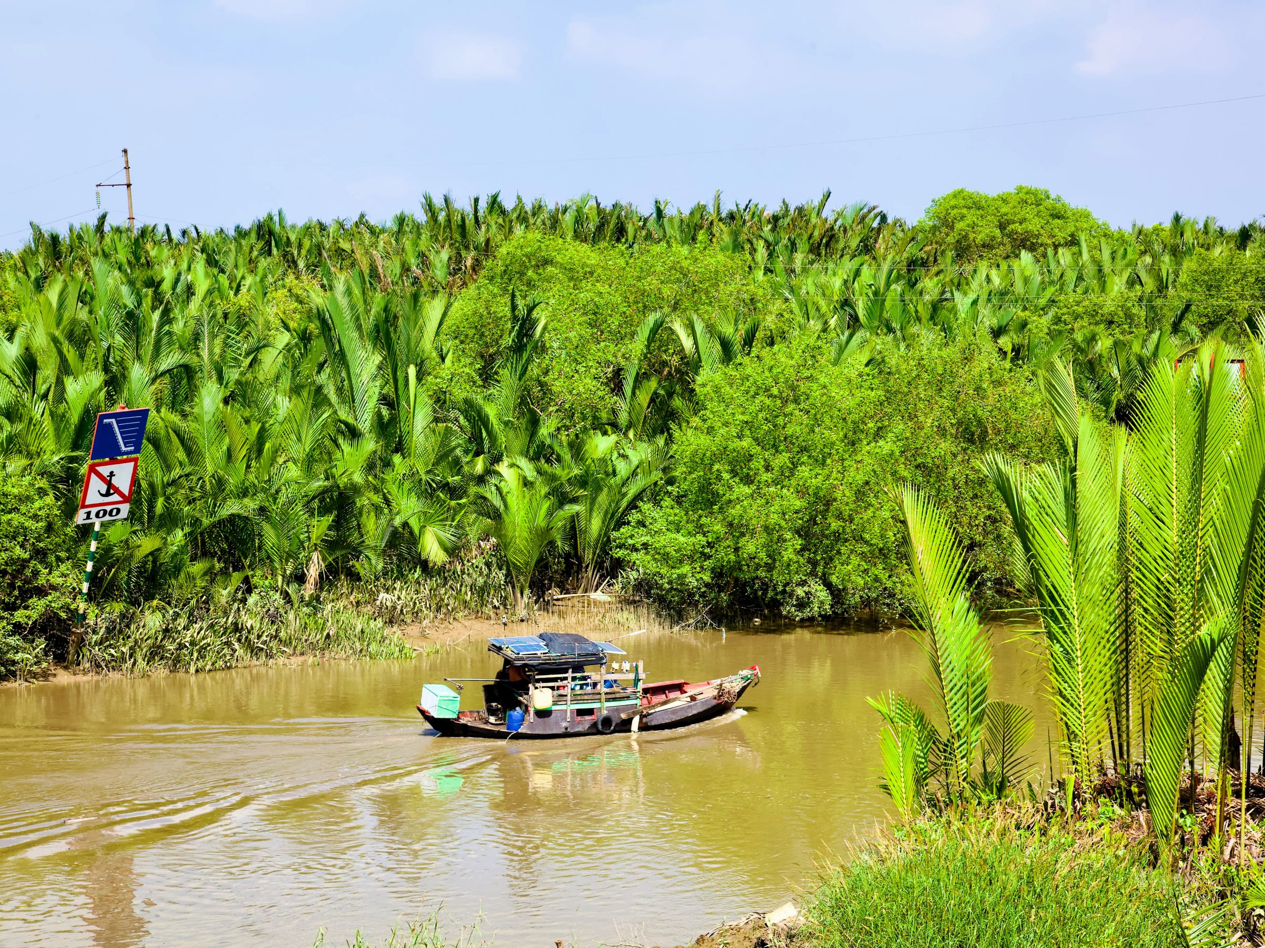
Joy Ride: An inviting, black, freshly-paved road that unfurls upon the landscape like a dropped ribbon, the Rừng Sác Road is a joy to ride on two wheels. Indeed, the road itself and the pleasure of riding it is one of Cần Giờ’s major attractions. The road stretches 37km, starting after the Bình Khánh ferry crossing and ending near Cần Giờ Coffee – a favorite meetup spot for cyclists, motorbikers, birders, photographers and locals alike. This rural route is delightfully deserted as it ploughs through acres upon acres of dense mangrove forest. Stop as often and wherever you like to take in a lungful of fresh air, tinged with a trace of salt from the not-too-distant ocean. The roadside is randomly dotted with vendors selling everything from crabs, turtles and frogs to more immediately consumable fare like coconut water (nước dừa), nypa palm fruit (dừa nước), sugarcane juice (nước mía), and other delights that will relieve and refresh the dusty rider.
The Everglades of Vietnam: Having spent many years between Florida and New York City, Cần Giờ and the Rừng Sác Road feel strangely familiar to me. Ho Chi Minh City has the cosmopolitan swag and action of New York, while the Rừng Sác Road – cutting through the heart of Cần Giờ’s swampy wilderness – resembles Florida’s Alligator Alley bisecting the Everglades. To complete the metaphor, following the Rừng Sác Road to its end at Cần Thạnh will take you to the vehicle ferry to Vũng Tàu – the “Coney Island” of Ho Chi Minh – a buzzing coastal city that’s a local favorite for seafood-fueled weekend getaways.
❤️Like this guide? Support Vietnam Coracle with a donation or join my Patreon to help keep this website free & 100% independent. Thank you, Tom

See & Do:
❤️Like this guide? Support Vietnam Coracle with a donation or join my Patreon to help keep this website free & 100% independent. Thank you, Tom
There’s no shortage of things to keep you occupied on Cần Giờ peninsula: from kayaking to cycling, visiting former resistance bases to climbing forest observation towers, wandering local villages to hunting down mysterious archaeological sites. Below is just a selection of some of the activities on offer and sights to see. (Note that, thanks to the ongoing biblical-scale development of the Vinhomes project, the beach that once made up Cần Giờ’s southern coastline is no longer accessible. Indeed, it’s currently nothing more than an enormous construction site.)
Ride/Cycle the Rừng Sác Road [MAP]
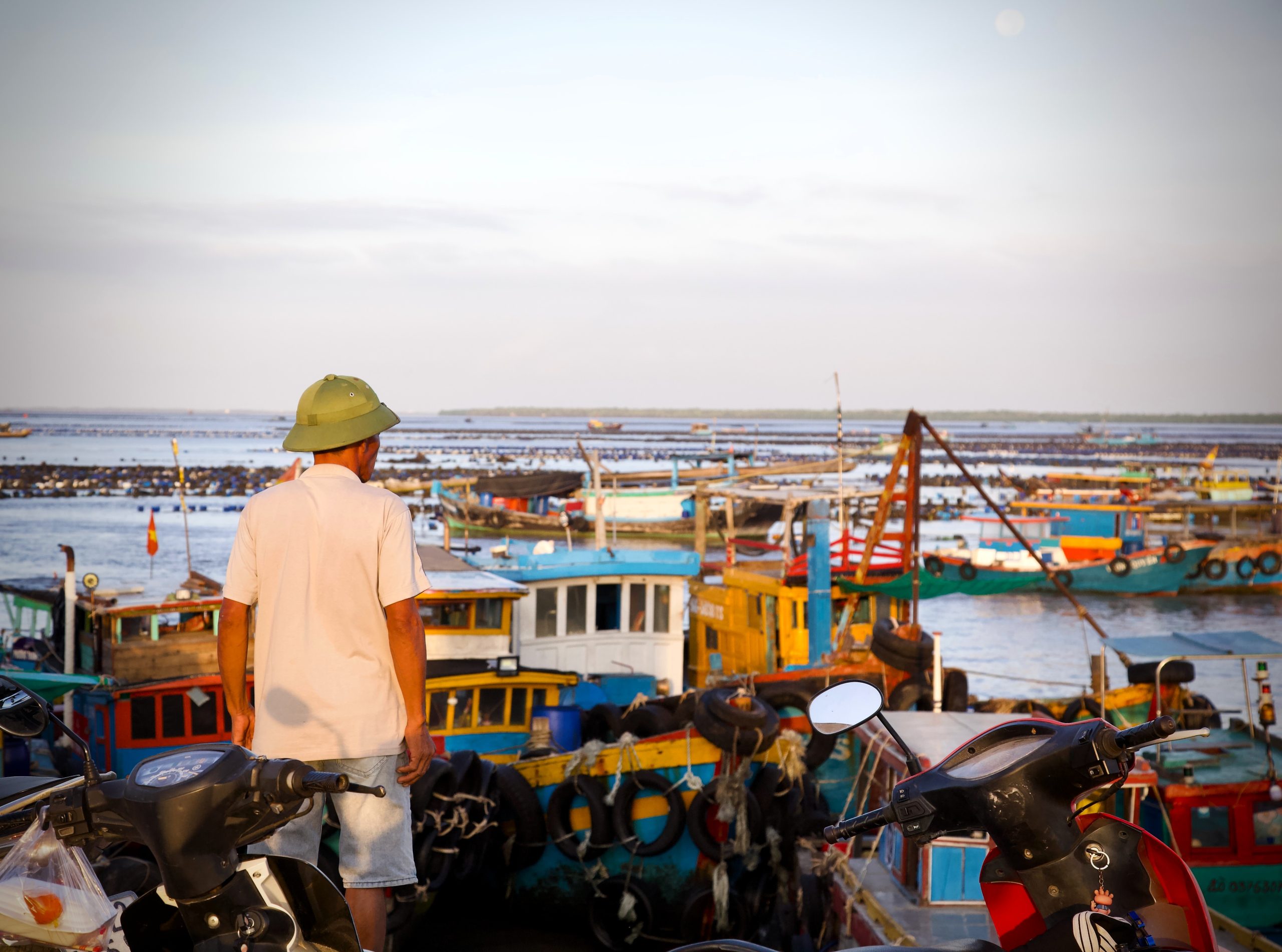
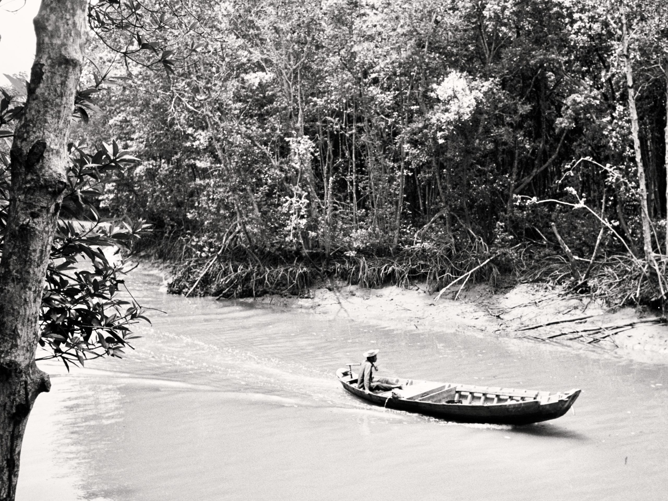
The best way to get acquainted with Cần Giờ’s terrain and topography is to ride a motorbike or bicycle the length of the Rừng Sác Road (the red line on my map). The ride is largely litter-free and balanced by an immaculate, well-landscaped median – a little human touch that contrasts nicely with the surrounding wilderness. I could scarcely believe my eyes when I first rode it: such a great riding road – and virtually empty to boot! – so close to Ho Chi Minh City. It’s an exhilarating, big-sky ride over mildly undulating countryside, through sparsely populated grasslands and over bridges crossing mangrove swamps fragmented by slowly pulsing channels of brackish water that rises, churns, and falls with the tide. Dart down one or two of the countless, inviting red-dirt roads that break off from the main Rừng Sác Road and disappear into the trees on the horizon. Stop at the top of one of the many bridges to chat with a local angler or take a photo of a lone fishing boat slanted on the muddy, low-tide shore; sip a coconut from the pier of one of the fishing villages at land’s end and get merrily lost as you try to find your way back to the main road.
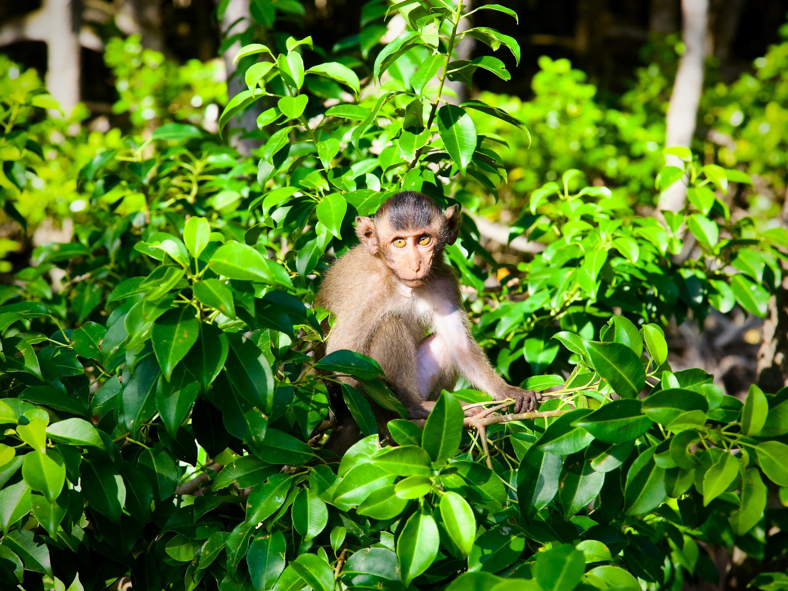
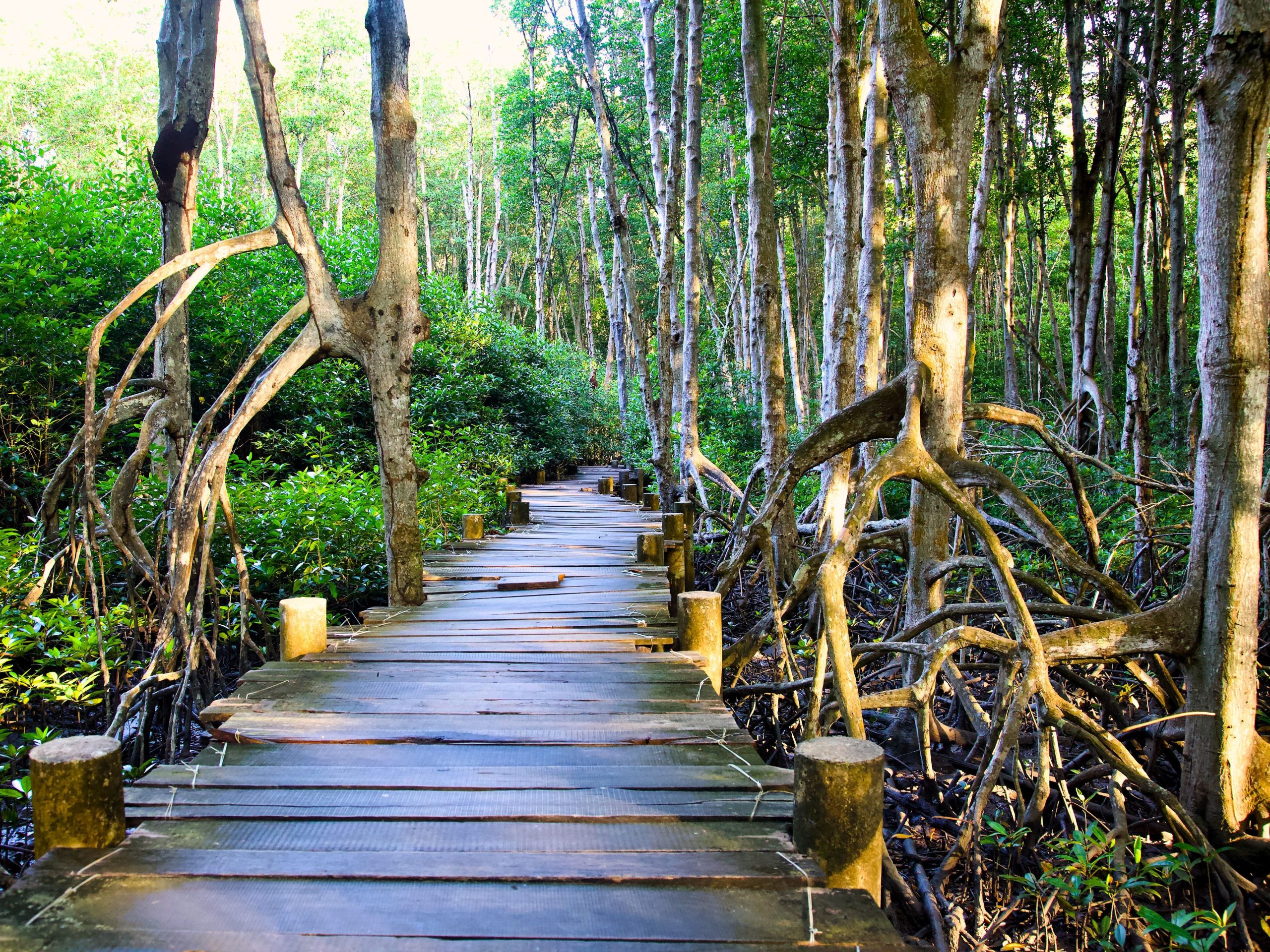
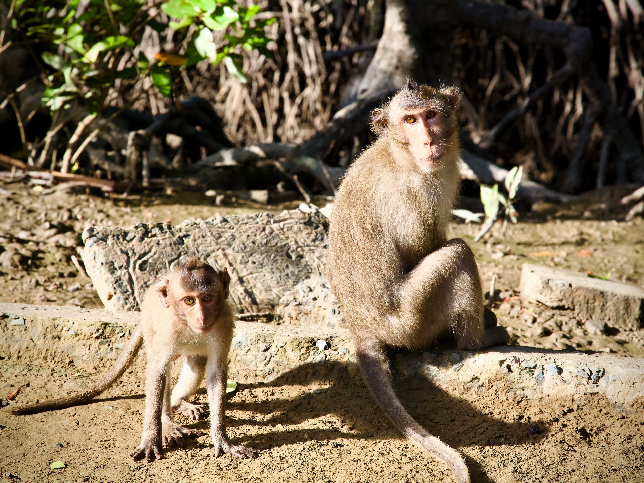
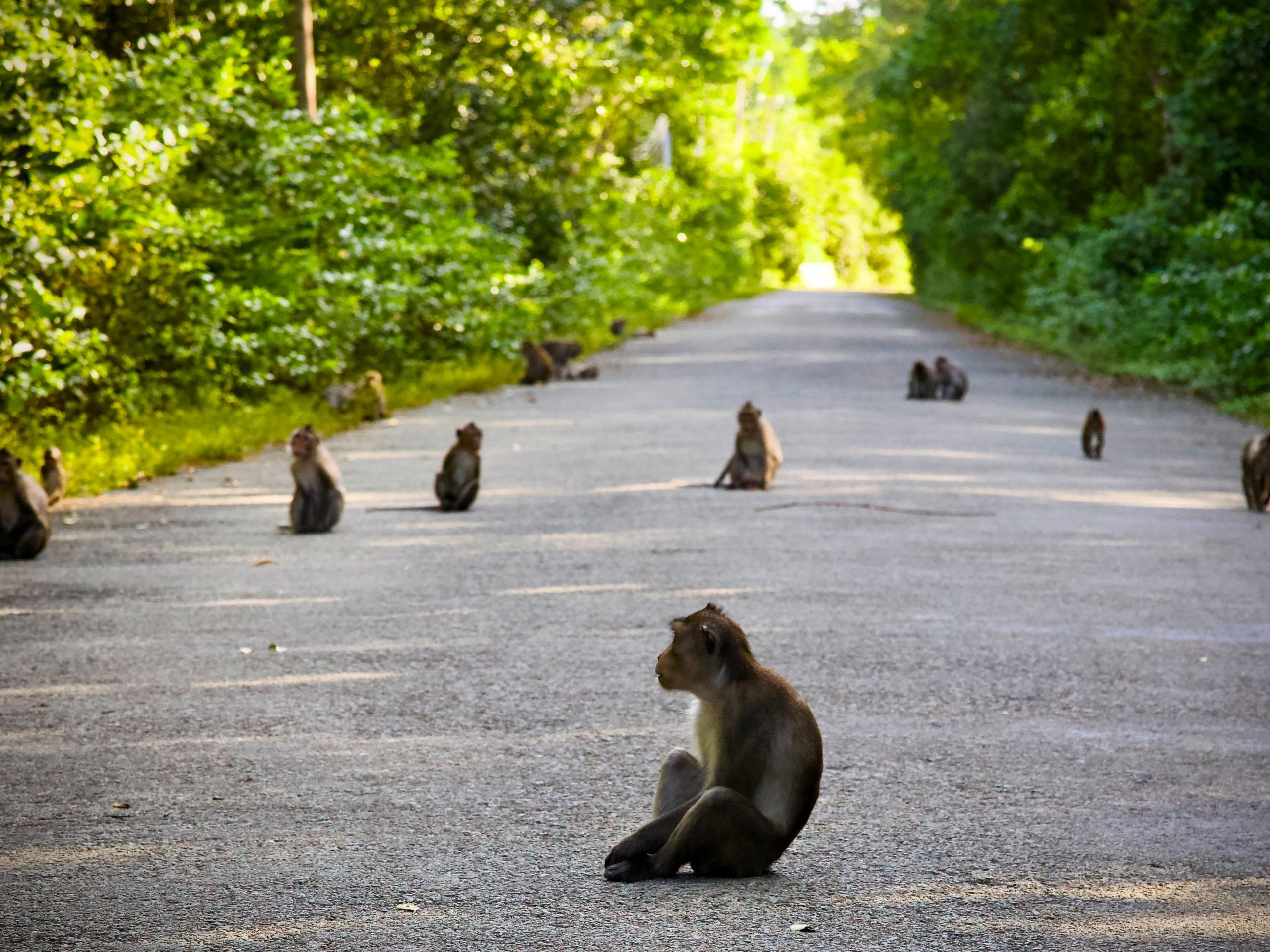
Rừng Sác Resistance Base & Monkey Island [MAP]
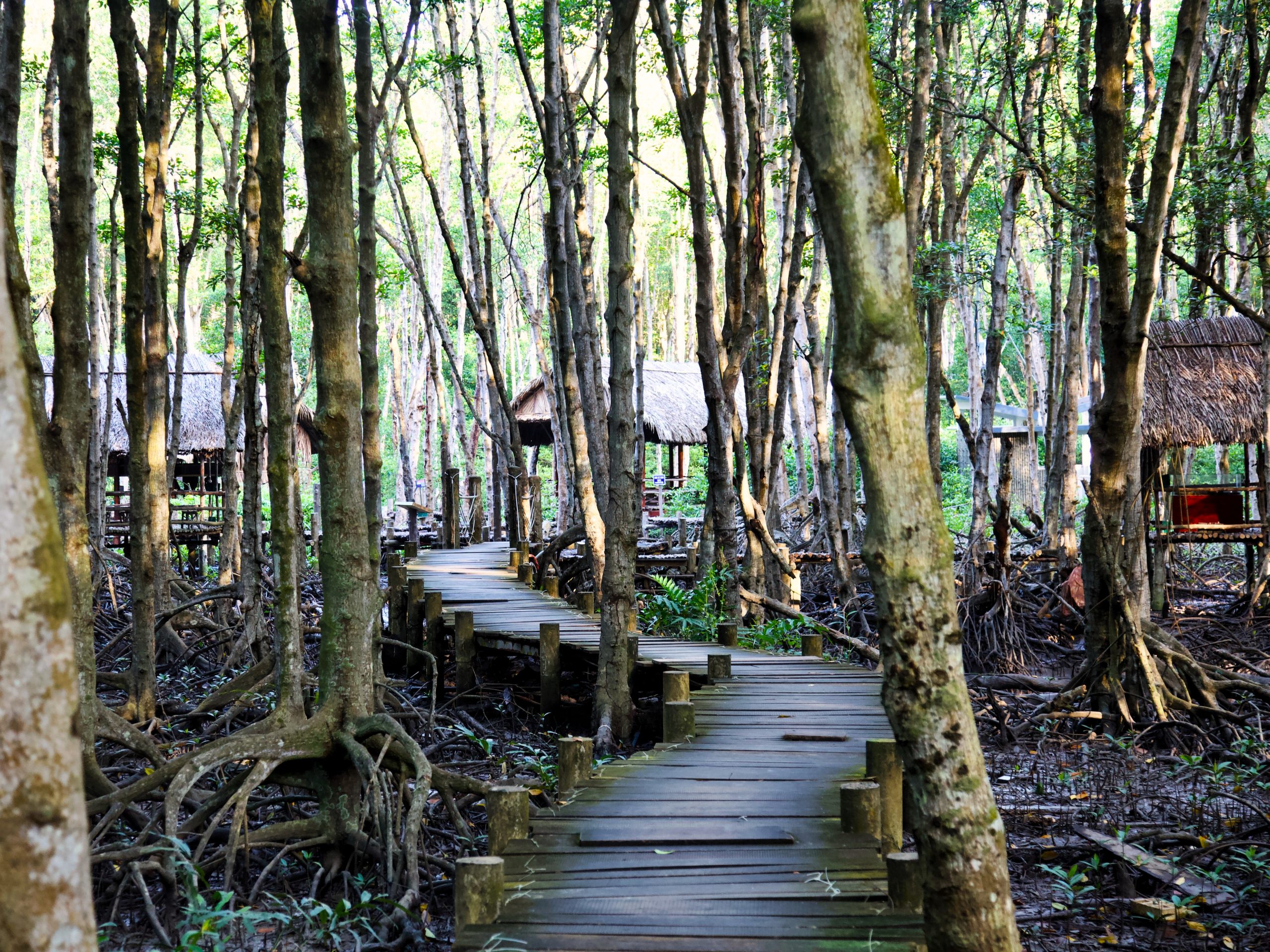
A well-preserved military base comprised of about 20 spartan huts, connected by wooden walkways elevated above the murky waters of a deep swamp, Rừng Sác Resistance Base is regionally well-known and a popular weekend destination for patriotic Vietnamese, veterans and war buffs. Even if you’re not interested in the war history, it’s worth visiting for the atmospheric forest walk (and for the monkeys, too!).
A shuttle takes you from the ticket office (100,000vnđ for foreign visitors, 35,000vnđ for Vietnamese) to the site’s main entrance. There’s also a small 25,000vnđ fee for the shuttle which is good for a round trip, so don’t lose your ticket. From the main entrance it’s a 15-minute walk into the swamp to get to the base; a motorboat will ferry you back to the entrance for a small fee if you don’t want to return on foot.
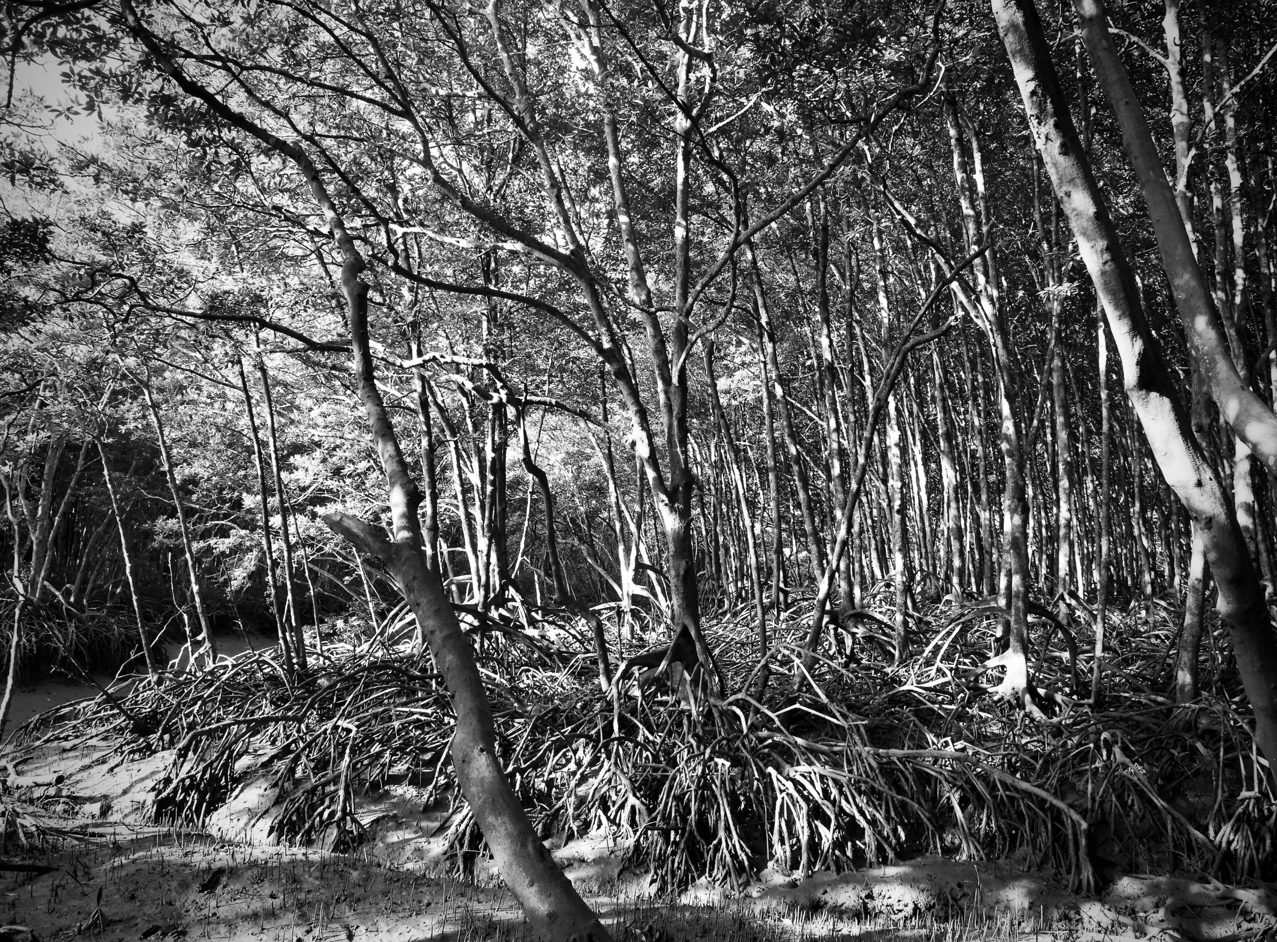
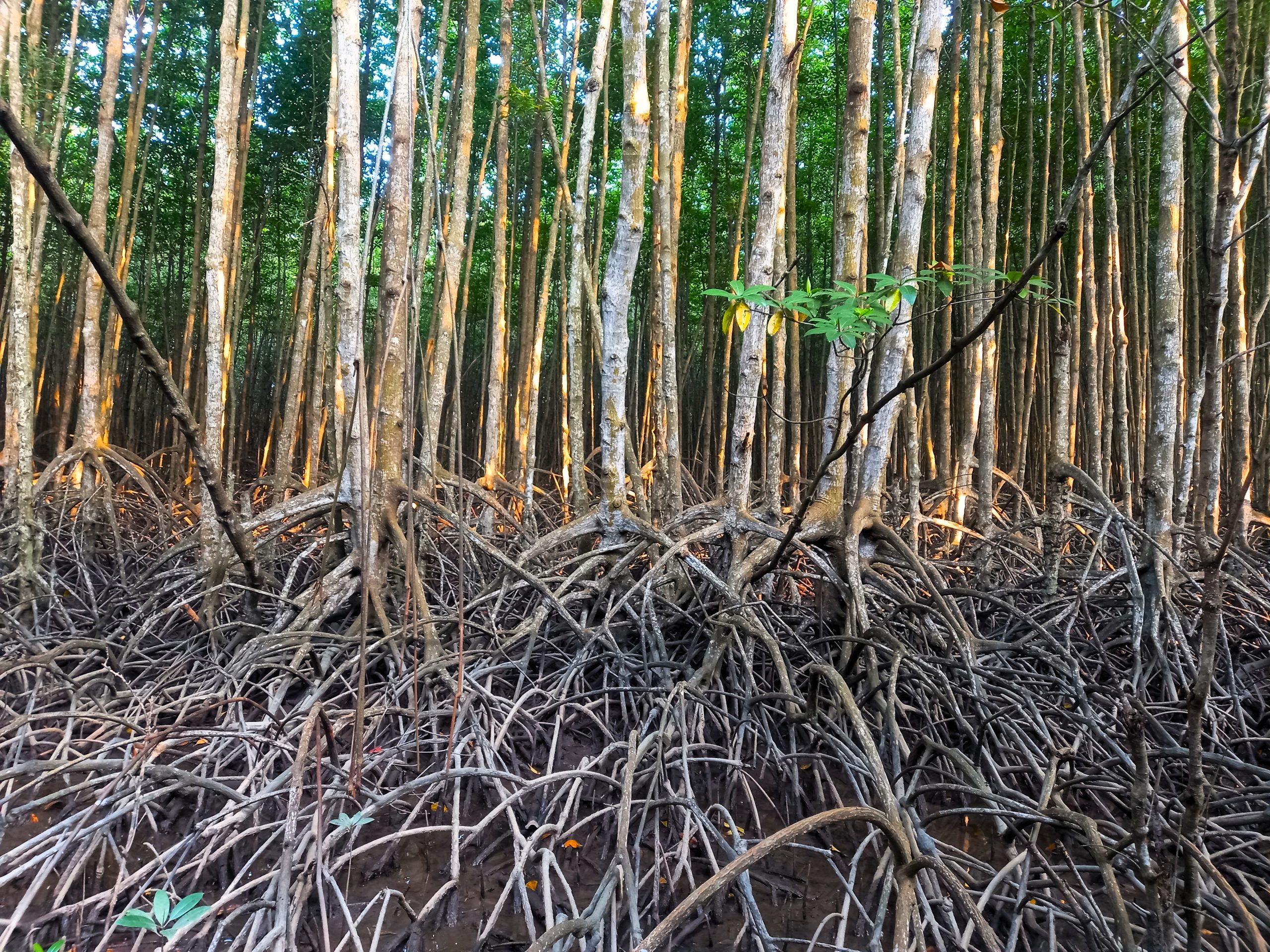
Walking through the mangrove trees to the base can be mystical. Many of the trees appear to be pulling up their own roots from the mud and you wonder if they might begin to walk when you’re not looking. The wooden walkway is unpredictable: watch your step. Some boards are new, some are rotted and they’re all held together with strips of plastic that have obviously been individually hand-tied. Rusty rebar is exposed in places where concrete handrails are crumbling in the moldering swamp. The forest is totally still and silent, except for the sounds of your footsteps and the “ploops”, “pleeps” and “plops” of pistol shrimp in the mud, snapping their claws at prey echoing among the trees.
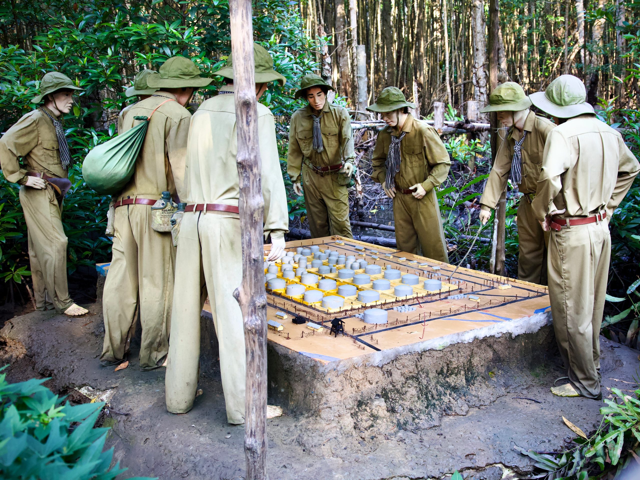
The base features mannequins dressed in various wartime gear and authentic equipment from the period such as weapons, communication devices and medicine. Plaques in Vietnamese and English detail the purpose of each hut and local military lore. For almost a decade, this was the danger-plagued home of the 10th Rừng Sác Special Forces Group – an elite unit of Vietnamese sappers, saboteurs, demolitionists, snipers and assassins who fought the Americans from the shadows of the swamps. Surviving in the heat and humidity of the swamp amongst mosquitoes, snakes and crocodiles, they evaded capture while executing daring raids against the far larger and technologically superior force of the U.S. military. They emerged from these mangroves to destroy U.S supply ships creeping their way up to Saigon along the nearby Lòng Tàu River. It was also from here that the notorious and successful attack on the Nhà Bè fuel depot was executed. There’s a great display detailing how this was done.
Rừng Sác military base opens at 7.00am, but the tour buses and the crowds only begin to arrive around 8.00am. It’s well worth getting here early and having the whole place to yourself, which is a completely different experience. It’s quiet, still and somber, leaving you better able to appreciate what happened here and what this place represents.
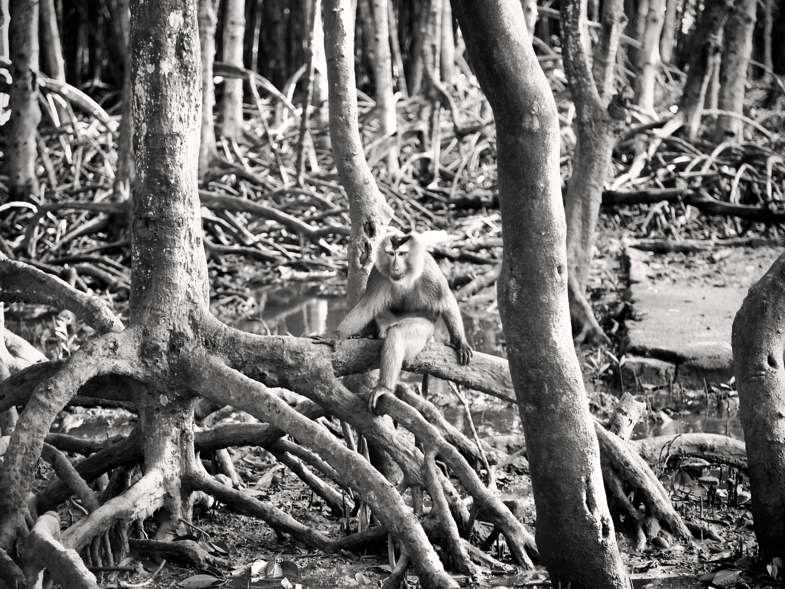
Due to the popularity of the base, other amenities and attractions have sprung up nearby, including a cafe, a crocodile enclosure, and a troop of opportunistic and aggressive macaques. While these free-roaming little monkeys have actually become an attraction unto themselves – known as Đảo Khỉ (Monkey Island) – I would recommend that they be viewed from a safe distance and considered more as a phalanx of goons that needs to be negotiated in order to get to the base. Selfies, feeding and petting are not recommended. Carrying a big stick is.
Bè Nổi Ecotourism (Minh Chiến) [MAP]
One of the few well-organized opportunities for firsthand experience of the local nature is Bè Nổi Ecotourism. Here you can enjoy boat tours, fishing, digging in the mud for your own crabs, and paddleboarding through the labyrinthine channels of the mangroves. If all you want is a fresh seafood meal on their floating restaurant, that can be arranged too. Lodging is also available. Contact Minh Chiến for details, a full menu and prices: +84 0396 120 042.
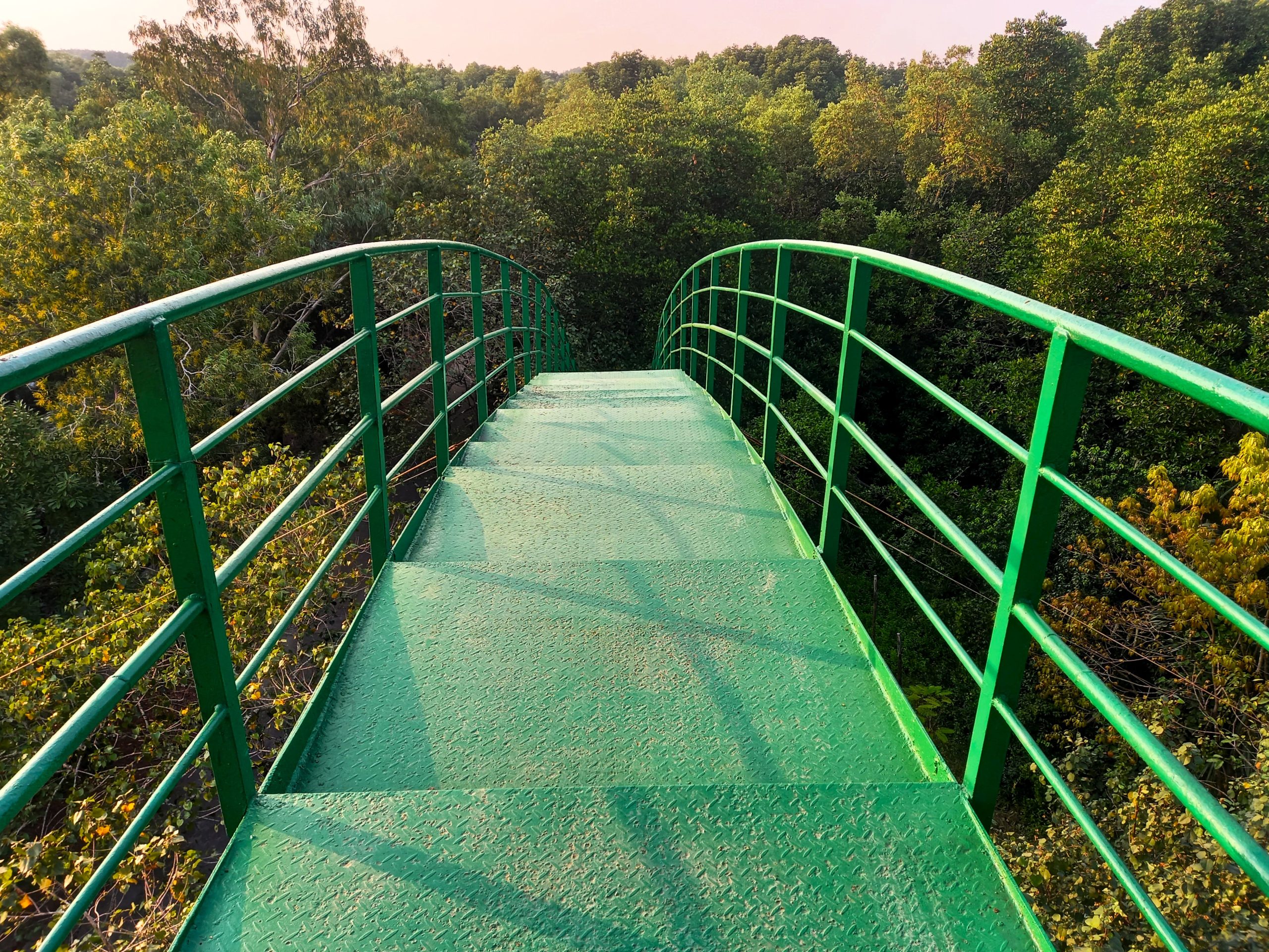
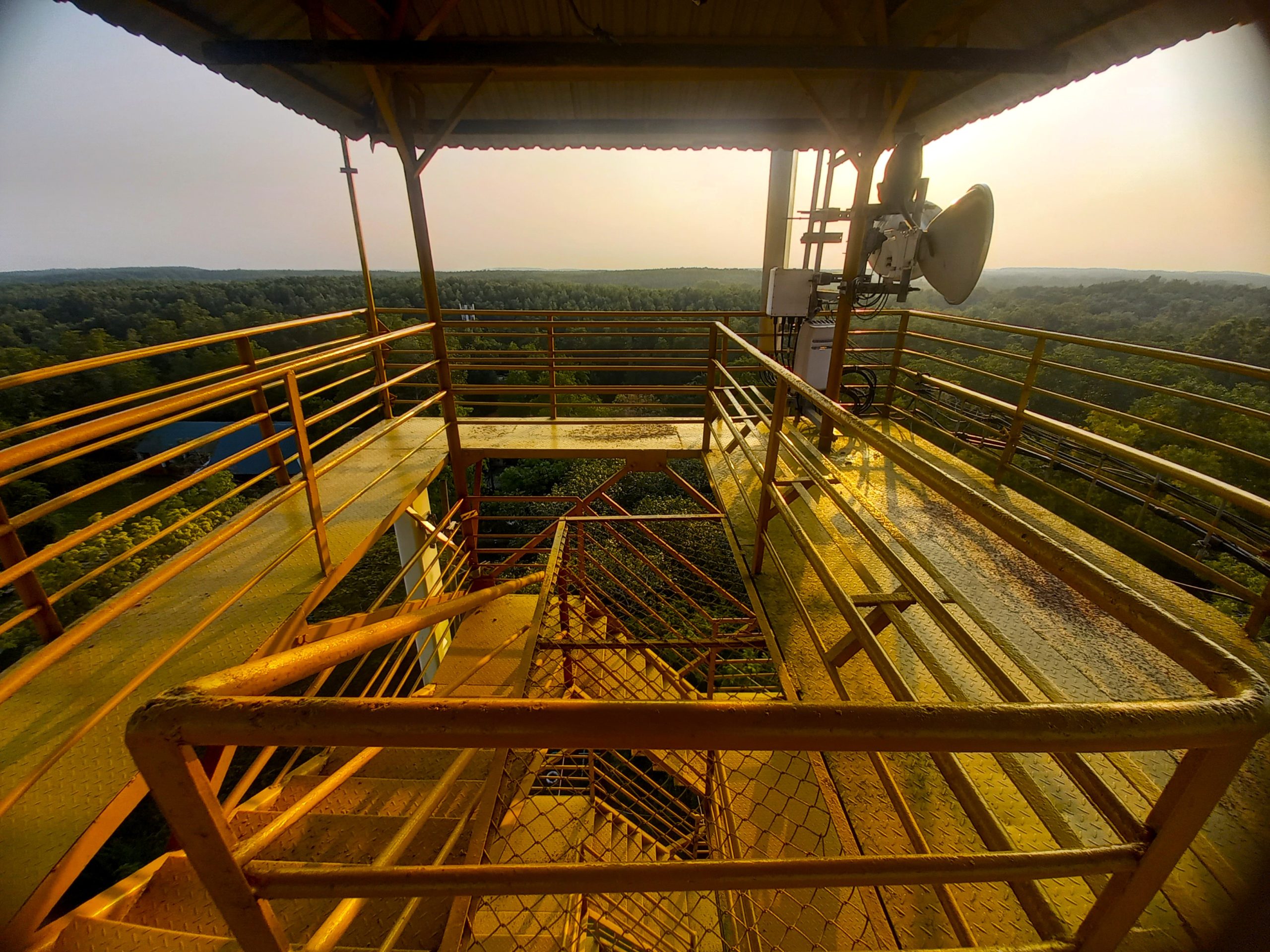
Vàm Sát Observation Towers [MAP]
Detour due west off the Rừng Sác Road for about 15-20 minutes west on a decent road past shrimp farms and salt fields (the blue line on my map) to reach the remote site of Vàm Sát. Formerly an ecotourism site (complete with giant concrete crocodiles around an artificial lake and dozens of real-life monkeys), the site is now largely abandoned, or at least it feels that way if you visit on a weekday. But this is a good thing, because you can climb up either of the site’s two, tall observation towers, both of which afford sensational panoramic views of the surrounding forest and waterways. It’s well worth the detour.
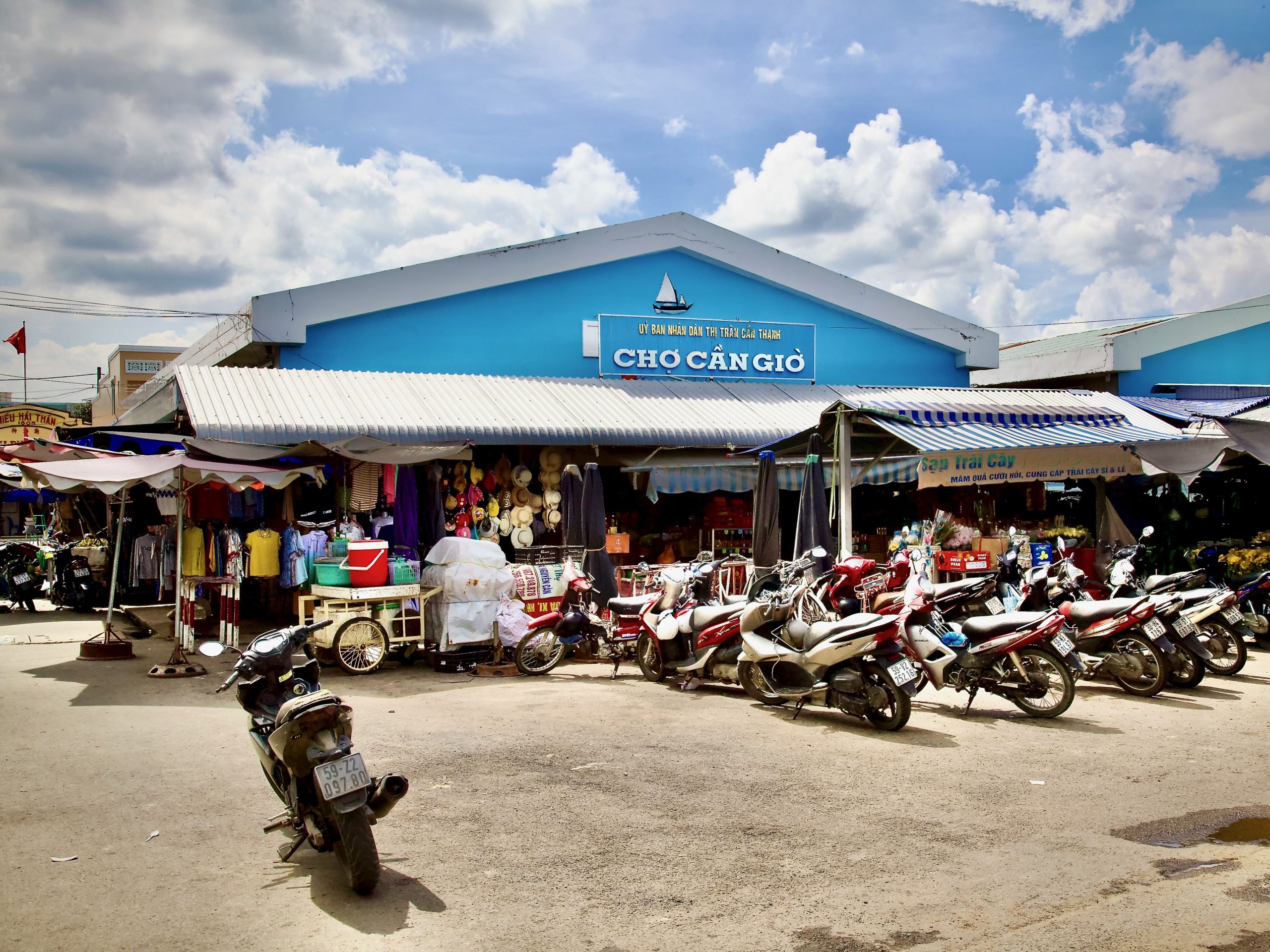
Cần Thạnh Town & Market [MAP]
The small town of Cần Thạnh sits at the southeastern “toe” of the peninsula. For such a small place, this fishing village is home to a surprising number of spiritual sites. Perhaps most unique is Lăng Ông Thủy Tướng (the “Whale Temple”), which is right next to the village market and enshrines a 12m-long whale skeleton – the celebrity at the center of the Nghinh Ông festival held in September/October, where devotees pray for bountiful catches and safe ocean travels. The chợ (local market) is lively and interesting, especially in the morning. Cần Thạnh’s temples and wet markets help maintain the rural, peaceful vibe here but, increasingly, new developments on the edge of town are harbingers of rapid change. Heading westward past these new additions, the landscape gradually dissolves again into salt farms, fields, patches of coastal sand, small, scattered countryside homes and aquaculture ponds all the way to Đông Hòa village (see below).
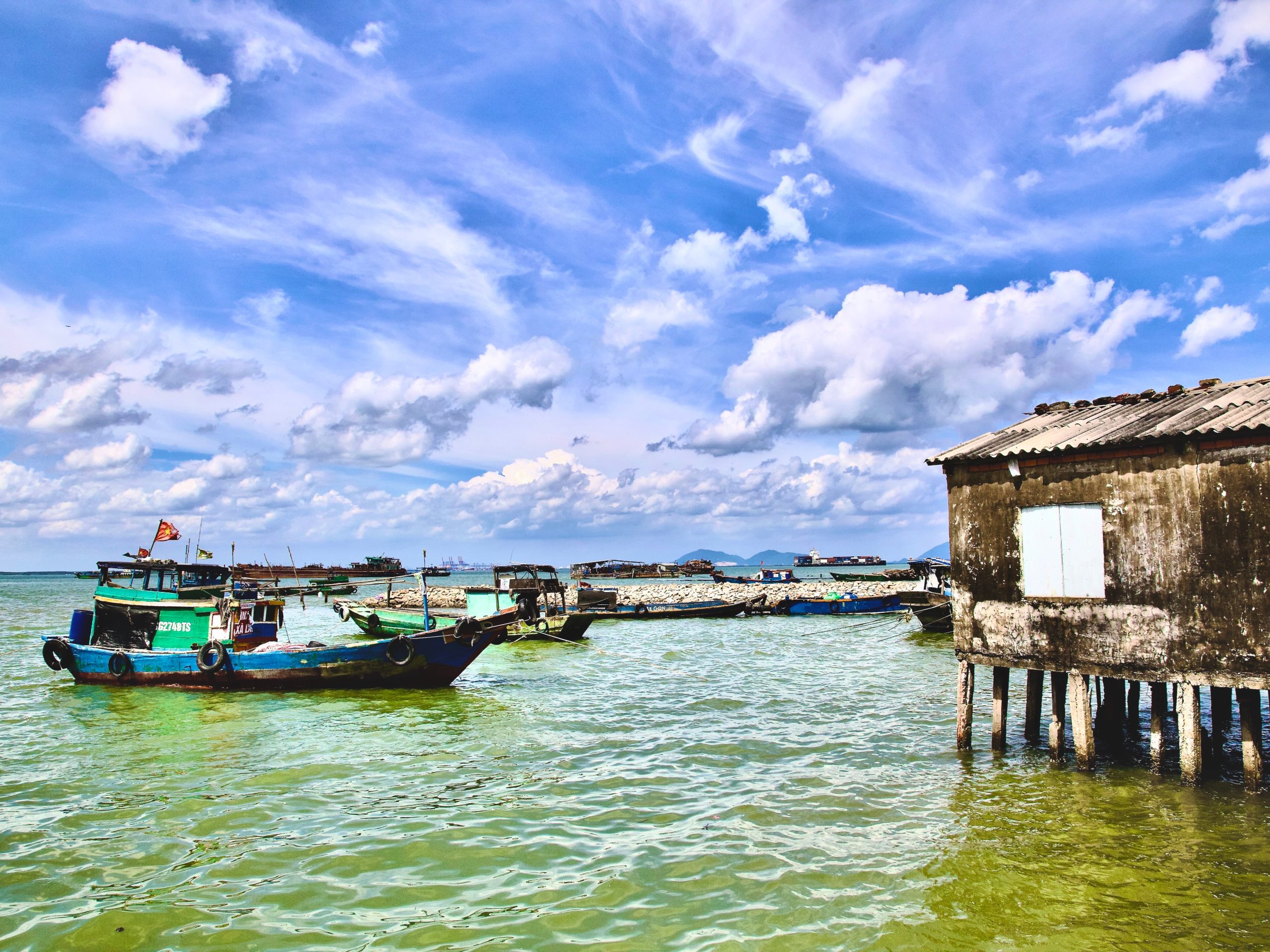
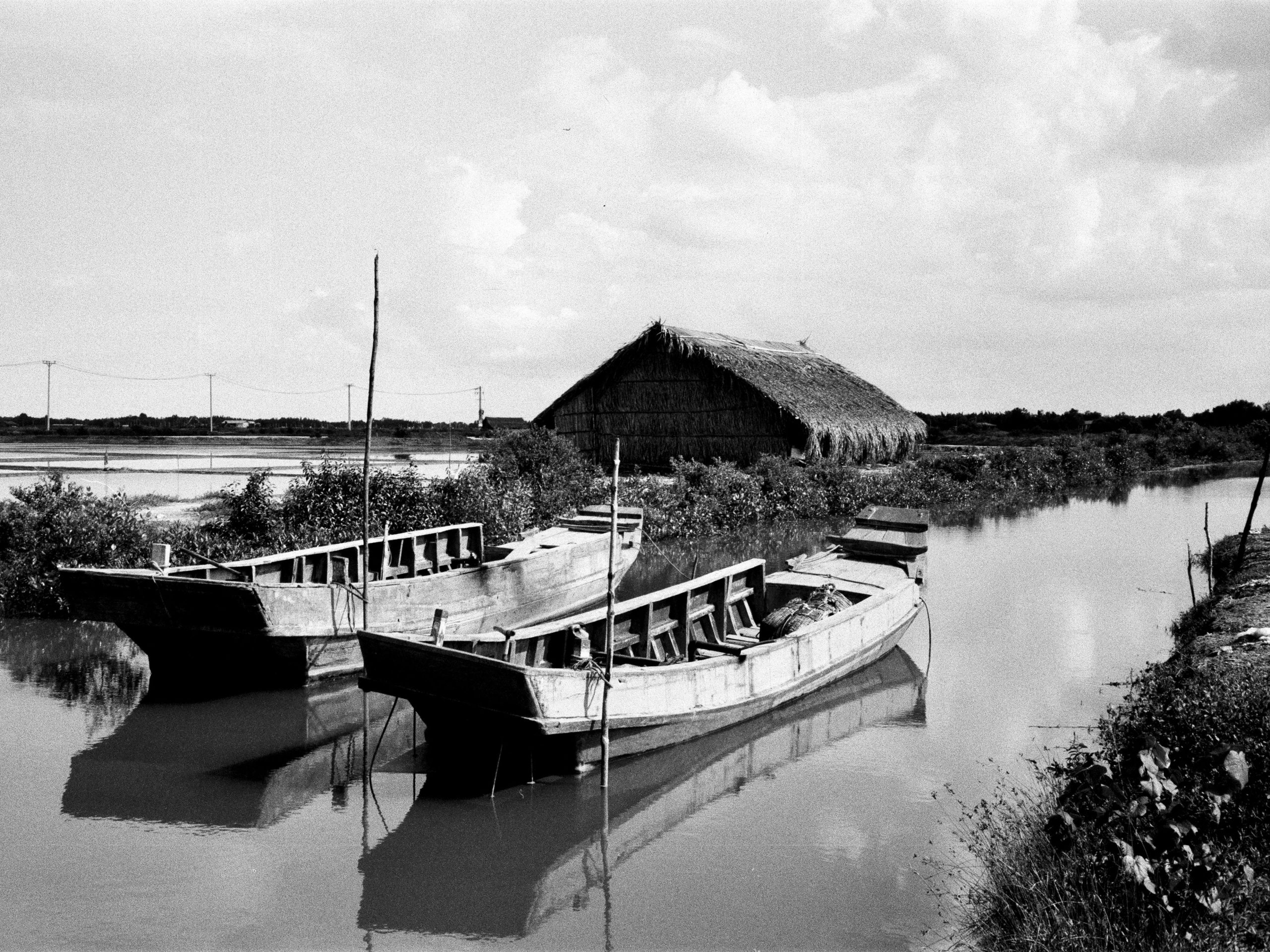
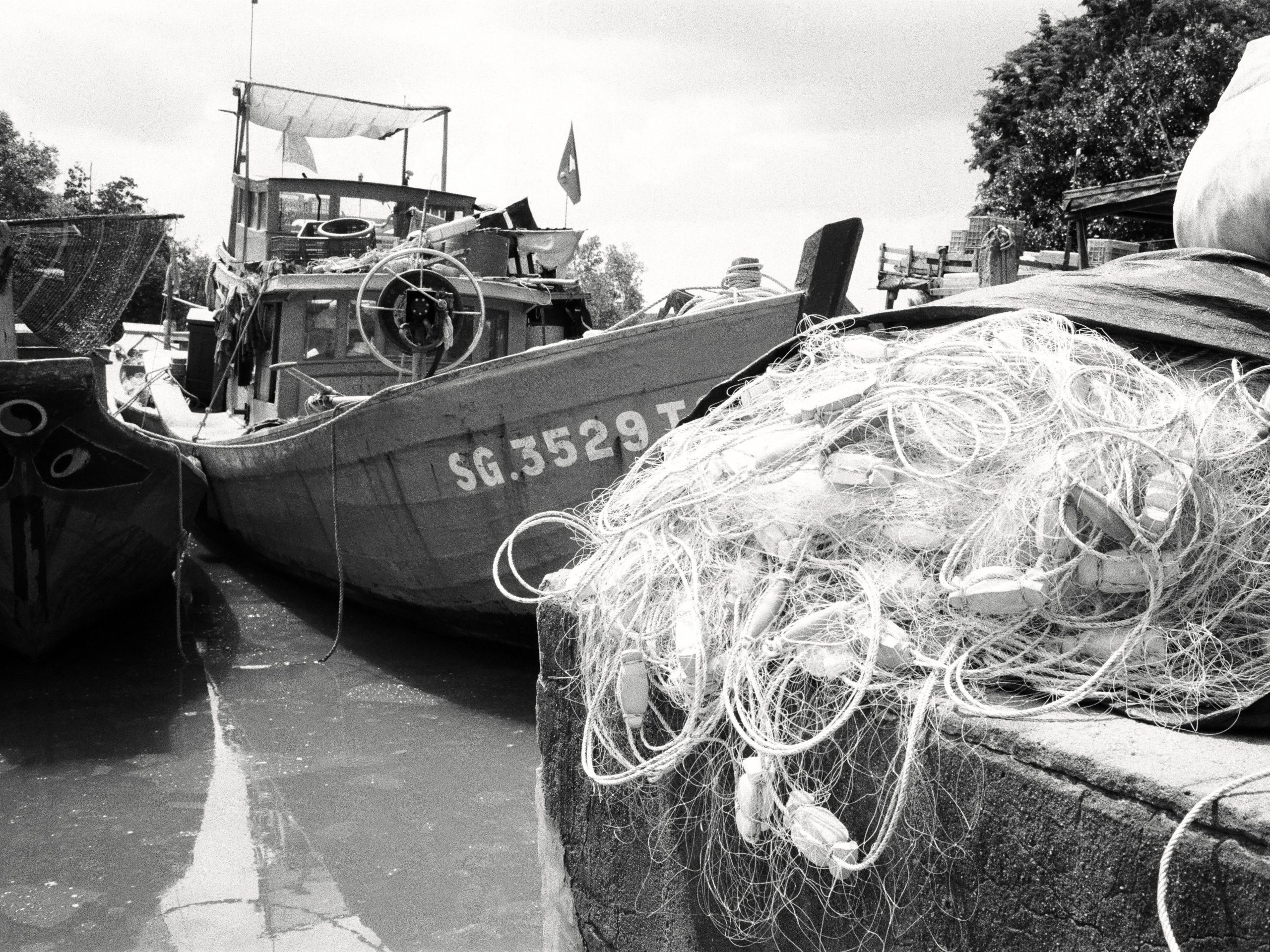
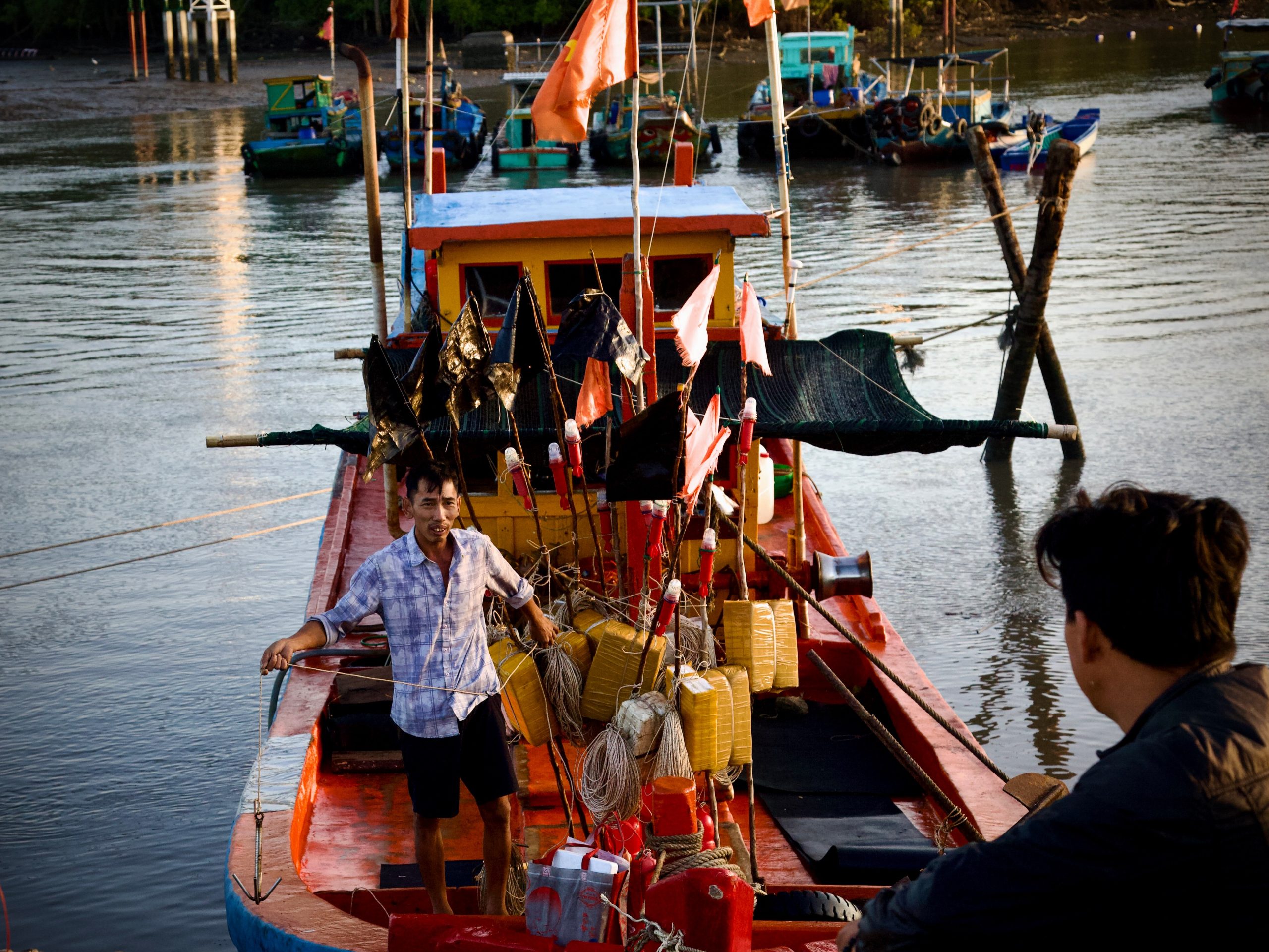
Đồng Hòa Fishing Village & Port [MAP]
By taking a combination of smaller roads and gravel lanes along the southern coast going due west, you’ll arrive at the western “heel” of Cần Giờ peninsula and the sleepy fishing village of Đồng Hòa. There are no specific ‘attractions’ here, but threading your way through the narrow alleys, watching the boats out on the water, waving at the friendly local kids and wandering along the fishing piers makes it a worthwhile excursion.
Giồng Cá Vồ Archaeological Site [MAP]
Inland from the peninsula’s southern coast is this active archaeological site, where scientists and archaeologists sift through the alluvial sands for remnants of the ancient Sa Huỳnh culture – one of the three great prehistoric cultures of Southeast Asia. 2000-year old jars bearing human remains and hundreds of ancient relics made of gold, precious stones, glass and shells have been discovered here in recent years. It is not developed for visitors yet and there is no established way to get to the site. But locals have been known to ferry visitors across the river for a small fee and, with a little effort, you may be able to arrange the same. It’s worth a try if you want to really get off the beaten path.
Sleep:
❤️Like this guide? Support Vietnam Coracle with a donation or join my Patreon to help keep this website free & 100% independent. Thank you, Tom
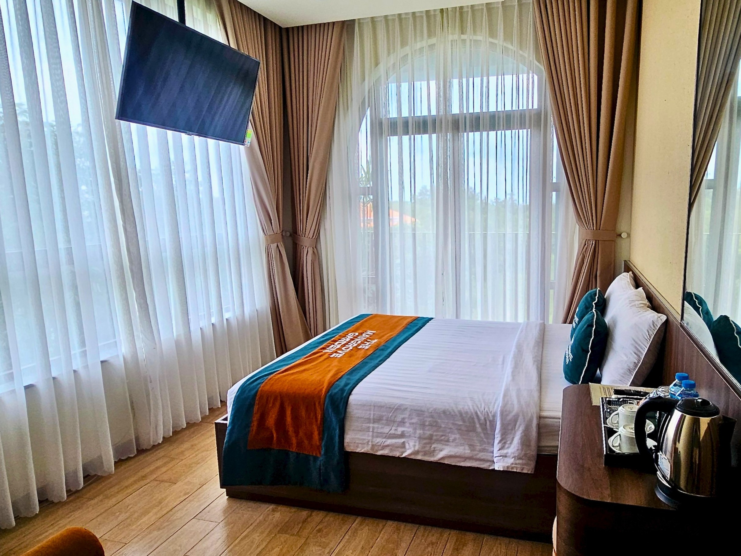
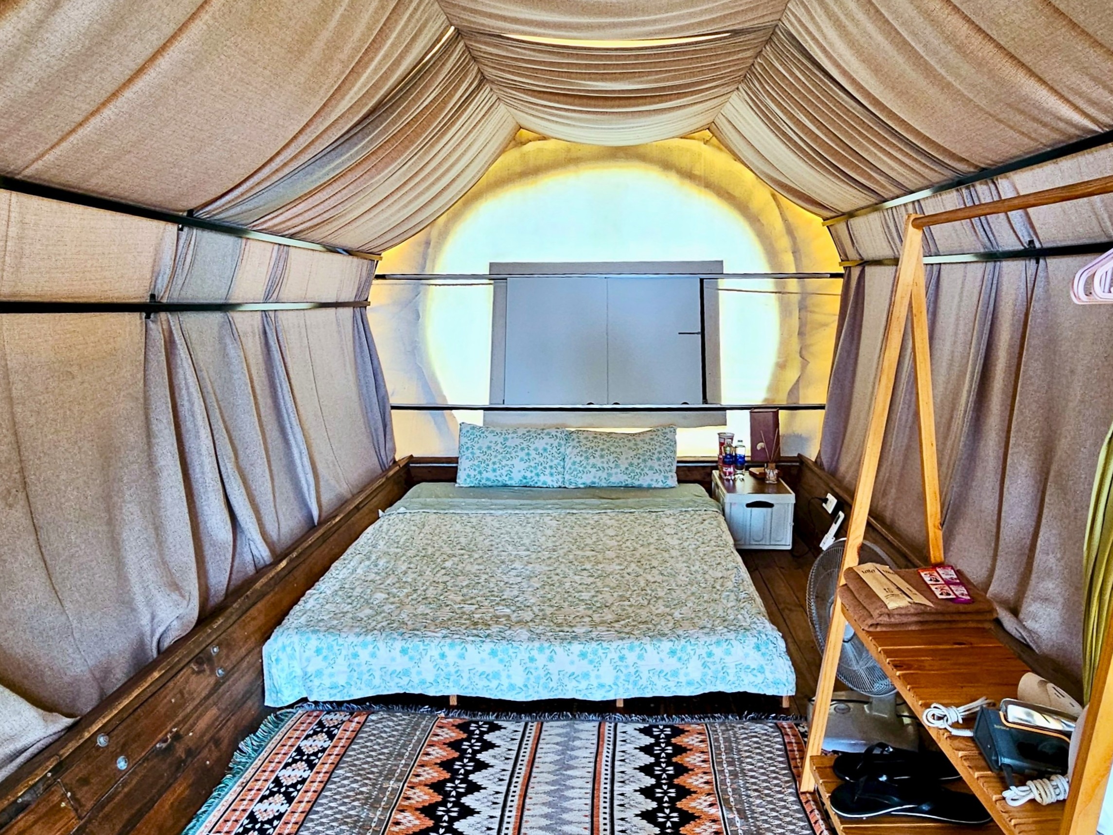
There are a fair amount of overnight options in the Cần Giờ area. Most fall within the budget to mid-range category, including a handful of resorts that were once beside the sea, but are now beside the VinHomes construction site and best avoided. The most comfortable options are several of the mini-hotels and local guest houses (called nhà nghỉ in Vietnamese) lining the main roads and back-streets of Cần Giờ, Cần Thạnh and Đồng Hòa. The most atmospheric options are camping and glamping spots. Below are just a couple of recommendations, but there are many more to choose from:
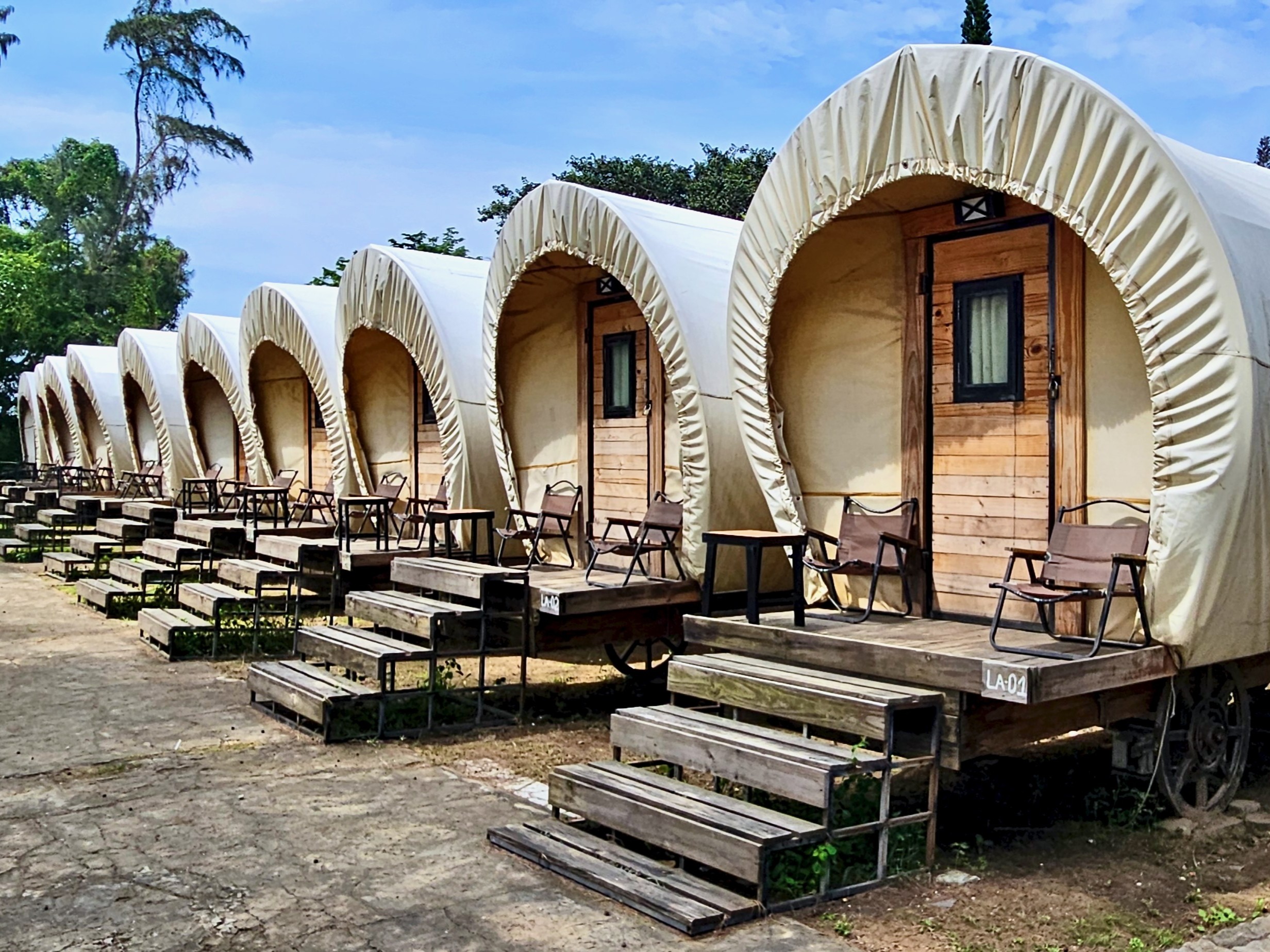
Lata Camping: (tel: 0869 338 998) [MAP]
Located near Đồng Hòa fishing village, this is by far the nicest glamping ground on the whole peninsula. Accommodation options include handsome wooden cabins, geodesic domes and whimsical Conestoga wagons – all air-conditioned. Lata Camping also features a large common dining area, restaurant, and modern, well-maintained bathrooms. A great place to overnight while exploring the region. Prices range from 300,000vnđ ($12) per night for a tent through to 1,500,000vnđ ($55) for a domes sleeping up to 4 people.
The Mangrove Garden (facebook.com/themangrovecangio) [MAP]
For a more boutique experience, The Mangrove Garden is the place to go: clean, bright rooms, modern décor and a swimming pool. With all the construction in the area being a major turn off for staying overnight, this new hotel is tucked away down a quiet, green lane but still close to several amenities, including a seafood night market and several decent restaurants. Prices range from 1,000,000-2,500,000vnđ ($35-$100) per night. However, their sister property, Mangrove Hotel, just a couple of minutes away, offers cheaper rooms starting from 500,000vnđ ($20).
Eat & Drink:
❤️Like this guide? Support Vietnam Coracle with a donation or join my Patreon to help keep this website free & 100% independent. Thank you, Tom
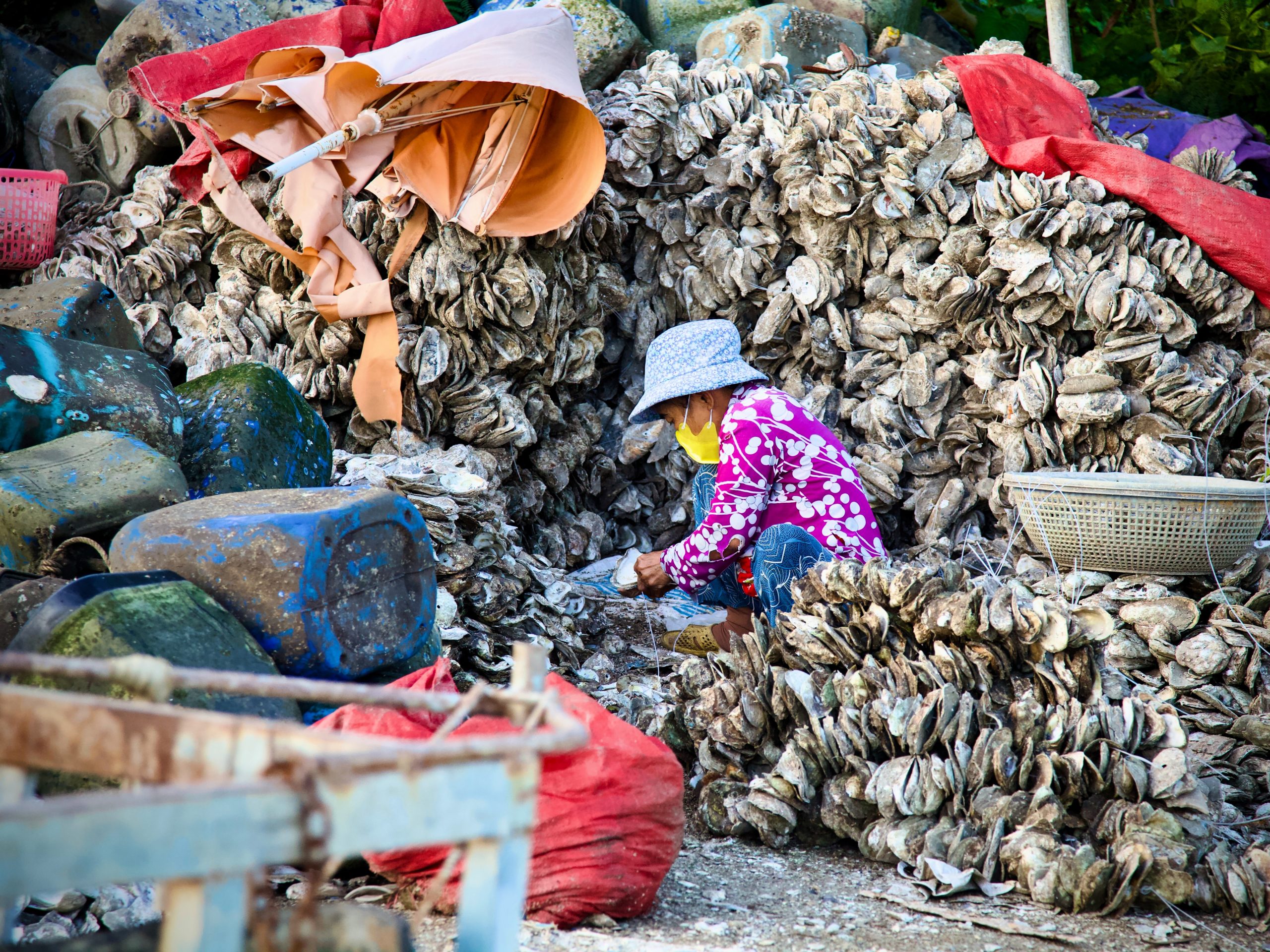
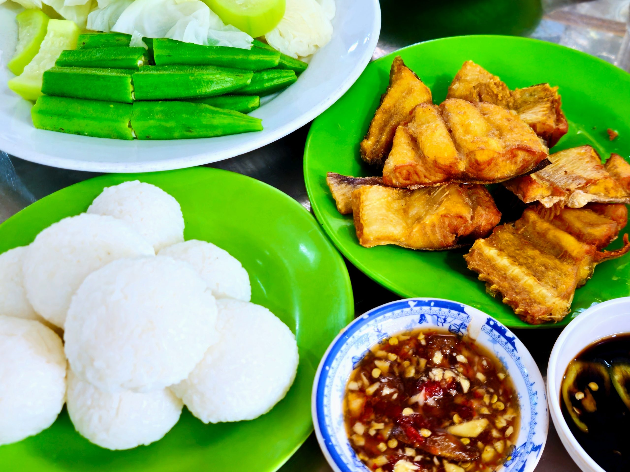
When you’re ready for a bite, there are a few interesting local Cần Giờ delicacies to try. As you might expect of a coastal Vietnamese district, seafood is famous and plentiful in and around Cần Giờ. Local seafood restaurants can be found throughout the area: look for signs saying quán hải sản. The brackish waters around Cần Giờ and its extensive mangrove forests mean that many of the seafood dishes are unique to this area. Indeed, for some Vietnamese visitors, the food is the main reason for coming to Cần Giờ. In addition to the bounty of the ocean, there’s plenty of good, standard Vietnamese street food to be found, particularly on the bustling streets around Cần Giờ local market and in the fishing hamlet of Đồng Hòa.
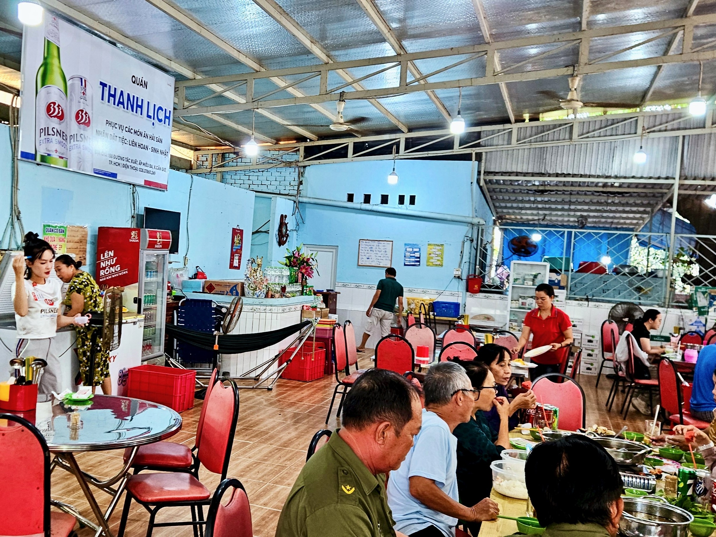
Quán Ăn Thanh Lịch: (158 Tắc Xuất street) [MAP] A great local spot where some of the Cần Giờ delicacies listed below are served. The restaurant is clean, the food is fresh and fairly priced, and the ladies who run it mean brusque business. What you can’t find here, you may find in other restaurants nearby – the area is a hotspot for local seafood.
Gỏi Cá Thòi Lòi với Lá Lìm Kìm – One of the most iconic local dishes, “thòi lòi” is a type of mudskipper fish common in brackish mangrove waters. It’s mixed with slightly bitter herbs and topped with a sweet-and-sour dressing, fried onions and chili.
Khô Cá Dứa – Although the name translates as “pineapple fish”, this is misleading: fruit plays no part in this dish. Cá Dứa is a type of catfish (Pangasius kunyit) which is fried to light, fluffy perfection and accompanied with tamarind sauce and rice balls. Order a plate of boiled vegetables to complement. It’s a delight.
Cá Đối Nướng Muối – Salt-roasted mullet
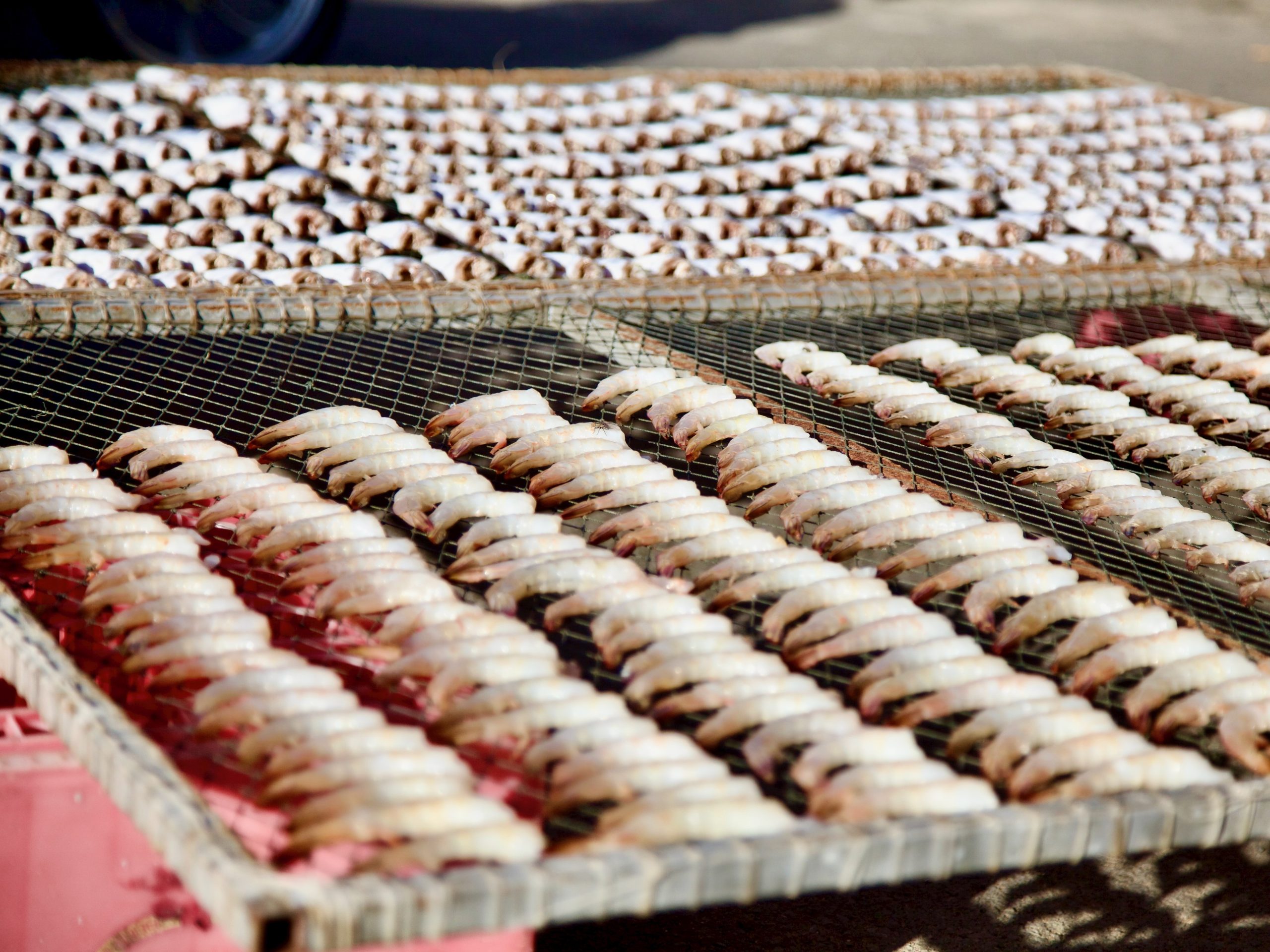
Cá Khô Một Nắng – Sun-dried herring or barracuda
Getting There:
[View Map]
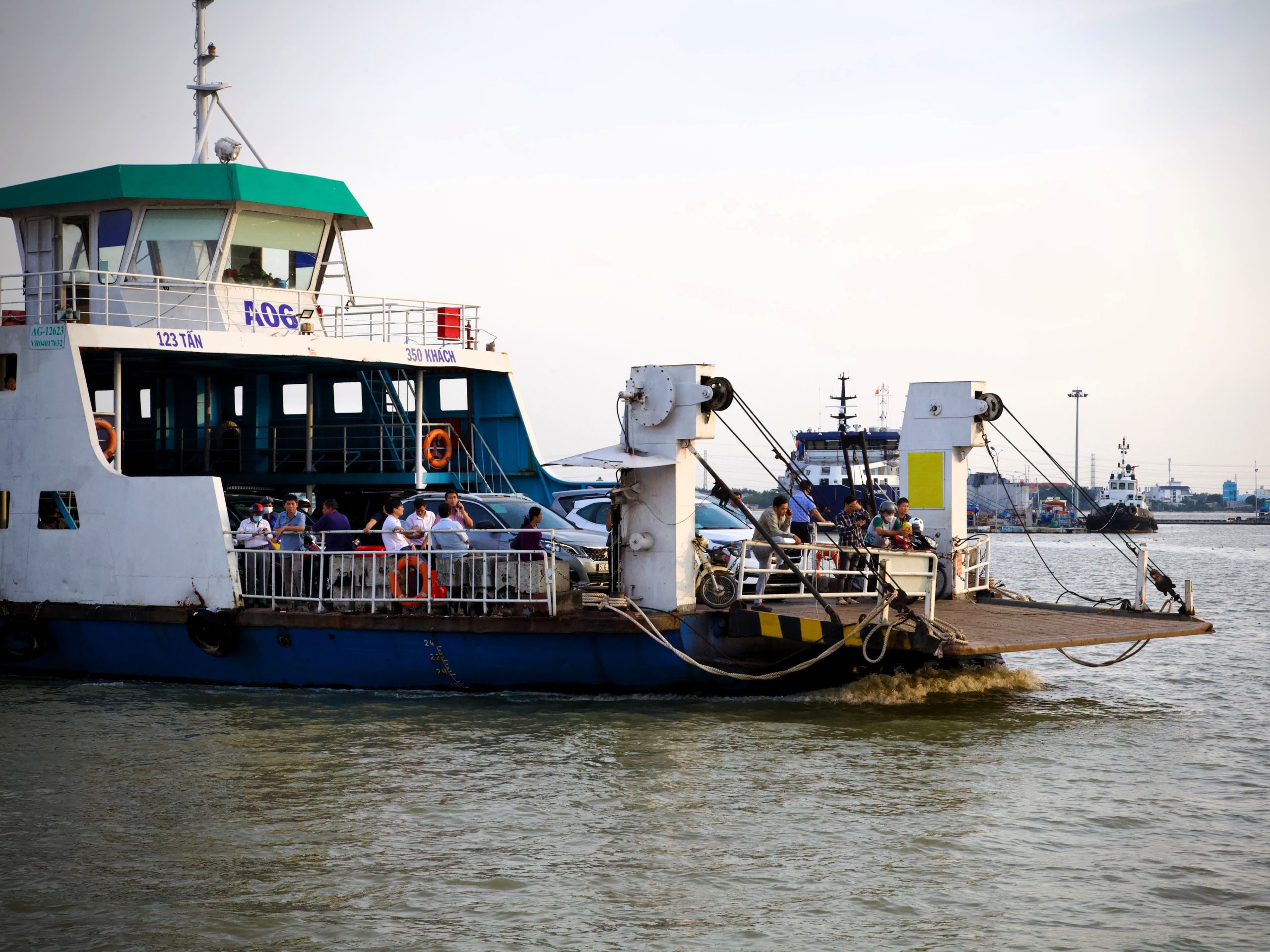
At the moment, Cần Giờ peninsula can only be reach by road, including a 10-minute ferry crossing at Bình Khánh. Plans are already underway to build a high-speed rail connection to Cần Giờ, reducing the travel time to just 15-20 minutes! But for now, the road journey from downtown Ho Chi Minh City to the tip of Cần Giờ peninsula takes about about 60-90 minutes. The Bình Khánh ferry crossing is just 15km due south of central Ho Chi Minh City. Then, from the other side of the ferry crossing, the Rừng Sác Road ploughs on for 40km due south and east to Cần Thạnh at the end of the peninsula.
Motorbike & Bicycle:
Riding to Cần Giờ is a favourite road trip for many cyclists and motorcyclist based in Ho Chi Minh City. Although the ride through the sprawling industrial suburbs to the Bình Khánh ferry can be unpleasant and congested, once you’re on the other side of the crossing, the Rừng Sác Road is flat, straight and smooth, making for a fun ride all the way along the Cần Giờ promontory. Slicing through the dense mangrove forest and with hardly any traffic at all, the riding is joyful. In fact, for riders who want to extend their road trip beyond Cần Giờ, there are several bike ferries that can take you off the peninsula and either due west to the Mekong Delta or due east to Vũng Tàu and the southeast coast. See the following guides: Lý Nhơn→Gia Thuận ferry | Cần Giờ→Cần Giuộc ferry | Cần Giờ→Vũng Tàu ferry
Public Transportation
Perhaps surprisingly, Cần Giờ can be easily reached by public transportation in the form of a local bus. From downtown Ho Chi Minh City bus 75 is a direct line all the way to Cần Thạnh town at the southeastern tip of the Cần Giờ peninsula with dozens of stops along the way. Alternatively, you could get a taxi, Grab car or bike to the Bình Khánh ferry, make the crossing and then catch bus 90 on the other side which takes you all the way along the Rừng Sác Road to Cần Thạnh, following the same route as bus 75. Buses run fairly frequently.
Taxi, Car, Ride-Hailing App:
If you don’t have your own wheels and don’t fancy taking a local bus, it’s possible to hire a car to go out to Cần Giờ and back in a day. Use one of the many ride-hailing apps available, such as Grab or XanhSM, or a taxi company such as Vinasun. A one-way fare is only around 600,000-700,000vnđ ($25).
❤️Like this guide? Support Vietnam Coracle with a donation or join my Patreon to help keep this website free & 100% independent. Thank you, Tom
Support My Work
Free | Independent | No Sponsored Content
“Hello, if you enjoy my website, please support it.
Thank you.” Tom
*Disclosure: Vietnam Coracle content is always free and independent. Martin has written this guide because he wants to: he likes this forest and he wants readers to know about it. For more details, see the Disclosure & Disclaimer statements and my About Page


Yooo. I’d say the 75 has to be the longest bus route of hcmc. Right??? Btw, I’d definitely read an article about bus riding around town. My ol 86 route .. you squeezed a rubber chicken if you wanted to stop!
Hi Dave,
I’m not sure which bus route is the longest in Ho Chi Minh City, but now that the city/province has expanded to include Binh Duong and Ba Ria-Vung Tau, I imagine their are many long bus routes that are technically still within Ho Chi Minh City province.
Best,
Tom
As soon as the pandemic lockdown ended, when inter-provincial travel was still restricted, I took the family down to Can Gio to enjoy the seaside. I was pleasantly surprised to see all the cute little hotels and campsites that had sprung up along the southern shore. Such a shame that they’ve become roadkill for Vingroup!
Hi Patrick,
Yes, it’s definitely very sad that the beach is no longer accessible and that all those businesses have suffered as a result. But at least there’s plenty more to explore and enjoy in Cần Giờ besides the beach.
Best,
Tom